
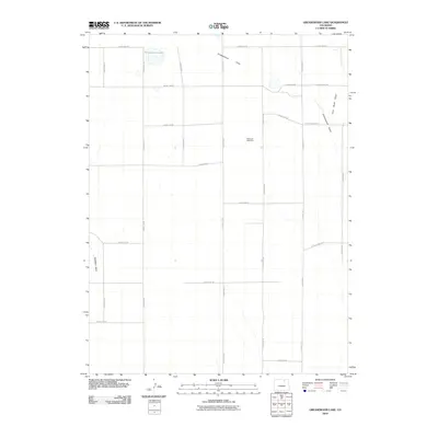
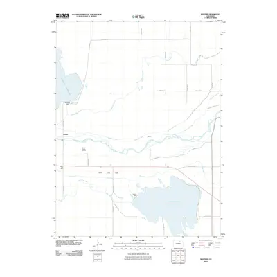
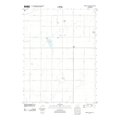
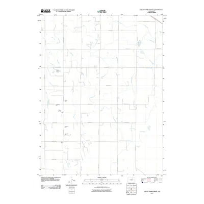
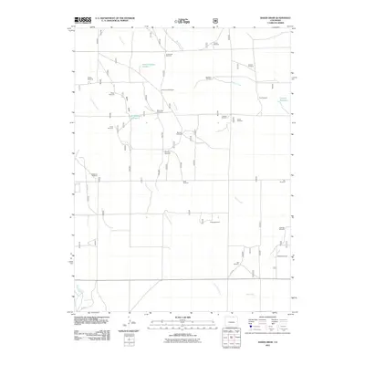
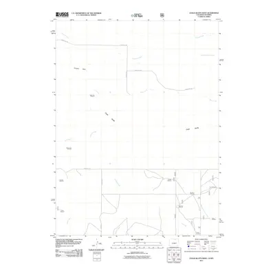
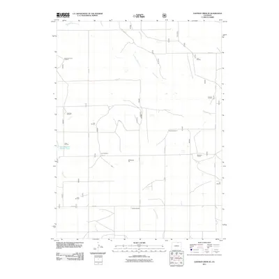
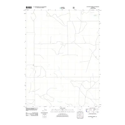
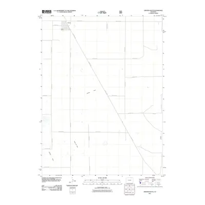
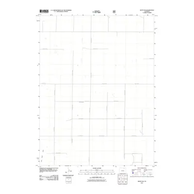
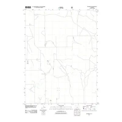
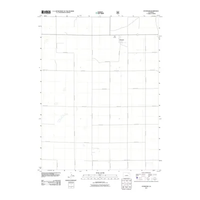
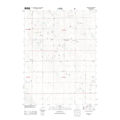
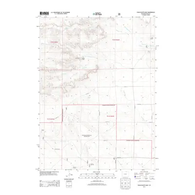
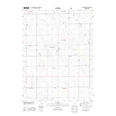
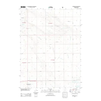
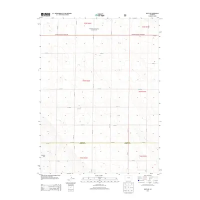
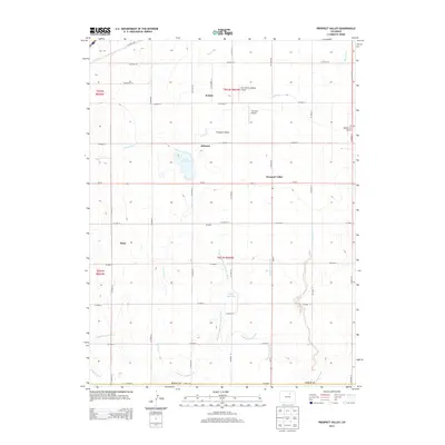
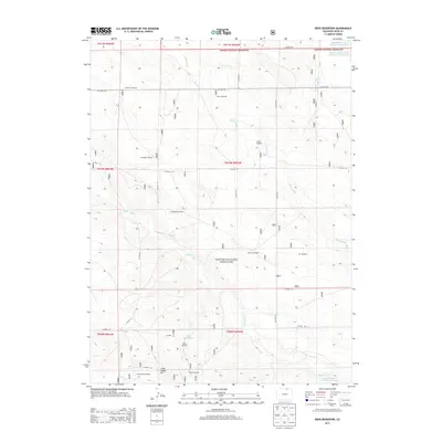
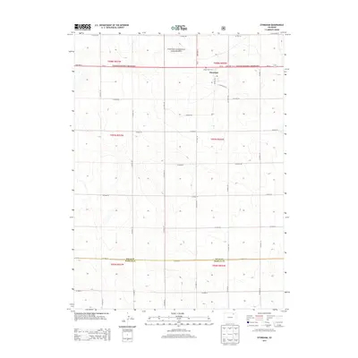
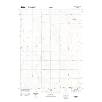
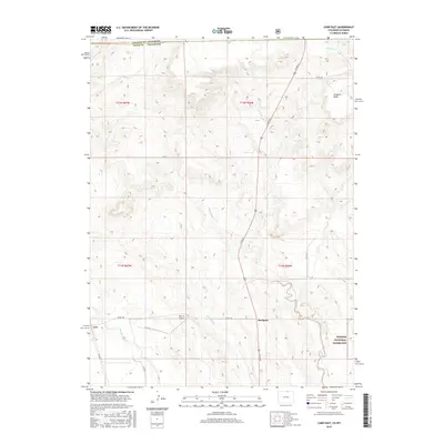
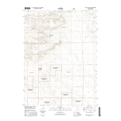
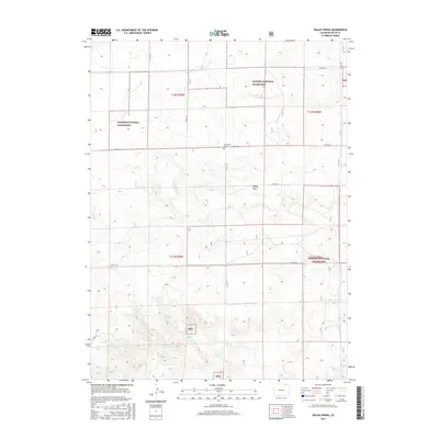
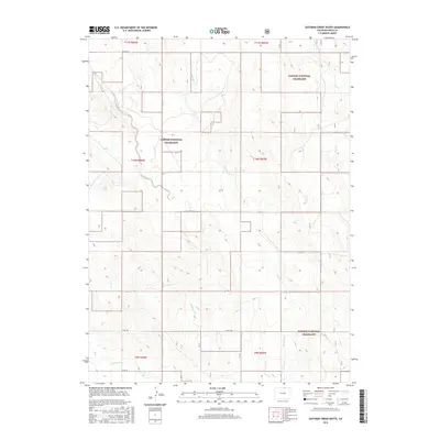
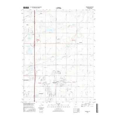
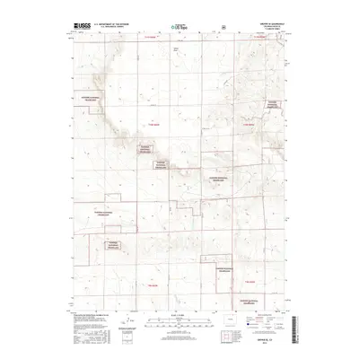
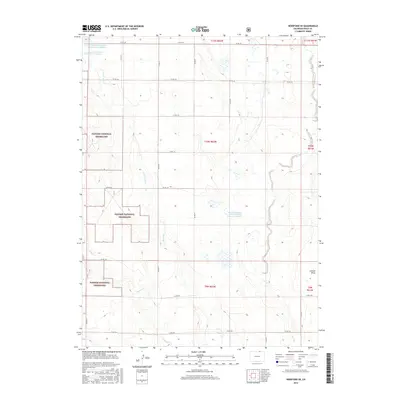
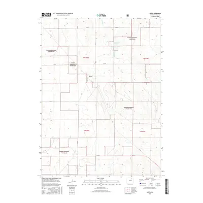
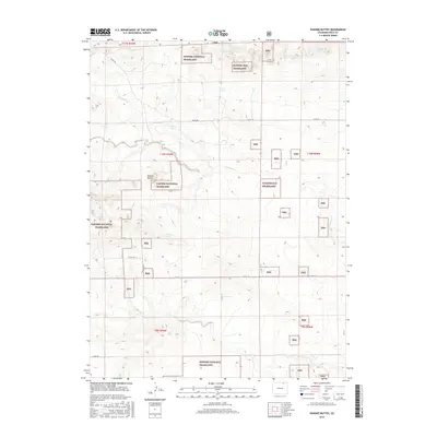
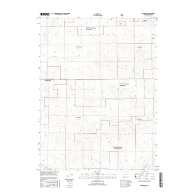
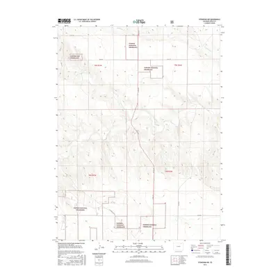
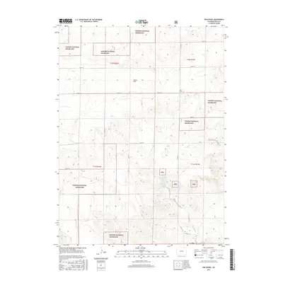
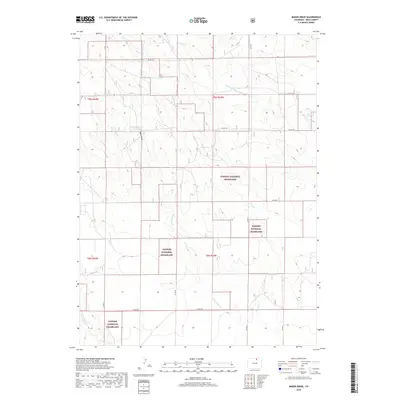
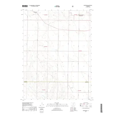
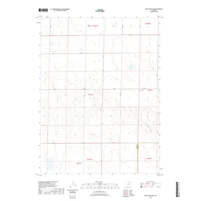
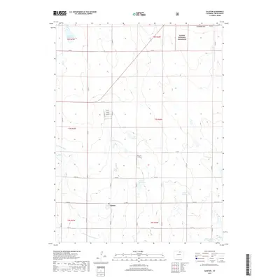
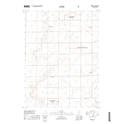
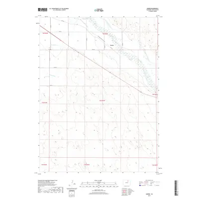
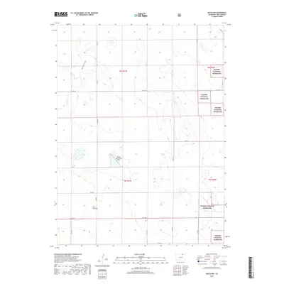
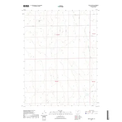
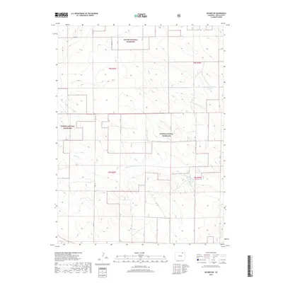
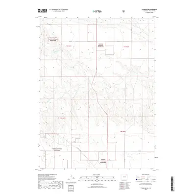
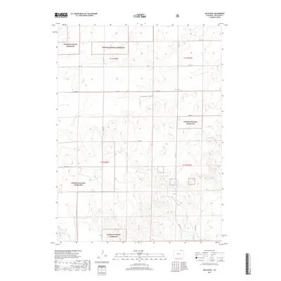
1972 Map of Chalk Bluffs SW
USGS Topo · Published 1974About this map
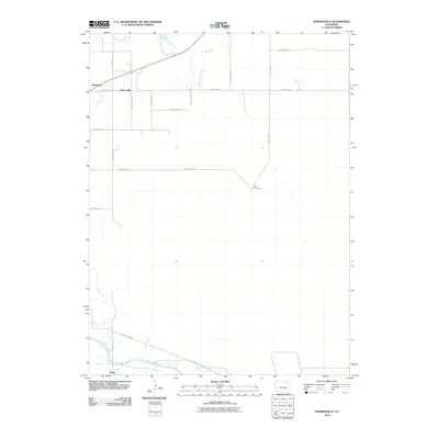
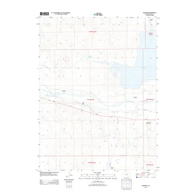
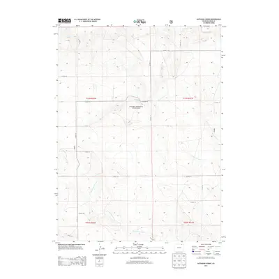
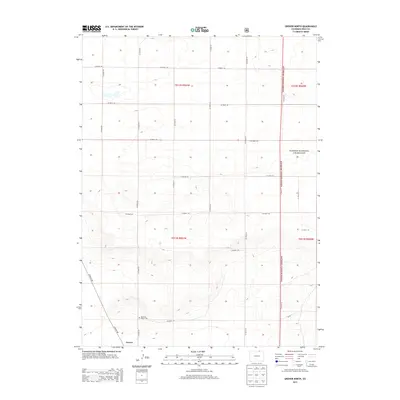
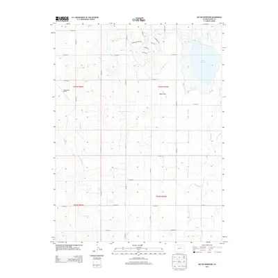
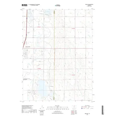
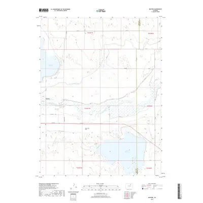
Central Plains Exper. Range Hdqrs. anchors this portion of Weld County, serving as a focal point for agricultural research in the early 1970s. The landscape is defined by a dense network of intermittent drainage channels, including Owl Creek, Cow Creek, and Eastman Creek, which carve through the high plains terrain. This topography illustrates the hydrological patterns of the region before significant modern development, showing the complex interplay of Coal Creek and Robinson Creek as they move across the township lines. A few scattered Wells suggest a reliance on groundwater for the ranching and experimental operations that dominate this section of Colorado. The map traces the division between Township 10 North and Township 11 North, providing a precise record of land management and use during this period of the twentieth century.
Find a feature on this map
12 named features on this map. Tap any name to fly to it.
Don’t see what you’re looking for? This feature index may not catch every label — zoom into the map to look around manually.
Map Details
Editions of this 1972 Chalk Bluffs SW Map
This is the sole edition of this map. No revisions or reprints were ever made.
Historical Maps of Weld County Through Time
357 maps found

1949 Gowanda
Weld County, CO

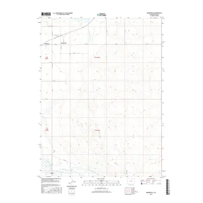
1950 Barnesville
Weld County, CO

1950 Bracewell
Weld County, CO

1950 Gowanda
Weld County, CO

1950 Greasewood Lake
Weld County, CO

1950 Hardin
Weld County, CO

1950 Klug Ranch
Weld County, CO

1950 Masters
Weld County, CO

1950 Milton Reservoir
Weld County, CO

1950 Prospect Valley
Weld County, CO

1950 South Roggen
Weld County, CO

1950 Tampa
Weld County, CO

1950 Valley View School
Weld County, CO

1950 Wiggins SW
Weld County, CO

1951 Bracewell
Weld County, CO

1951 Dearfield
Weld County, CO

1951 Hardin
Weld County, CO

1951 Klug Ranch
Weld County, CO

1951 Masters
Weld County, CO

1951 Milton Reservoir
Weld County, CO

1951 Omar
Weld County, CO

1951 Point Of Rocks
Weld County, CO

1951 Prospect Valley
Weld County, CO

1951 Roggen
Weld County, CO

1951 Valley View School
Weld County, CO

1960 Antelope Reservoir
Weld County, CO

1960 Cobb Lake
Weld County, CO

1960 Galeton
Weld County, CO

1960 Purcell
Weld County, CO

1972 Baker Draw
Weld County, CO

1972 Carr East
Weld County, CO

1972 Chalk Bluffs East
Weld County, CO

1972 Chalk Bluffs SE
Weld County, CO
1972 Chalk Bluffs SW
Weld County, CO

1972 Chalk Bluffs West
Weld County, CO

1972 Cornish
Weld County, CO

1972 Dover
Weld County, CO

1972 Dutch Girl Lake
Weld County, CO

1972 Fosston
Weld County, CO

1972 Grover NE
Weld County, CO

1972 Grover North
Weld County, CO

1972 Grover SE
Weld County, CO

1972 Grover South
Weld County, CO

1972 Hereford NW
Weld County, CO

1972 Hereford SE
Weld County, CO

1972 Hereford
Weld County, CO

1972 Keota NW
Weld County, CO

1972 Keota SE
Weld County, CO

1972 Keota
Weld County, CO

1972 Reno Reservoir
Weld County, CO

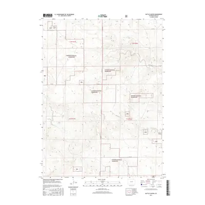
1977 Battle Canyon
Weld County, CO

1977 Dolan Spring
Weld County, CO

1977 Gatehook Spring
Weld County, CO

1977 Pawnee Buttes
Weld County, CO

1977 Raymer NE
Weld County, CO

1977 Raymer NW
Weld County, CO

1977 Stoneham
Weld County, CO

1977 Vim School
Weld County, CO

1978 Avalo
Weld County, CO

1978 Buckingham
Weld County, CO

1978 Stoneham NW
Weld County, CO

1997 Antelope Reservoir
Weld County, CO

1997 Avalo
Weld County, CO

1997 Baker Draw
Weld County, CO

1997 Battle Canyon
Weld County, CO

1997 Buckingham
Weld County, CO

1997 Carr East
Weld County, CO

1997 Chalk Bluffs East
Weld County, CO

1997 Chalk Bluffs West
Weld County, CO

1997 Cornish
Weld County, CO

1997 Dolan Spring
Weld County, CO

1997 Dover
Weld County, CO

1997 Eastman Creek SE
Weld County, CO

1997 Eastman Creek South
Weld County, CO

1997 Fosston
Weld County, CO

1997 Galeton
Weld County, CO

1997 Gatehook Spring
Weld County, CO

1997 Grover NE
Weld County, CO

1997 Grover SE
Weld County, CO

1997 Grover South
Weld County, CO

1997 Hereford Se
Weld County, CO

1997 Keota NW
Weld County, CO

1997 Keota SE
Weld County, CO

1997 Keota
Weld County, CO

1997 Pawnee Buttes
Weld County, CO

1997 Purcell
Weld County, CO

1997 Raymer NE
Weld County, CO

1997 Raymer NW
Weld County, CO

1997 Reno Reservoir
Weld County, CO

1997 Stoneham NW
Weld County, CO

1997 Stoneham
Weld County, CO

1997 Vim School
Weld County, CO
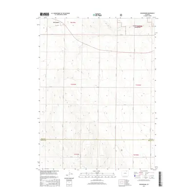
2010 Barnesville
Weld County, CO

2010 Bracewell
Weld County, CO
2010 Cobb Lake
Weld County, CO
2010 Dearfield
Weld County, CO
2010 Gowanda
Weld County, CO
2010 Greasewood Lake
Weld County, CO
2010 Hardin
Weld County, CO
2010 Hereford
Weld County, CO
2010 Klug Ranch
Weld County, CO
2010 Masters
Weld County, CO
2010 Milton Reservoir
Weld County, CO
2010 Omar
Weld County, CO
2010 Point of Rocks
Weld County, CO
2010 Prospect Valley
Weld County, CO
2010 Roggen
Weld County, CO
2010 South Roggen
Weld County, CO
2010 Tampa
Weld County, CO
2010 Valley View School
Weld County, CO
2010 Wiggins SW
Weld County, CO
2011 Antelope Reservoir
Weld County, CO
2011 Avalo
Weld County, CO
2011 Baker Draw
Weld County, CO
2011 Battle Canyon
Weld County, CO
2011 Buckingham
Weld County, CO
2011 Carr East
Weld County, CO

2011 Chalk Bluffs East
Weld County, CO
2011 Chalk Bluffs West
Weld County, CO
2011 Cornish
Weld County, CO
2011 Dolan Spring
Weld County, CO
2011 Dover
Weld County, CO

2011 Dutch Girl Lake
Weld County, CO
2011 Eastman Creek SE
Weld County, CO
2011 Eastman Creek South
Weld County, CO
2011 Fosston
Weld County, CO
2011 Galeton
Weld County, CO
2011 Gatehook Spring
Weld County, CO
2011 Grover NE
Weld County, CO
2011 Grover North
Weld County, CO
2011 Grover SE
Weld County, CO
2011 Grover South
Weld County, CO
2011 Hereford NW
Weld County, CO
2011 Hereford SE
Weld County, CO
2011 Keota NW
Weld County, CO
2011 Keota SE
Weld County, CO
2011 Keota
Weld County, CO
2011 Pawnee Buttes
Weld County, CO
2011 Purcell
Weld County, CO
2011 Raymer NE
Weld County, CO
2011 Raymer NW
Weld County, CO
2011 Reno Reservoir
Weld County, CO
2011 Stoneham NW
Weld County, CO
2011 Stoneham
Weld County, CO
2011 Vim School
Weld County, CO
2013 Antelope Reservoir
Weld County, CO
2013 Avalo
Weld County, CO
2013 Baker Draw
Weld County, CO

2013 Barnesville
Weld County, CO
2013 Battle Canyon
Weld County, CO

2013 Bracewell
Weld County, CO
2013 Buckingham
Weld County, CO
2013 Carr East
Weld County, CO
2013 Chalk Bluffs East
Weld County, CO
2013 Chalk Bluffs West
Weld County, CO
2013 Cobb Lake
Weld County, CO
2013 Cornish
Weld County, CO
2013 Dearfield
Weld County, CO
2013 Dolan Spring
Weld County, CO
2013 Dover
Weld County, CO
2013 Dutch Girl Lake
Weld County, CO
2013 Eastman Creek SE
Weld County, CO
2013 Eastman Creek South
Weld County, CO
2013 Fosston
Weld County, CO
2013 Galeton
Weld County, CO
2013 Gatehook Spring
Weld County, CO
2013 Gowanda
Weld County, CO
2013 Greasewood Lake
Weld County, CO
2013 Grover NE
Weld County, CO
2013 Grover North
Weld County, CO
2013 Grover SE
Weld County, CO
2013 Grover South
Weld County, CO
2013 Hardin
Weld County, CO
2013 Hereford NW
Weld County, CO
2013 Hereford SE
Weld County, CO
2013 Hereford
Weld County, CO
2013 Keota NW
Weld County, CO
2013 Keota SE
Weld County, CO
2013 Keota
Weld County, CO
2013 Klug Ranch
Weld County, CO
2013 Masters
Weld County, CO
2013 Milton Reservoir
Weld County, CO
2013 Omar
Weld County, CO
2013 Pawnee Buttes
Weld County, CO
2013 Point of Rocks
Weld County, CO
2013 Prospect Valley
Weld County, CO
2013 Purcell
Weld County, CO
2013 Raymer NE
Weld County, CO
2013 Raymer NW
Weld County, CO
2013 Reno Reservoir
Weld County, CO
2013 Roggen
Weld County, CO
2013 South Roggen
Weld County, CO
2013 Stoneham NW
Weld County, CO
2013 Stoneham
Weld County, CO
2013 Tampa
Weld County, CO
2013 Valley View School
Weld County, CO
2013 Vim School
Weld County, CO
2013 Wiggins SW
Weld County, CO
2016 Antelope Reservoir
Weld County, CO
2016 Avalo
Weld County, CO
2016 Baker Draw
Weld County, CO
2016 Barnesville
Weld County, CO
2016 Battle Canyon
Weld County, CO

2016 Bracewell
Weld County, CO
2016 Buckingham
Weld County, CO
2016 Carr East
Weld County, CO
2016 Chalk Bluffs East
Weld County, CO
2016 Chalk Bluffs West
Weld County, CO
2016 Cobb Lake
Weld County, CO
2016 Cornish
Weld County, CO

2016 Dearfield
Weld County, CO
2016 Dolan Spring
Weld County, CO
2016 Dover
Weld County, CO
2016 Dutch Girl Lake
Weld County, CO
2016 Eastman Creek SE
Weld County, CO
2016 Eastman Creek South
Weld County, CO
2016 Fosston
Weld County, CO
2016 Galeton
Weld County, CO
2016 Gatehook Spring
Weld County, CO
2016 Gowanda
Weld County, CO
2016 Greasewood Lake
Weld County, CO
2016 Grover NE
Weld County, CO
2016 Grover North
Weld County, CO
2016 Grover SE
Weld County, CO
2016 Grover South
Weld County, CO
2016 Hardin
Weld County, CO
2016 Hereford NW
Weld County, CO
2016 Hereford SE
Weld County, CO
2016 Hereford
Weld County, CO
2016 Keota NW
Weld County, CO
2016 Keota SE
Weld County, CO
2016 Keota
Weld County, CO
2016 Klug Ranch
Weld County, CO

2016 Masters
Weld County, CO
2016 Milton Reservoir
Weld County, CO
2016 Omar
Weld County, CO
2016 Pawnee Buttes
Weld County, CO
2016 Point of Rocks
Weld County, CO
2016 Prospect Valley
Weld County, CO

2016 Purcell
Weld County, CO
2016 Raymer NE
Weld County, CO
2016 Raymer NW
Weld County, CO
2016 Reno Reservoir
Weld County, CO
2016 Roggen
Weld County, CO
2016 South Roggen
Weld County, CO
2016 Stoneham NW
Weld County, CO
2016 Stoneham
Weld County, CO
2016 Tampa
Weld County, CO
2016 Valley View School
Weld County, CO
2016 Vim School
Weld County, CO
2016 Wiggins SW
Weld County, CO
2019 Antelope Reservoir
Weld County, CO
2019 Avalo
Weld County, CO
2019 Baker Draw
Weld County, CO
2019 Barnesville
Weld County, CO
2019 Battle Canyon
Weld County, CO
2019 Bracewell
Weld County, CO
2019 Buckingham
Weld County, CO
2019 Carr East
Weld County, CO
2019 Chalk Bluffs East
Weld County, CO
2019 Chalk Bluffs West
Weld County, CO
2019 Cobb Lake
Weld County, CO

2019 Cornish
Weld County, CO
2019 Dearfield
Weld County, CO
2019 Dolan Spring
Weld County, CO
2019 Dover
Weld County, CO
2019 Dutch Girl Lake
Weld County, CO
2019 Eastman Creek SE
Weld County, CO
2019 Eastman Creek South
Weld County, CO
2019 Fosston
Weld County, CO
2019 Galeton
Weld County, CO
2019 Gatehook Spring
Weld County, CO
2019 Gowanda
Weld County, CO
2019 Greasewood Lake
Weld County, CO
2019 Grover NE
Weld County, CO
2019 Grover North
Weld County, CO
2019 Grover SE
Weld County, CO
2019 Grover South
Weld County, CO
2019 Hardin
Weld County, CO
2019 Hereford NW
Weld County, CO
2019 Hereford SE
Weld County, CO
2019 Hereford
Weld County, CO
2019 Keota NW
Weld County, CO
2019 Keota SE
Weld County, CO
2019 Keota
Weld County, CO
2019 Klug Ranch
Weld County, CO
2019 Masters
Weld County, CO
2019 Milton Reservoir
Weld County, CO
2019 Omar
Weld County, CO
2019 Pawnee Buttes
Weld County, CO
2019 Point of Rocks
Weld County, CO
2019 Prospect Valley
Weld County, CO
2019 Purcell
Weld County, CO
2019 Raymer NE
Weld County, CO
2019 Raymer NW
Weld County, CO
2019 Reno Reservoir
Weld County, CO
2019 Roggen
Weld County, CO
2019 South Roggen
Weld County, CO
2019 Stoneham NW
Weld County, CO
2019 Stoneham
Weld County, CO
2019 Tampa
Weld County, CO
2019 Valley View School
Weld County, CO
2019 Vim School
Weld County, CO
2019 Wiggins SW
Weld County, CO

2022 Antelope Reservoir
Weld County, CO

2022 Avalo
Weld County, CO

2022 Baker Draw
Weld County, CO

2022 Barnesville
Weld County, CO

2022 Battle Canyon
Weld County, CO

2022 Bracewell
Weld County, CO

2022 Buckingham
Weld County, CO

2022 Carr East
Weld County, CO

2022 Chalk Bluffs West
Weld County, CO

2022 Cobb Lake
Weld County, CO

2022 Cornish
Weld County, CO

2022 Dearfield
Weld County, CO

2022 Dolan Spring
Weld County, CO

2022 Dover
Weld County, CO

2022 Dutch Girl Lake
Weld County, CO

2022 Eastman Creek SE
Weld County, CO

2022 Eastman Creek South
Weld County, CO

2022 Fosston
Weld County, CO

2022 Galeton
Weld County, CO

2022 Gatehook Spring
Weld County, CO

2022 Gowanda
Weld County, CO

2022 Greasewood Lake
Weld County, CO

2022 Grover NE
Weld County, CO

2022 Grover North
Weld County, CO

2022 Grover SE
Weld County, CO

2022 Grover South
Weld County, CO

2022 Hardin
Weld County, CO

2022 Hereford NW
Weld County, CO

2022 Hereford SE
Weld County, CO

2022 Hereford
Weld County, CO

2022 Keota NW
Weld County, CO

2022 Keota SE
Weld County, CO

2022 Keota
Weld County, CO

2022 Klug Ranch
Weld County, CO

2022 Masters
Weld County, CO

2022 Milton Reservoir
Weld County, CO

2022 Omar
Weld County, CO

2022 Pawnee Buttes
Weld County, CO

2022 Point of Rocks
Weld County, CO

2022 Prospect Valley
Weld County, CO

2022 Purcell
Weld County, CO

2022 Raymer NE
Weld County, CO

2022 Raymer NW
Weld County, CO

2022 Reno Reservoir
Weld County, CO

2022 Roggen
Weld County, CO

2022 South Roggen
Weld County, CO

2022 Stoneham NW
Weld County, CO

2022 Stoneham
Weld County, CO

2022 Tampa
Weld County, CO

2022 Valley View School
Weld County, CO

2022 Vim School
Weld County, CO

2022 Wiggins SW
Weld County, CO

2023 Chalk Bluffs East
Weld County, CO