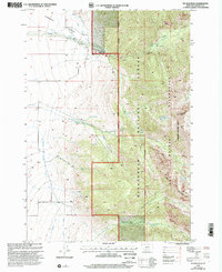
1997 Map of No Man Peak
USGS Topo · Published 2002About this map
Cameron Bench and the high peaks of the Madison Range dominate this landscape, illustrating the transition from managed agricultural land to protected wilderness. The western half of the map is defined by an extensive network of irrigation infrastructure, including the Kramer Ditch, Indian Creek Ditch, Cummings Ditch, and Armitage Ditch, which channel water from Indian Creek and Deer Creek to the benchlands. The only named settlement is the Wonder Ranch, situated near the Madison Ranger District Boundary. To the east, the terrain rises sharply into the Beaverhead National Forest and the Lee Metcalf Wilderness (Taylor Hilgard Unit), where high-altitude features like Rainbow Lakes and the namesake No Man Peak sit within the high Madison mountains. This survey effectively documents the intersection of high-country water sources and the vital irrigation systems supporting ranching in the valley below.
Find a feature on this map
19 named features on this map. Tap any name to fly to it.
Don’t see what you’re looking for? This feature index may not catch every label — zoom into the map to look around manually.
Map Details
Editions of this 1997 No Man Peak Map
This is the sole edition of this map. No revisions or reprints were ever made.
Other maps of this area

1888 · Three Forks
USGS Topo · 1:250,000

1894 · Three Forks
USGS Topo · 1:250,000

1895 · Three Forks
USGS Topo · 1:250,000

1947 · Bozeman
USGS Topo · 1:250,000

1948 · Bozeman
USGS Topo · 1:250,000

1950 · Cliff Lake
USGS Topo · 1:62,500

1950 · Hebgen Dam
USGS Topo · 1:62,500

1950 · Cameron
USGS Topo · 1:62,500

1950 · Sphinx Mountain
USGS Topo · 1:62,500

1955 · Bozeman
USGS Topo · 1:250,000