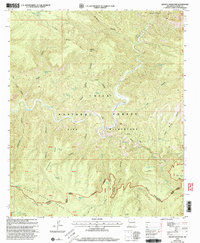
1999 Map of Granny Mountain
USGS Topo · Published 2002About this map
Gila Wilderness and Gila National Forest dominate this landscape in the late 20th century, revealing a backcountry shaped by rugged terrain and a network of historic trails. The Gila River and its tributary Sapillo Creek carve deep through the canyonlands, where isolated landmarks like Miller Spring Cabin and Dorsey provide evidence of sparse human habitation and livestock management. These remote outposts are connected by an extensive system of paths, including the Miller Sprs Trail 160 and the Sheep Corral Trail, reflecting the area's continued use for grazing and wilderness recreation.
Find a feature on this map
90 named features on this map. Tap any name to fly to it.
Don’t see what you’re looking for? This feature index may not catch every label — zoom into the map to look around manually.
Map Details
Editions of this 1999 Granny Mountain Map
This is the sole edition of this map. No revisions or reprints were ever made.
Other maps of this area

1909 · Silver City
USGS Topo · 1:125,000

1911 · Alum Mountain
USGS Topo · 1:125,000

1913 · Alum Mountain
USGS Topo · 1:125,000

1947 · Twin Sisters
USGS Topo · 1:24,000

1948 · Twin Sisters
USGS Topo · 1:24,000

1950 · Dorsey Ranch
USGS Topo · 1:24,000

1950 · Reading Mountain
USGS Topo · 1:24,000

1951 · Dorsey Ranch
USGS Topo · 1:24,000
1952 · Reading Mountain
USGS Topo · 1:24,000

1954 · Silver City
USGS Topo · 1:250,000