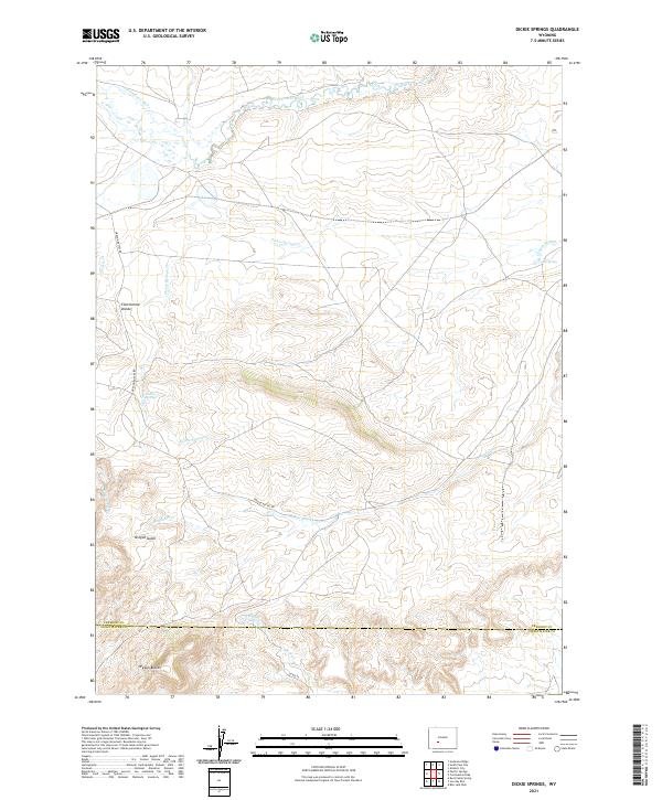
2021 Map of Dickie Springs
USGS Topo · Published 2021About this map
The Continental Divide defines the western terrain of this landscape, marking the high ground where watersheds split in the high desert of the Wyoming basin. This area is defined by its intermittent drainage patterns and historical trail significance, most notably seen in the concentration of names like Oregon Gulch, Oregon Slough, and Oregon Spring. These features, along with the Oregon Buttes Rd, underscore the historical movement through this territory towards the prominent Oregon Buttes in the south. The north is anchored by the Sweetwater River, a vital water source for travelers and cattle in an otherwise arid expanse. Small, isolated watering points such as Dickie Springs and Edmund Springs appear as critical landmarks for local hydrology, while seasonal flows like Meadow Cr and Dickie Springs Cr reveal the intricate, delicate drainage system of the high plateau.
Find a feature on this map
23 named features on this map. Tap any name to fly to it.
Don’t see what you’re looking for? This feature index may not catch every label — zoom into the map to look around manually.
Map Details
Editions of this 2021 Dickie Springs Map
This is the sole edition of this map. No revisions or reprints were ever made.
Other maps of this area

1953 · Atlantic City
USGS Topo · 1:24,000

1953 · South Pass City
USGS Topo · 1:24,000

1955 · Lander
USGS Topo · 1:250,000

1958 · Lander
USGS Topo · 1:250,000

1958 · Pacific Springs
USGS Topo · 1:24,000

1958 · Freighter Gap
USGS Topo · 1:62,500

1958 · The Pinnacles
USGS Topo · 1:62,500

1958 · Dickie Springs
USGS Topo · 1:24,000

1958 · Continental Peak
USGS Topo · 1:24,000

1961 · Lander
USGS Topo · 1:250,000