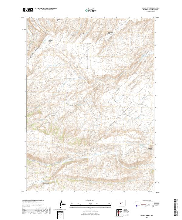
2021 Map of Gravel Spring
USGS Topo · Published 2021About this map
Commissary Hill and the Red Canyon Rim define the high northwestern reaches of this Fremont County landscape, where the terrain drops into a network of drainages feeding into the Beaver Cr basin. The map reveals an intricate system of water management in an arid environment, notably the Tweed Ditch and Schlichting Ditch, which redirect flow across the high plateaus. These man-made features contrast with the natural hydrology of Gravel Spring and Chalk Spring, which likely served as vital landmarks for early travel and livestock. To the east, the Dilabaugh Buttes stand as prominent markers above Wilson Draw, illustrating the classic high-plains topography of the Cottonwood Divide. The presence of Dickinson Ave suggests a more modern layer of access to this otherwise deeply corrugated landscape of gulches and draws.
Find a feature on this map
32 named features on this map. Tap any name to fly to it.
Don’t see what you’re looking for? This feature index may not catch every label — zoom into the map to look around manually.
Map Details
Editions of this 2021 Gravel Spring Map
This is the sole edition of this map. No revisions or reprints were ever made.
Other maps of this area

1953 · Lewiston Lakes
USGS Topo · 1:24,000

1953 · Gravel Spring
USGS Topo · 1:24,000

1953 · Radium Springs
USGS Topo · 1:24,000

1953 · Schlichting Mountain
USGS Topo · 1:24,000

1953 · Del Monte Ridge
USGS Topo · 1:24,000

1953 · Atlantic City
USGS Topo · 1:24,000

1953 · Weiser Pass
USGS Topo · 1:24,000

1954 · Wolf Point
USGS Topo · 1:24,000

1954 · Miners Delight
USGS Topo · 1:24,000

1955 · Lander
USGS Topo · 1:250,000