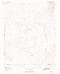
1966 Map of Grey Hill Spring
USGS Topo · Published 1969About this map
Navajo Indian Reservation lands dominate this mid-century topographical study, revealing a landscape defined by an intricate network of desert drainage systems. The terrain is shaped by the seasonal flow of the Salt Springs Wash and Coyote Wash, which converge as they carve through the arid high desert. This 1966 field-checked survey highlights the vital water sources and early infrastructure of the region, including the eponymous Grey Hill Spring and an industrial Pipeline that traverses the southern reaches. Near the border of San Juan Co and Mc Kinley Co, the map documents several scattered wells and the prominent rise of Grey Hill, providing a clear record of the area's physical geography and land-use patterns during the late 1960s.
Find a feature on this map
9 named features on this map. Tap any name to fly to it.
Don’t see what you’re looking for? This feature index may not catch every label — zoom into the map to look around manually.
Map Details
Editions of this 1966 Grey Hill Spring Map
2 editions found
Other maps of this area

1886 · Wingate
USGS Topo · 1:250,000

1889 · Chaco
USGS Topo · 1:250,000

1892 · Wingate
USGS Topo · 1:250,000

1892 · Chaco
USGS Topo · 1:250,000

1954 · Shiprock
USGS Topo · 1:250,000

1954 · Gallup
USGS Topo · 1:250,000

1958 · Gallup
USGS Topo · 1:250,000

1958 · Shiprock
USGS Topo · 1:250,000

1959 · Shiprock
USGS Topo · 1:250,000

1959 · Gallup
USGS Topo · 1:250,000