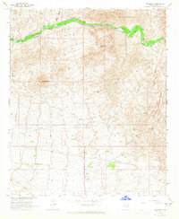
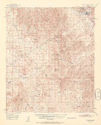
1964 Map of Grayback
USGS Topo · Published 1965About this map
The Gila River winds through the northern portion of this Pinal County landscape, providing a sharp contrast to the surrounding arid terrain. Along its banks, the A-Diamond Ranch represents the agricultural and ranching presence in the region during the mid-1960s. The topography is defined by significant mineral interest, evidenced by the Golden Bell Mine and Wooley Mine, as well as numerous Prospects scattered across the ridgelines. A network of Jeep Trails and footpaths suggests a region primarily used for resource extraction and livestock grazing rather than dense settlement. Infrastructure like the Radio Tower and Substation indicates the encroachment of modern utilities into the desert. The presence of Uslm 2395 serves as a reminder of the foundational mineral surveys that established mining claims in this part of Arizona.
Find a feature on this map
13 named features on this map. Tap any name to fly to it.
Don’t see what you’re looking for? This feature index may not catch every label — zoom into the map to look around manually.
Map Details
Editions of this 1964 Grayback Map
3 editions found
Other maps of this area

1900 · Florence
USGS Topo · 1:125,000

1902 · Florence
USGS Topo · 1:125,000

1910 · Ray
USGS Topo · 1:62,500

1911 · Winkelman
USGS Topo · 1:125,000

1913 · Winkelman
USGS Topo · 1:125,000

1934 · Newman Peak
USGS Topo · 1:125,000

1949 · Crozier Peak
USGS Topo · 1:24,000

1949 · Winkelman
USGS Topo · 1:62,500
1950 · Crozier Peak
USGS Topo · 1:24,000
1951 · Winkelman
USGS Topo · 1:62,500