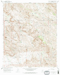
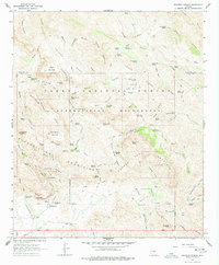
1966 Map of Weavers Needle
USGS Topo · Published 1978About this map
Weavers Needle stands as a prominent volcanic landmark within the Superstition Mountains, a landscape defined by sharp elevation shifts and a network of named springs vital for survival in the arid terrain. This 1966 field-checked survey reveals the complex human presence throughout the Tonto National Forest, from working cattle operations like Tortilla Ranch and Whitlow Corral to various encampments such as Bark Camp, Reeds Camp, and Williams Camp. The map documents a geography steeped in lore, tracing the Dutchmans Trail and marking the site of Lost Dutch Spring and the Miller Mines. This era of the Superstition Wilderness reflects a time when the pack trails were the primary lifelines through the high desert, connecting remote sites like Geronimo Cave and Miners Summit before modern expansion altered the periphery of these mountains.
Find a feature on this map
91 named features on this map. Tap any name to fly to it.
Don’t see what you’re looking for? This feature index may not catch every label — zoom into the map to look around manually.
Map Details
Editions of this 1966 Weavers Needle Map
5 editions found
Other maps of this area

1900 · Florence
USGS Topo · 1:125,000

1902 · Florence
USGS Topo · 1:125,000

1907 · Roosevelt
USGS Topo · 1:125,000

1909 · Four Peaks
USGS Topo · 1:125,000

1912 · Roosevelt
USGS Topo · 1:125,000

1948 · Superior
USGS Topo · 1:62,500

1948 · Iron Mountain
USGS Topo · 1:24,000

1948 · Picketpost Mtn
USGS Topo · 1:24,000

1949 · Iron Mountain
USGS Topo · 1:24,000

1949 · Picketpost Mtn
USGS Topo · 1:24,000