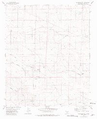
1981 Map of Golondrina Well
USGS Topo · Published 1981About this map
The desert landscape of Lincoln County in the early 1980s reveals a sophisticated water and fuel infrastructure necessary for ranching and industry. A prominent Aqueduct and series of Pipelines traverse the terrain, connecting essential water sources like Golondrina Well and Hasperos Well. The map highlights the intersection of transportation and utility, featuring a Landing Strip and the Corona Pumping Sta positioned near the convergence of Little Hasperos Canyon and Hasperos Canyon. These features, along with named catchments like Dead Mexican Tank and Pipeline Tank, illustrate the reliance on groundwater and managed runoff in this arid region of New Mexico. Small-scale industrial traces also appear, including a Gravel Pit and the Dabble Mills site, suggesting a history of local resource extraction and processing.
Find a feature on this map
24 named features on this map. Tap any name to fly to it.
Don’t see what you’re looking for? This feature index may not catch every label — zoom into the map to look around manually.
Map Details
Editions of this 1981 Golondrina Well Map
This is the sole edition of this map. No revisions or reprints were ever made.
Other maps of this area

1954 · Fort Sumner
USGS Topo · 1:250,000

1955 · Roswell
USGS Topo · 1:250,000

1958 · Fort Sumner
USGS Topo · 1:250,000

1958 · Roswell
USGS Topo · 1:250,000

1962 · Roswell
USGS Topo · 1:250,000

1980 · Corona
USGS Topo · 1:100,000
1981 · Pedernal Arroyo
USGS Topo · 1:24,000

1981 · Huff Hill
USGS Topo · 1:24,000

1981 · Cowboy Mesa SW
USGS Topo · 1:24,000
1981 · Juan Largo Canyon West
USGS Topo · 1:24,000