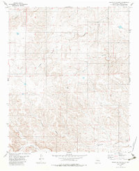
1981 Map of Granville Canyon
USGS Topo · Published 1983About this map
Granville Canyon and its complex network of drainage systems define the rugged high-country topography of Lincoln County in the early 1980s. The landscape is marked by several named watercourses, including Arroyo Serrano in the north and the winding Agua Chiquita Creek to the south. Small, isolated ranching outposts and named locales such as South Winkler and Pacheco are scattered across the terrain, connected by unimproved roads that navigate the steep elevation changes. The southern portion of the quadrangle is dominated by the confluence of local drainages into Blackwater Canyon, where the Blackwater Ranch represents the primary human footprint in an area otherwise shaped by natural erosion and seasonal flows. This survey provides a clear look at the pastoral and hydrological layout of the region before significant modern development, preserving the locations of rural settlements like Merton.
Find a feature on this map
10 named features on this map. Tap any name to fly to it.
Don’t see what you’re looking for? This feature index may not catch every label — zoom into the map to look around manually.
Map Details
Editions of this 1981 Granville Canyon Map
2 editions found
Other maps of this area

1936 · Arabela
USGS Topo · 1:48,000

1942 · Arabela
USGS Topo · 1:62,500

1955 · Roswell
USGS Topo · 1:250,000

1958 · Roswell
USGS Topo · 1:250,000

1961 · Tinnie
USGS Topo · 1:62,500

1962 · Roswell
USGS Topo · 1:250,000

1962 · Horseshoe Bend
USGS Topo · 1:62,500

1967 · White Flat
USGS Topo · 1:24,000
1967 · Elsie Canyon
USGS Topo · 1:24,000

1979 · Roswell
USGS Topo · 1:100,000