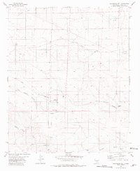
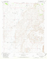
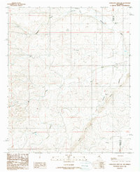
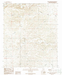
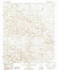
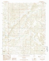
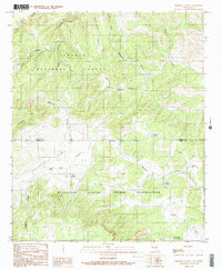
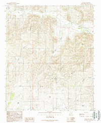
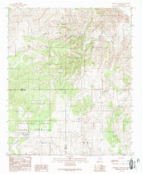
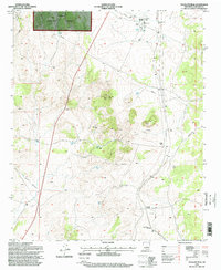
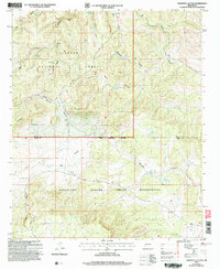
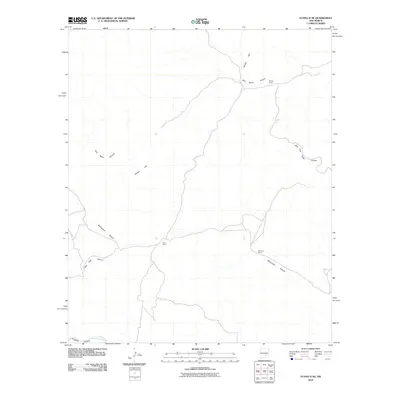
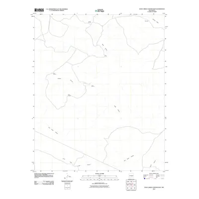
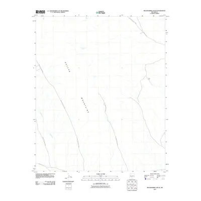
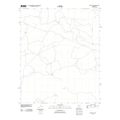
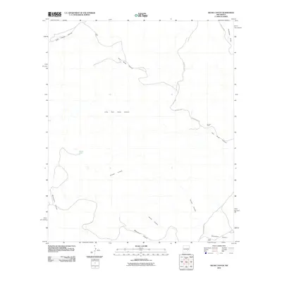
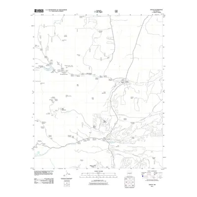
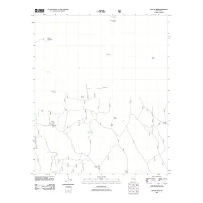
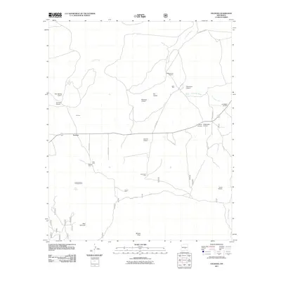
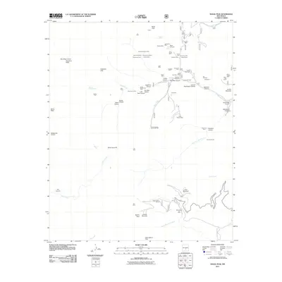
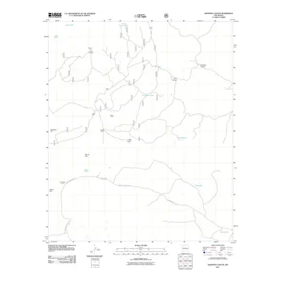
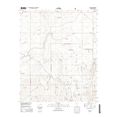
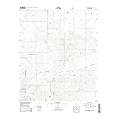
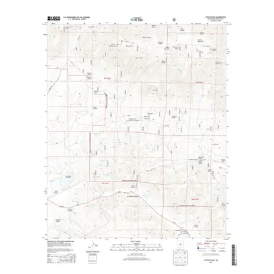
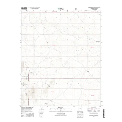
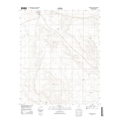
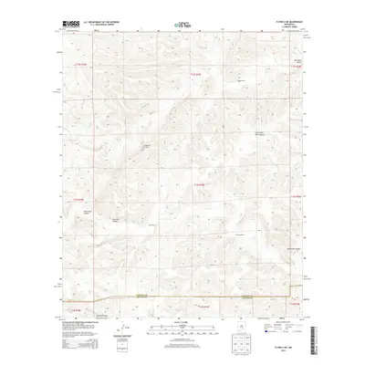
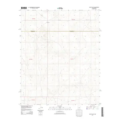
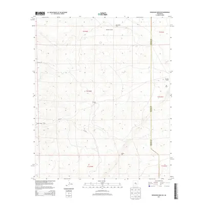
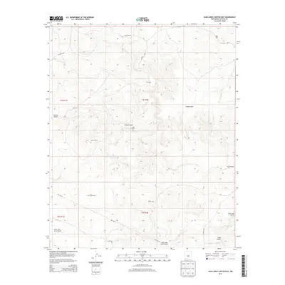
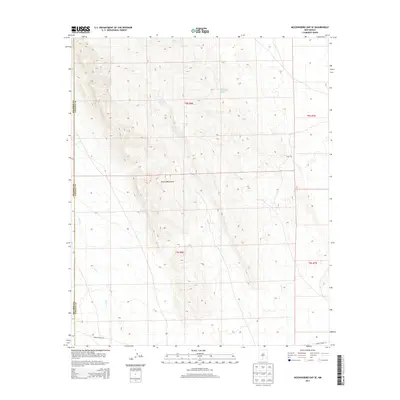
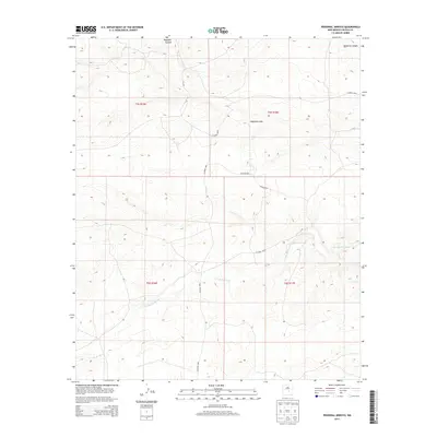
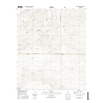
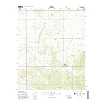
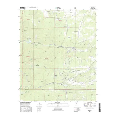
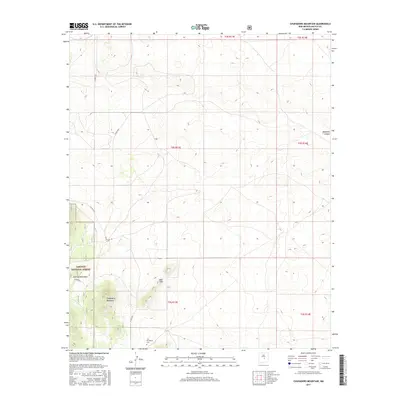
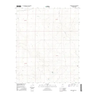
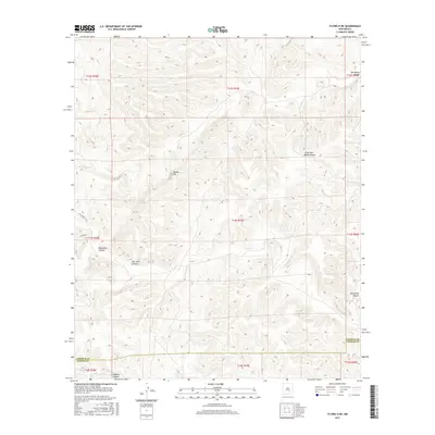
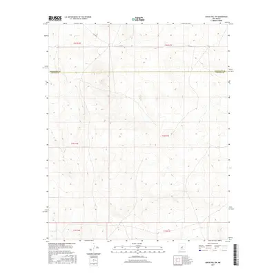
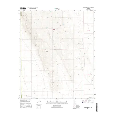
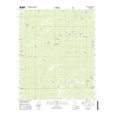
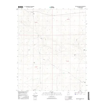
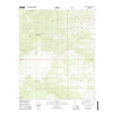
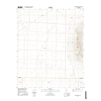
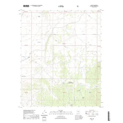
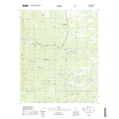
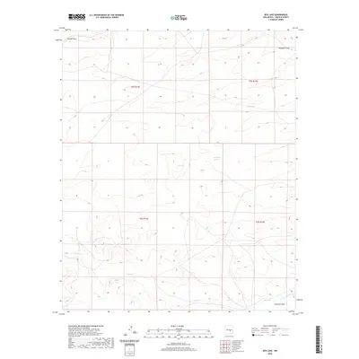
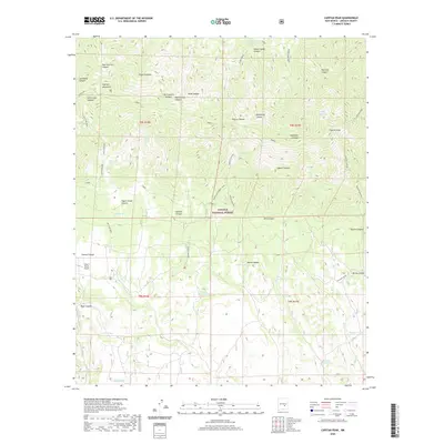
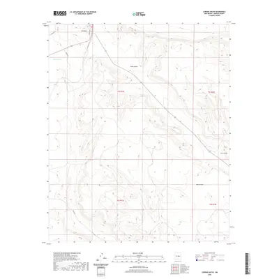
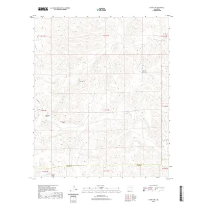
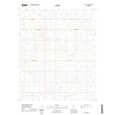
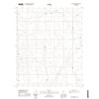
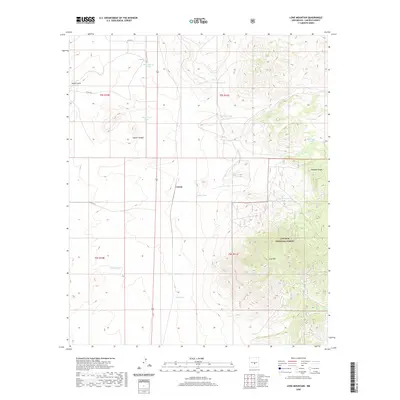
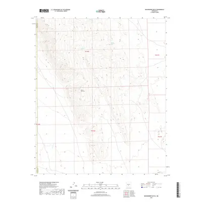
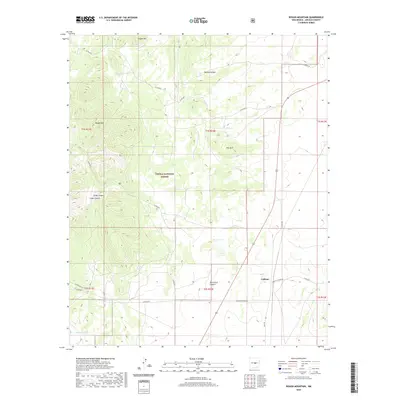
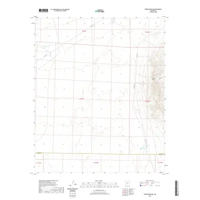
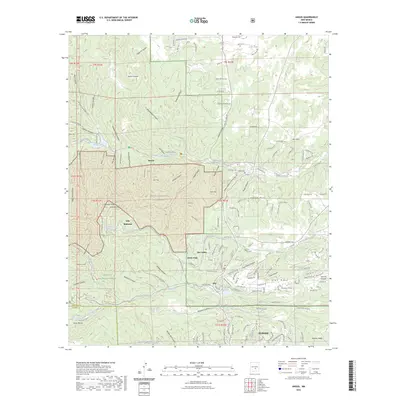
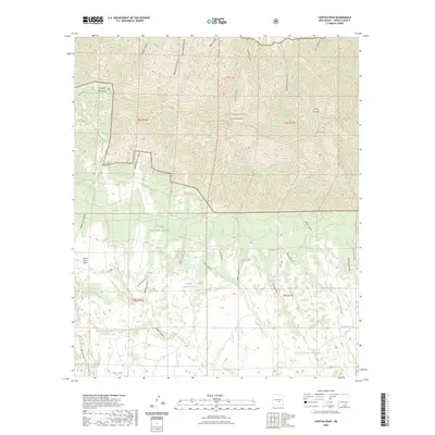
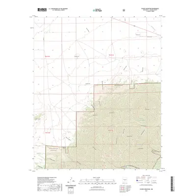
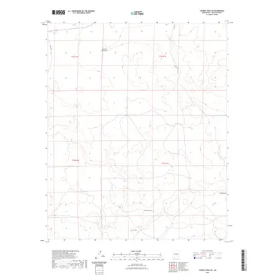
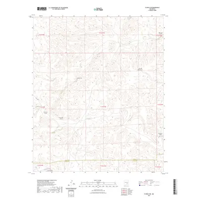
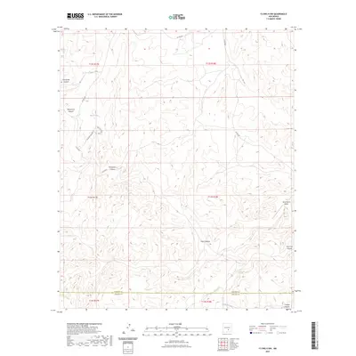
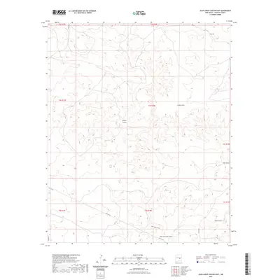
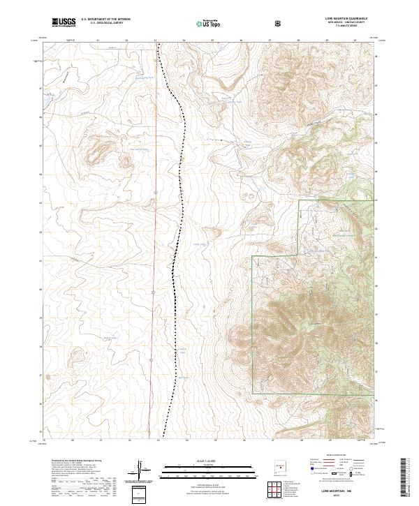
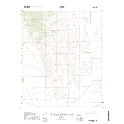
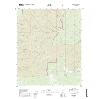
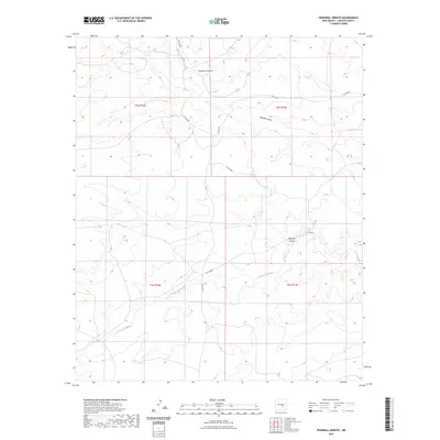
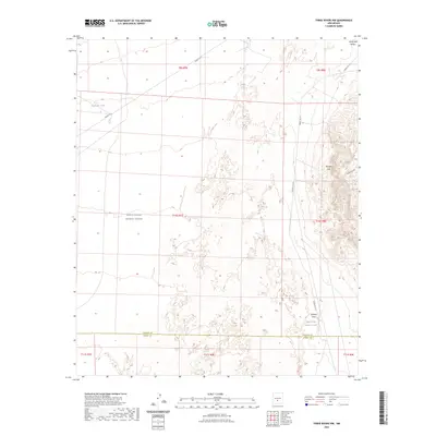
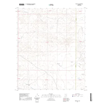
1982 Map of Lone Mountain
USGS Topo · Published 1982About this map
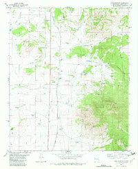
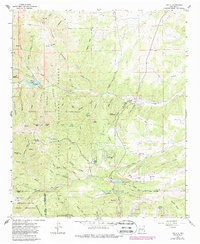
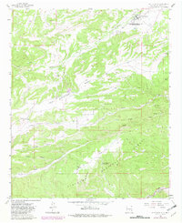
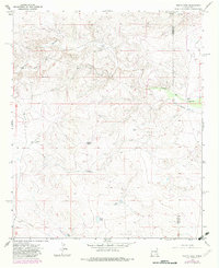
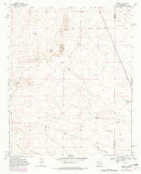
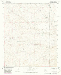
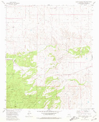
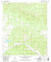
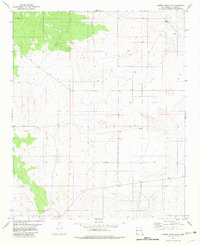
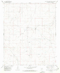
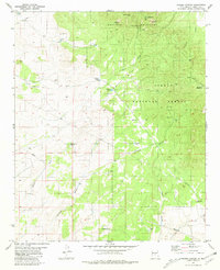
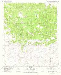
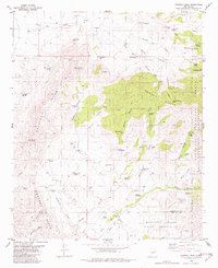
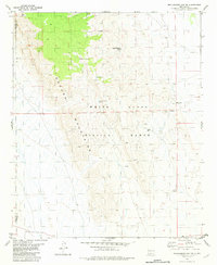
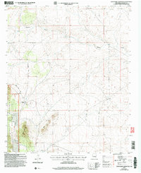
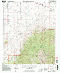
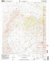
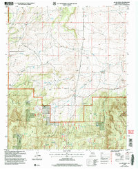
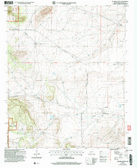
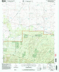
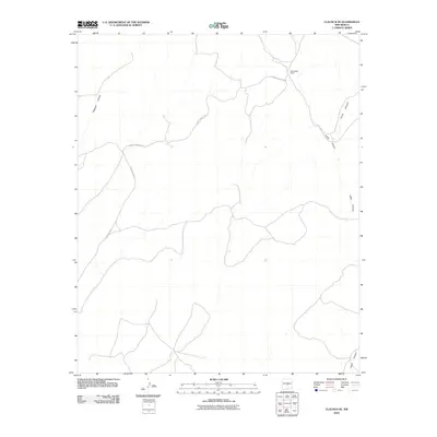
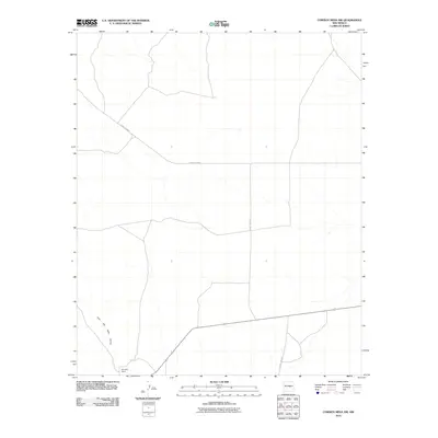
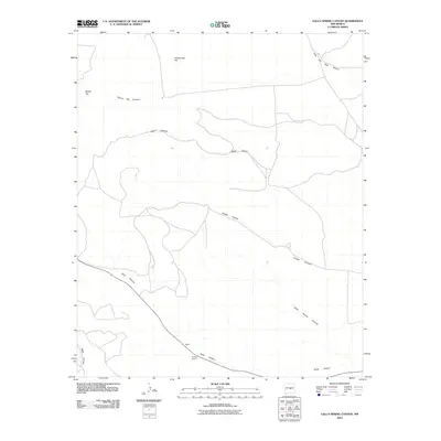
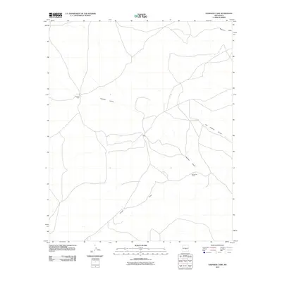
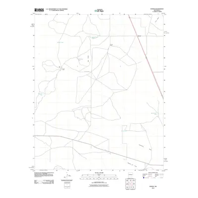
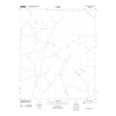
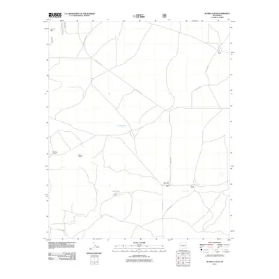
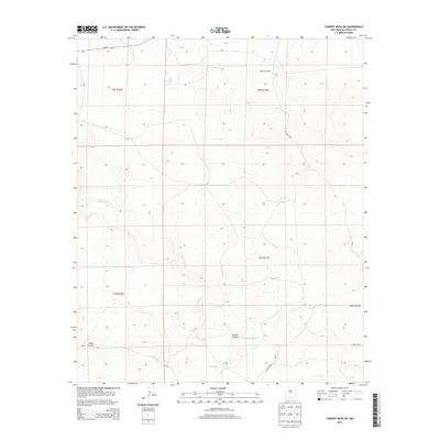
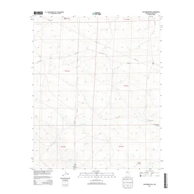
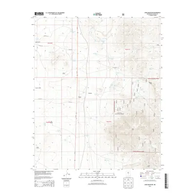
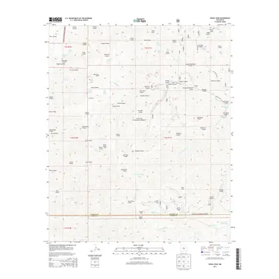
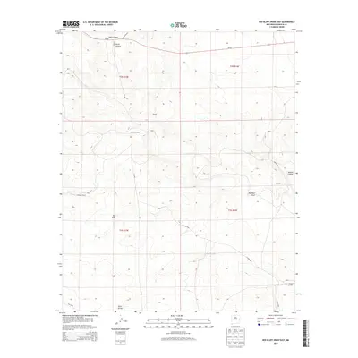
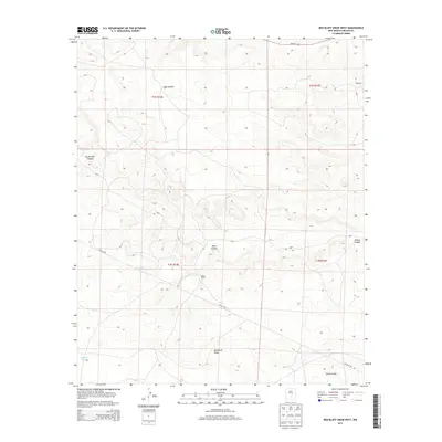
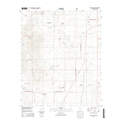
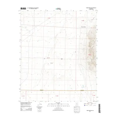
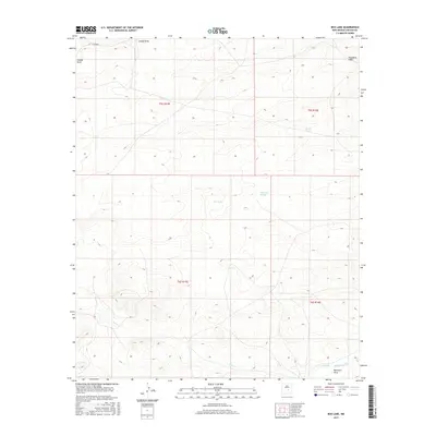
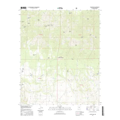
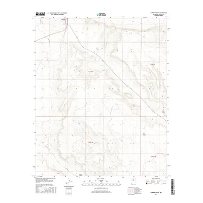
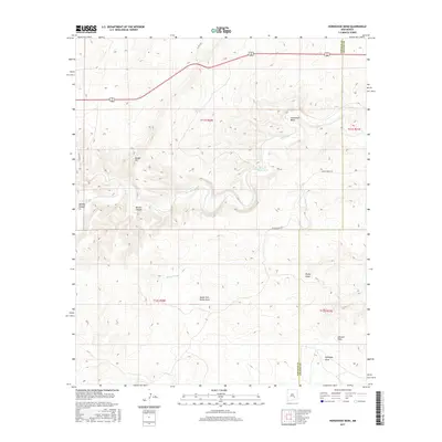
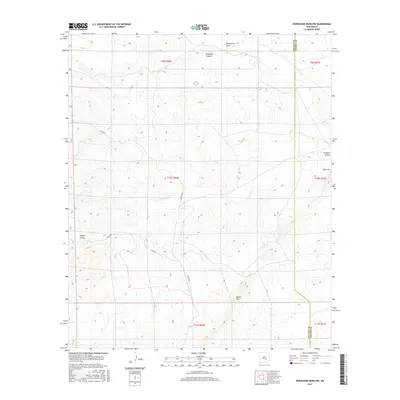
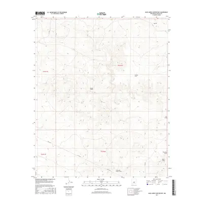
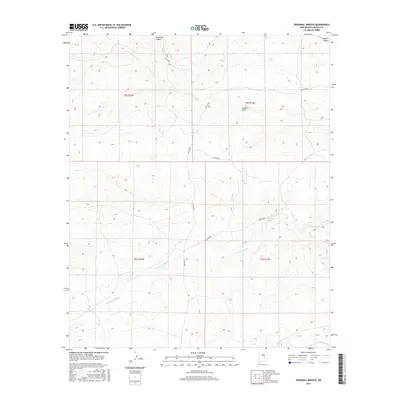
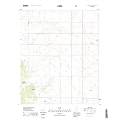
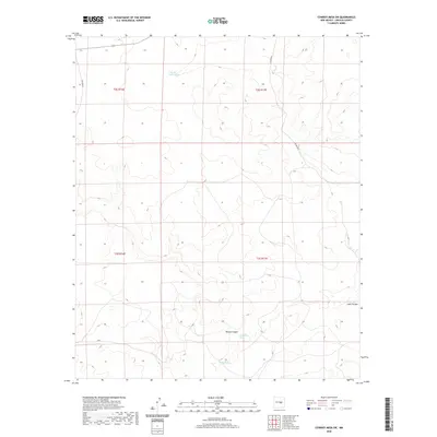
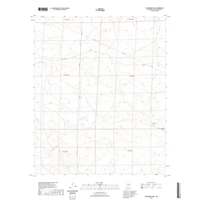
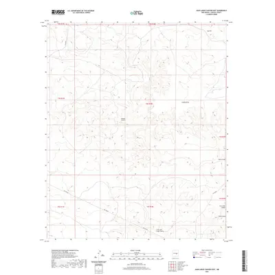
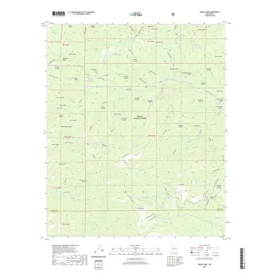
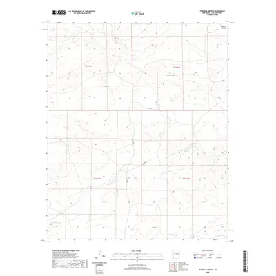
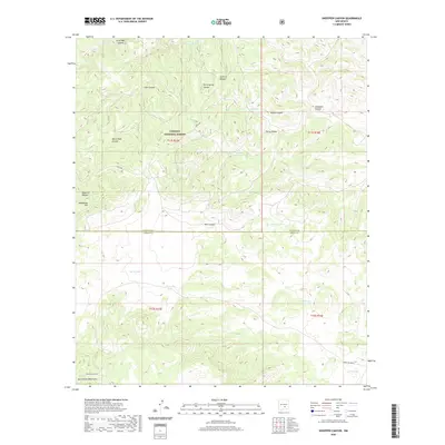
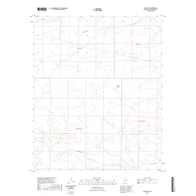
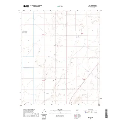
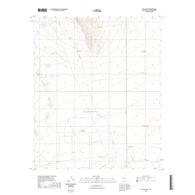
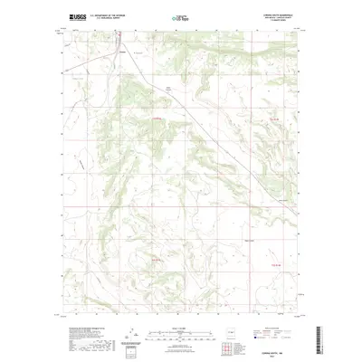
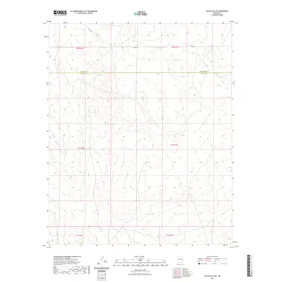
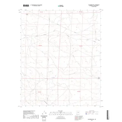
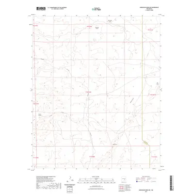
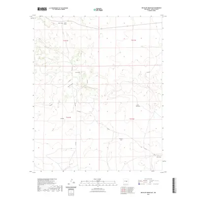
Lone Mountain dominates the eastern half of this Lincoln County landscape, surrounded by the high-elevation terrain of the Lincoln National Forest. The map documents a landscape defined by water scarcity and ranching infrastructure, where the Southern Pacific tracks bisect the western plains. Life in this arid environment is evidenced by dozens of water management features, from the Dunning Ranch to family-named landmarks like Harkey Tank and Collier Spring.
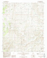
Find a feature on this map
49 named features on this map. Tap any name to fly to it.
Don’t see what you’re looking for? This feature index may not catch every label — zoom into the map to look around manually.
Map Details
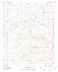
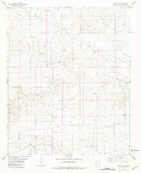
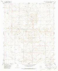
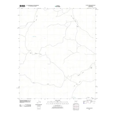
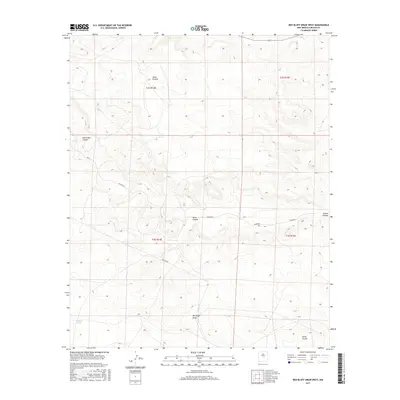
Editions of this 1982 Lone Mountain Map
This is the sole edition of this map. No revisions or reprints were ever made.
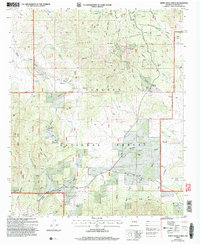
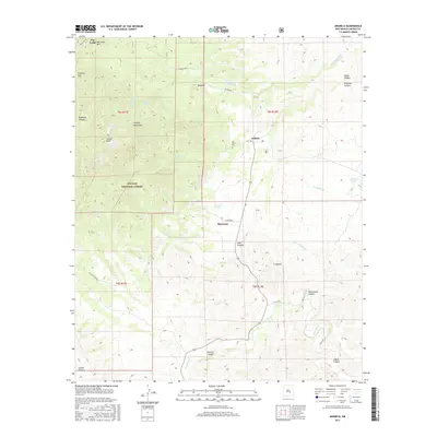
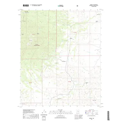
Historical Maps of Coyote Through Time
488 maps found

1935 Capitan Mountains
Lincoln County, NM

1936 Arabela
Lincoln County, NM
1940 Capitan Mountains
Lincoln County, NM

1942 Arabela
Lincoln County, NM

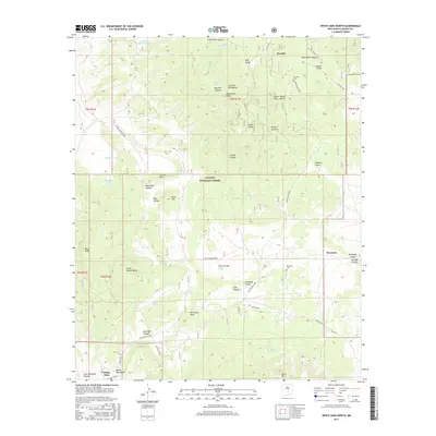
1948 Chihuahua Ranch
Lincoln County, NM
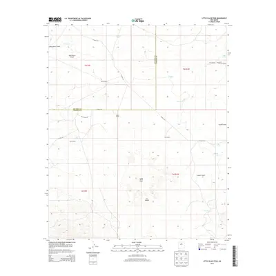
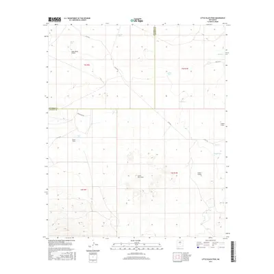
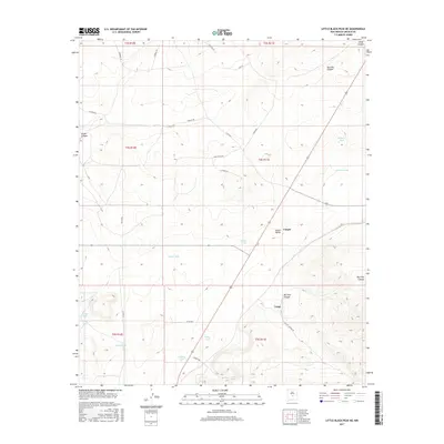
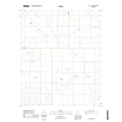
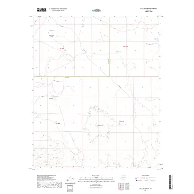
1950 Little Black Peak
Lincoln County, NM

1950 Oscura
Lincoln County, NM

1961 Lincoln
Lincoln County, NM
1961 Tinnie
Lincoln County, NM
1963 Angus
Lincoln County, NM
1963 Fort Stanton
Lincoln County, NM

1967 Chivata Canyon
Lincoln County, NM

1967 Elsie Canyon
Lincoln County, NM
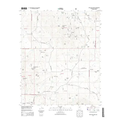
1967 North Lake
Lincoln County, NM
1967 Ramon
Lincoln County, NM
1967 Ramon SW
Lincoln County, NM
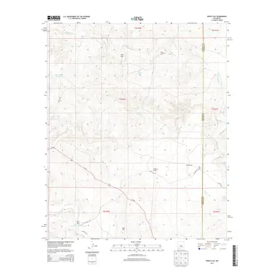
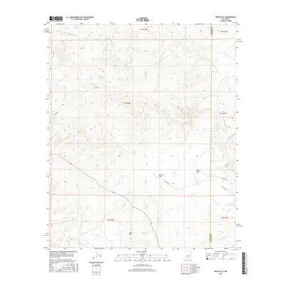
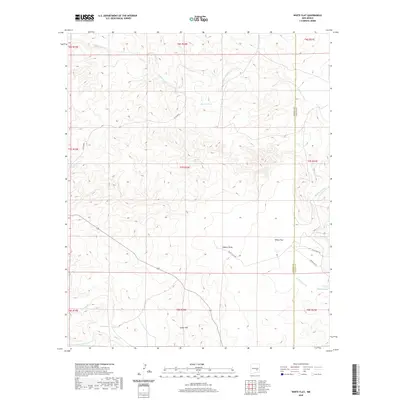
1967 White Flat
Lincoln County, NM

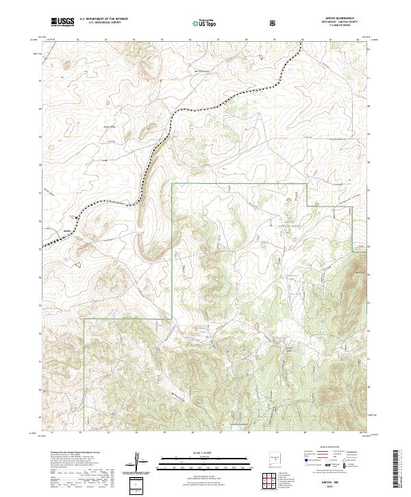
1973 Ancho
Lincoln County, NM

1973 Chupadero Mountain
Lincoln County, NM

1973 Jacob Spring
Lincoln County, NM

1973 Jicarilla Peak
Lincoln County, NM
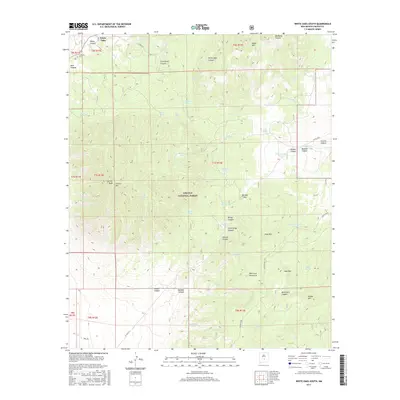
1973 White Oaks North
Lincoln County, NM

1973 White Oaks South
Lincoln County, NM

1981 Arabela
Lincoln County, NM
1981 Arroyo Serrano East
Lincoln County, NM
1981 Arroyo Serrano West
Lincoln County, NM
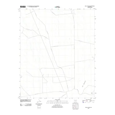
1981 Box Lake
Lincoln County, NM
1981 Bull Gap
Lincoln County, NM
1981 Bull Gap SW
Lincoln County, NM
1981 Capitan Pass
Lincoln County, NM
1981 Capitan Peak
Lincoln County, NM
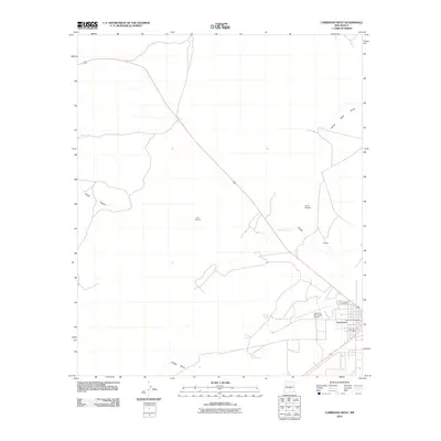
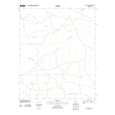
1981 Cistern Draw
Lincoln County, NM
1981 Claunch SE
Lincoln County, NM

1981 Corona South
Lincoln County, NM

1981 Cowboy Mesa
Lincoln County, NM

1981 Cowboy Mesa NE
Lincoln County, NM
1981 Cowboy Mesa NW
Lincoln County, NM
1981 Cowboy Mesa SW
Lincoln County, NM
1981 Cub Mountain
Lincoln County, NM

1981 Encinoso
Lincoln County, NM

1981 Gacho Hill SE
Lincoln County, NM

1981 Gacho Hill SW
Lincoln County, NM

1981 Gallo Spring Canyon
Lincoln County, NM
1981 Gallo Spring Canyon NE
Lincoln County, NM
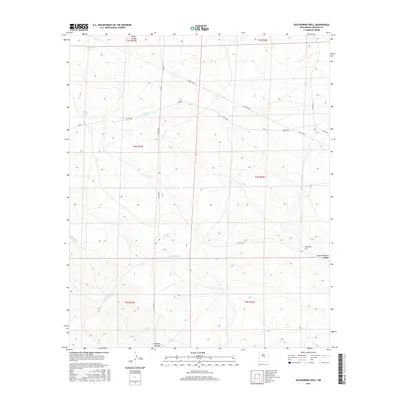
1981 Golondrina Well
Lincoln County, NM

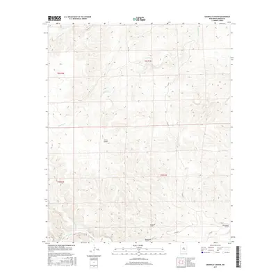
1981 Granville Canyon
Lincoln County, NM
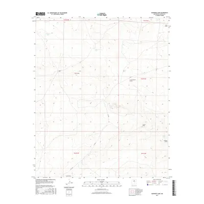
1981 Hasperos Camp
Lincoln County, NM
1981 Huff Hill
Lincoln County, NM
1981 Juan Largo Canyon East
Lincoln County, NM
1981 Juan Largo Canyon West
Lincoln County, NM
1981 Kyle Harrison Canyon
Lincoln County, NM
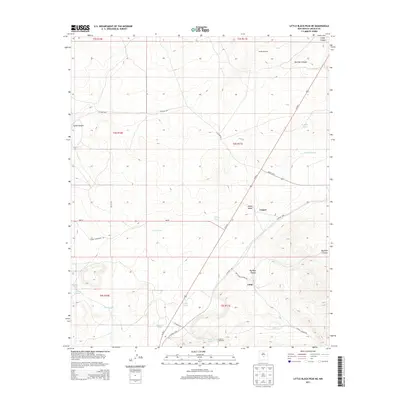
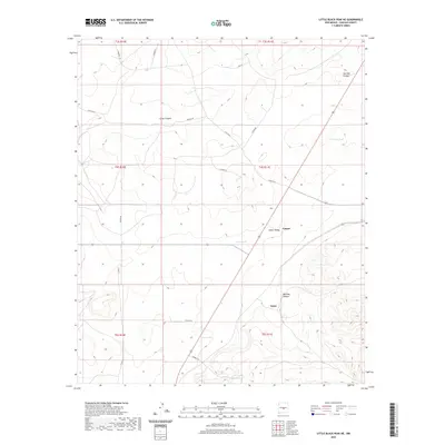
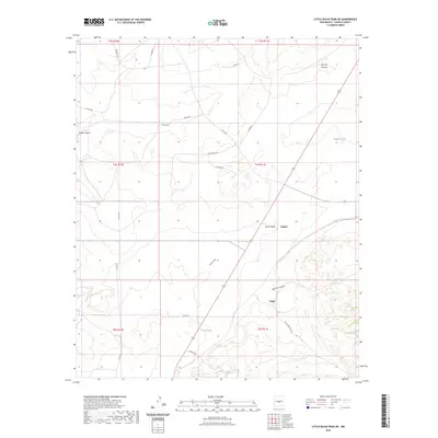
1981 Little Black Peak
Lincoln County, NM
1981 Little Black Peak NE
Lincoln County, NM

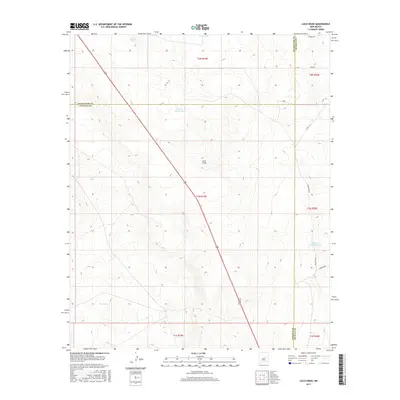
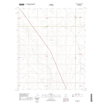
1981 Loco Draw
Lincoln County, NM

1981 Oscura
Lincoln County, NM
1981 Pajaro Canyon
Lincoln County, NM
1981 Pedernal Arroyo
Lincoln County, NM
1981 Pelon Hill
Lincoln County, NM
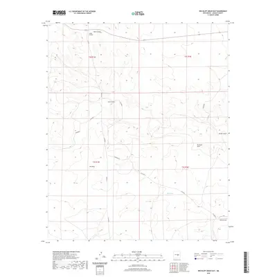
1981 Red Bluff Draw East
Lincoln County, NM
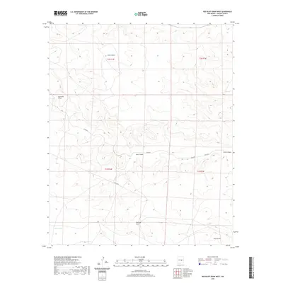
1981 Red Bluff Draw West
Lincoln County, NM

1981 Rough Mountain
Lincoln County, NM
1981 Tecolote Peak
Lincoln County, NM
1981 Three Rivers NW
Lincoln County, NM

1982 Carrizozo East
Lincoln County, NM

1982 Carrizozo West
Lincoln County, NM
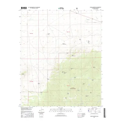
1982 Church Mountain
Lincoln County, NM
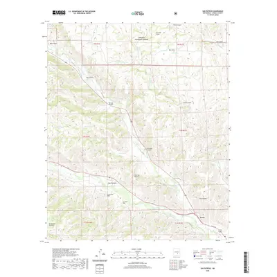
1982 Godfrey Peak
Lincoln County, NM
1982 Lone Mountain
Lincoln County, NM
1982 Mockingbird Gap SE
Lincoln County, NM
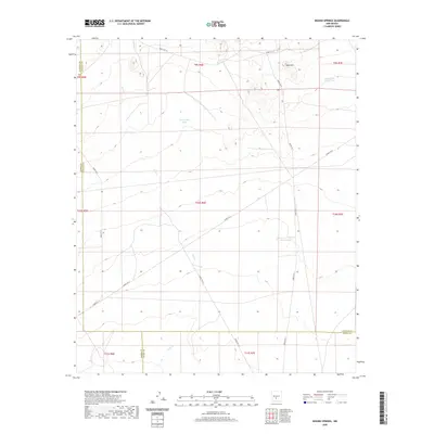
1982 Mound Springs
Lincoln County, NM
1982 Nogal Peak
Lincoln County, NM
1982 Wagon Canyon
Lincoln County, NM
1988 Horseshoe Bend NW
Lincoln County, NM
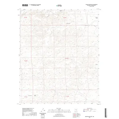
1988 Nelson Canyon East
Lincoln County, NM
1988 Skunk Canyon
Lincoln County, NM

1988 Sunset
Lincoln County, NM
1989 Flying H NE
Lincoln County, NM
1989 Flying H NW
Lincoln County, NM
1989 Lincoln
Lincoln County, NM
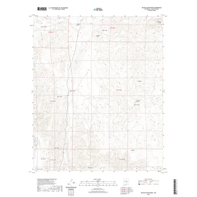
1989 Nelson Canyon West
Lincoln County, NM

1989 San Patricio
Lincoln County, NM
1989 Sheeppen Canyon
Lincoln County, NM
1989 Tinnie
Lincoln County, NM
1989 Wahalee Canyon
Lincoln County, NM
1995 Pajaro Canyon
Lincoln County, NM

1995 Rough Mountain
Lincoln County, NM
1995 Tecolote Peak
Lincoln County, NM

2004 Ancho
Lincoln County, NM

2004 Angus
Lincoln County, NM

2004 Arabela
Lincoln County, NM
2004 Arroyo Serrano West
Lincoln County, NM
2004 Capitan Pass
Lincoln County, NM
2004 Capitan Peak
Lincoln County, NM
2004 Chupadero Mountain
Lincoln County, NM
2004 Church Mountain
Lincoln County, NM

2004 Encinoso
Lincoln County, NM

2004 Fort Stanton
Lincoln County, NM
2004 Godfrey Peak
Lincoln County, NM
2004 Jacob Spring
Lincoln County, NM
2004 Jicarilla Peak
Lincoln County, NM
2004 Kyle Harrison Canyon
Lincoln County, NM
2004 Lincoln
Lincoln County, NM

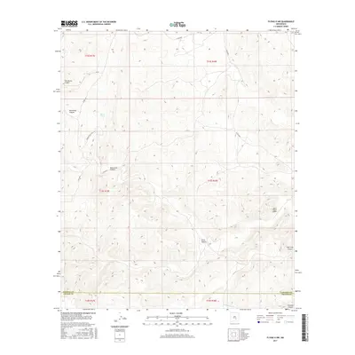
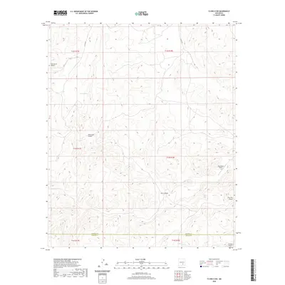
2004 Lone Mountain
Lincoln County, NM
2004 Nogal Peak
Lincoln County, NM

2004 San Patricio
Lincoln County, NM
2004 Sheeppen Canyon
Lincoln County, NM
2004 White Oaks North
Lincoln County, NM

2004 White Oaks South
Lincoln County, NM
2010 Arroyo Serrano East
Lincoln County, NM
2010 Box Lake
Lincoln County, NM
2010 Bull Gap
Lincoln County, NM
2010 Bull Gap SW
Lincoln County, NM
2010 Carrizozo West
Lincoln County, NM

2010 Chivata Canyon
Lincoln County, NM
2010 Cistern Draw
Lincoln County, NM
2010 Claunch SE
Lincoln County, NM
2010 Corona South
Lincoln County, NM
2010 Cowboy Mesa
Lincoln County, NM
2010 Cowboy Mesa NE
Lincoln County, NM
2010 Cowboy Mesa NW
Lincoln County, NM
2010 Cowboy Mesa SW
Lincoln County, NM
2010 Cub Mountain
Lincoln County, NM
2010 Elsie Canyon
Lincoln County, NM
2010 Flying H NE
Lincoln County, NM
2010 Flying H NW
Lincoln County, NM
2010 Gacho Hill SE
Lincoln County, NM
2010 Gacho Hill SW
Lincoln County, NM
2010 Gallo Spring Canyon
Lincoln County, NM
2010 Gallo Spring Canyon NE
Lincoln County, NM
2010 Golondrina Well
Lincoln County, NM
2010 Granville Canyon
Lincoln County, NM
2010 Hasperos Camp
Lincoln County, NM
2010 Horseshoe Bend
Lincoln County, NM
2010 Horseshoe Bend NW
Lincoln County, NM
2010 Huff Hill
Lincoln County, NM
2010 Juan Largo Canyon East
Lincoln County, NM

2010 Juan Largo Canyon West
Lincoln County, NM
2010 Little Black Peak
Lincoln County, NM
2010 Little Black Peak NE
Lincoln County, NM
2010 Loco Draw
Lincoln County, NM
2010 Mockingbird Gap SE
Lincoln County, NM
2010 Mound Springs
Lincoln County, NM
2010 Nelson Canyon East
Lincoln County, NM
2010 Nelson Canyon West
Lincoln County, NM
2010 North Lake
Lincoln County, NM
2010 Oscura
Lincoln County, NM
2010 Pedernal Arroyo
Lincoln County, NM
2010 Pelon Hill
Lincoln County, NM
2010 Ramon
Lincoln County, NM
2010 Ramon SW
Lincoln County, NM
2010 Red Bluff Draw East
Lincoln County, NM
2010 Red Bluff Draw West
Lincoln County, NM
2010 Skunk Canyon
Lincoln County, NM
2010 Sunset
Lincoln County, NM
2010 Three Rivers NW
Lincoln County, NM
2010 Tinnie
Lincoln County, NM
2010 Wagon Canyon
Lincoln County, NM
2010 Wahalee Canyon
Lincoln County, NM
2010 White Flat
Lincoln County, NM
2011 Ancho
Lincoln County, NM
2011 Angus
Lincoln County, NM
2011 Arabela
Lincoln County, NM
2011 Arroyo Serrano West
Lincoln County, NM
2011 Capitan Pass
Lincoln County, NM
2011 Capitan Peak
Lincoln County, NM
2011 Carrizozo East
Lincoln County, NM
2011 Chupadero Mountain
Lincoln County, NM
2011 Church Mountain
Lincoln County, NM
2011 Encinoso
Lincoln County, NM
2011 Fort Stanton
Lincoln County, NM
2011 Godfrey Peak
Lincoln County, NM
2011 Jacob Spring
Lincoln County, NM
2011 Jicarilla Peak
Lincoln County, NM
2011 Kyle Harrison Canyon
Lincoln County, NM
2011 Lincoln
Lincoln County, NM
2011 Lone Mountain
Lincoln County, NM
2011 Nogal Peak
Lincoln County, NM
2011 Pajaro Canyon
Lincoln County, NM
2011 Rough Mountain
Lincoln County, NM
2011 San Patricio
Lincoln County, NM
2011 Sheeppen Canyon
Lincoln County, NM
2011 Tecolote Peak
Lincoln County, NM
2011 White Oaks North
Lincoln County, NM
2011 White Oaks South
Lincoln County, NM
2013 Ancho
Lincoln County, NM
2013 Angus
Lincoln County, NM
2013 Arabela
Lincoln County, NM
2013 Arroyo Serrano East
Lincoln County, NM
2013 Arroyo Serrano West
Lincoln County, NM
2013 Box Lake
Lincoln County, NM
2013 Bull Gap
Lincoln County, NM
2013 Bull Gap SW
Lincoln County, NM
2013 Capitan Pass
Lincoln County, NM

2013 Capitan Peak
Lincoln County, NM
2013 Carrizozo East
Lincoln County, NM
2013 Carrizozo West
Lincoln County, NM
2013 Chivata Canyon
Lincoln County, NM
2013 Chupadero Mountain
Lincoln County, NM
2013 Church Mountain
Lincoln County, NM
2013 Cistern Draw
Lincoln County, NM
2013 Claunch SE
Lincoln County, NM
2013 Corona South
Lincoln County, NM
2013 Cowboy Mesa
Lincoln County, NM
2013 Cowboy Mesa NE
Lincoln County, NM
2013 Cowboy Mesa NW
Lincoln County, NM
2013 Cowboy Mesa SW
Lincoln County, NM
2013 Cub Mountain
Lincoln County, NM
2013 Elsie Canyon
Lincoln County, NM
2013 Encinoso
Lincoln County, NM
2013 Flying H NE
Lincoln County, NM
2013 Flying H NW
Lincoln County, NM
2013 Fort Stanton
Lincoln County, NM
2013 Gacho Hill SE
Lincoln County, NM
2013 Gacho Hill SW
Lincoln County, NM
2013 Gallo Spring Canyon
Lincoln County, NM
2013 Gallo Spring Canyon NE
Lincoln County, NM
2013 Godfrey Peak
Lincoln County, NM
2013 Golondrina Well
Lincoln County, NM
2013 Granville Canyon
Lincoln County, NM
2013 Hasperos Camp
Lincoln County, NM
2013 Horseshoe Bend
Lincoln County, NM
2013 Horseshoe Bend NW
Lincoln County, NM
2013 Huff Hill
Lincoln County, NM
2013 Jacob Spring
Lincoln County, NM
2013 Jicarilla Peak
Lincoln County, NM
2013 Juan Largo Canyon East
Lincoln County, NM
2013 Juan Largo Canyon West
Lincoln County, NM
2013 Kyle Harrison Canyon
Lincoln County, NM
2013 Lincoln
Lincoln County, NM
2013 Little Black Peak
Lincoln County, NM
2013 Little Black Peak NE
Lincoln County, NM
2013 Loco Draw
Lincoln County, NM
2013 Lone Mountain
Lincoln County, NM
2013 Mockingbird Gap SE
Lincoln County, NM
2013 Mound Springs
Lincoln County, NM
2013 Nelson Canyon East
Lincoln County, NM
2013 Nelson Canyon West
Lincoln County, NM
2013 Nogal Peak
Lincoln County, NM
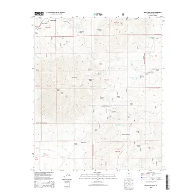
2013 North Lake
Lincoln County, NM
2013 Oscura
Lincoln County, NM
2013 Pajaro Canyon
Lincoln County, NM
2013 Pedernal Arroyo
Lincoln County, NM
2013 Pelon Hill
Lincoln County, NM
2013 Ramon
Lincoln County, NM
2013 Ramon SW
Lincoln County, NM
2013 Red Bluff Draw East
Lincoln County, NM
2013 Red Bluff Draw West
Lincoln County, NM
2013 Rough Mountain
Lincoln County, NM
2013 San Patricio
Lincoln County, NM
2013 Sheeppen Canyon
Lincoln County, NM
2013 Skunk Canyon
Lincoln County, NM
2013 Sunset
Lincoln County, NM
2013 Tecolote Peak
Lincoln County, NM
2013 Three Rivers NW
Lincoln County, NM
2013 Tinnie
Lincoln County, NM
2013 Wagon Canyon
Lincoln County, NM
2013 Wahalee Canyon
Lincoln County, NM
2013 White Flat
Lincoln County, NM
2013 White Oaks North
Lincoln County, NM
2013 White Oaks South
Lincoln County, NM
2017 Ancho
Lincoln County, NM
2017 Angus
Lincoln County, NM
2017 Arabela
Lincoln County, NM
2017 Arroyo Serrano East
Lincoln County, NM
2017 Arroyo Serrano West
Lincoln County, NM
2017 Box Lake
Lincoln County, NM
2017 Bull Gap
Lincoln County, NM
2017 Bull Gap SW
Lincoln County, NM
2017 Capitan Pass
Lincoln County, NM
2017 Capitan Peak
Lincoln County, NM
2017 Carrizozo East
Lincoln County, NM
2017 Carrizozo West
Lincoln County, NM
2017 Chivata Canyon
Lincoln County, NM
2017 Chupadero Mountain
Lincoln County, NM
2017 Church Mountain
Lincoln County, NM
2017 Cistern Draw
Lincoln County, NM
2017 Claunch SE
Lincoln County, NM
2017 Corona South
Lincoln County, NM
2017 Cowboy Mesa
Lincoln County, NM
2017 Cowboy Mesa NE
Lincoln County, NM
2017 Cowboy Mesa NW
Lincoln County, NM
2017 Cowboy Mesa SW
Lincoln County, NM
2017 Cub Mountain
Lincoln County, NM
2017 Elsie Canyon
Lincoln County, NM
2017 Encinoso
Lincoln County, NM
2017 Flying H NE
Lincoln County, NM
2017 Flying H NW
Lincoln County, NM
2017 Fort Stanton
Lincoln County, NM
2017 Gacho Hill SE
Lincoln County, NM
2017 Gacho Hill SW
Lincoln County, NM
2017 Gallo Spring Canyon
Lincoln County, NM
2017 Gallo Spring Canyon NE
Lincoln County, NM
2017 Godfrey Peak
Lincoln County, NM
2017 Golondrina Well
Lincoln County, NM
2017 Granville Canyon
Lincoln County, NM
2017 Hasperos Camp
Lincoln County, NM
2017 Horseshoe Bend
Lincoln County, NM
2017 Horseshoe Bend NW
Lincoln County, NM
2017 Huff Hill
Lincoln County, NM
2017 Jacob Spring
Lincoln County, NM
2017 Jicarilla Peak
Lincoln County, NM
2017 Juan Largo Canyon East
Lincoln County, NM
2017 Juan Largo Canyon West
Lincoln County, NM
2017 Kyle Harrison Canyon
Lincoln County, NM
2017 Lincoln
Lincoln County, NM
2017 Little Black Peak
Lincoln County, NM
2017 Little Black Peak NE
Lincoln County, NM
2017 Loco Draw
Lincoln County, NM
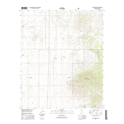
2017 Lone Mountain
Lincoln County, NM
2017 Mockingbird Gap SE
Lincoln County, NM
2017 Mound Springs
Lincoln County, NM
2017 Nelson Canyon East
Lincoln County, NM
2017 Nelson Canyon West
Lincoln County, NM
2017 Nogal Peak
Lincoln County, NM
2017 North Lake
Lincoln County, NM
2017 Oscura
Lincoln County, NM
2017 Pajaro Canyon
Lincoln County, NM
2017 Pedernal Arroyo
Lincoln County, NM
2017 Pelon Hill
Lincoln County, NM
2017 Ramon
Lincoln County, NM
2017 Ramon SW
Lincoln County, NM
2017 Red Bluff Draw East
Lincoln County, NM
2017 Red Bluff Draw West
Lincoln County, NM
2017 Rough Mountain
Lincoln County, NM
2017 San Patricio
Lincoln County, NM
2017 Sheeppen Canyon
Lincoln County, NM
2017 Skunk Canyon
Lincoln County, NM
2017 Sunset
Lincoln County, NM
2017 Tecolote Peak
Lincoln County, NM
2017 Three Rivers NW
Lincoln County, NM
2017 Tinnie
Lincoln County, NM
2017 Wagon Canyon
Lincoln County, NM
2017 Wahalee Canyon
Lincoln County, NM
2017 White Flat
Lincoln County, NM
2017 White Oaks North
Lincoln County, NM
2017 White Oaks South
Lincoln County, NM
2020 Ancho
Lincoln County, NM
2020 Angus
Lincoln County, NM
2020 Arabela
Lincoln County, NM
2020 Arroyo Serrano East
Lincoln County, NM
2020 Arroyo Serrano West
Lincoln County, NM
2020 Box Lake
Lincoln County, NM
2020 Bull Gap
Lincoln County, NM
2020 Bull Gap SW
Lincoln County, NM
2020 Capitan Pass
Lincoln County, NM
2020 Capitan Peak
Lincoln County, NM
2020 Carrizozo East
Lincoln County, NM
2020 Carrizozo West
Lincoln County, NM
2020 Chivata Canyon
Lincoln County, NM
2020 Chupadero Mountain
Lincoln County, NM
2020 Church Mountain
Lincoln County, NM
2020 Cistern Draw
Lincoln County, NM
2020 Claunch SE
Lincoln County, NM
2020 Corona South
Lincoln County, NM
2020 Cowboy Mesa
Lincoln County, NM
2020 Cowboy Mesa NE
Lincoln County, NM
2020 Cowboy Mesa NW
Lincoln County, NM
2020 Cowboy Mesa SW
Lincoln County, NM
2020 Cub Mountain
Lincoln County, NM
2020 Elsie Canyon
Lincoln County, NM
2020 Encinoso
Lincoln County, NM
2020 Flying H NE
Lincoln County, NM
2020 Flying H NW
Lincoln County, NM
2020 Fort Stanton
Lincoln County, NM
2020 Gacho Hill SE
Lincoln County, NM
2020 Gacho Hill SW
Lincoln County, NM
2020 Gallo Spring Canyon
Lincoln County, NM
2020 Gallo Spring Canyon NE
Lincoln County, NM
2020 Godfrey Peak
Lincoln County, NM
2020 Golondrina Well
Lincoln County, NM
2020 Granville Canyon
Lincoln County, NM
2020 Hasperos Camp
Lincoln County, NM
2020 Horseshoe Bend
Lincoln County, NM
2020 Horseshoe Bend NW
Lincoln County, NM
2020 Huff Hill
Lincoln County, NM
2020 Jacob Spring
Lincoln County, NM
2020 Jicarilla Peak
Lincoln County, NM
2020 Juan Largo Canyon East
Lincoln County, NM
2020 Juan Largo Canyon West
Lincoln County, NM
2020 Kyle Harrison Canyon
Lincoln County, NM
2020 Lincoln
Lincoln County, NM
2020 Little Black Peak
Lincoln County, NM
2020 Little Black Peak NE
Lincoln County, NM
2020 Loco Draw
Lincoln County, NM
2020 Lone Mountain
Lincoln County, NM
2020 Mockingbird Gap SE
Lincoln County, NM
2020 Mound Springs
Lincoln County, NM
2020 Nelson Canyon East
Lincoln County, NM
2020 Nelson Canyon West
Lincoln County, NM
2020 Nogal Peak
Lincoln County, NM
2020 North Lake
Lincoln County, NM
2020 Oscura
Lincoln County, NM
2020 Pajaro Canyon
Lincoln County, NM
2020 Pedernal Arroyo
Lincoln County, NM
2020 Pelon Hill
Lincoln County, NM
2020 Ramon
Lincoln County, NM
2020 Ramon SW
Lincoln County, NM
2020 Red Bluff Draw East
Lincoln County, NM
2020 Red Bluff Draw West
Lincoln County, NM
2020 Rough Mountain
Lincoln County, NM
2020 San Patricio
Lincoln County, NM
2020 Sheeppen Canyon
Lincoln County, NM
2020 Skunk Canyon
Lincoln County, NM
2020 Sunset
Lincoln County, NM
2020 Tecolote Peak
Lincoln County, NM
2020 Three Rivers NW
Lincoln County, NM
2020 Tinnie
Lincoln County, NM
2020 Wagon Canyon
Lincoln County, NM
2020 Wahalee Canyon
Lincoln County, NM
2020 White Flat
Lincoln County, NM
2020 White Oaks North
Lincoln County, NM
2020 White Oaks South
Lincoln County, NM
2023 Ancho
Lincoln County, NM
2023 Angus
Lincoln County, NM
2023 Arabela
Lincoln County, NM
2023 Arroyo Serrano East
Lincoln County, NM
2023 Arroyo Serrano West
Lincoln County, NM
2023 Box Lake
Lincoln County, NM
2023 Bull Gap
Lincoln County, NM
2023 Bull Gap SW
Lincoln County, NM
2023 Capitan Pass
Lincoln County, NM
2023 Capitan Peak
Lincoln County, NM
2023 Carrizozo East
Lincoln County, NM
2023 Carrizozo West
Lincoln County, NM
2023 Chivata Canyon
Lincoln County, NM
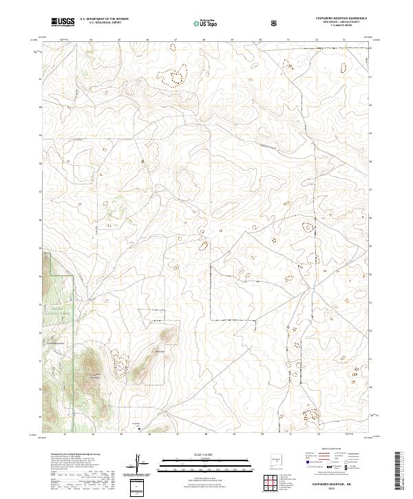
2023 Chupadero Mountain
Lincoln County, NM
2023 Church Mountain
Lincoln County, NM
2023 Cistern Draw
Lincoln County, NM
2023 Claunch SE
Lincoln County, NM
2023 Corona South
Lincoln County, NM
2023 Cowboy Mesa
Lincoln County, NM
2023 Cowboy Mesa NE
Lincoln County, NM
2023 Cowboy Mesa NW
Lincoln County, NM
2023 Cowboy Mesa SW
Lincoln County, NM
2023 Cub Mountain
Lincoln County, NM
2023 Elsie Canyon
Lincoln County, NM
2023 Encinoso
Lincoln County, NM
2023 Flying H NE
Lincoln County, NM
2023 Flying H NW
Lincoln County, NM
2023 Fort Stanton
Lincoln County, NM
2023 Gacho Hill SE
Lincoln County, NM
2023 Gacho Hill SW
Lincoln County, NM
2023 Gallo Spring Canyon
Lincoln County, NM
2023 Gallo Spring Canyon NE
Lincoln County, NM
2023 Godfrey Peak
Lincoln County, NM
2023 Golondrina Well
Lincoln County, NM
2023 Granville Canyon
Lincoln County, NM
2023 Hasperos Camp
Lincoln County, NM
2023 Horseshoe Bend
Lincoln County, NM
2023 Horseshoe Bend NW
Lincoln County, NM
2023 Huff Hill
Lincoln County, NM
2023 Jacob Spring
Lincoln County, NM
2023 Jicarilla Peak
Lincoln County, NM
2023 Juan Largo Canyon East
Lincoln County, NM
2023 Juan Largo Canyon West
Lincoln County, NM
2023 Kyle Harrison Canyon
Lincoln County, NM
2023 Lincoln
Lincoln County, NM
2023 Little Black Peak
Lincoln County, NM
2023 Little Black Peak NE
Lincoln County, NM
2023 Loco Draw
Lincoln County, NM
2023 Lone Mountain
Lincoln County, NM
2023 Mockingbird Gap SE
Lincoln County, NM
2023 Mound Springs
Lincoln County, NM
2023 Nelson Canyon East
Lincoln County, NM
2023 Nelson Canyon West
Lincoln County, NM
2023 Nogal Peak
Lincoln County, NM
2023 North Lake
Lincoln County, NM
2023 Oscura
Lincoln County, NM
2023 Pajaro Canyon
Lincoln County, NM
2023 Pedernal Arroyo
Lincoln County, NM
2023 Pelon Hill
Lincoln County, NM
2023 Ramon
Lincoln County, NM
2023 Ramon SW
Lincoln County, NM
2023 Red Bluff Draw East
Lincoln County, NM
2023 Red Bluff Draw West
Lincoln County, NM
2023 Rough Mountain
Lincoln County, NM
2023 San Patricio
Lincoln County, NM
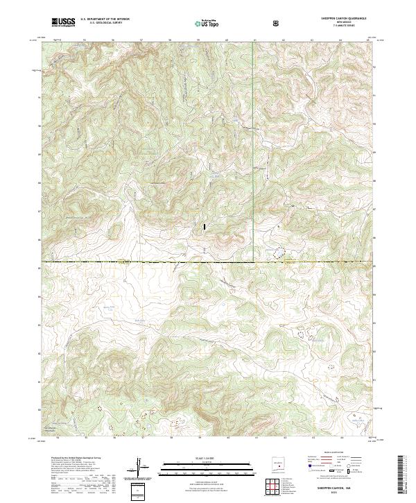
2023 Sheeppen Canyon
Lincoln County, NM
2023 Skunk Canyon
Lincoln County, NM
2023 Sunset
Lincoln County, NM
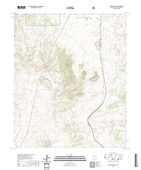
2023 Tecolote Peak
Lincoln County, NM
2023 Three Rivers NW
Lincoln County, NM
2023 Tinnie
Lincoln County, NM
2023 Wagon Canyon
Lincoln County, NM
2023 Wahalee Canyon
Lincoln County, NM
2023 White Flat
Lincoln County, NM
2023 White Oaks North
Lincoln County, NM
2023 White Oaks South
Lincoln County, NM