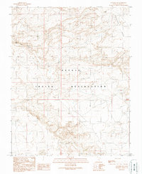
1989 Map of Goulding NW
USGS Topo · Published 1989About this map
The high plateau of Douglas Mesa dominates the northeastern corner of this corner of San Juan County, illustrating the dramatic vertical relief found within the Navajo Indian Reservation. This 1989 provisional edition reflects landscape data field-checked in the mid-1980s, documenting a remote desert environment defined by seasonal drainage and shifting terrain. Notable topographic features include the deep cut of Water Tank Canyon and the presence of a localized Water Tank, suggesting the critical importance of water management in this arid territory. The southern reaches of the map are characterized by Shifting Sand, highlighting the dynamic geomorphology of the region. The map also delineates the jurisdictional boundary between T 41 S and T 42 S, providing a clear reference for land-use and historical surveying within the reservation.
Find a feature on this map
6 named features on this map. Tap any name to fly to it.
Don’t see what you’re looking for? This feature index may not catch every label — zoom into the map to look around manually.
Map Details
Editions of this 1989 Goulding NW Map
This is the sole edition of this map. No revisions or reprints were ever made.
Other maps of this area

1886 · Henry Mountains
USGS Topo · 1:250,000

1892 · Henry Mountains
USGS Topo · 1:250,000

1952 · Clay Hills 4 SW
USGS Topo · 1:24,000

1952 · Clay Hills 3 SE
USGS Topo · 1:24,000

1952 · Clay Hills 4 SE
USGS Topo · 1:24,000

1952 · Oljeto
USGS Topo · 1:62,500
1954 · Clay Hills 3 NE
USGS Topo · 1:24,000

1954 · Clay Hills 2 SE
USGS Topo · 1:24,000
1954 · Clay Hills
USGS Topo · 1:62,500

1956 · Escalante
USGS Topo · 1:250,000