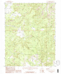
1985 Map of House Park Butte
USGS Topo · Published 1985About this map
House Park Butte serves as a central landmark in this high-desert landscape of southeastern Utah, where the drainages of Butler Wash and Beef Basin carve through the plateau. The map captures the intersection of major public lands, with the northern reaches of the Manti-La Sal National Forest meeting the southern boundary of Canyonlands National Park. This transition is marked by geological features like Kirk Arch and the isolated drainage of West Fork Salt Creek. The terrain is characterized by deep erosional features such as Ruin Canyon and Calf Canyon, while a solitary Adit and 4wd tracks suggest the history of uranium prospecting and cattle ranching that once defined this area. Reliable water sources like Crystal Spring and the sheltered Davis Pocket reflect the sparse but vital locations required for survival in this arid environment.
Find a feature on this map
20 named features on this map. Tap any name to fly to it.
Don’t see what you’re looking for? This feature index may not catch every label — zoom into the map to look around manually.
Map Details
Editions of this 1985 House Park Butte Map
This is the sole edition of this map. No revisions or reprints were ever made.
Other maps of this area

1885 · La Sal
USGS Topo · 1:250,000

1886 · Abajo
USGS Topo · 1:250,000

1892 · Abajo
USGS Topo · 1:250,000

1893 · Abajo
USGS Topo · 1:250,000

1935 · Elk Ridge
USGS Topo · 1:96,000

1940 · Elk Ridge
USGS Topo · 1:125,000

1953 · The Needles
USGS Topo · 1:62,500

1954 · Elk Ridge 1 SW
USGS Topo · 1:24,000

1954 · Elk Ridge 2 SE
USGS Topo · 1:24,000

1954 · Elk Ridge 1 NW
USGS Topo · 1:24,000