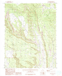
1985 Map of Hotel Rock
USGS Topo · Published 1985About this map
Hotel Rock stands as a prominent landmark within this high-desert landscape of San Juan County, which was surveyed during the late 1970s and 1980s. The area is defined by the striking geological verticality of Comb Ridge and the broad, elevated expanses of Little Baullie Mesa and Milk Ranch Point. Within the Manti-La Sal National Forest, the map reveals a network of water-carved features including Arch Canyon, Whiskers Draw, and the curiously named Cheese and Raisins. These drainages, along with Dog Tanks Spring and several other tanks, highlight the critical water sources in a region characterized by deep canyons and flat-topped mesas. Traces of human activity are present in the form of a Trail and the Roadside Park located near the eastern edge along Butler Wash, offering a detailed view of the terrain before more modern developments.
Find a feature on this map
22 named features on this map. Tap any name to fly to it.
Don’t see what you’re looking for? This feature index may not catch every label — zoom into the map to look around manually.
Map Details
Editions of this 1985 Hotel Rock Map
This is the sole edition of this map. No revisions or reprints were ever made.
Other maps of this area

1886 · Abajo
USGS Topo · 1:250,000

1892 · Abajo
USGS Topo · 1:250,000

1893 · Abajo
USGS Topo · 1:250,000

1935 · Elk Ridge
USGS Topo · 1:96,000

1940 · Elk Ridge
USGS Topo · 1:125,000

1954 · Elk Ridge 4 NW
USGS Topo · 1:24,000

1954 · Elk Ridge 3 NE
USGS Topo · 1:24,000

1954 · Elk Ridge 3 SE
USGS Topo · 1:24,000

1954 · Bears Ears
USGS Topo · 1:62,500

1956 · Cortez
USGS Topo · 1:250,000