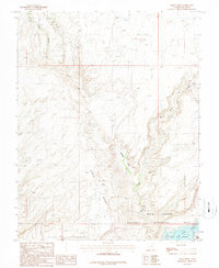
1987 Map of Nokai Dome
USGS Topo · Published 1987About this map
Nokai Dome rises as the central topographic feature in this 1980s landscape, which marks the intersection of the Glen Canyon National Recreation Area and the Navajo Indian Res. The southern edge of the map is defined by the San Juan River as it enters Lake Powell, showing the water levels and shoreline before modern fluctuations. Remote industrial activity is evident through labels like Skelly 6054 and various prospects, alongside a remote Landing Strip perched on the high ground. The drainage systems of Lake Canyon, Castle Creek, and Johnnies Hole Creek cut through the high desert, illustrating the complex erosion patterns and accessibility of this corner of San Juan County during the late twentieth century.
Find a feature on this map
15 named features on this map. Tap any name to fly to it.
Don’t see what you’re looking for? This feature index may not catch every label — zoom into the map to look around manually.
Map Details
Editions of this 1987 Nokai Dome Map
This is the sole edition of this map. No revisions or reprints were ever made.
Other maps of this area

1886 · Henry Mountains
USGS Topo · 1:250,000

1892 · Henry Mountains
USGS Topo · 1:250,000

1952 · Clay Hills 3 NW
USGS Topo · 1:24,000

1952 · Navajo Mountain 4 NE
USGS Topo · 1:24,000

1952 · Oljeto
USGS Topo · 1:62,500

1953 · Navajo Mountain 4 NW
USGS Topo · 1:24,000

1953 · Lake Canyon
USGS Topo · 1:62,500

1953 · No Mans Mesa
USGS Topo · 1:62,500

1954 · Clay Hills 2 SW
USGS Topo · 1:24,000

1954 · Clay Hills 2 NW
USGS Topo · 1:24,000