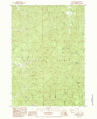
1984 Map of Goodwin Peak
USGS Topo · Published 1984About this map
The Siuslaw National Forest dominates this landscape along the border of Lane and Douglas counties, where the Coast Range topography is defined by complex drainage systems and high ridges. The small settlement of Maple is positioned near the western edge of the quadrangle, serving as a rare point of human habitation amidst the dense forest. High points such as Goodwin Peak, equipped with radio facilities, and the curiously named Mt Popocatepetl overlook a web of waterways including Fiddle Creek, Sweet Creek, and the North Fork Smith River. This 1984 provisional survey illustrates the intersection of timber-focused geography and water resources, marked by features like a Rock Quarry and prominent cascades including Sweet Creek Falls and Beaver Creek Falls. The network of creeks—such as Karnowsky Creek, Cedar Creek, and Paxton Creek—carve through the steep terrain, illustrating the hydrologic character of the Oregon coast interior.
Find a feature on this map
39 named features on this map. Tap any name to fly to it.
Don’t see what you’re looking for? This feature index may not catch every label — zoom into the map to look around manually.
Map Details
Editions of this 1984 Goodwin Peak Map
This is the sole edition of this map. No revisions or reprints were ever made.
Other maps of this area

1918 · Mapleton
USGS Topo · 1:48,000

1919 · Earl
USGS Topo · 1:48,000

1920 · Siltcoos Lake
USGS Topo · 1:62,500

1920 · Heceta Head
USGS Topo · 1:62,500

1940 · Mapleton
USGS Topo · 1:62,500

1941 · Siltcoos Lake
USGS Topo · 1:62,500

1942 · Heceta Head
USGS Topo · 1:62,500

1942 · Siltcoos Lake
USGS Topo · 1:62,500

1943 · Goodwin Peak
USGS Topo · 1:62,500

1945 · Mapleton
USGS Topo · 1:62,500