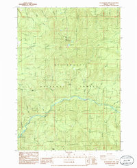
1986 Map of Huckleberry Mtn
USGS Topo · Published 1986About this map
Salmon Creek carves a deep valley through the heart of the Willamette National Forest in this mid-1980s topographical study. The terrain is defined by high ridgelines, including the prominent Huckleberry Mtn and Bunchgrass Ridge, which overlook a dense network of tributaries such as Wall Creek and Tumble Creek. Notable landmarks include Salmon Creek Falls and high peaks like Eagle Butte and Squaw Butte. Throughout the landscape, the presence of numerous Borrow Pits and several Quarries suggests the importance of forest road maintenance and resource extraction during this era. The map also documents specific hydrological features like Devils Canyon and the winding course of Trapper Creek, providing a detailed look at the drainage patterns of Lane County before more recent environmental shifts.
Find a feature on this map
51 named features on this map. Tap any name to fly to it.
Don’t see what you’re looking for? This feature index may not catch every label — zoom into the map to look around manually.
Map Details
Editions of this 1986 Huckleberry Mtn Map
This is the sole edition of this map. No revisions or reprints were ever made.
Other maps of this area

1925 · Waldo Lake
USGS Topo · 1:125,000

1955 · Chucksney Mtn
USGS Topo · 1:62,500

1956 · Waldo Lake
USGS Topo · 1:62,500

1956 · Oakridge
USGS Topo · 1:62,500

1956 · Sardine Butte
USGS Topo · 1:62,500

1958 · Roseburg
USGS Topo · 1:250,000

1959 · Roseburg
USGS Topo · 1:250,000

1983 · Oakridge
USGS Topo · 1:100,000
1986 · Mc Credie Springs
USGS Topo · 1:24,000
1986 · Blair Lake
USGS Topo · 1:24,000