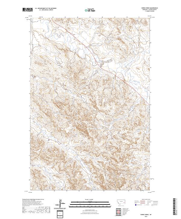
2024 Map of Horse Creek
USGS Topo · Published 2024About this map
The Jack Creek Divide dominates this southeastern Montana landscape, serving as a significant topographic spine that separates the complex drainages of Custer County. In this modern survey, the intricate network of seasonal waterways including Pumpkin Creek, Horse Creek, and Johnson Creek illustrates the highly dissected nature of the local terrain. These creek beds and their surrounding breaks define the ranching character of the region, where water management is centralized at sites like the Pine Hill Reservoir. Named summits such as Gravel Hill, Dug Long Hill, and Pine Hill provide critical orientation points across a landscape largely defined by sections and township lines. Movement through this rangeland follows established routes like Tongue River Rd and RD 538, which connect the remote drainage basins of Nelson Creek and Fall Creek to the broader county infrastructure.
Find a feature on this map
20 named features on this map. Tap any name to fly to it.
Don’t see what you’re looking for? This feature index may not catch every label — zoom into the map to look around manually.
Map Details
Editions of this 2024 Horse Creek Map
This is the sole edition of this map. No revisions or reprints were ever made.
Other maps of this area

1953 · Miles City
USGS Topo · 1:250,000

1957 · Miles City
USGS Topo · 1:250,000

1958 · Miles City
USGS Topo · 1:250,000

1968 · Paddy Fay Creek
USGS Topo · 1:24,000

1969 · Horse Creek
USGS Topo · 1:24,000

1969 · Haines Springs
USGS Topo · 1:24,000

1969 · Circle L Creek
USGS Topo · 1:24,000

1969 · First Creek
USGS Topo · 1:24,000

1969 · Beebe SW
USGS Topo · 1:24,000
1969 · Beebe
USGS Topo · 1:24,000