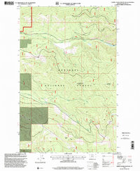
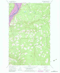
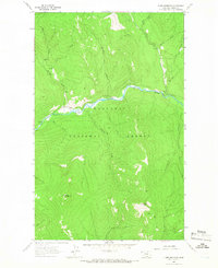
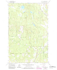
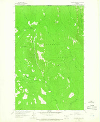
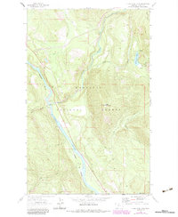
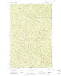
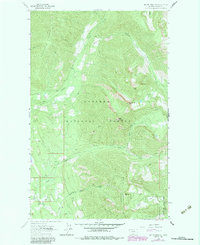
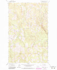
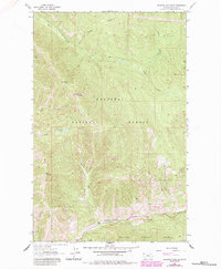
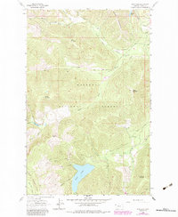
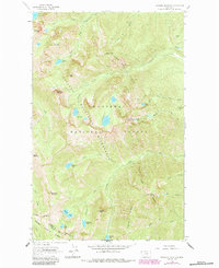
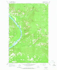
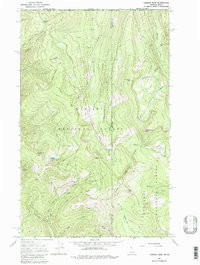
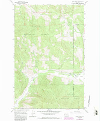
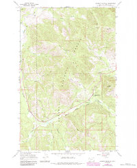
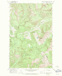
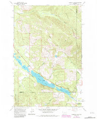
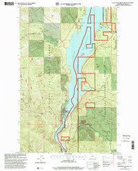
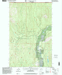
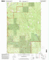
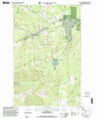
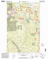
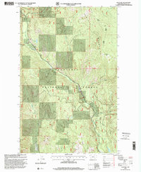
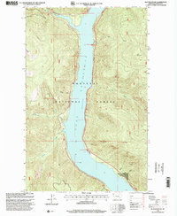
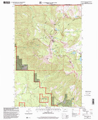
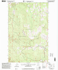
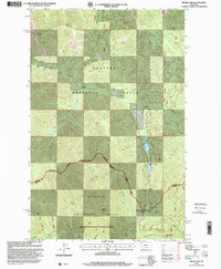
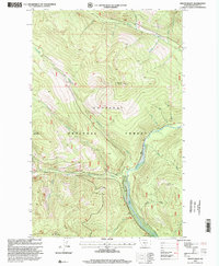
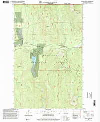
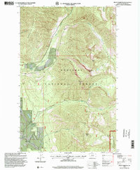
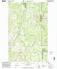
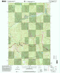
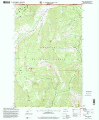
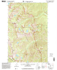
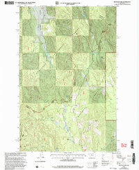
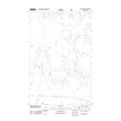
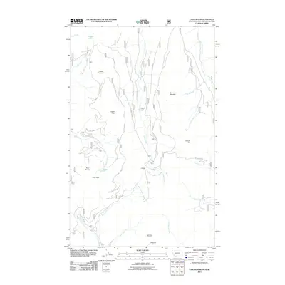
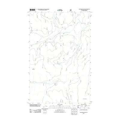
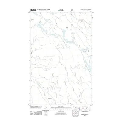
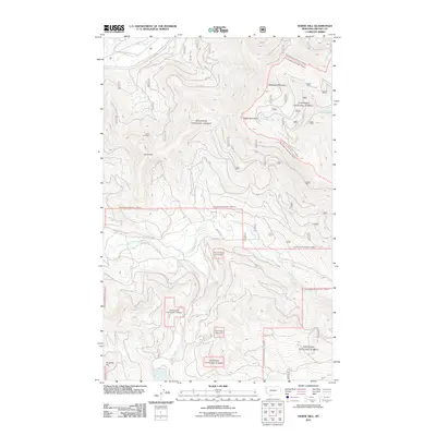
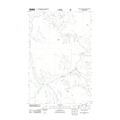
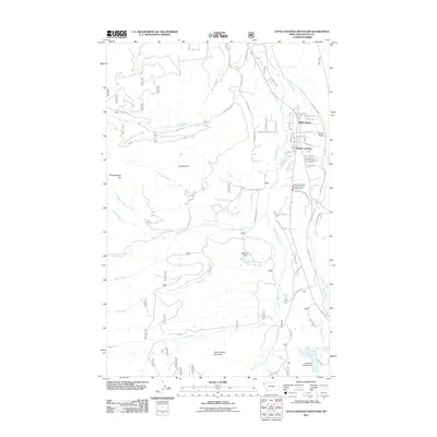
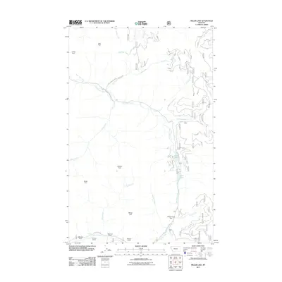
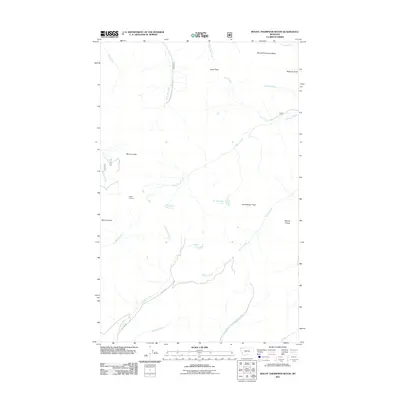
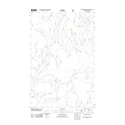
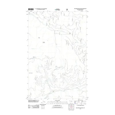
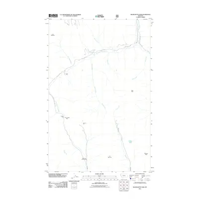
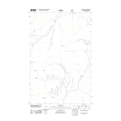
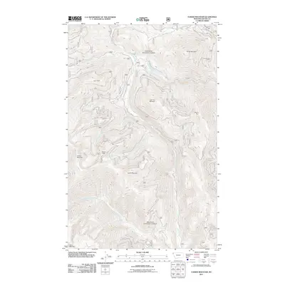
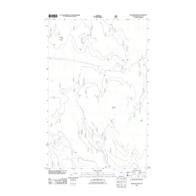
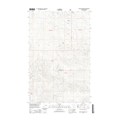
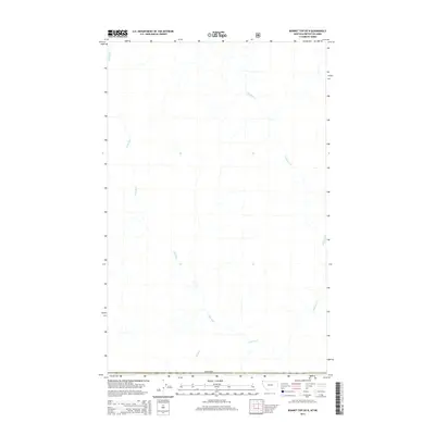
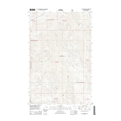
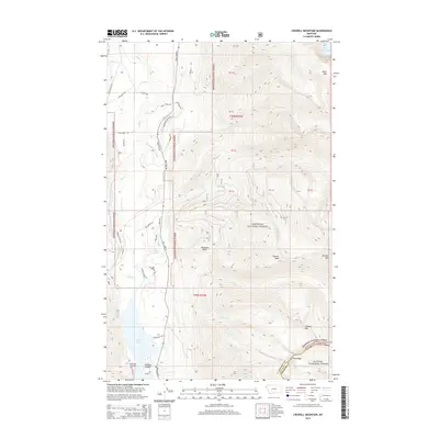
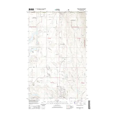
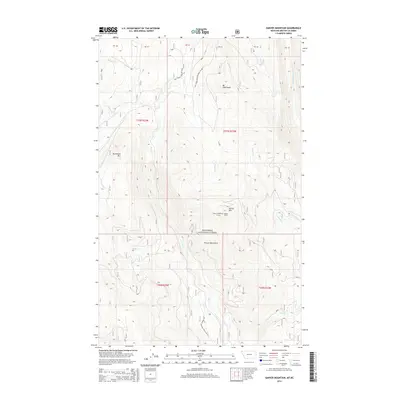
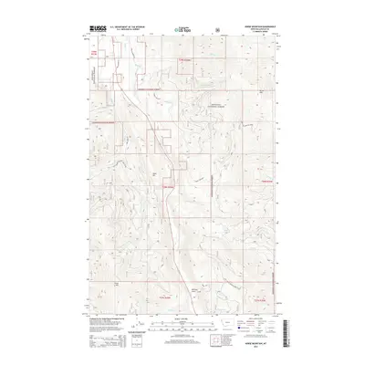
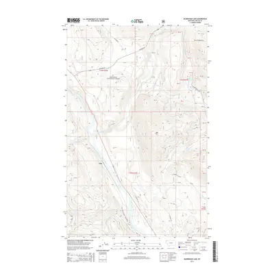
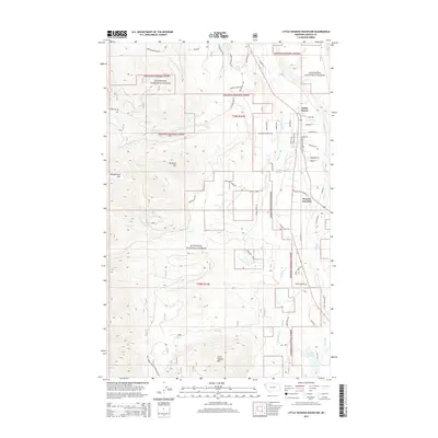
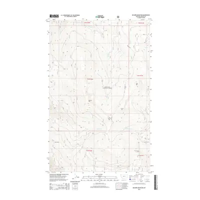
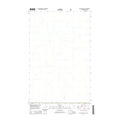
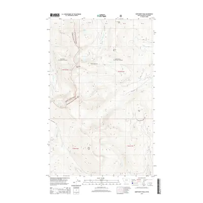
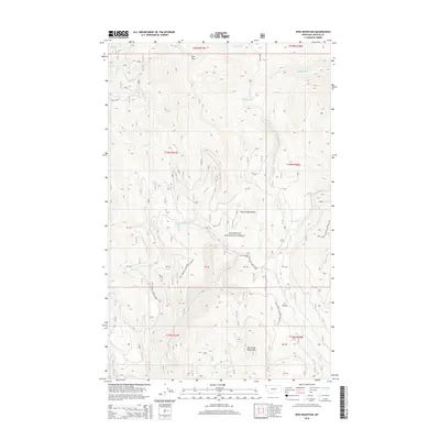
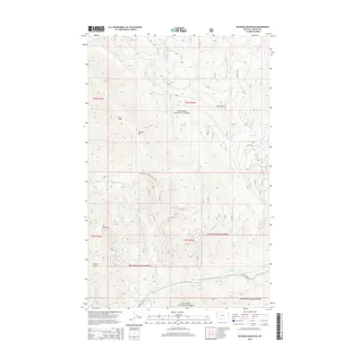
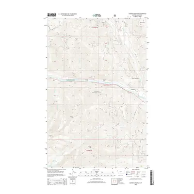
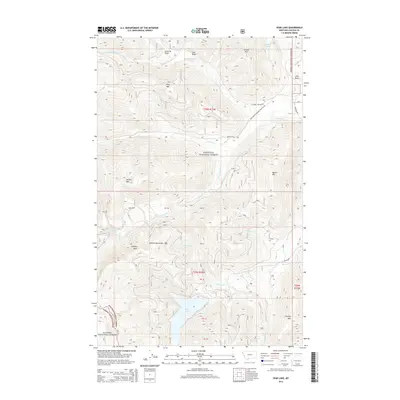
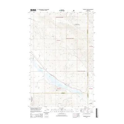
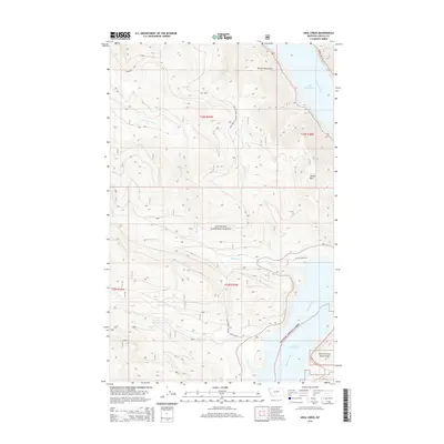
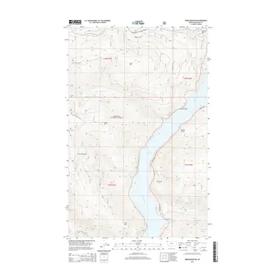
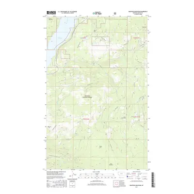
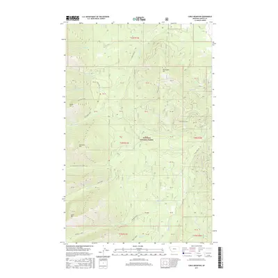
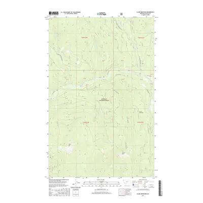
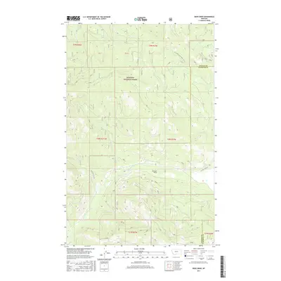
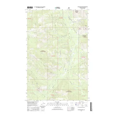
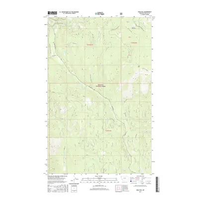
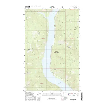
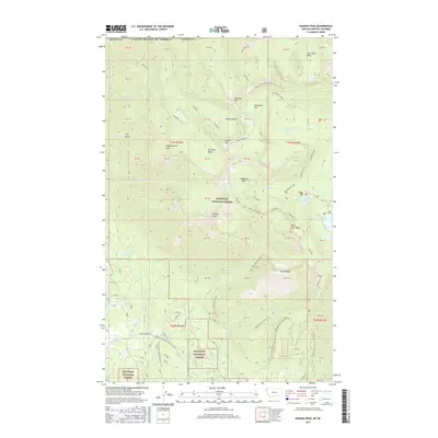
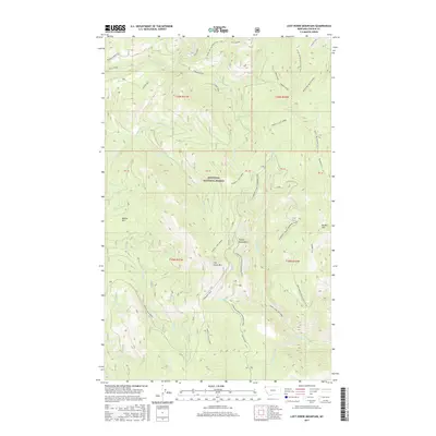
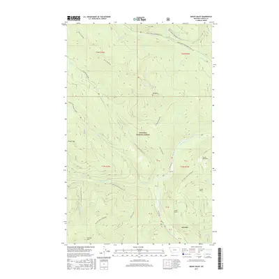
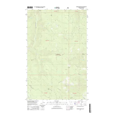
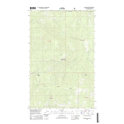
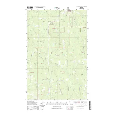
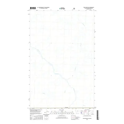
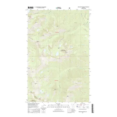
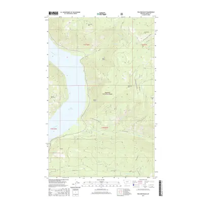
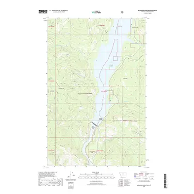
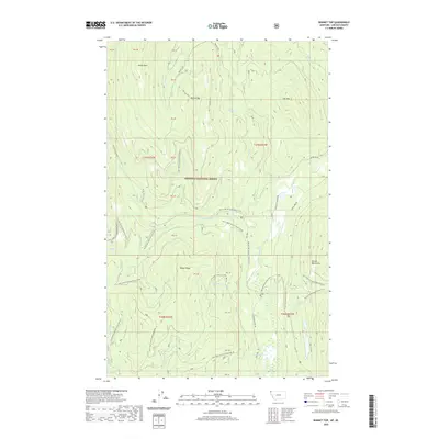
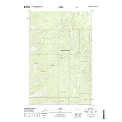
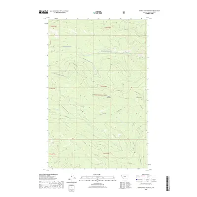
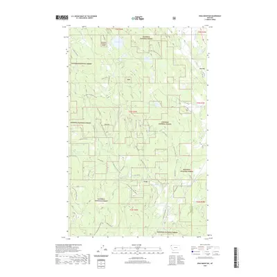
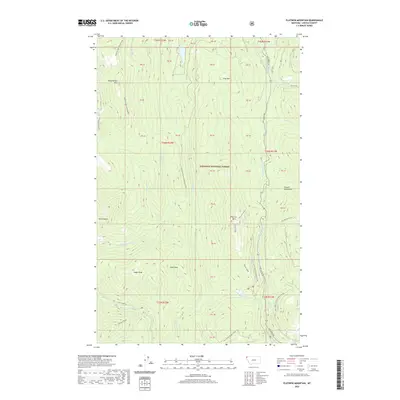
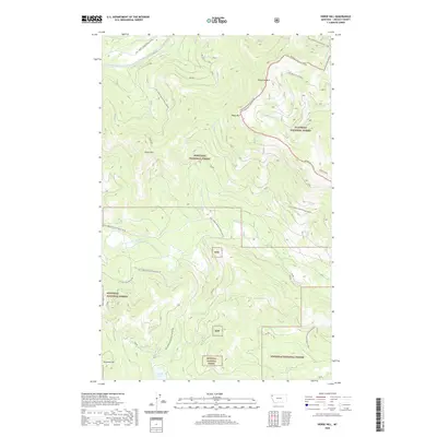
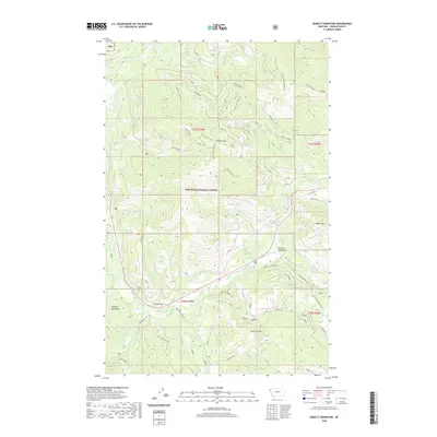
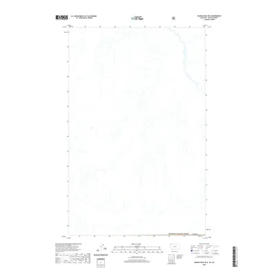
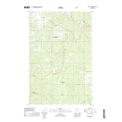
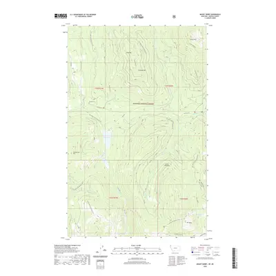
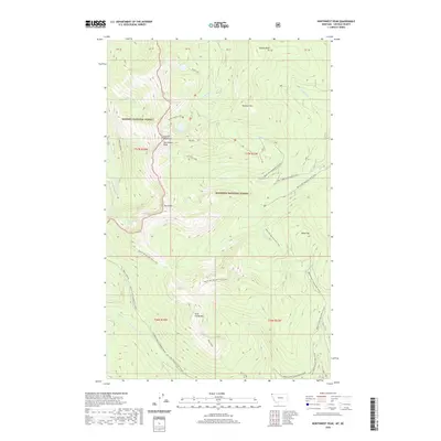
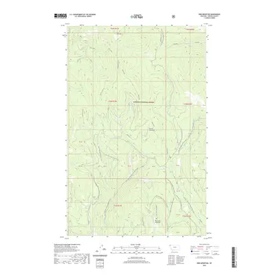
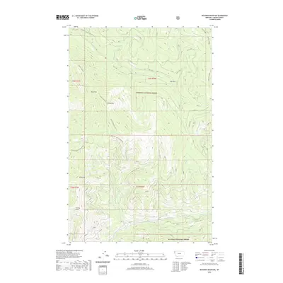
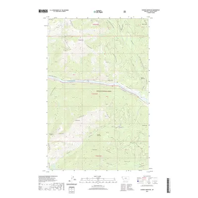
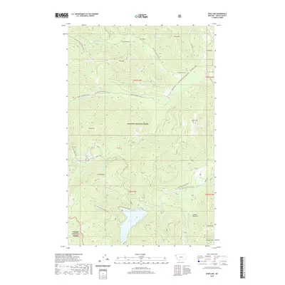
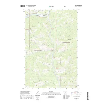
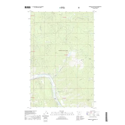
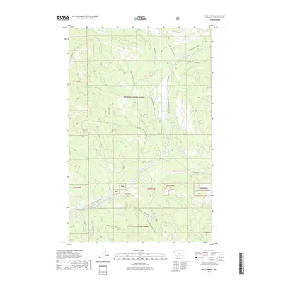
1977 Map of Cripple Horse Mountain
USGS Topo · Published 2000About this map
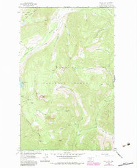
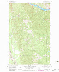
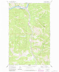
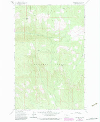
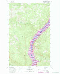
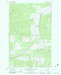
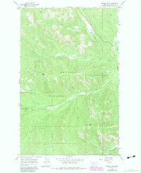
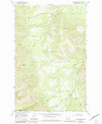
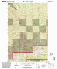
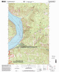
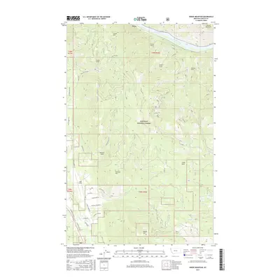
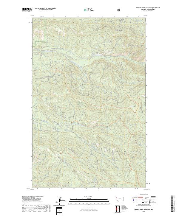
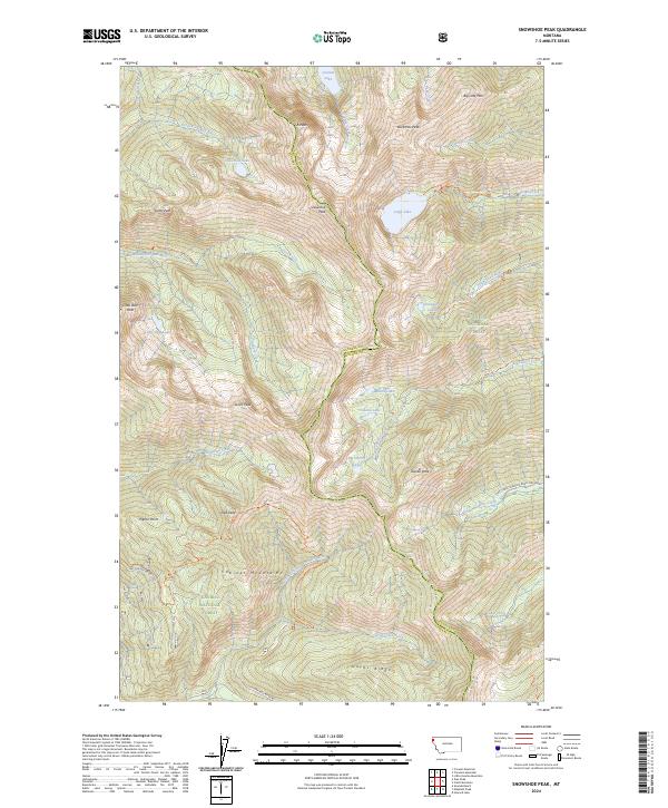
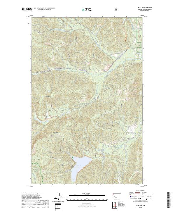
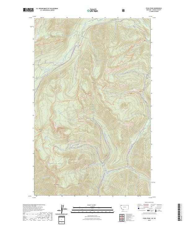
Kootenai National Forest dominates this landscape in Lincoln County, where the topography is defined by high peaks and deeply cut drainages. The area is anchored by the prominent Cripple Horse Mountain and the steep Hornet Ridge to the south. Water systems are central to the terrain, with Cripple Horse Creek and its South Fork flowing through the center of the sheet, while North Fork Canyon Creek carves through the southwestern section. An industrial presence is marked by a Gravel Pit near the northern boundary, suggesting localized resource extraction within the forest. The drainage patterns of Warland Creek in the northeast further illustrate the complex watershed of this mountainous region, which remained largely undeveloped forest land throughout the late twentieth century.
Find a feature on this map
10 named features on this map. Tap any name to fly to it.
Don’t see what you’re looking for? This feature index may not catch every label — zoom into the map to look around manually.
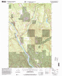
Map Details
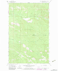
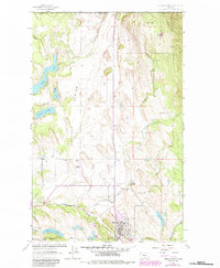
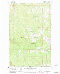
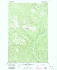
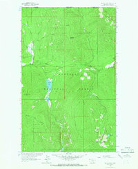
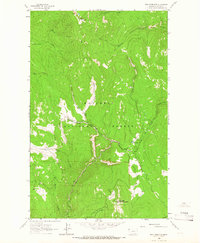
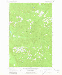
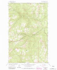
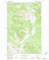
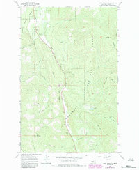
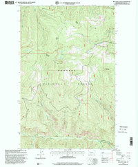
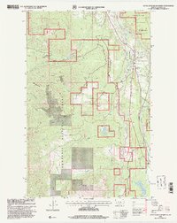
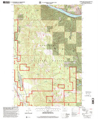
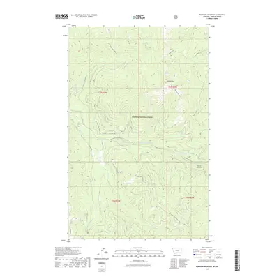
Editions of this 1977 Cripple Horse Mountain Map
This is the sole edition of this map. No revisions or reprints were ever made.
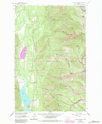
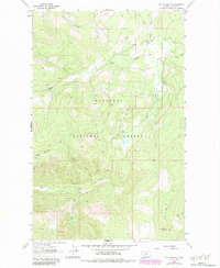
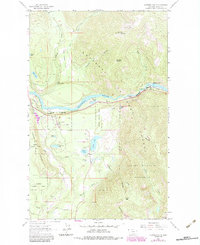
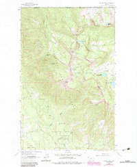
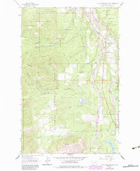
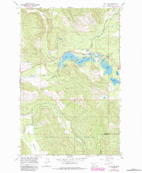
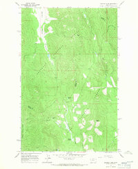
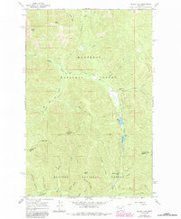
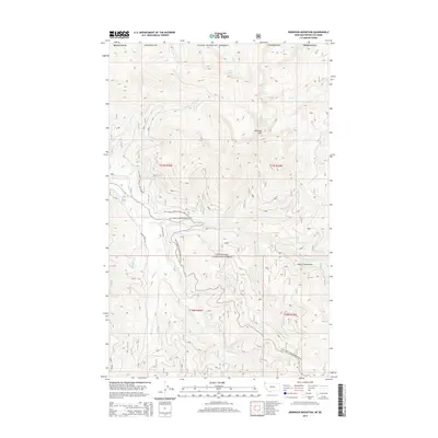
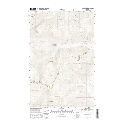
Historical Maps of Lincoln County Through Time
506 maps found

1920 Jennings
Lincoln County, MT
1935 Thompson Lakes
Lincoln County, MT

1942 Thompson Lakes
Lincoln County, MT
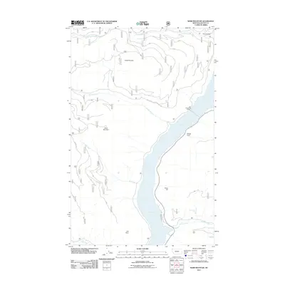
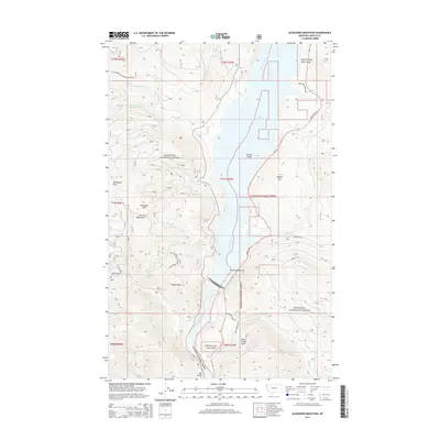
1963 Alexander Mountain
Lincoln County, MT
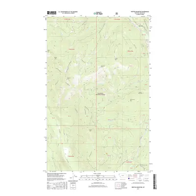
1963 Banfield Mountain
Lincoln County, MT
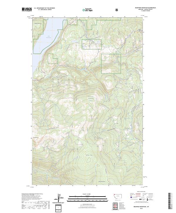
1963 Beartrap Mountain
Lincoln County, MT
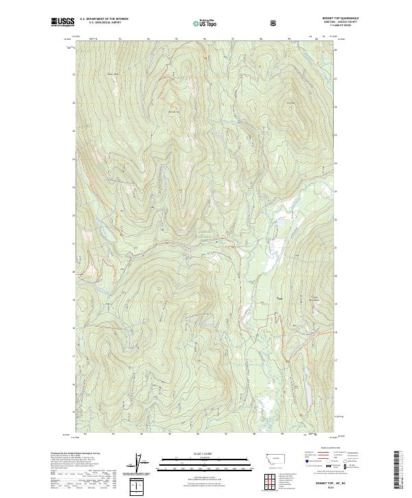
1963 Bonnet Top
Lincoln County, MT
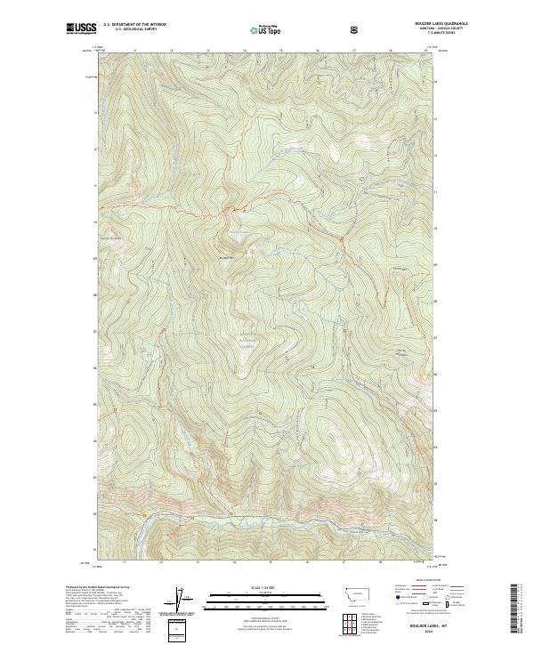
1963 Boulder Lakes
Lincoln County, MT
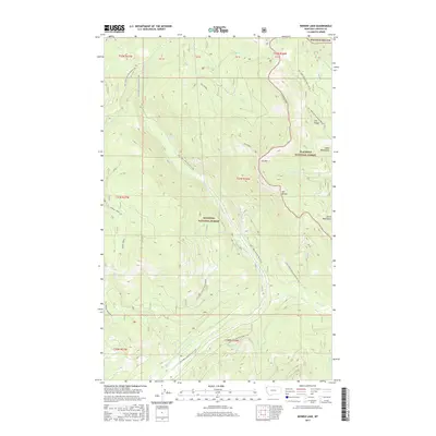
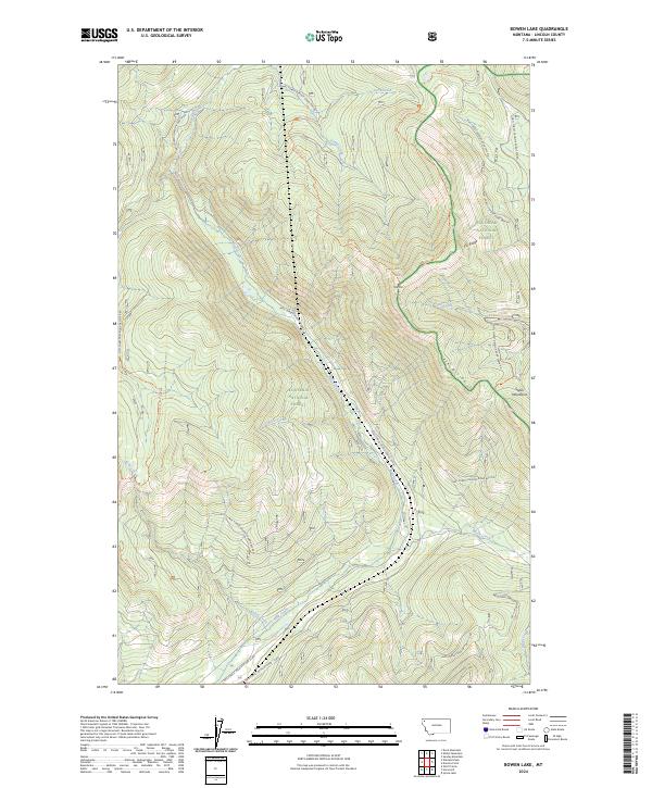
1963 Bowen Lake
Lincoln County, MT
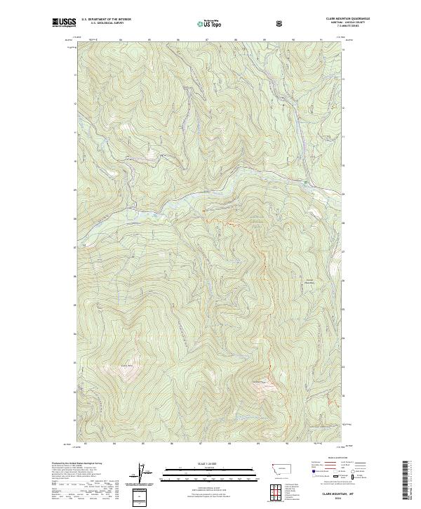
1963 Clark Mountain
Lincoln County, MT
1963 Cripple Horse Mountain
Lincoln County, MT
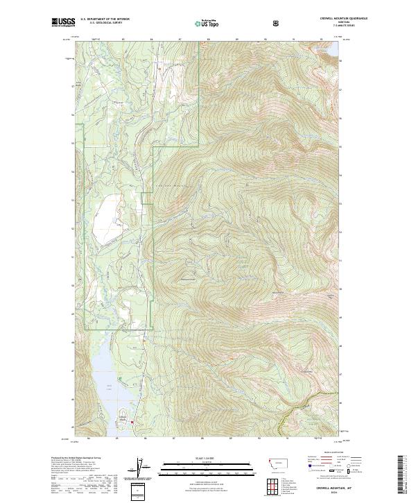
1963 Crowell Mountain
Lincoln County, MT
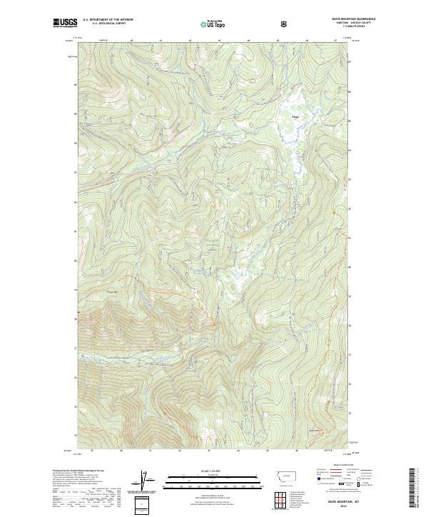
1963 Davis Mountain
Lincoln County, MT
1963 Edna Mountain
Lincoln County, MT
1963 Eureka North
Lincoln County, MT
1963 Eureka South
Lincoln County, MT
1963 Flatiron Mountain
Lincoln County, MT
1963 Garver Mountain
Lincoln County, MT
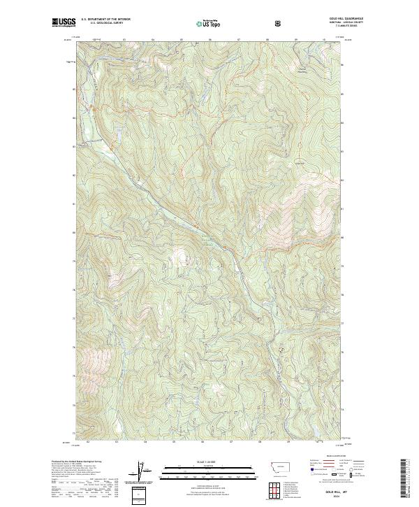
1963 Gold Hill
Lincoln County, MT
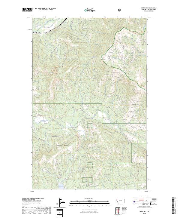
1963 Horse Hill
Lincoln County, MT
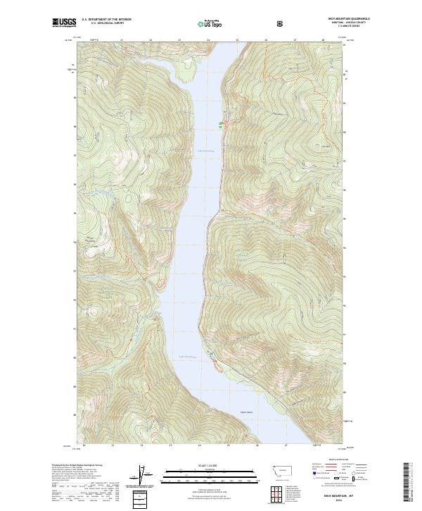
1963 Inch Mountain
Lincoln County, MT
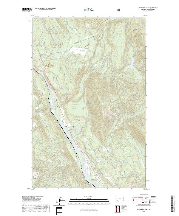
1963 Kilbrennan Lake
Lincoln County, MT
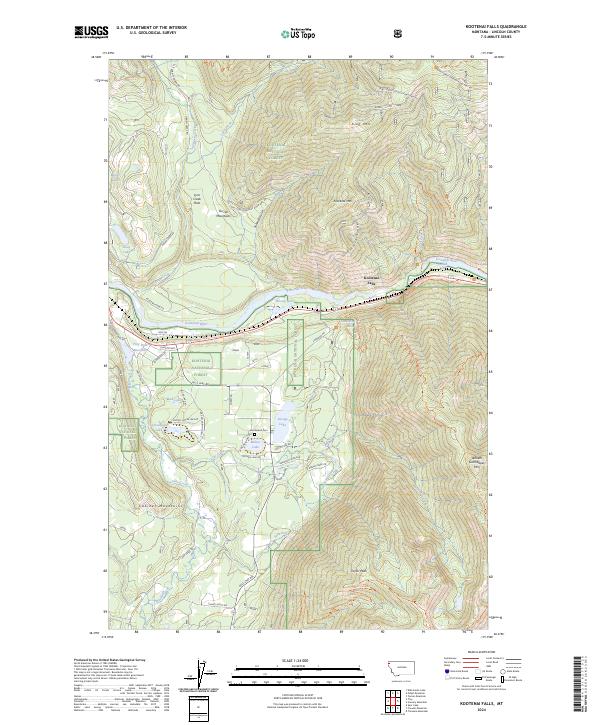
1963 Kootenai Falls
Lincoln County, MT
1963 Ksanka Peak
Lincoln County, MT
1963 Little Hoodoo Mountain
Lincoln County, MT
1963 Lost Horse Mountain
Lincoln County, MT
1963 Mc Guire Mountain
Lincoln County, MT
1963 Mount Baldy
Lincoln County, MT
1963 Mount Henry
Lincoln County, MT
1963 Mount Marston
Lincoln County, MT
1963 Newton Mountain
Lincoln County, MT
1963 Northwest Peak
Lincoln County, MT
1963 Parsnip Mountain
Lincoln County, MT
1963 Pinkham Mountain
Lincoln County, MT
1963 Pink Mountain
Lincoln County, MT
1963 Pulpit Mountain
Lincoln County, MT
1963 Red Mountain
Lincoln County, MT
1963 Richards Mountain
Lincoln County, MT
1963 Robinson Mountain
Lincoln County, MT
1963 Scenery Mountain
Lincoln County, MT
1963 Skillet Mountain
Lincoln County, MT
1963 Spar Lake
Lincoln County, MT
1963 Stahl Peak
Lincoln County, MT
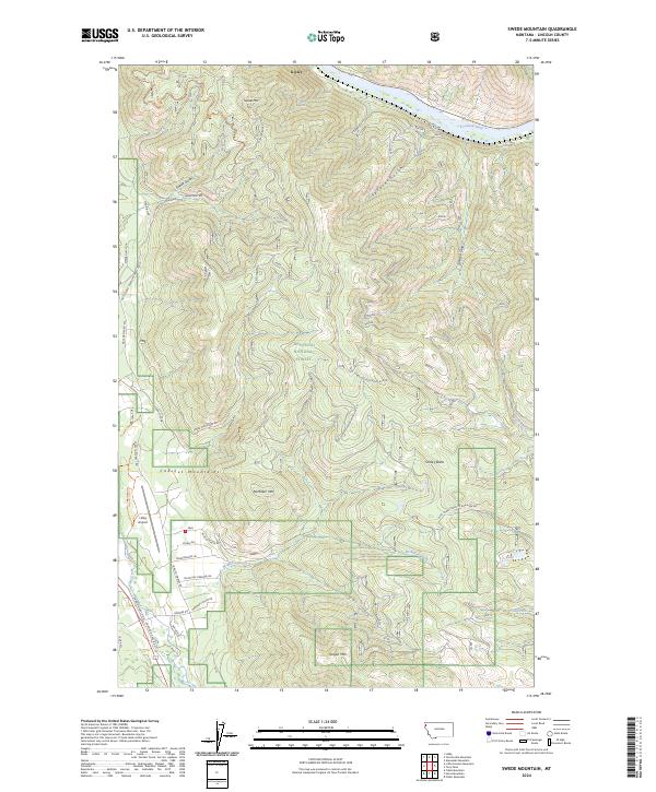
1963 Swede Mountain
Lincoln County, MT
1963 Tony Peak
Lincoln County, MT
1963 Treasure Mountain
Lincoln County, MT
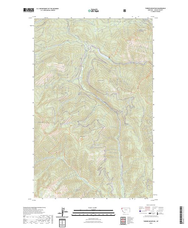
1963 Turner Mountain
Lincoln County, MT
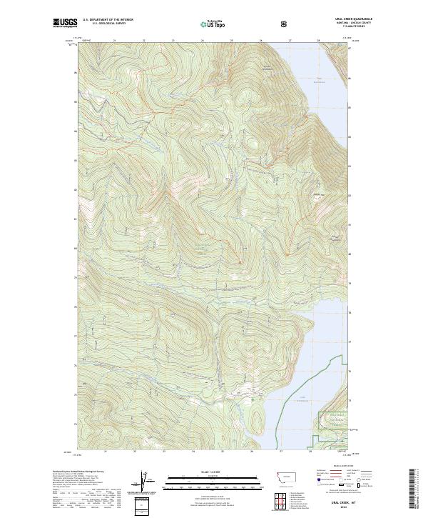
1963 Ural Creek
Lincoln County, MT
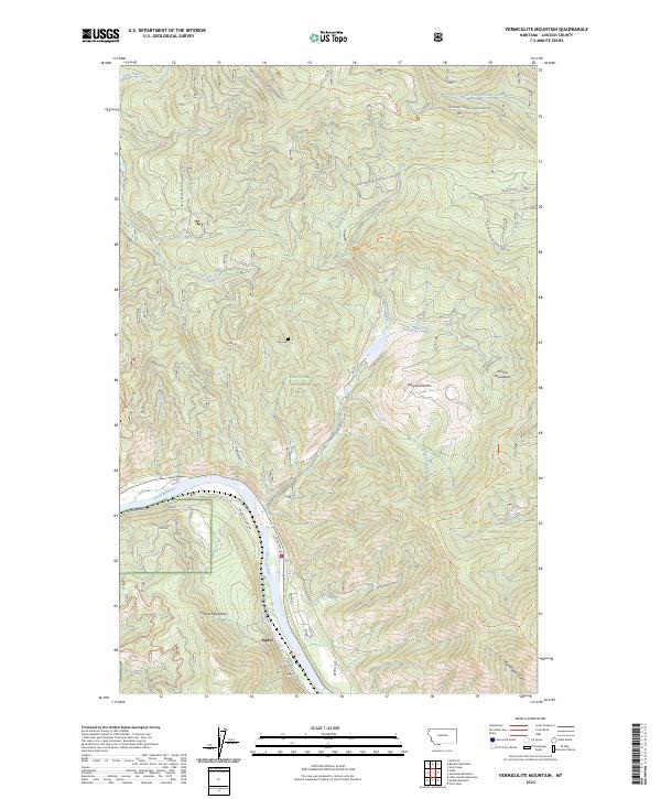
1963 Vermiculite Mountain
Lincoln County, MT
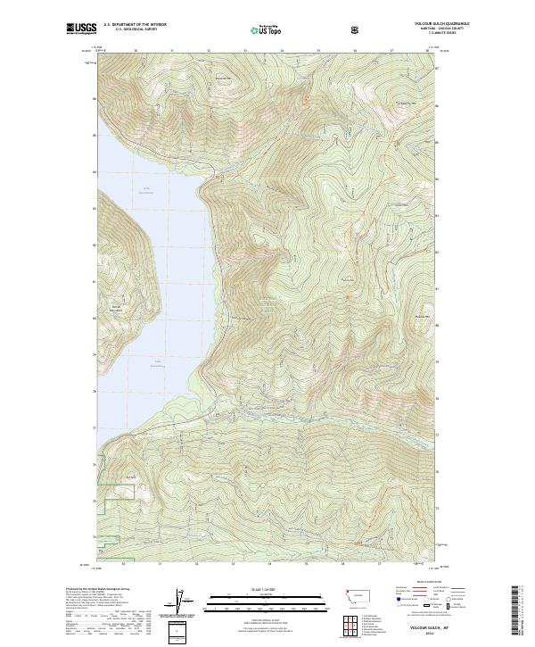
1963 Volcour
Lincoln County, MT
1963 Warland Peak
Lincoln County, MT
1963 Webb Mountain
Lincoln County, MT
1963 Wolf Prairie
Lincoln County, MT
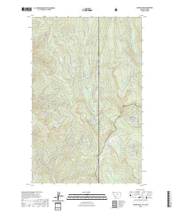
1965 Canuck Peak
Lincoln County, MT
1966 Barren Peak
Lincoln County, MT
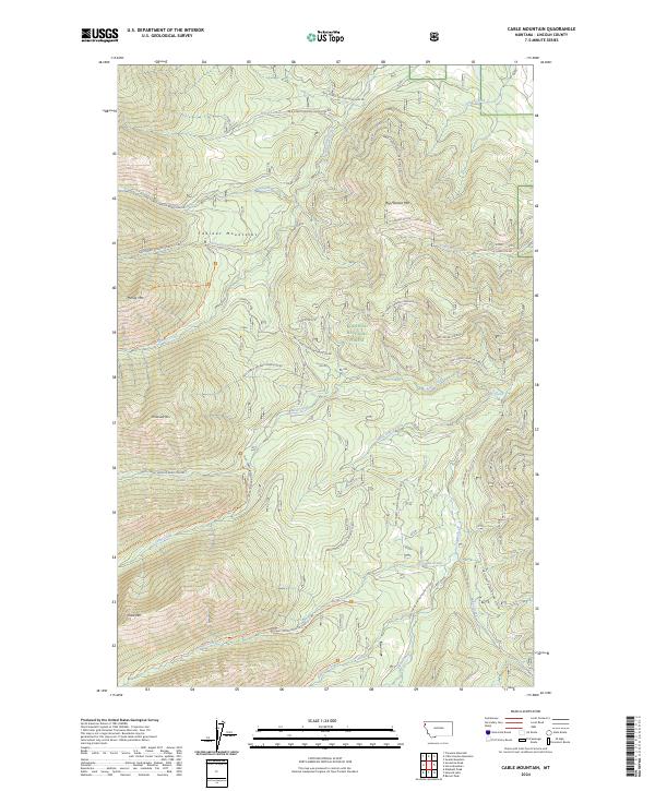
1966 Cable Mountain
Lincoln County, MT
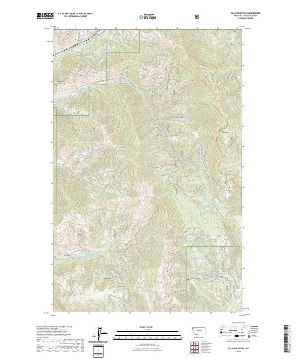
1966 Calx Mountain
Lincoln County, MT
1966 Deer Creek
Lincoln County, MT
1966 Fisher Mountain
Lincoln County, MT
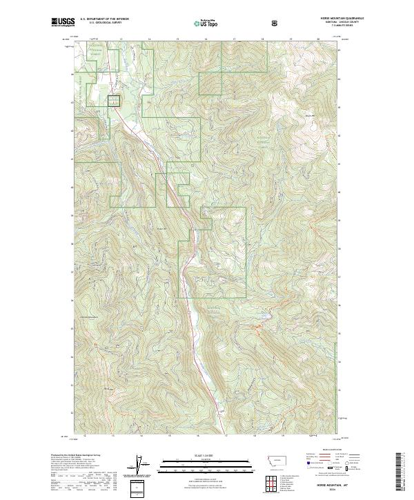
1966 Horse Mountain
Lincoln County, MT
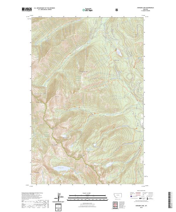
1966 Howard Lake
Lincoln County, MT
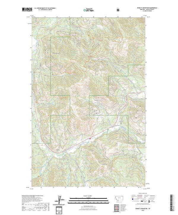
1966 Kenelty Mountain
Lincoln County, MT
1966 Loon Lake
Lincoln County, MT
1966 Mantrap Fork
Lincoln County, MT
1966 Miller Lake
Lincoln County, MT
1966 Mount Thompson-Seton
Lincoln County, MT
1966 Sawtooth Mountain
Lincoln County, MT
1966 Silver Butte Pass
Lincoln County, MT
1966 Snowshoe Peak
Lincoln County, MT
1966 Thompson Lakes
Lincoln County, MT
1977 Cripple Horse Mountain
Lincoln County, MT
1979 Yaak River
Lincoln County, MT
1983 Volcour Gulch
Lincoln County, MT
1994 Mount Thompson-Seton
Lincoln County, MT
1997 Alexander Mountain
Lincoln County, MT
1997 Banfield Mountain
Lincoln County, MT
1997 Barren Peak
Lincoln County, MT
1997 Beartrap Mountain
Lincoln County, MT
1997 Bonnet Top
Lincoln County, MT
1997 Boulder Lakes
Lincoln County, MT
1997 Bowen Lake
Lincoln County, MT
1997 Cable Mountain
Lincoln County, MT
1997 Calx Mountain
Lincoln County, MT
1997 Clark Mountain
Lincoln County, MT
1997 Cripple Horse Mountain
Lincoln County, MT
1997 Crowell Mountain
Lincoln County, MT
1997 Davis Mountain
Lincoln County, MT
1997 Deer Creek
Lincoln County, MT
1997 Edna Mountain
Lincoln County, MT
1997 Eureka North
Lincoln County, MT
1997 Eureka South
Lincoln County, MT
1997 Fisher Mountain
Lincoln County, MT
1997 Flatiron Mountain
Lincoln County, MT
1997 Garver Mountain
Lincoln County, MT
1997 Gold Hill
Lincoln County, MT
1997 Horse Hill
Lincoln County, MT
1997 Horse Mountain
Lincoln County, MT
1997 Howard Lake
Lincoln County, MT
1997 Inch Mountain
Lincoln County, MT
1997 Kenelty Mountain
Lincoln County, MT
1997 Kilbrennan Lake
Lincoln County, MT
1997 Kootenai Falls
Lincoln County, MT
1997 Ksanka Peak
Lincoln County, MT
1997 Little Hoodoo Mountain
Lincoln County, MT
1997 Loon Lake
Lincoln County, MT
1997 Lost Horse Mountain
Lincoln County, MT
1997 Mc Guire Mountain
Lincoln County, MT
1997 Miller Lake
Lincoln County, MT
1997 Mount Baldy
Lincoln County, MT
1997 Mount Henry
Lincoln County, MT
1997 Mount Marston
Lincoln County, MT
1997 Newton Mountain
Lincoln County, MT
1997 Northwest Peak
Lincoln County, MT
1997 Parsnip Mountain
Lincoln County, MT
1997 Pinkham Mountain
Lincoln County, MT
1997 Pink Mountain
Lincoln County, MT
1997 Pulpit Mountain
Lincoln County, MT
1997 Red Mountain
Lincoln County, MT
1997 Richards Mountain
Lincoln County, MT
1997 Robinson Mountain
Lincoln County, MT
1997 Sawtooth Mountain
Lincoln County, MT
1997 Scenery Mountain
Lincoln County, MT
1997 Silver Butte Pass
Lincoln County, MT
1997 Skillet Mountain
Lincoln County, MT
1997 Snowshoe Peak
Lincoln County, MT
1997 Spar Lake
Lincoln County, MT
1997 Stahl Peak
Lincoln County, MT
1997 Swede Mountain
Lincoln County, MT
1997 Thompson Lakes
Lincoln County, MT
1997 Tony Peak
Lincoln County, MT
1997 Treasure Mountain
Lincoln County, MT
1997 Turner Mountain
Lincoln County, MT
1997 Ural Creek
Lincoln County, MT
1997 Vermiculite Mountain
Lincoln County, MT
1997 Volcour Gulch
Lincoln County, MT
1997 Warland Peak
Lincoln County, MT
1997 Webb Mountain
Lincoln County, MT
1997 Wolf Prairie
Lincoln County, MT
1999 Mantrap Fork
Lincoln County, MT

2011 Alexander Mountain
Lincoln County, MT
2011 Banfield Mountain
Lincoln County, MT
2011 Barren Peak
Lincoln County, MT
2011 Beartrap Mountain
Lincoln County, MT

2011 Bonnet Top
Lincoln County, MT
2011 Boulder Lakes
Lincoln County, MT
2011 Bowen Lake
Lincoln County, MT
2011 Cable Mountain
Lincoln County, MT
2011 Calx Mountain
Lincoln County, MT
2011 Canuck Peak
Lincoln County, MT
2011 Clark Mountain
Lincoln County, MT
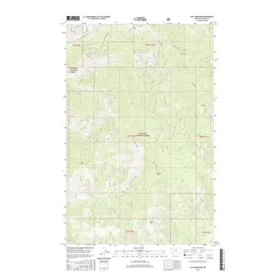
2011 Cripple Horse Mountain
Lincoln County, MT
2011 Crowell Mountain
Lincoln County, MT
2011 Davis Mountain
Lincoln County, MT
2011 Deer Creek
Lincoln County, MT
2011 Edna Mountain
Lincoln County, MT
2011 Eureka North
Lincoln County, MT
2011 Eureka South
Lincoln County, MT
2011 Fisher Mountain
Lincoln County, MT
2011 Flatiron Mountain
Lincoln County, MT

2011 Garver Mountain
Lincoln County, MT
2011 Gold Hill
Lincoln County, MT
2011 Horse Hill
Lincoln County, MT
2011 Horse Mountain
Lincoln County, MT
2011 Howard Lake
Lincoln County, MT
2011 Inch Mountain
Lincoln County, MT
2011 Kenelty Mountain
Lincoln County, MT
2011 Kilbrennan Lake
Lincoln County, MT
2011 Kootenai Falls
Lincoln County, MT
2011 Ksanka Peak
Lincoln County, MT
2011 Little Hoodoo Mountain
Lincoln County, MT
2011 Loon Lake
Lincoln County, MT
2011 Lost Horse Mountain
Lincoln County, MT

2011 Mantrap Fork
Lincoln County, MT
2011 McGuire Mountain
Lincoln County, MT
2011 Miller Lake
Lincoln County, MT
2011 Mount Baldy
Lincoln County, MT
2011 Mount Henry
Lincoln County, MT
2011 Mount Marston
Lincoln County, MT
2011 Mount Thompson-Seton
Lincoln County, MT
2011 Newton Mountain
Lincoln County, MT
2011 Northwest Peak
Lincoln County, MT
2011 Parsnip Mountain
Lincoln County, MT
2011 Pinkham Mountain
Lincoln County, MT
2011 Pink Mountain
Lincoln County, MT
2011 Pulpit Mountain
Lincoln County, MT
2011 Red Mountain
Lincoln County, MT
2011 Richards Mountain
Lincoln County, MT
2011 Robinson Mountain
Lincoln County, MT
2011 Sawtooth Mountain
Lincoln County, MT
2011 Scenery Mountain
Lincoln County, MT
2011 Silver Butte Pass
Lincoln County, MT
2011 Skillet Mountain
Lincoln County, MT
2011 Snowshoe Peak
Lincoln County, MT
2011 Spar Lake
Lincoln County, MT
2011 Stahl Peak
Lincoln County, MT
2011 Swede Mountain
Lincoln County, MT
2011 Thompson Lakes
Lincoln County, MT
2011 Tony Peak
Lincoln County, MT

2011 Treasure Mountain
Lincoln County, MT
2011 Turner Mountain
Lincoln County, MT
2011 Ural Creek
Lincoln County, MT
2011 Vermiculite Mountain
Lincoln County, MT
2011 Volcour Gulch
Lincoln County, MT
2011 Warland Peak
Lincoln County, MT
2011 Webb Mountain
Lincoln County, MT
2011 Wolf Prairie
Lincoln County, MT
2014 Alexander Mountain
Lincoln County, MT
2014 Banfield Mountain
Lincoln County, MT
2014 Barren Peak
Lincoln County, MT
2014 Beartrap Mountain
Lincoln County, MT
2014 Bonnet Top
Lincoln County, MT
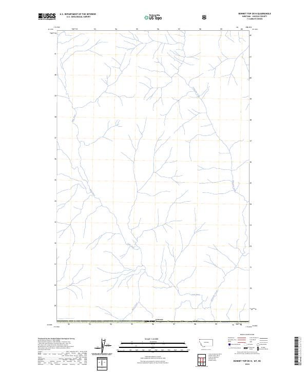
2014 Bonnet Top OE N
Lincoln County, MT
2014 Boulder Lakes
Lincoln County, MT
2014 Bowen Lake
Lincoln County, MT
2014 Cable Mountain
Lincoln County, MT
2014 Calx Mountain
Lincoln County, MT
2014 Canuck Peak
Lincoln County, MT
2014 Clark Mountain
Lincoln County, MT
2014 Cripple Horse Mountain
Lincoln County, MT
2014 Crowell Mountain
Lincoln County, MT
2014 Davis Mountain
Lincoln County, MT
2014 Deer Creek
Lincoln County, MT
2014 Edna Mountain
Lincoln County, MT
2014 Eureka North
Lincoln County, MT
2014 Eureka South
Lincoln County, MT
2014 Fisher Mountain
Lincoln County, MT
2014 Flatiron Mountain
Lincoln County, MT
2014 Garver Mountain
Lincoln County, MT
2014 Garver Mountain OE N
Lincoln County, MT
2014 Gold Hill
Lincoln County, MT
2014 Horse Hill
Lincoln County, MT
2014 Horse Mountain
Lincoln County, MT
2014 Howard Lake
Lincoln County, MT
2014 Inch Mountain
Lincoln County, MT
2014 Kenelty Mountain
Lincoln County, MT
2014 Kilbrennan Lake
Lincoln County, MT
2014 Kootenai Falls
Lincoln County, MT
2014 Ksanka Peak
Lincoln County, MT
2014 Ksanka Peak OE N
Lincoln County, MT
2014 Little Hoodoo Mountain
Lincoln County, MT
2014 Loon Lake
Lincoln County, MT
2014 Lost Horse Mountain
Lincoln County, MT
2014 Mantrap Fork
Lincoln County, MT
2014 McGuire Mountain
Lincoln County, MT
2014 Miller Lake
Lincoln County, MT
2014 Mount Baldy
Lincoln County, MT
2014 Mount Henry
Lincoln County, MT
2014 Mount Henry OE N
Lincoln County, MT
2014 Mount Marston
Lincoln County, MT
2014 Mount Thompson-Seton
Lincoln County, MT
2014 Newton Mountain
Lincoln County, MT
2014 Northwest Peak
Lincoln County, MT
2014 Northwest Peak OE N
Lincoln County, MT
2014 Parsnip Mountain
Lincoln County, MT
2014 Pinkham Mountain
Lincoln County, MT
2014 Pink Mountain
Lincoln County, MT
2014 Pulpit Mountain
Lincoln County, MT
2014 Red Mountain
Lincoln County, MT
2014 Red Mountain OE N
Lincoln County, MT
2014 Richards Mountain
Lincoln County, MT
2014 Robinson Mountain
Lincoln County, MT
2014 Robinson Mountain OE N
Lincoln County, MT
2014 Sawtooth Mountain
Lincoln County, MT
2014 Scenery Mountain
Lincoln County, MT
2014 Silver Butte Pass
Lincoln County, MT
2014 Skillet Mountain
Lincoln County, MT
2014 Snowshoe Peak
Lincoln County, MT
2014 Spar Lake
Lincoln County, MT
2014 Stahl Peak
Lincoln County, MT
2014 Stahl Peak OE N
Lincoln County, MT
2014 Swede Mountain
Lincoln County, MT
2014 Thompson Lakes
Lincoln County, MT
2014 Tony Peak
Lincoln County, MT
2014 Treasure Mountain
Lincoln County, MT
2014 Turner Mountain
Lincoln County, MT
2014 Ural Creek
Lincoln County, MT
2014 Vermiculite Mountain
Lincoln County, MT
2014 Volcour Gulch
Lincoln County, MT
2014 Warland Peak
Lincoln County, MT
2014 Webb Mountain
Lincoln County, MT

2014 Wolf Prairie
Lincoln County, MT
2017 Alexander Mountain
Lincoln County, MT
2017 Banfield Mountain
Lincoln County, MT
2017 Barren Peak
Lincoln County, MT
2017 Beartrap Mountain
Lincoln County, MT
2017 Bonnet Top
Lincoln County, MT
2017 Bonnet Top OE N
Lincoln County, MT
2017 Boulder Lakes
Lincoln County, MT
2017 Bowen Lake
Lincoln County, MT
2017 Cable Mountain
Lincoln County, MT
2017 Calx Mountain
Lincoln County, MT
2017 Canuck Peak
Lincoln County, MT
2017 Clark Mountain
Lincoln County, MT
2017 Cripple Horse Mountain
Lincoln County, MT
2017 Crowell Mountain
Lincoln County, MT
2017 Davis Mountain
Lincoln County, MT
2017 Deer Creek
Lincoln County, MT
2017 Edna Mountain
Lincoln County, MT
2017 Eureka North
Lincoln County, MT
2017 Eureka South
Lincoln County, MT
2017 Fisher Mountain
Lincoln County, MT
2017 Flatiron Mountain
Lincoln County, MT
2017 Garver Mountain
Lincoln County, MT
2017 Garver Mountain OE N
Lincoln County, MT
2017 Gold Hill
Lincoln County, MT
2017 Horse Hill
Lincoln County, MT
2017 Horse Mountain
Lincoln County, MT
2017 Howard Lake
Lincoln County, MT
2017 Inch Mountain
Lincoln County, MT
2017 Kenelty Mountain
Lincoln County, MT
2017 Kilbrennan Lake
Lincoln County, MT
2017 Kootenai Falls
Lincoln County, MT
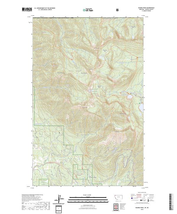
2017 Ksanka Peak
Lincoln County, MT
2017 Ksanka Peak OE N
Lincoln County, MT
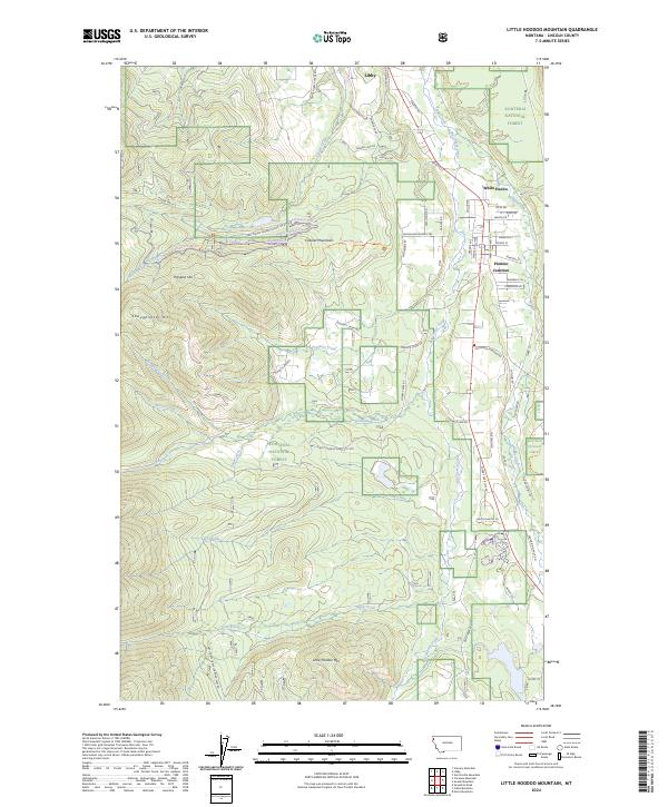
2017 Little Hoodoo Mountain
Lincoln County, MT
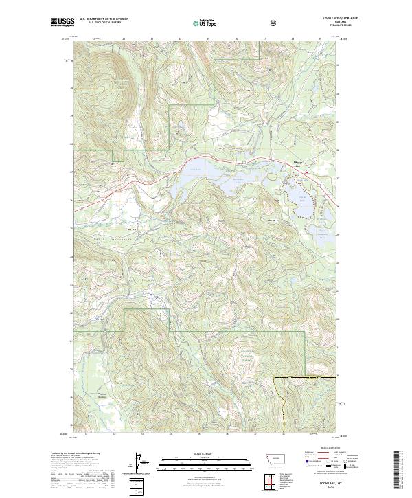
2017 Loon Lake
Lincoln County, MT
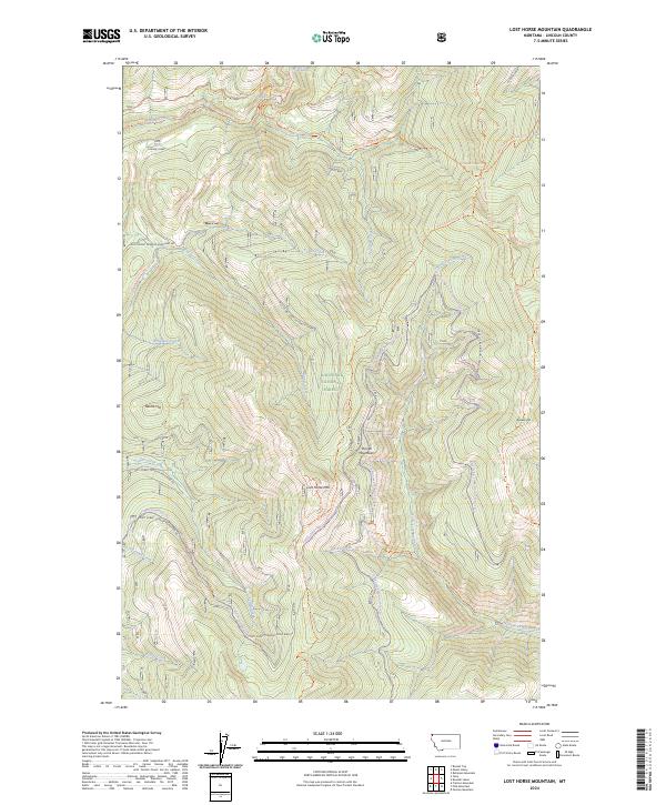
2017 Lost Horse Mountain
Lincoln County, MT
2017 Mantrap Fork
Lincoln County, MT
2017 McGuire Mountain
Lincoln County, MT
2017 Miller Lake
Lincoln County, MT
2017 Mount Baldy
Lincoln County, MT
2017 Mount Henry
Lincoln County, MT
2017 Mount Henry OE N
Lincoln County, MT
2017 Mount Marston
Lincoln County, MT
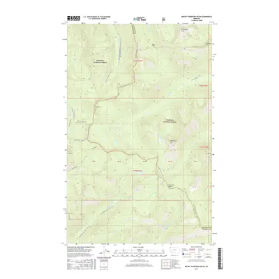
2017 Mount Thompson-Seton
Lincoln County, MT
2017 Newton Mountain
Lincoln County, MT
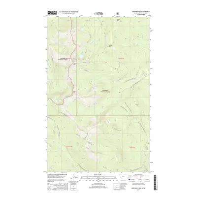
2017 Northwest Peak
Lincoln County, MT
2017 Northwest Peak OE N
Lincoln County, MT
2017 Parsnip Mountain
Lincoln County, MT
2017 Pinkham Mountain
Lincoln County, MT
2017 Pink Mountain
Lincoln County, MT
2017 Pulpit Mountain
Lincoln County, MT
2017 Red Mountain
Lincoln County, MT
2017 Red Mountain OE N
Lincoln County, MT
2017 Richards Mountain
Lincoln County, MT
2017 Robinson Mountain
Lincoln County, MT
2017 Robinson Mountain OE N
Lincoln County, MT
2017 Sawtooth Mountain
Lincoln County, MT
2017 Scenery Mountain
Lincoln County, MT
2017 Silver Butte Pass
Lincoln County, MT
2017 Skillet Mountain
Lincoln County, MT
2017 Snowshoe Peak
Lincoln County, MT
2017 Spar Lake
Lincoln County, MT
2017 Stahl Peak
Lincoln County, MT
2017 Stahl Peak OE N
Lincoln County, MT
2017 Swede Mountain
Lincoln County, MT
2017 Thompson Lakes
Lincoln County, MT
2017 Tony Peak
Lincoln County, MT
2017 Treasure Mountain
Lincoln County, MT
2017 Turner Mountain
Lincoln County, MT
2017 Ural Creek
Lincoln County, MT
2017 Vermiculite Mountain
Lincoln County, MT
2017 Volcour Gulch
Lincoln County, MT
2017 Warland Peak
Lincoln County, MT
2017 Webb Mountain
Lincoln County, MT
2017 Wolf Prairie
Lincoln County, MT
2020 Alexander Mountain
Lincoln County, MT
2020 Banfield Mountain
Lincoln County, MT
2020 Barren Peak
Lincoln County, MT
2020 Beartrap Mountain
Lincoln County, MT
2020 Bonnet Top
Lincoln County, MT
2020 Bonnet Top OE N
Lincoln County, MT
2020 Boulder Lakes
Lincoln County, MT
2020 Bowen Lake
Lincoln County, MT
2020 Cable Mountain
Lincoln County, MT
2020 Calx Mountain
Lincoln County, MT
2020 Canuck Peak
Lincoln County, MT
2020 Clark Mountain
Lincoln County, MT
2020 Cripple Horse Mountain
Lincoln County, MT
2020 Crowell Mountain
Lincoln County, MT
2020 Davis Mountain
Lincoln County, MT
2020 Deer Creek
Lincoln County, MT
2020 Edna Mountain
Lincoln County, MT
2020 Eureka North
Lincoln County, MT
2020 Eureka South
Lincoln County, MT
2020 Fisher Mountain
Lincoln County, MT
2020 Flatiron Mountain
Lincoln County, MT
2020 Garver Mountain
Lincoln County, MT
2020 Garver Mountain OE N
Lincoln County, MT
2020 Gold Hill
Lincoln County, MT
2020 Horse Hill
Lincoln County, MT
2020 Horse Mountain
Lincoln County, MT
2020 Howard Lake
Lincoln County, MT
2020 Inch Mountain
Lincoln County, MT
2020 Kenelty Mountain
Lincoln County, MT
2020 Kilbrennan Lake
Lincoln County, MT
2020 Kootenai Falls
Lincoln County, MT
2020 Ksanka Peak
Lincoln County, MT
2020 Ksanka Peak OE N
Lincoln County, MT
2020 Little Hoodoo Mountain
Lincoln County, MT
2020 Loon Lake
Lincoln County, MT
2020 Lost Horse Mountain
Lincoln County, MT
2020 Mantrap Fork
Lincoln County, MT
2020 McGuire Mountain
Lincoln County, MT
2020 Miller Lake
Lincoln County, MT
2020 Mount Baldy
Lincoln County, MT
2020 Mount Henry
Lincoln County, MT
2020 Mount Henry OE N
Lincoln County, MT
2020 Mount Marston
Lincoln County, MT

2020 Mount Thompson-Seton
Lincoln County, MT
2020 Newton Mountain
Lincoln County, MT
2020 Northwest Peak
Lincoln County, MT
2020 Northwest Peak OE N
Lincoln County, MT
2020 Parsnip Mountain
Lincoln County, MT
2020 Pinkham Mountain
Lincoln County, MT
2020 Pink Mountain
Lincoln County, MT
2020 Pulpit Mountain
Lincoln County, MT
2020 Red Mountain
Lincoln County, MT
2020 Red Mountain OE N
Lincoln County, MT
2020 Richards Mountain
Lincoln County, MT
2020 Robinson Mountain
Lincoln County, MT
2020 Robinson Mountain OE N
Lincoln County, MT
2020 Sawtooth Mountain
Lincoln County, MT
2020 Scenery Mountain
Lincoln County, MT
2020 Silver Butte Pass
Lincoln County, MT
2020 Skillet Mountain
Lincoln County, MT
2020 Snowshoe Peak
Lincoln County, MT
2020 Spar Lake
Lincoln County, MT

2020 Stahl Peak
Lincoln County, MT
2020 Stahl Peak OE N
Lincoln County, MT
2020 Swede Mountain
Lincoln County, MT
2020 Thompson Lakes
Lincoln County, MT
2020 Tony Peak
Lincoln County, MT
2020 Treasure Mountain
Lincoln County, MT
2020 Turner Mountain
Lincoln County, MT
2020 Ural Creek
Lincoln County, MT
2020 Vermiculite Mountain
Lincoln County, MT
2020 Volcour Gulch
Lincoln County, MT
2020 Warland Peak
Lincoln County, MT
2020 Webb Mountain
Lincoln County, MT
2020 Wolf Prairie
Lincoln County, MT
2024 Alexander Mountain
Lincoln County, MT
2024 Banfield Mountain
Lincoln County, MT
2024 Barren Peak
Lincoln County, MT
2024 Beartrap Mountain
Lincoln County, MT
2024 Bonnet Top
Lincoln County, MT
2024 Bonnet Top OE N
Lincoln County, MT
2024 Boulder Lakes
Lincoln County, MT
2024 Bowen Lake
Lincoln County, MT
2024 Cable Mountain
Lincoln County, MT
2024 Calx Mountain
Lincoln County, MT
2024 Canuck Peak
Lincoln County, MT
2024 Clark Mountain
Lincoln County, MT
2024 Cripple Horse Mountain
Lincoln County, MT
2024 Crowell Mountain
Lincoln County, MT
2024 Davis Mountain
Lincoln County, MT
2024 Deer Creek
Lincoln County, MT
2024 Edna Mountain
Lincoln County, MT
2024 Eureka North
Lincoln County, MT
2024 Eureka South
Lincoln County, MT
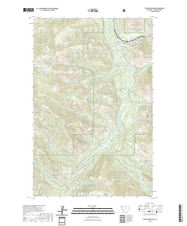
2024 Fisher Mountain
Lincoln County, MT
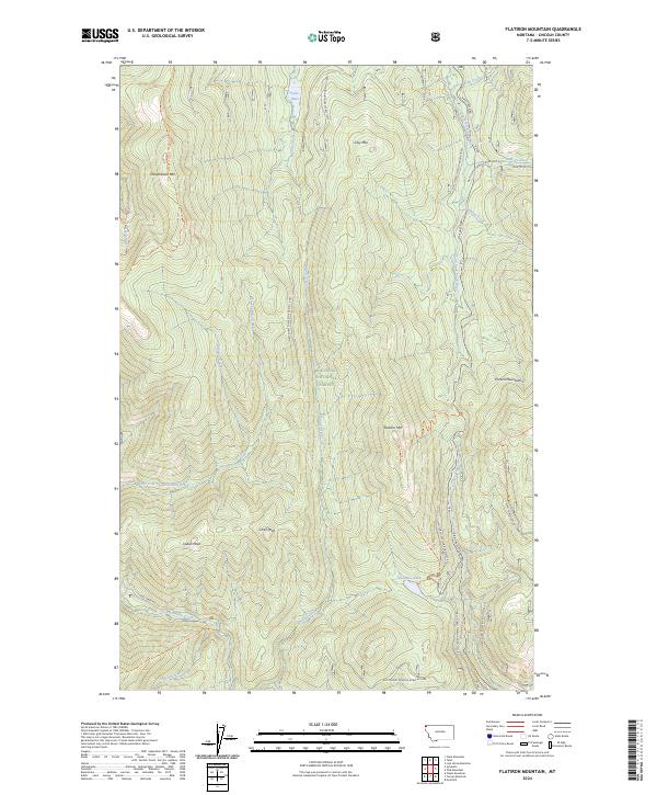
2024 Flatiron Mountain
Lincoln County, MT
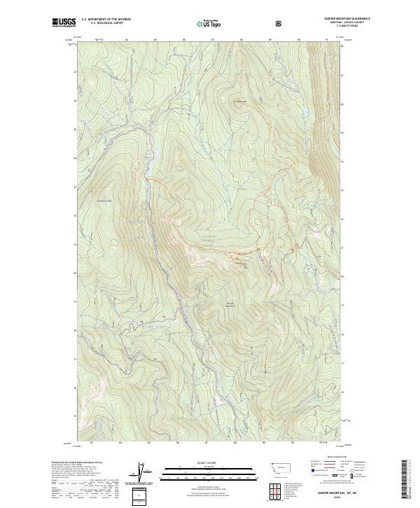
2024 Garver Mountain
Lincoln County, MT
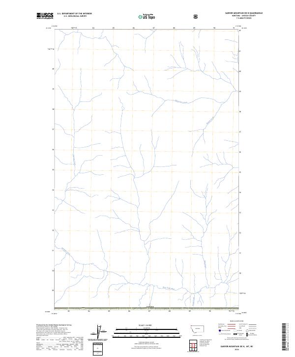
2024 Garver Mountain OE N
Lincoln County, MT
2024 Gold Hill
Lincoln County, MT
2024 Horse Hill
Lincoln County, MT
2024 Horse Mountain
Lincoln County, MT
2024 Howard Lake
Lincoln County, MT
2024 Inch Mountain
Lincoln County, MT
2024 Kenelty Mountain
Lincoln County, MT
2024 Kilbrennan Lake
Lincoln County, MT
2024 Kootenai Falls
Lincoln County, MT
2024 Ksanka Peak
Lincoln County, MT
2024 Ksanka Peak OE N
Lincoln County, MT
2024 Little Hoodoo Mountain
Lincoln County, MT
2024 Loon Lake
Lincoln County, MT
2024 Lost Horse Mountain
Lincoln County, MT
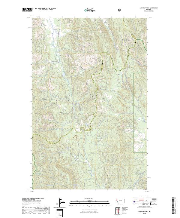
2024 Mantrap Fork
Lincoln County, MT
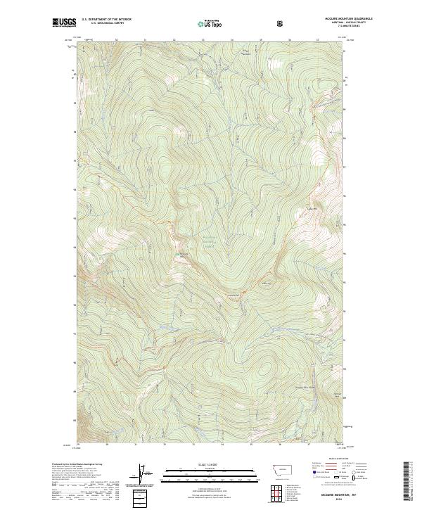
2024 McGuire Mountain
Lincoln County, MT
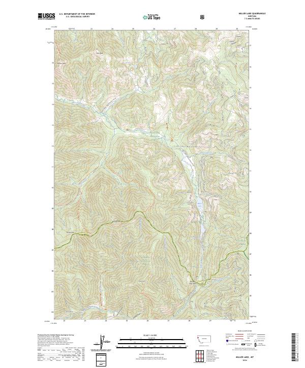
2024 Miller Lake
Lincoln County, MT
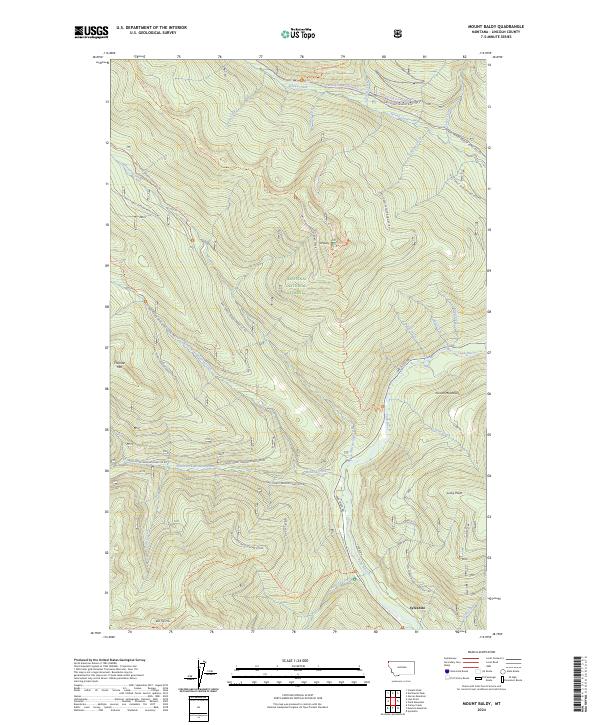
2024 Mount Baldy
Lincoln County, MT
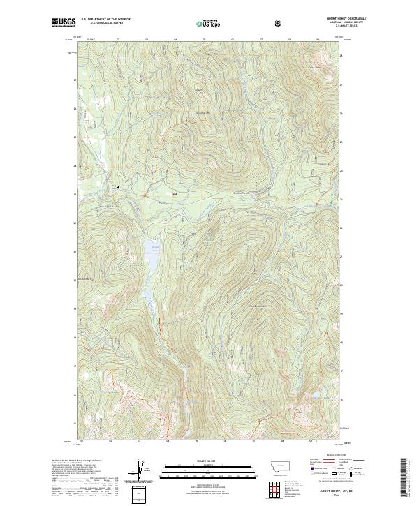
2024 Mount Henry
Lincoln County, MT
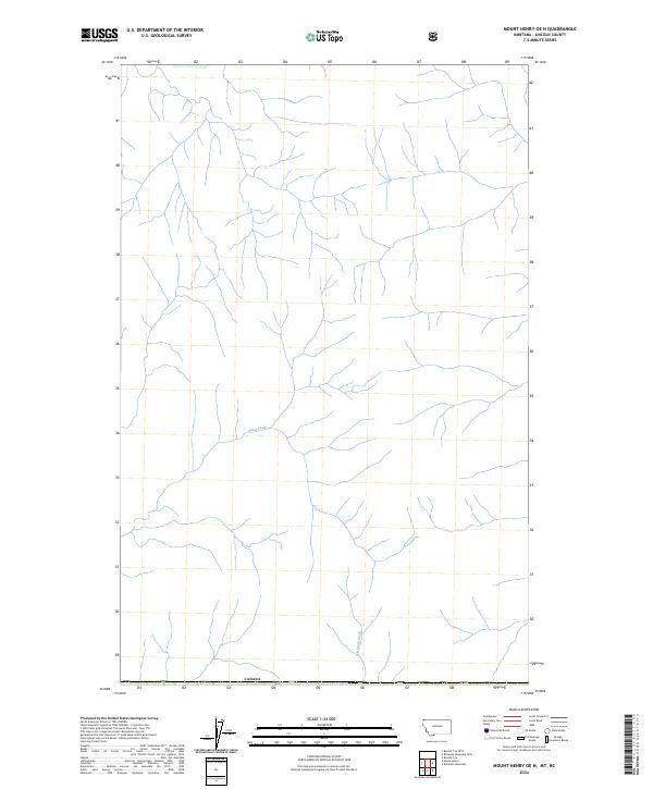
2024 Mount Henry OE N
Lincoln County, MT
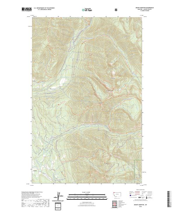
2024 Mount Marston
Lincoln County, MT
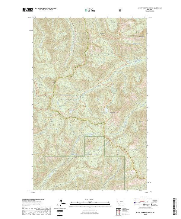
2024 Mount Thompson-Seton
Lincoln County, MT
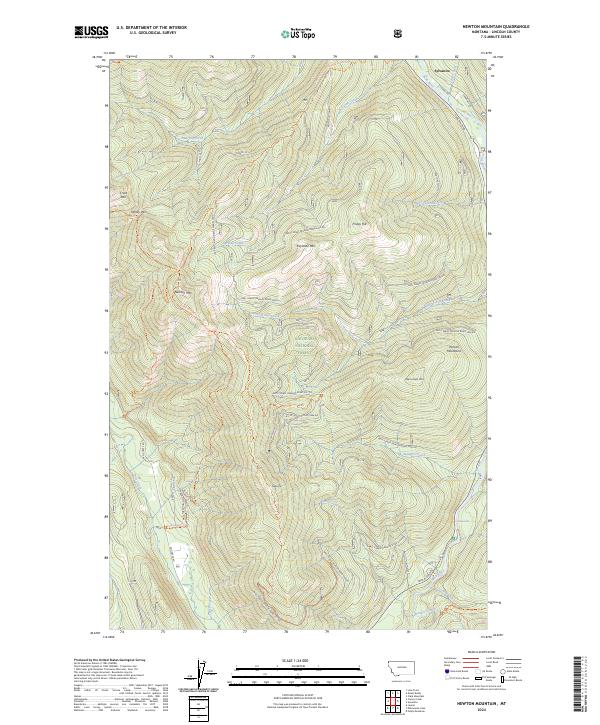
2024 Newton Mountain
Lincoln County, MT
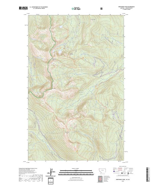
2024 Northwest Peak
Lincoln County, MT
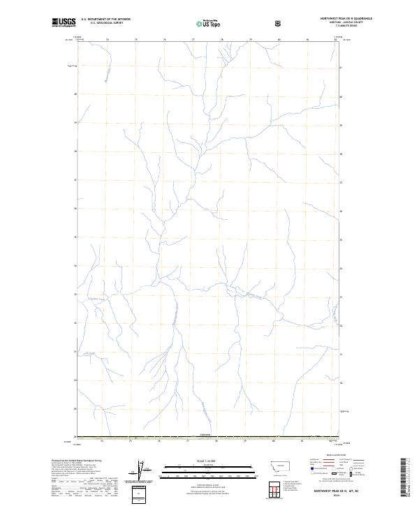
2024 Northwest Peak OE N
Lincoln County, MT
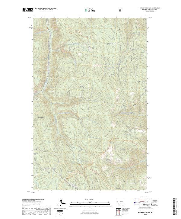
2024 Parsnip Mountain
Lincoln County, MT
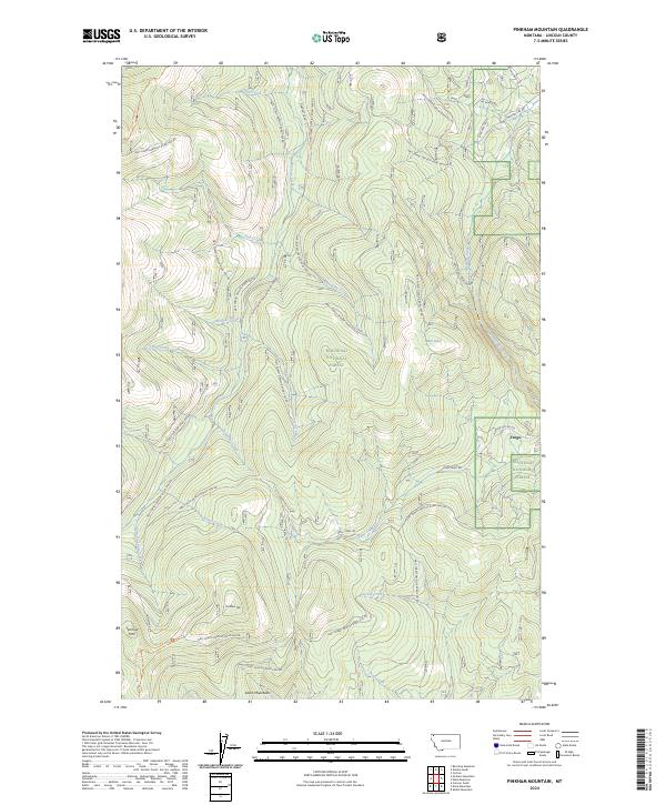
2024 Pinkham Mountain
Lincoln County, MT
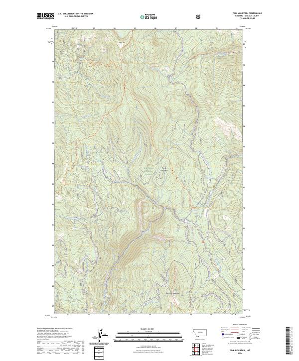
2024 Pink Mountain
Lincoln County, MT
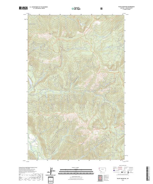
2024 Pulpit Mountain
Lincoln County, MT
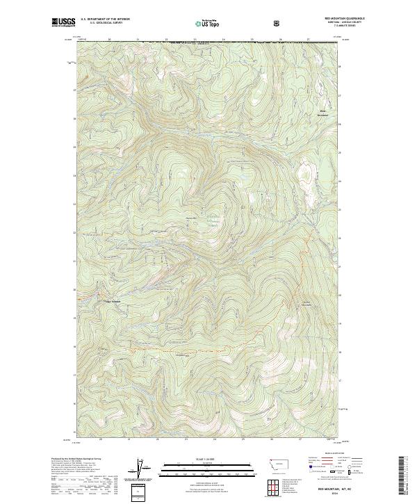
2024 Red Mountain
Lincoln County, MT
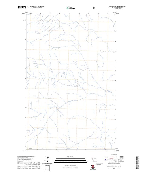
2024 Red Mountain OE N
Lincoln County, MT
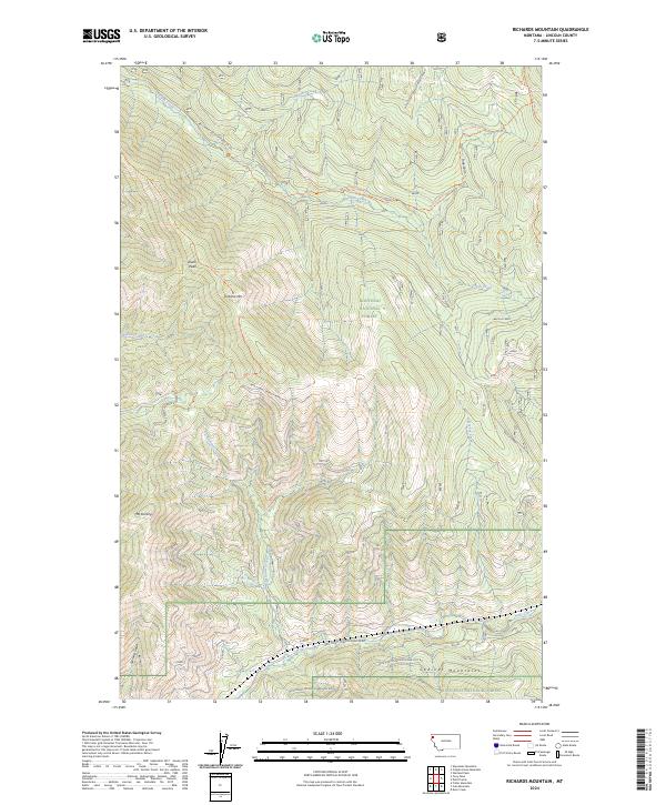
2024 Richards Mountain
Lincoln County, MT
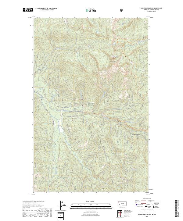
2024 Robinson Mountain
Lincoln County, MT
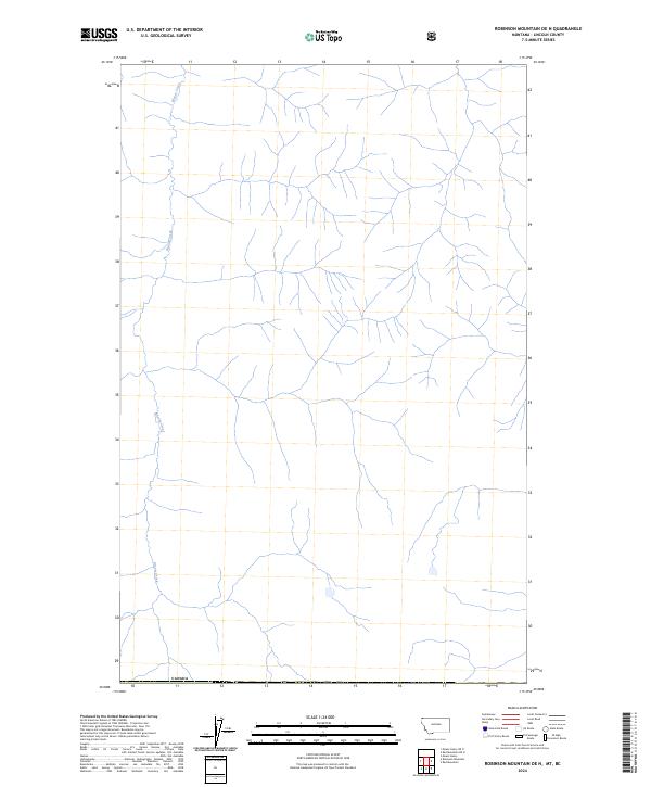
2024 Robinson Mountain OE N
Lincoln County, MT

2024 Sawtooth Mountain
Lincoln County, MT
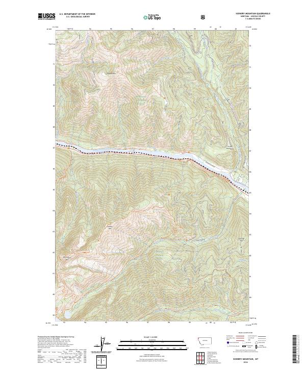
2024 Scenery Mountain
Lincoln County, MT
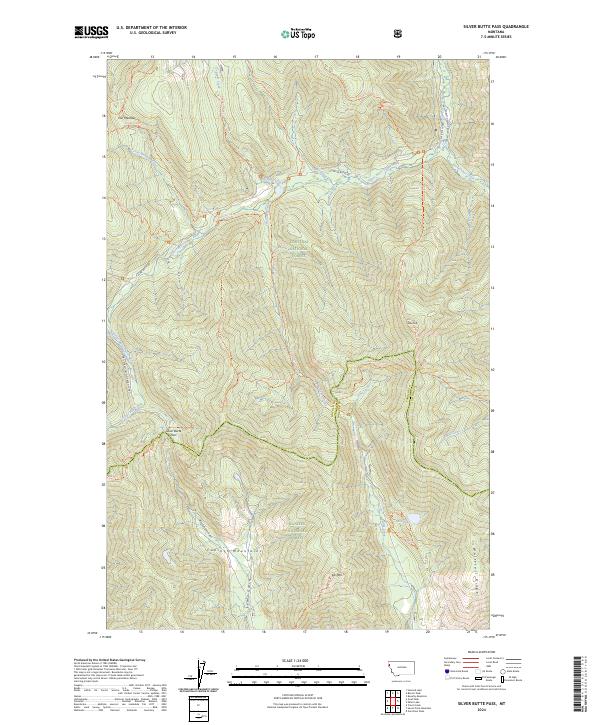
2024 Silver Butte Pass
Lincoln County, MT
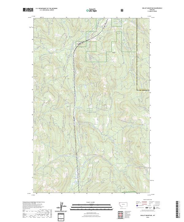
2024 Skillet Mountain
Lincoln County, MT
2024 Snowshoe Peak
Lincoln County, MT
2024 Spar Lake
Lincoln County, MT
2024 Stahl Peak
Lincoln County, MT
2024 Stahl Peak OE N
Lincoln County, MT
2024 Swede Mountain
Lincoln County, MT
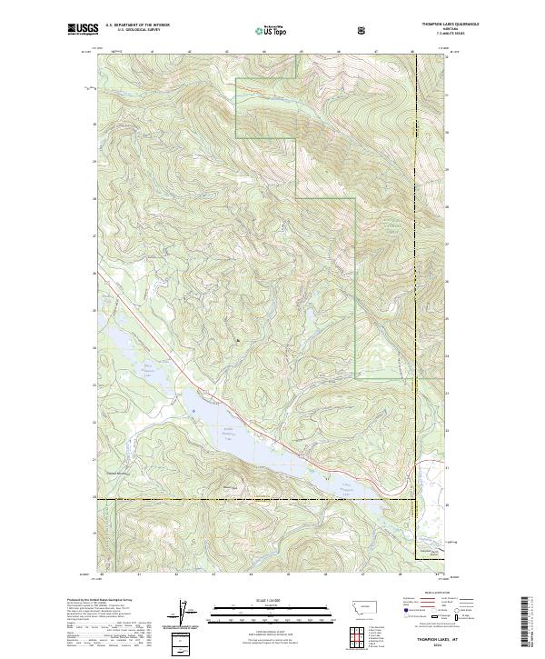
2024 Thompson Lakes
Lincoln County, MT
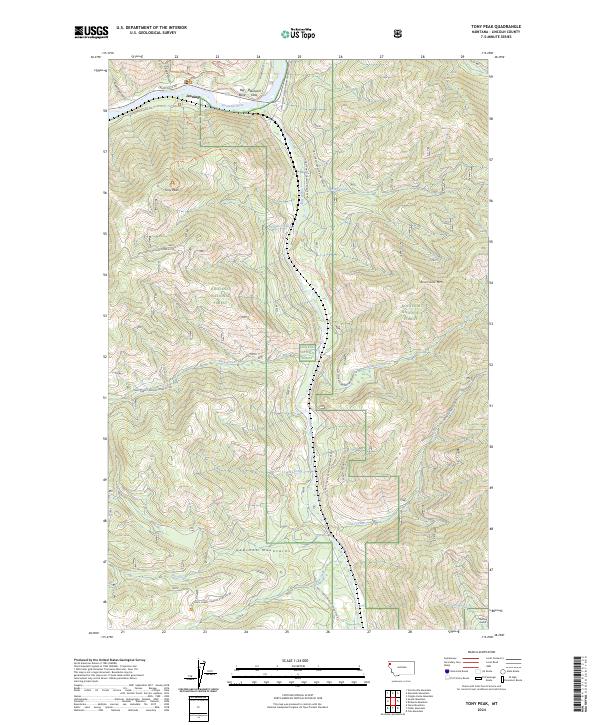
2024 Tony Peak
Lincoln County, MT
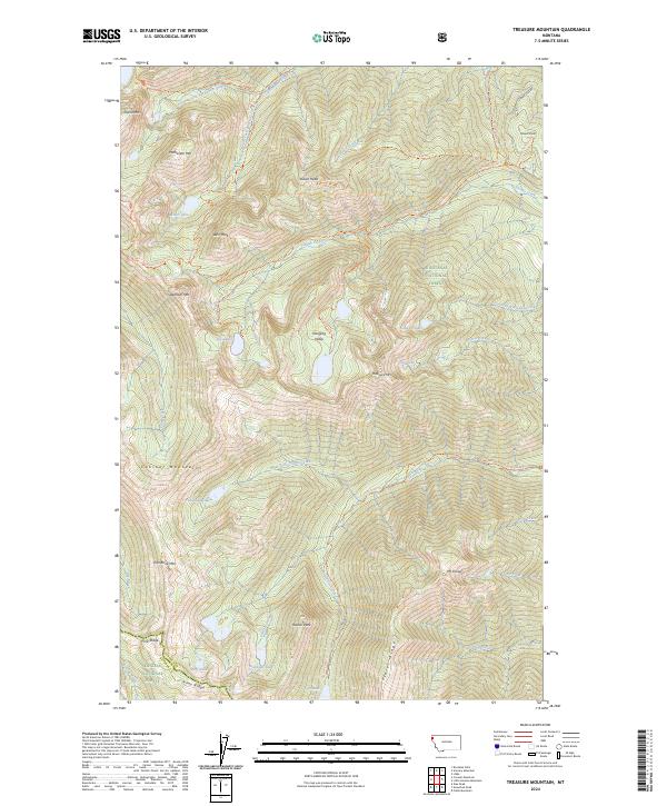
2024 Treasure Mountain
Lincoln County, MT
2024 Turner Mountain
Lincoln County, MT
2024 Ural Creek
Lincoln County, MT
2024 Vermiculite Mountain
Lincoln County, MT
2024 Volcour Gulch
Lincoln County, MT
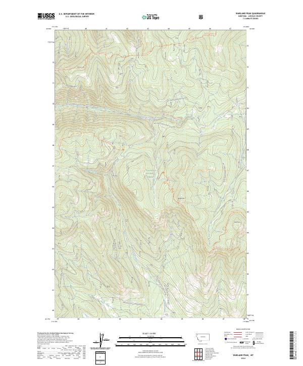
2024 Warland Peak
Lincoln County, MT
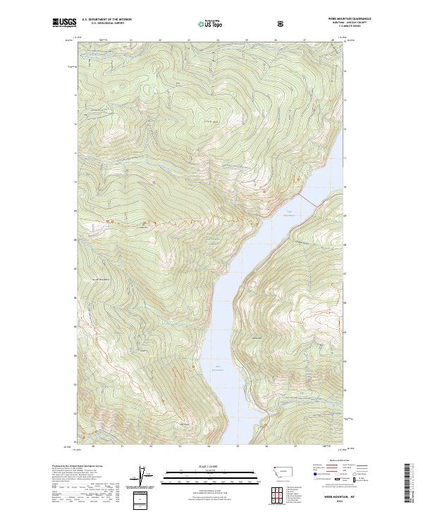
2024 Webb Mountain
Lincoln County, MT
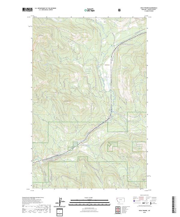
2024 Wolf Prairie
Lincoln County, MT