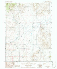
1986 Map of Grass Valley Ranch
USGS Topo · Published 1986About this map
Grass Valley Ranch sits at the base of the Simpson Park Mountains, serving as a focal point for activity in this high-desert basin during the mid-1980s. The landscape is defined by the transition from the broad, flat Grass Valley floor to the steep eastern ridges, where numerous prospects indicate a history of mineral exploration. Water management is a primary theme of the map, evidenced by the presence of a long aqueduct and a flume designed to direct flow from drainages like Skull Creek and Callaghan Creek. The inclusion of a landing strip near the ranch underscores the necessity of aerial access for this isolated cattle and ranching operation. Perennial water sources such as Barton Spring and Steiner Creek provide essential resources in an otherwise arid environment where every well and spring is meticulously noted.
Find a feature on this map
21 named features on this map. Tap any name to fly to it.
Don’t see what you’re looking for? This feature index may not catch every label — zoom into the map to look around manually.
Map Details
Editions of this 1986 Grass Valley Ranch Map
This is the sole edition of this map. No revisions or reprints were ever made.
Other maps of this area

1926 · Roberts Mountains
USGS Topo · 1:250,000

1929 · Roberts Mountains
USGS Topo · 1:250,000

1955 · Millett
USGS Topo · 1:250,000

1956 · Mount Callaghan
USGS Topo · 1:62,500

1956 · Walti Hot Springs
USGS Topo · 1:62,500

1956 · Hall Creek
USGS Topo · 1:62,500

1956 · Ackerman Canyon
USGS Topo · 1:62,500

1959 · Millett
USGS Topo · 1:250,000

1979 · Simpson Park Mtns
USGS Topo · 1:100,000
1986 · Hall Creek South
USGS Topo · 1:24,000