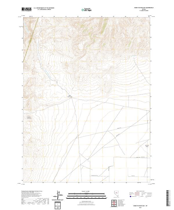
2021 Map of Home Station Gap
USGS Topo · Published 2021About this map
Home Station Gap serves as a critical topographic corridor between the Augusta Mountains and the expanse of Antelope Valley. This high-desert landscape in northern Nevada is defined by drainage patterns and sparse water sources, such as Home Station Wash and the secluded Hess Spring to the northeast. The map documents the persistent network of remote tracks that support the region's ranching economy, notably Brides Wells Daileys Rd and Ranch Rd. Boundary lines for Pershing and Lander counties intersect these desert ranges, while isolated landmarks like Brides Wells and Bridge Wells signify the essential, localized water infrastructure that has historically anchored movement through this arid territory.
Find a feature on this map
15 named features on this map. Tap any name to fly to it.
Don’t see what you’re looking for? This feature index may not catch every label — zoom into the map to look around manually.
Map Details
Editions of this 2021 Home Station Gap Map
This is the sole edition of this map. No revisions or reprints were ever made.
Other maps of this area

1932 · Sonoma Range
USGS Topo · 1:250,000

1939 · Sonoma Range
USGS Topo · 1:250,000

1955 · Millett
USGS Topo · 1:250,000

1955 · Winnemucca
USGS Topo · 1:250,000

1958 · Winnemucca
USGS Topo · 1:250,000

1959 · Millett
USGS Topo · 1:250,000

1961 · Cain Mountain
USGS Topo · 1:62,500

1961 · Mt. Moses
USGS Topo · 1:62,500

1962 · Winnemucca
USGS Topo · 1:250,000

1966 · Shoshone Meadows
USGS Topo · 1:62,500