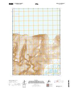
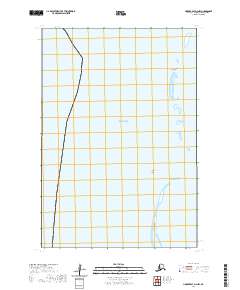
2020 Map of Hooper Bay D-3 SE
USGS Topo · Published 2020About this map
The Askinuk Mountains dominate this coastal Alaskan landscape, rising above a complex network of tidewater rivers and creek systems. Located along the eastern edge of the Bering Sea, the terrain shifts from the high elevations of the mountains down to the marshy lowlands drained by the Ekashlukt River and Lithkealik River. This 2020 survey illustrates the remote character of the Kusilvak Census Area, where the land meets the sea at prominent landmarks like Point Smith and the protected waters of Kongishluk Bay. The intricate drainage patterns of Towak Cr and Kousiakrak Cr suggest a shifting, wetland-heavy environment typical of the Yukon-Kuskokwim Delta region. Researchers can observe how the topography transitions from steep mountain slopes to the vast alluvial plains that define this section of the coast.
Find a feature on this map
14 named features on this map. Tap any name to fly to it.
Don’t see what you’re looking for? This feature index may not catch every label — zoom into the map to look around manually.
Map Details
Editions of this 2020 Hooper Bay D-3 SE Map
This is the sole edition of this map. No revisions or reprints were ever made.
Other maps of this area

1951 · Hooper Bay
USGS Topo · 1:250,000

1952 · Hooper Bay C-3
USGS Topo · 1:63,360

1952 · Hooper Bay D-2
USGS Topo · 1:63,360

1953 · Hooper Bay
USGS Topo · 1:250,000

1953 · Hooper Bay C-2
USGS Topo · 1:63,360
1953 · Hooper Bay D-3
USGS Topo · 1:63,360

1964 · Hooper Bay
USGS Topo · 1:250,000
2020 · Hooper Bay C-3 NE
USGS Topo · 1:25,000
2020 · Hooper Bay D-2 SW
USGS Topo · 1:25,000
2020 · Hooper Bay D-3 NW
USGS Topo · 1:25,000