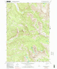
1964 Map of Washington Peak
USGS Topo · Published 1990About this map
The high alpine intersection of Challis National Forest and Sawtooth National Forest is defined here by the towering White Cloud Peaks and the 10,519-foot summit of Washington Peak. This mid-century survey illustrates a landscape primarily shaped by glacial activity and early resource extraction. The presence of the Aztec Mine near Fisher Creek and the Black Rock Mine in Washington Basin speaks to the prospecting history within these high basins. The hydrology is equally prominent, with numerous alpine waters including Fourth of July Lake, Phyllis Lake, and the cascading Star Lakes feeding into drainage systems like Fourth of July Creek. A single Jeep Trail provides the only mechanized access into the southeastern portion of the quadrangle, highlighting the primitive state of the backcountry during this period of the 1960s.
Find a feature on this map
31 named features on this map. Tap any name to fly to it.
Don’t see what you’re looking for? This feature index may not catch every label — zoom into the map to look around manually.
Map Details
Editions of this 1964 Washington Peak Map
3 editions found
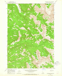
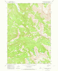
Other maps of this area

1900 · Sawtooth
USGS Topo · 1:125,000

1919 · Custer
USGS Topo · 1:125,000

1922 · Custer
USGS Topo · 1:125,000

1955 · Hailey
USGS Topo · 1:250,000

1957 · Challis
USGS Topo · 1:250,000

1959 · Hailey
USGS Topo · 1:250,000

1960 · Challis
USGS Topo · 1:250,000

1962 · Hailey
USGS Topo · 1:250,000

1963 · Challis
USGS Topo · 1:250,000

1963 · Casino Lakes
USGS Topo · 1:24,000