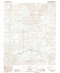
1986 Map of Washington Wash
USGS Topo · Published 1987About this map
Hexie Mountains and the Cottonwood Mountains converge in this high-desert region of Joshua Tree National Monument. The landscape is defined by its complex drainage network, where seasonal waterways like Fried Liver Wash and Washington Wash cut through the arid terrain. While much of the area is designated as Joshua Tree Wilderness, evidence of human activity is visible in the southwestern corner near the Snow Cloud Mine. A series of Prospects and a lonely Prospect further east indicate mid-century mineral exploration before the area was more strictly preserved. Access during this era was limited to rugged 4wd tracks that follow the natural contours of Pinkham Canyon and Cottonwood Basin, illustrating the era's reliance on primitive trails for desert navigation.
Find a feature on this map
21 named features on this map. Tap any name to fly to it.
Don’t see what you’re looking for? This feature index may not catch every label — zoom into the map to look around manually.
Map Details
Editions of this 1986 Washington Wash Map
This is the sole edition of this map. No revisions or reprints were ever made.
Other maps of this area

1904 · Indio
USGS Topo · 1:125,000

1940 · Cottonwood Spring
USGS Topo · 1:62,500

1941 · Coachella
USGS Topo · 1:62,500

1943 · Coachella
USGS Topo · 1:62,500

1943 · Pinkham Well
USGS Topo · 1:62,500

1944 · Cottonwood Spring
USGS Topo · 1:62,500

1944 · Pinkham Well
USGS Topo · 1:62,500

1944 · Pinyon Well
USGS Topo · 1:62,500

1947 · Santa Ana
USGS Topo · 1:250,000

1949 · Santa Ana
USGS Topo · 1:250,000