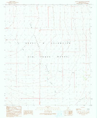
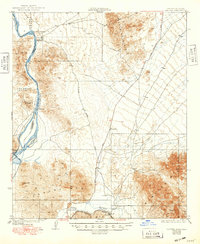
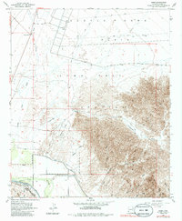
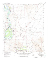
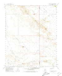
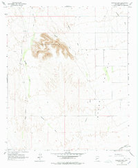
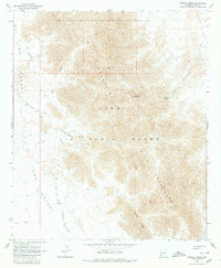
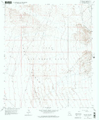
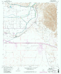
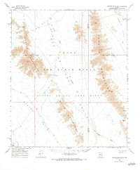
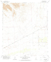
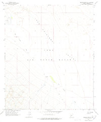
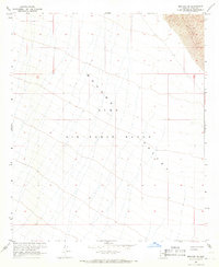
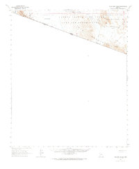
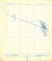
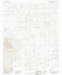
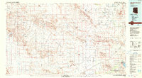
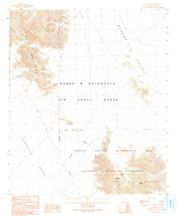
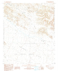
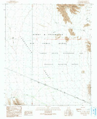
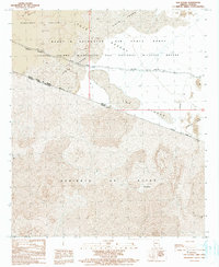
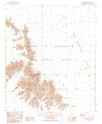
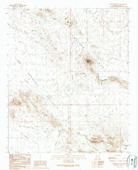
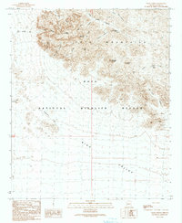
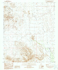
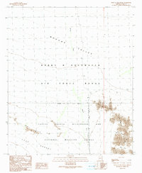
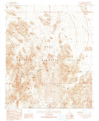
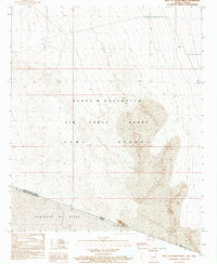
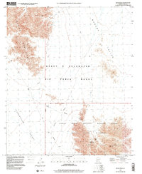
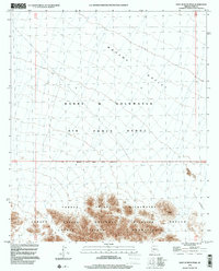
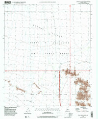
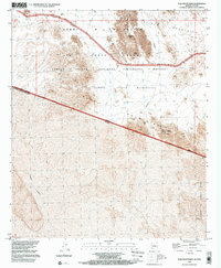
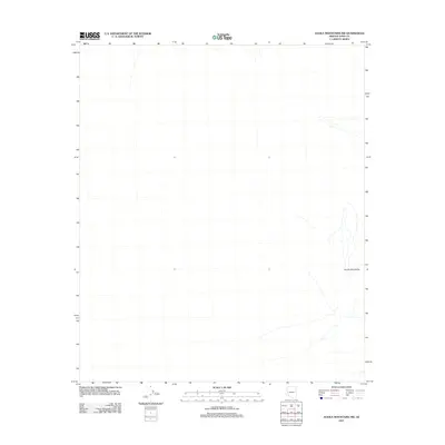
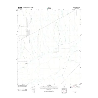
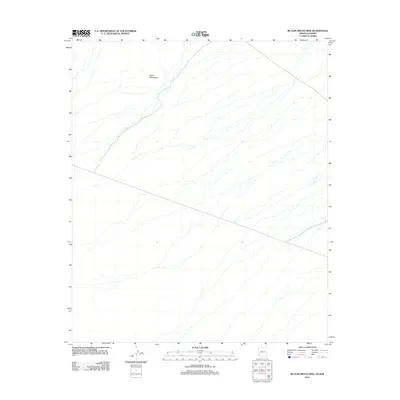
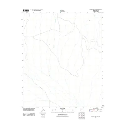
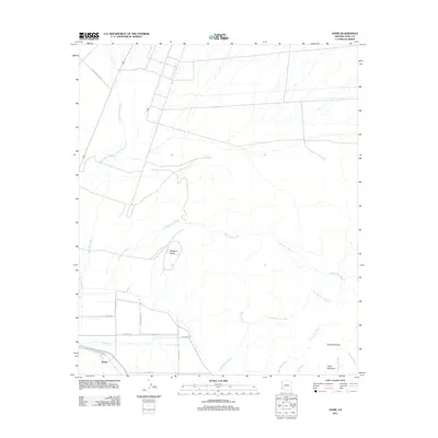
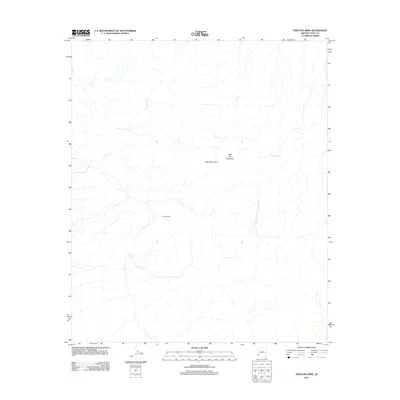
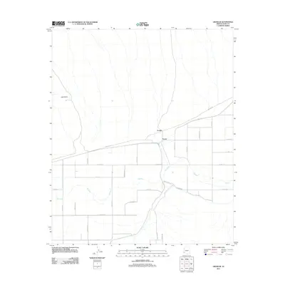
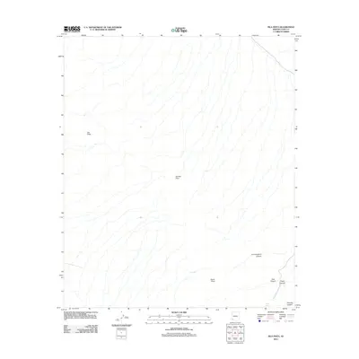
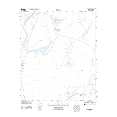
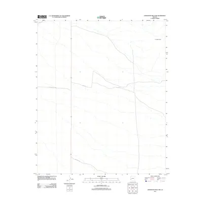
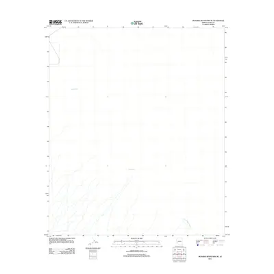
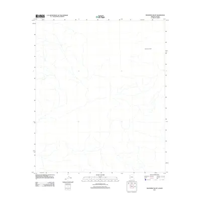
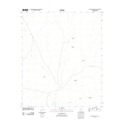
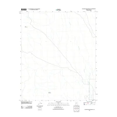
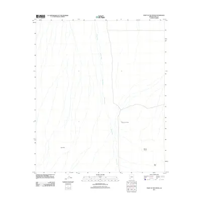
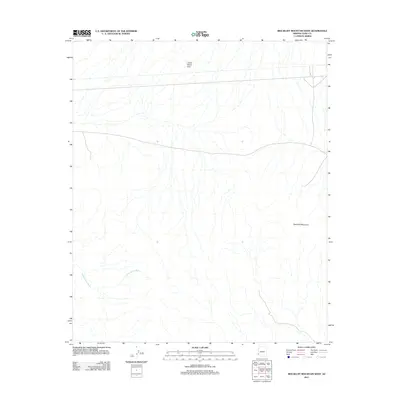
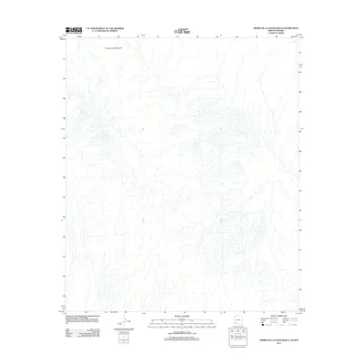
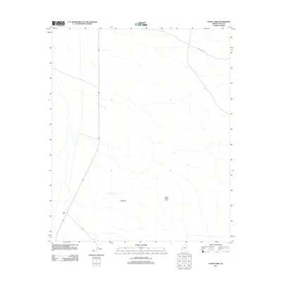
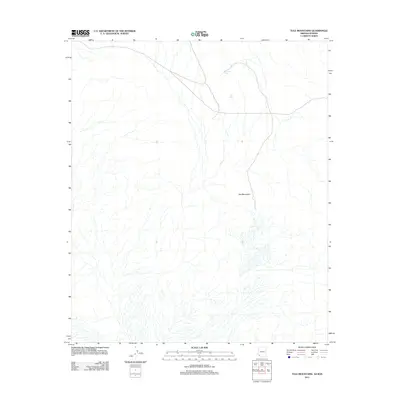
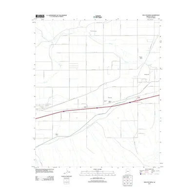
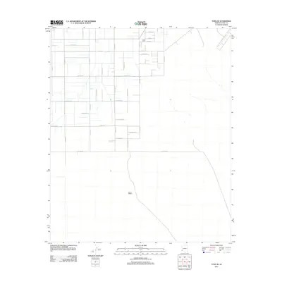
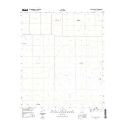
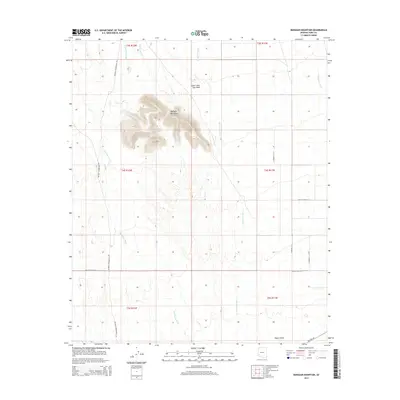
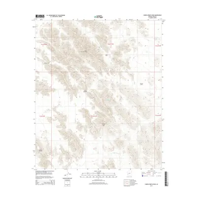
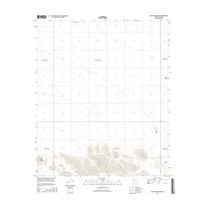
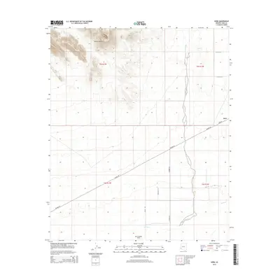
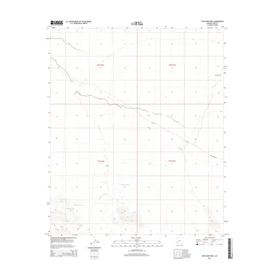
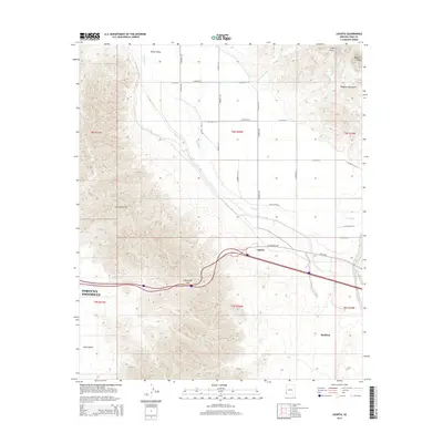
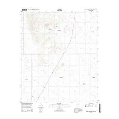
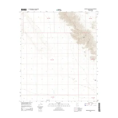
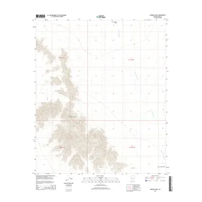
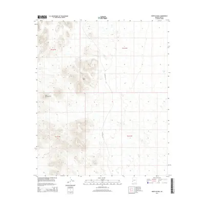
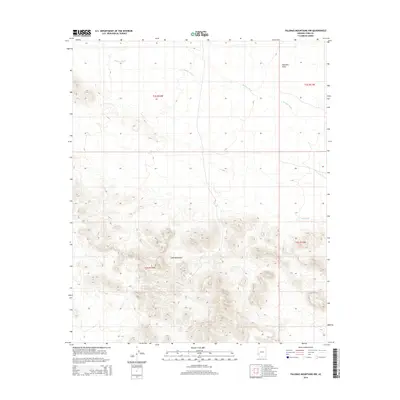
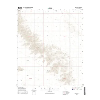
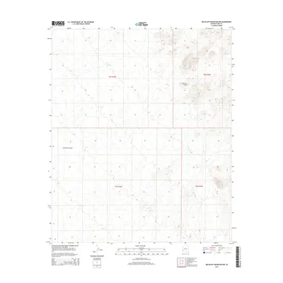
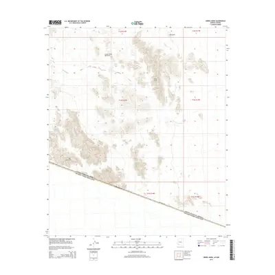
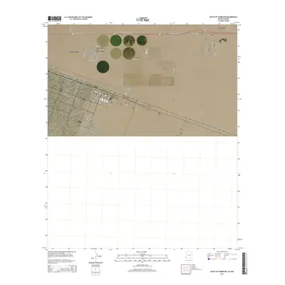
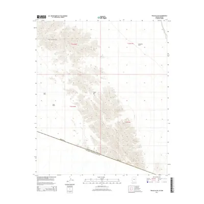
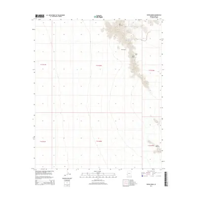
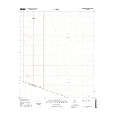
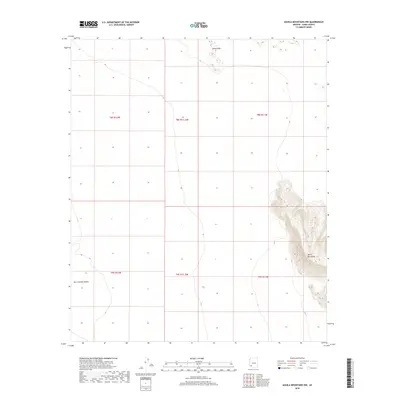
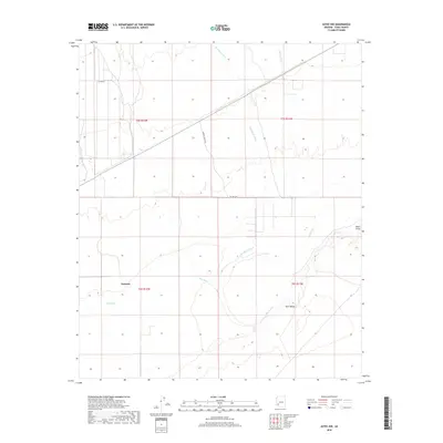
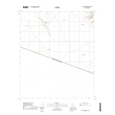
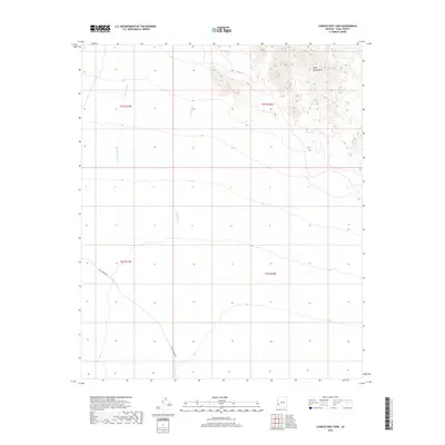
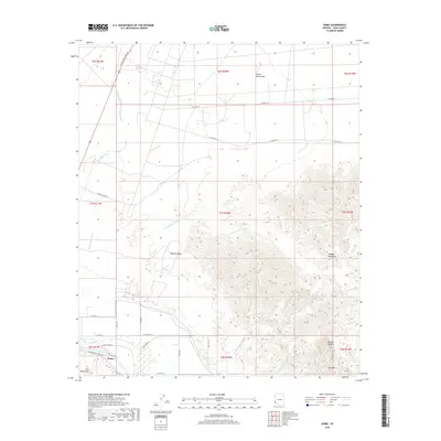
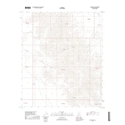
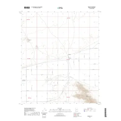
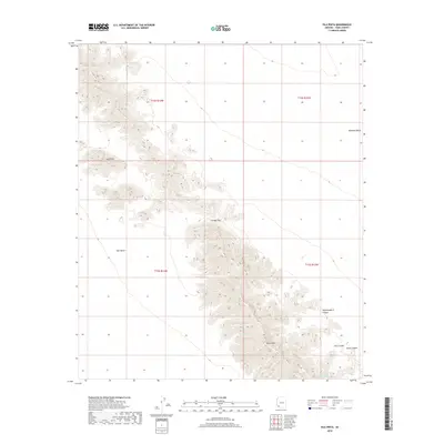
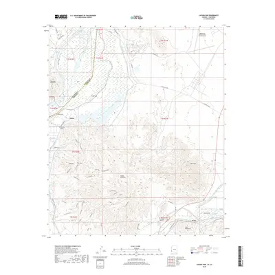
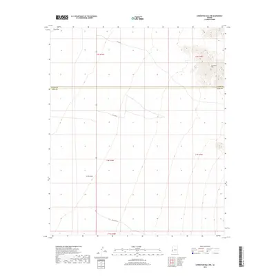
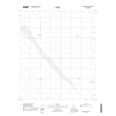
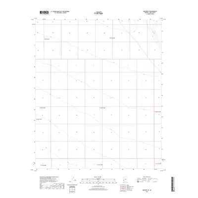
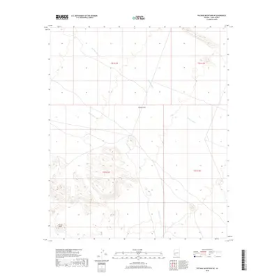
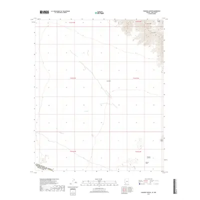
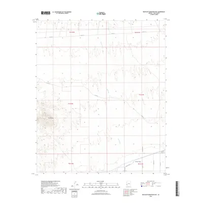
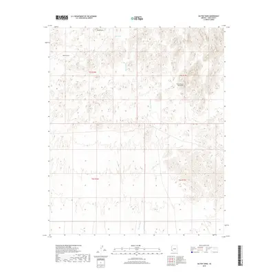
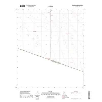
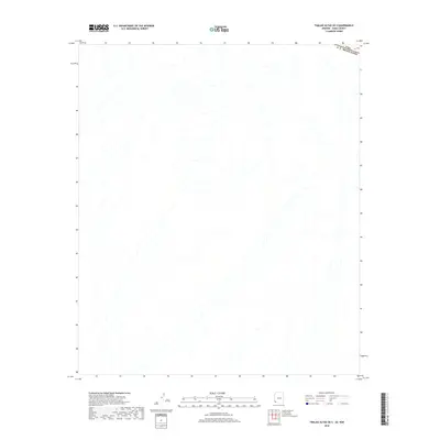
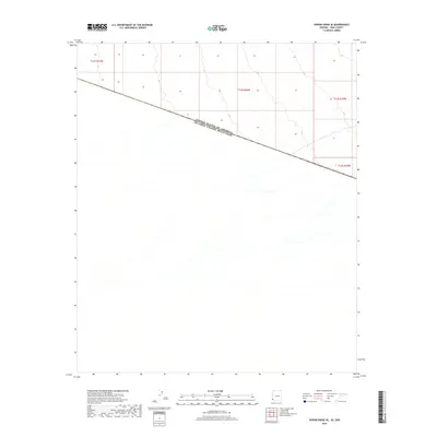
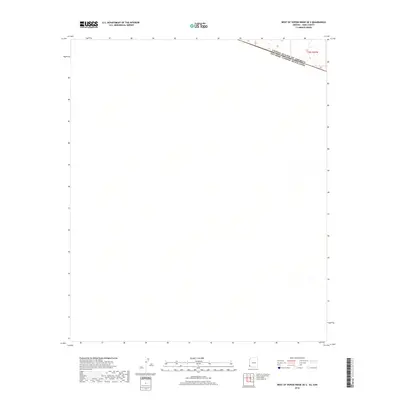
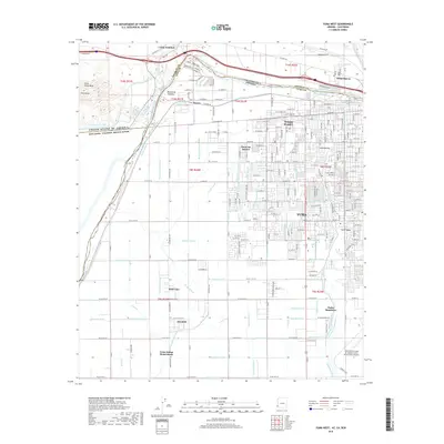
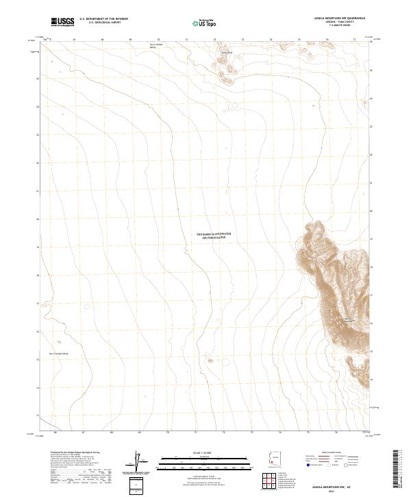
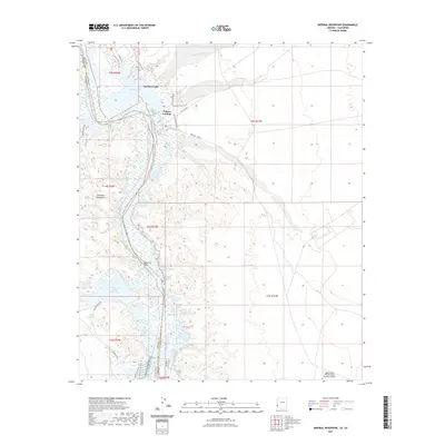
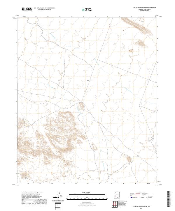
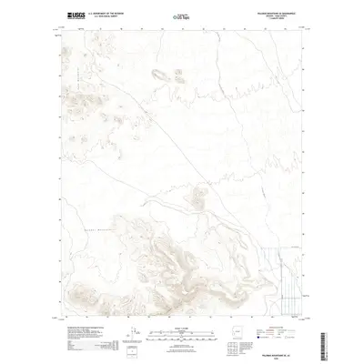
1990 Map of Aguila Mountains SW
USGS Topo · Published 1990About this map
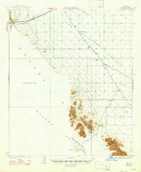
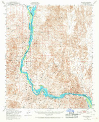
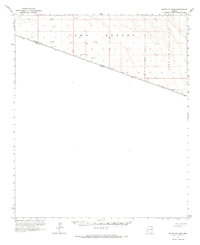
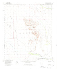
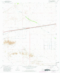
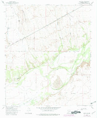
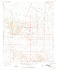
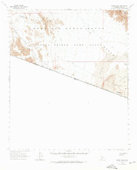
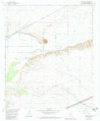
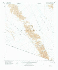
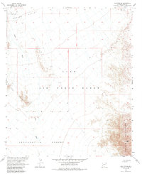
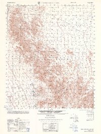
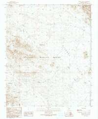
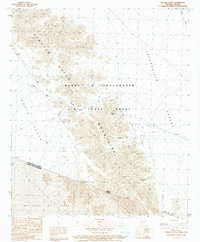
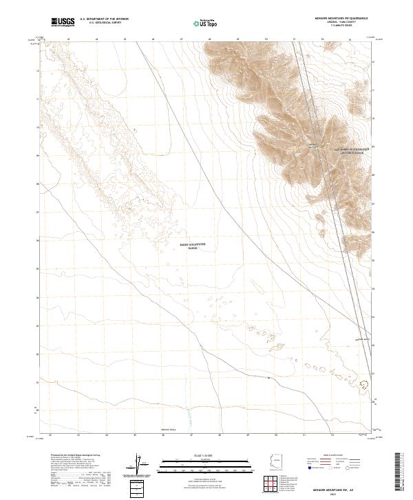
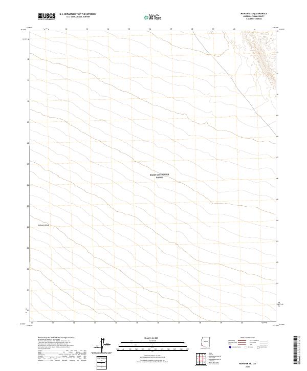
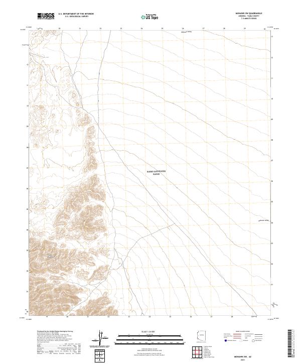
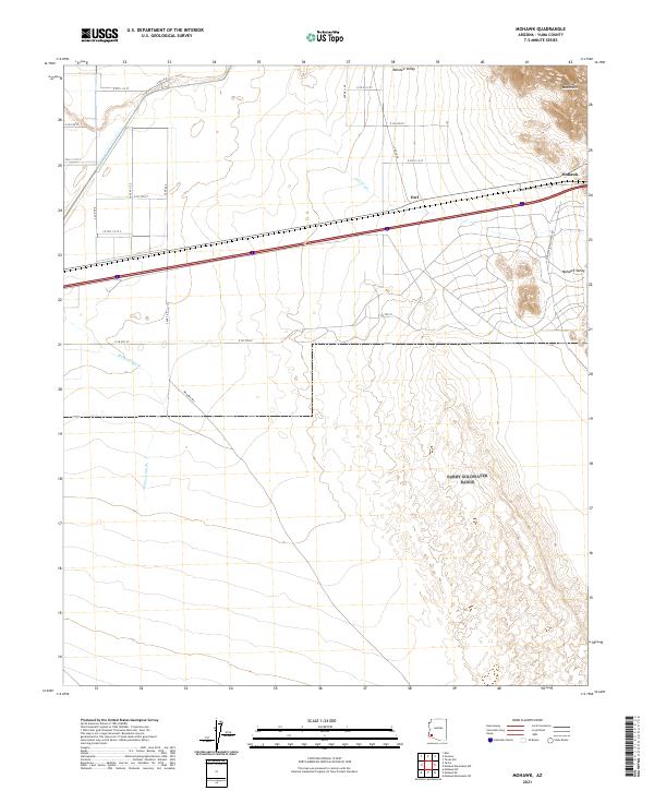
Barry M Goldwater Air Force Range dominates this desert landscape, where military restricted airspace overlies the arid floor of the San Cristobal Valley. This 1990 provisional edition, compiled from decades of aerial photography, captures a region defined by ephemeral drainage patterns and wind-blown geology. Drainage from the surrounding mountains carves deep channels through the terrain, most notably along San Cristobal Wash and Growler Wash, which converge as they snake across the valley floor. The presence of Sand Dunes in the northwest corner highlights the active environmental shifts in this protected military corridor. While largely devoid of permanent civilian settlements, the map provides precise section lines and benchmarks that are essential for understanding the administrative boundaries of this vast Arizona range.
Find a feature on this map
10 named features on this map. Tap any name to fly to it.
Don’t see what you’re looking for? This feature index may not catch every label — zoom into the map to look around manually.
Map Details
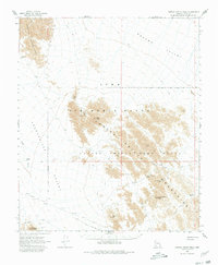
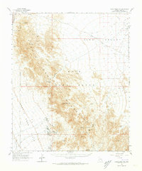
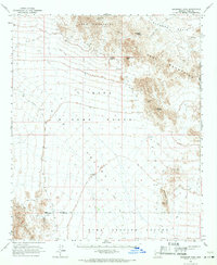
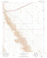
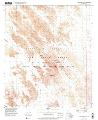
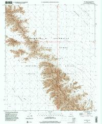
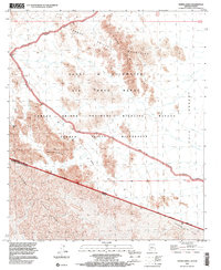
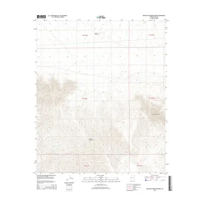
Editions of this 1990 Aguila Mountains SW Map
This is the sole edition of this map. No revisions or reprints were ever made.
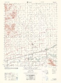
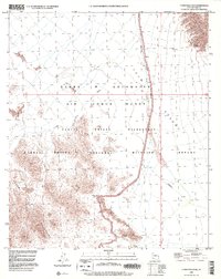
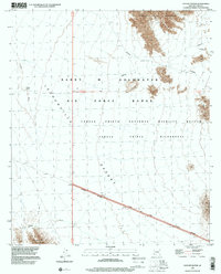
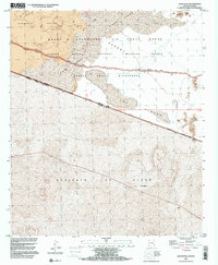
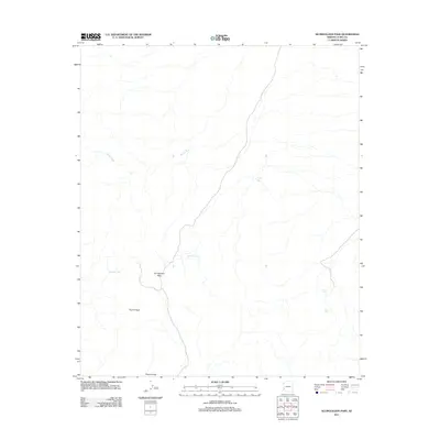
Historical Maps of Yuma County Through Time
507 maps found

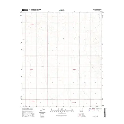
1926 Fortuna
Yuma County, AZ

1926 Mohawk
Yuma County, AZ
1927 Aguila Mountains
Yuma County, AZ

1927 Hyder
Yuma County, AZ

1927 Kim
Yuma County, AZ
1928 Mohawk
Yuma County, AZ

1928 Norton
Yuma County, AZ
1929 Fortuna
Yuma County, AZ
1929 Laguna
Yuma County, AZ

1929 Norton
Yuma County, AZ
1930 Aguila Mountains
Yuma County, AZ
1930 Hyder
Yuma County, AZ
1930 Stoval
Yuma County, AZ
1931 Kim
Yuma County, AZ
1943 Laguna
Yuma County, AZ
1945 Picacho
Yuma County, AZ
1950 Stoval
Yuma County, AZ
1951 Picacho
Yuma County, AZ
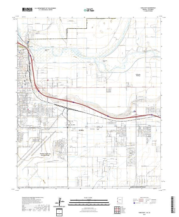
1952 Yuma East
Yuma County, AZ
1952 Yuma West
Yuma County, AZ
1954 Picacho
Yuma County, AZ
1955 Dome
Yuma County, AZ
1955 Growler
Yuma County, AZ
1955 Imperial Reservoir
Yuma County, AZ
1955 Laguna Dam
Yuma County, AZ
1955 Laguna
Yuma County, AZ
1955 Red Bluff Mtn
Yuma County, AZ
1955 Roll
Yuma County, AZ
1955 Roll
Yuma County, AZ
1962 Eagletail Mts
Yuma County, AZ
1962 Kofa Butte
Yuma County, AZ
1962 Little Horn Mts
Yuma County, AZ
1962 Livingston Hills
Yuma County, AZ
1964 South of Yuma
Yuma County, AZ
1965 Aguila Mountains
Yuma County, AZ
1965 Aztec Hills
Yuma County, AZ
1965 Aztec NW
Yuma County, AZ
1965 Baragan Mtn
Yuma County, AZ
1965 Cabeza Prieta Peak
Yuma County, AZ
1965 Castle Dome Mts
Yuma County, AZ
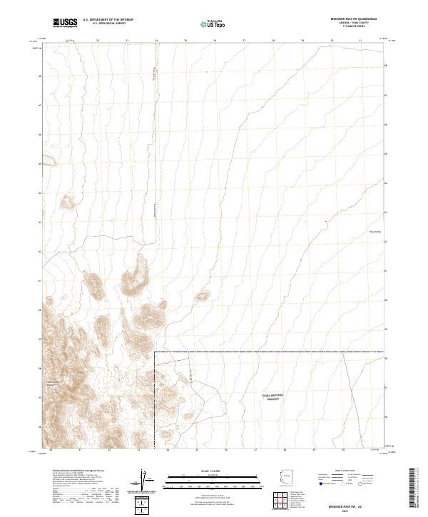
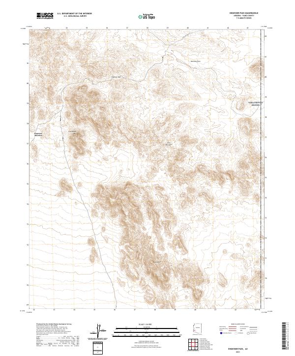
1965 Engesser Pass
Yuma County, AZ
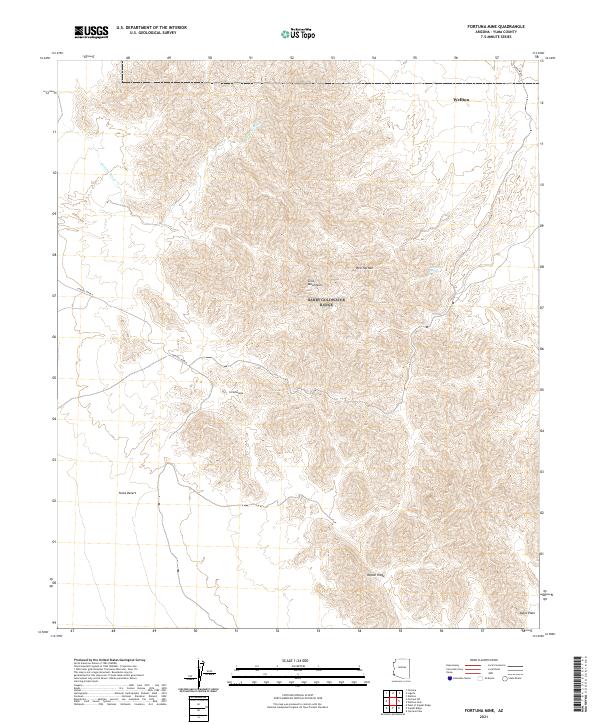
1965 Fortuna Mine
Yuma County, AZ
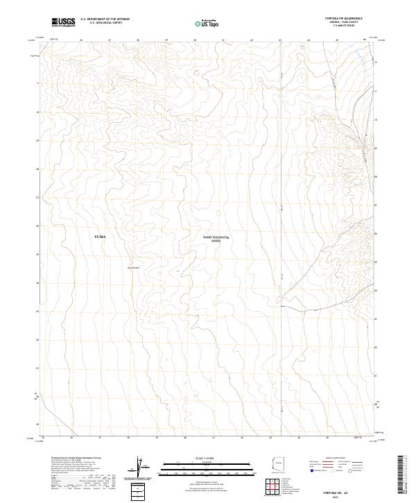
1965 Fortuna SW
Yuma County, AZ
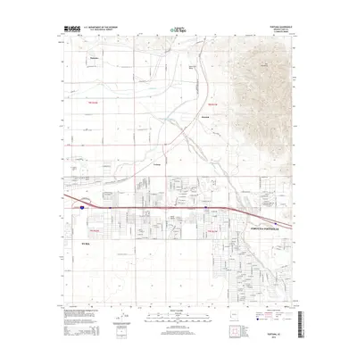
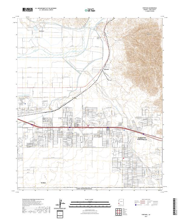
1965 Fortuna
Yuma County, AZ
1965 Granite Mountains
Yuma County, AZ
1965 Horn
Yuma County, AZ
1965 Isla Pinta
Yuma County, AZ
1965 Kofa
Yuma County, AZ
1965 Ligurta
Yuma County, AZ
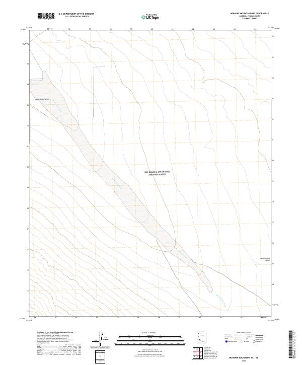
1965 Mohawk Mts NE
Yuma County, AZ
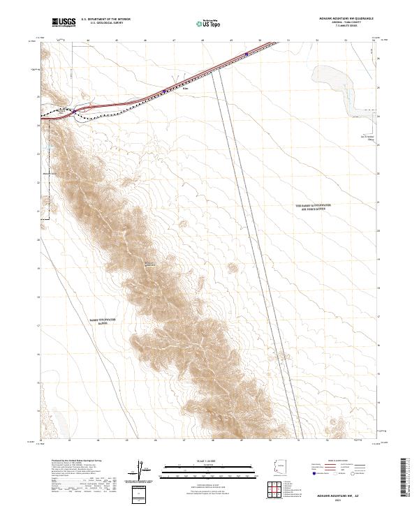
1965 Mohawk Mts NW
Yuma County, AZ
1965 Mohawk Mts SE
Yuma County, AZ
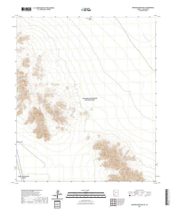
1965 Mohawk Mts SW
Yuma County, AZ
1965 Mohawk SE
Yuma County, AZ
1965 Mohawk SW
Yuma County, AZ
1965 Mohawk
Yuma County, AZ
1965 O'Neill Hills
Yuma County, AZ
1965 Palomas Mts
Yuma County, AZ
1965 Sierra Arida
Yuma County, AZ
1965 Texas Hill
Yuma County, AZ
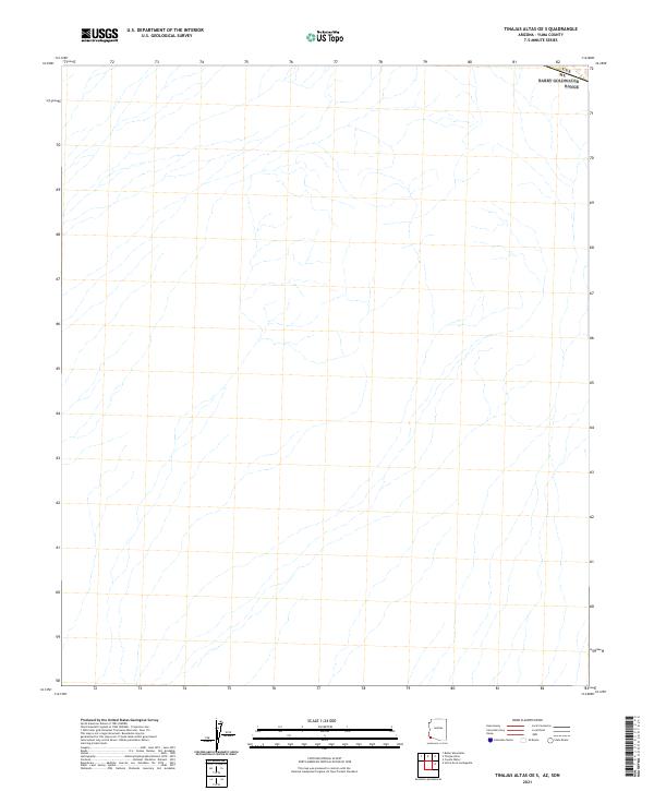
1965 Tinajas Altas
Yuma County, AZ
1965 Tule Mountains
Yuma County, AZ
1965 Turtleback Mountain
Yuma County, AZ
1965 Vopoki Ridge
Yuma County, AZ
1965 Wellton Mesa
Yuma County, AZ
1965 Wellton SE
Yuma County, AZ
1965 Yuma East
Yuma County, AZ
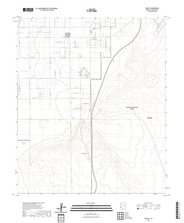
1965 Yuma SE
Yuma County, AZ
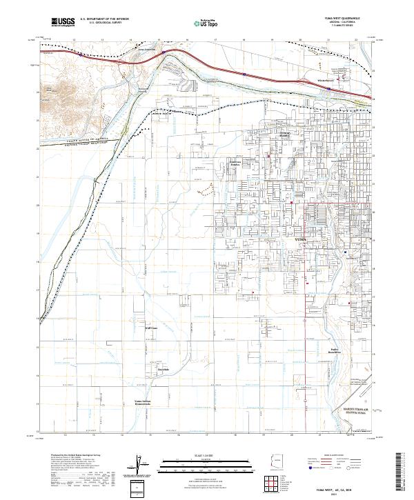
1965 Yuma West
Yuma County, AZ
1968 Castle Dome Mts
Yuma County, AZ
1968 Roll
Yuma County, AZ
1980 Cabeza Prieta Mts
Yuma County, AZ
1980 Tinajas Altas Mts
Yuma County, AZ
1982 Tinajas Altas
Yuma County, AZ
1986 Mesquite Jim Well
Yuma County, AZ
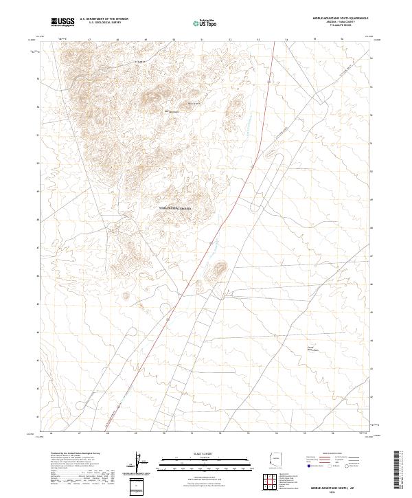
1986 Middle Mountains South
Yuma County, AZ
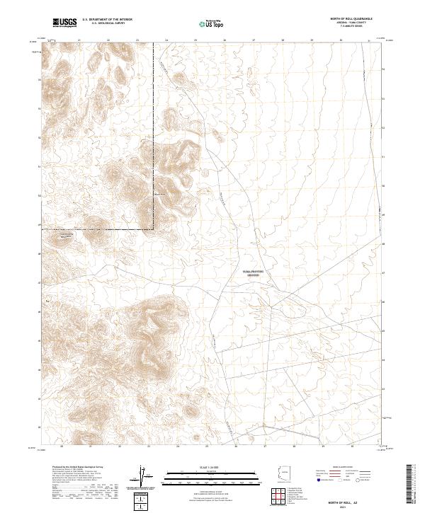
1986 North of Roll
Yuma County, AZ
1986 Red Bluff Mountain East
Yuma County, AZ
1986 Red Bluff Mountain NW
Yuma County, AZ
1986 Red Bluff Mountain West
Yuma County, AZ
1986 Salton Tanks
Yuma County, AZ
1988 Little Horn Mountains
Yuma County, AZ
1990 Aguila Mountains NW
Yuma County, AZ
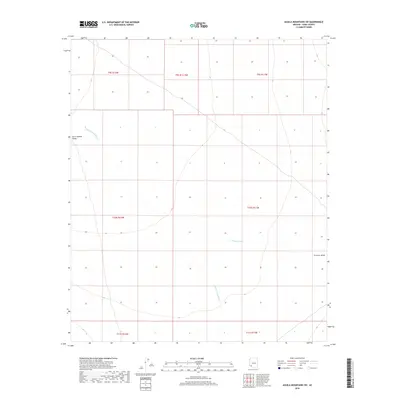
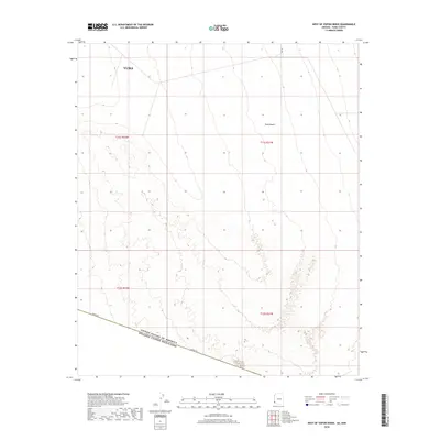
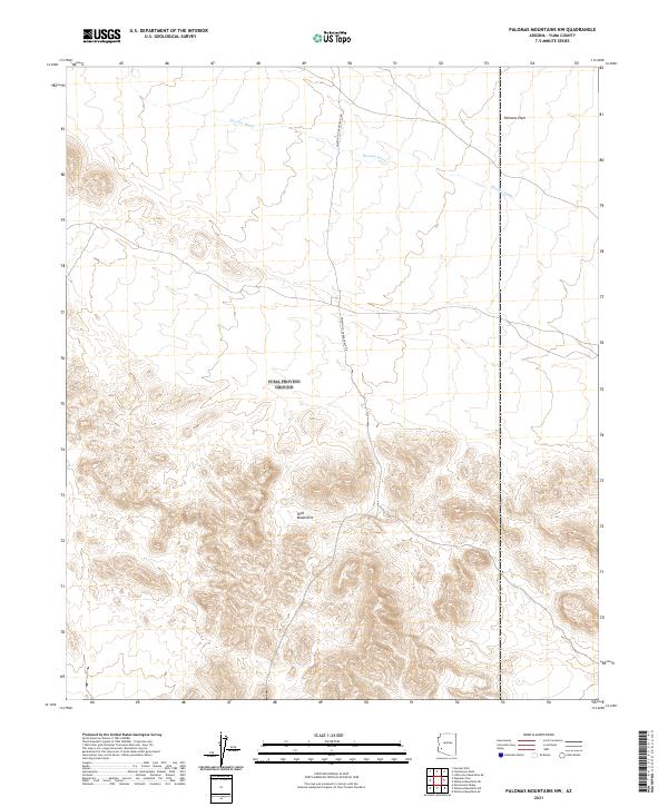
1990 Aguila Mountains SW
Yuma County, AZ
1990 Arch Tank
Yuma County, AZ
1990 Bryan Mountains
Yuma County, AZ
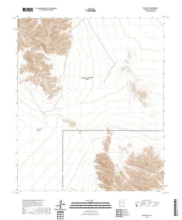
1990 Buck Peak
Yuma County, AZ
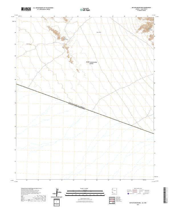
1990 Butler Mountains
Yuma County, AZ
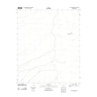
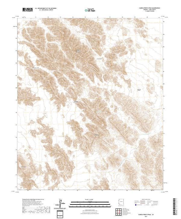
1990 Cabeza Prieta Peak
Yuma County, AZ
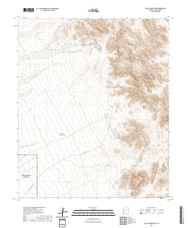
1990 Castle Dome Peak
Yuma County, AZ
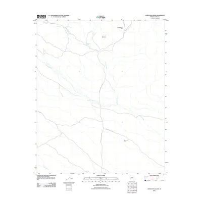
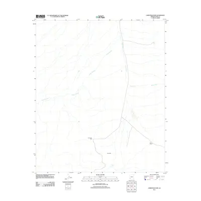
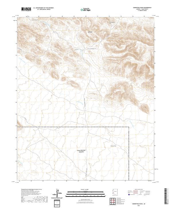
1990 Cementosa Wash
Yuma County, AZ
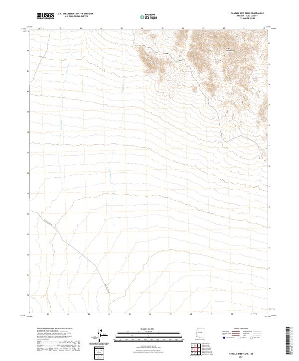
1990 Charlie Died Tank
Yuma County, AZ
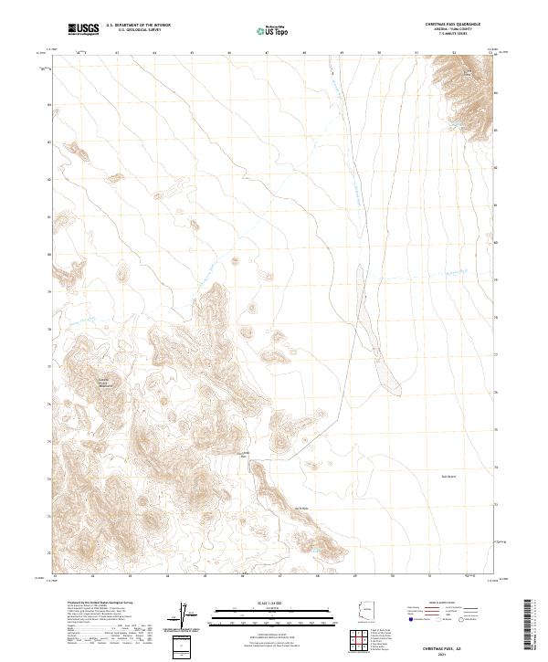
1990 Christmas Pass
Yuma County, AZ
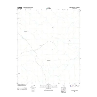
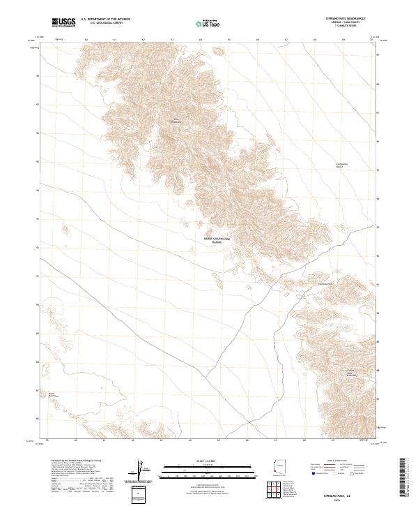
1990 Cipriano Pass
Yuma County, AZ
1990 Coyote Water
Yuma County, AZ
1990 East of Buck Peak
Yuma County, AZ
1990 Engesser Pass SW
Yuma County, AZ
1990 Engesser Pass
Yuma County, AZ
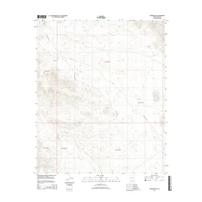
1990 Hoodoo Well
Yuma County, AZ
1990 Isla Pinta
Yuma County, AZ
1990 Kofa Butte
Yuma County, AZ
1990 Kofa Deep Well
Yuma County, AZ
1990 Las Playas
Yuma County, AZ
1990 Little Horn Mountains SE
Yuma County, AZ
1990 Livingston Hills NW
Yuma County, AZ
1990 Livingston Hills
Yuma County, AZ
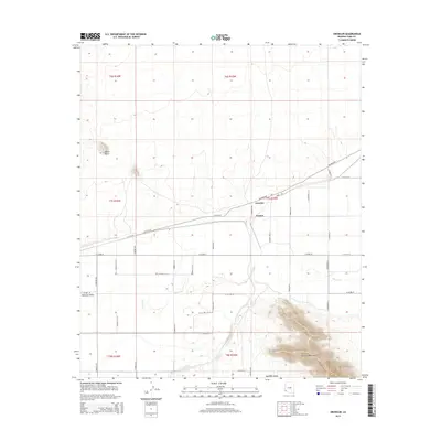
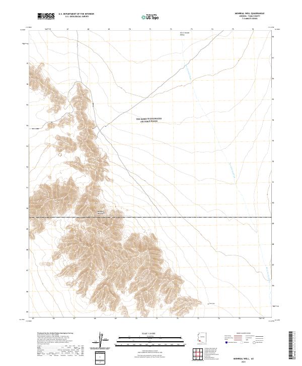
1990 Monreal Well
Yuma County, AZ
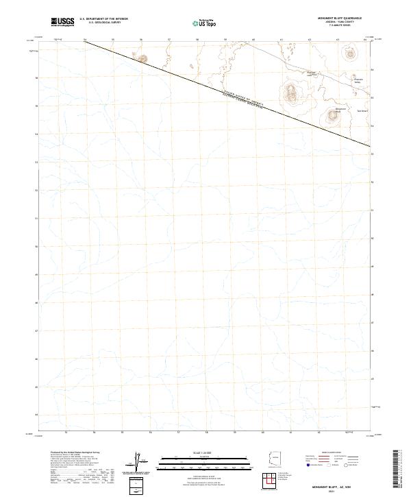
1990 Monument Bluff
Yuma County, AZ
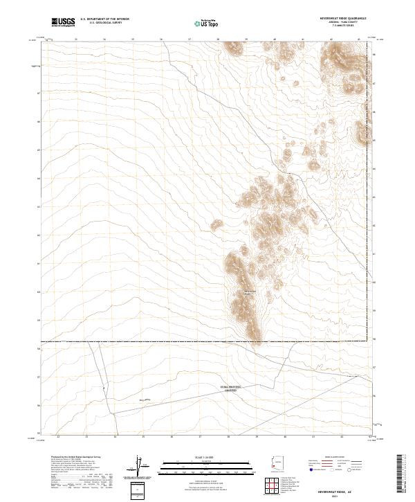
1990 Neversweat Ridge
Yuma County, AZ
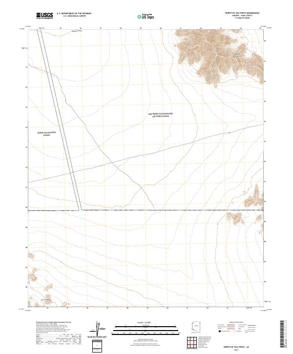
1990 North of Isla Pinta
Yuma County, AZ
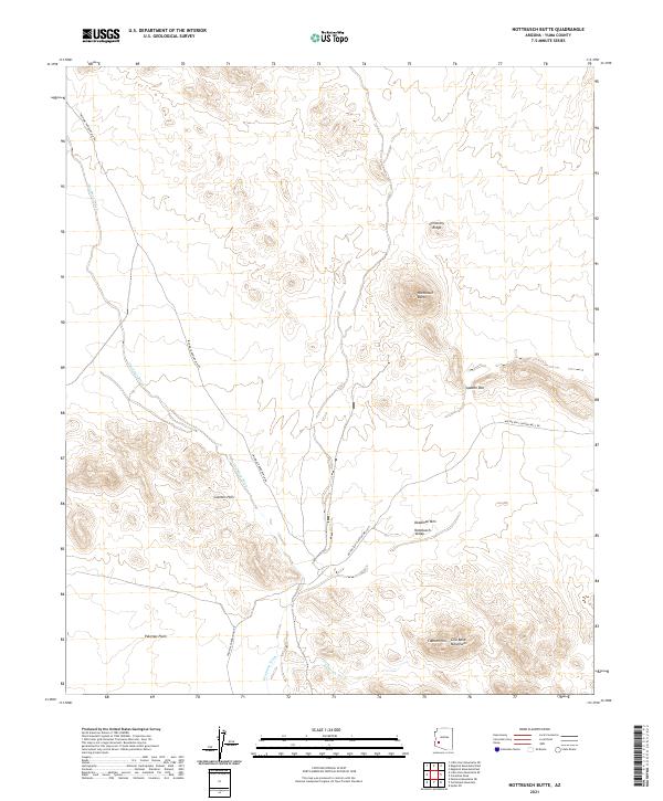
1990 Nottbusch Butte
Yuma County, AZ
1990 Palm Canyon
Yuma County, AZ
1990 Palomas Mountains NE
Yuma County, AZ
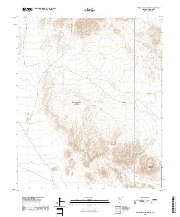
1990 Palomas Mountains NW
Yuma County, AZ
1990 Palomas Mountains SE
Yuma County, AZ
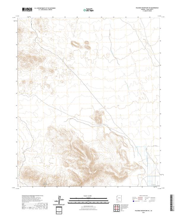
1990 Palomas Mountains SW
Yuma County, AZ
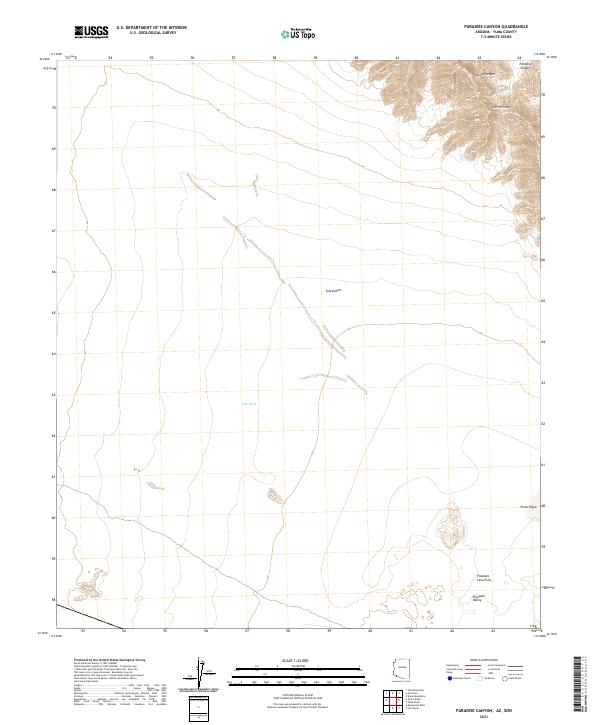
1990 Paradise Canyon
Yuma County, AZ
1990 Pinta Playa
Yuma County, AZ
1990 Point of the Pintas
Yuma County, AZ
1990 Raven Butte
Yuma County, AZ
1990 Sierra Arida
Yuma County, AZ
1990 Sierra De La Lechuguilla
Yuma County, AZ
1990 Slumgullion Pass
Yuma County, AZ
1990 Southeast of Somerton
Yuma County, AZ
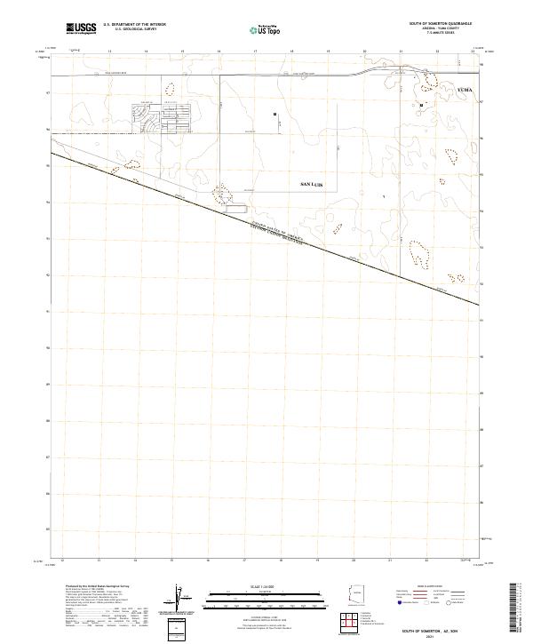
1990 South of Somerton
Yuma County, AZ
1990 Stone Cabin
Yuma County, AZ
1990 Tinajas Altas
Yuma County, AZ
1990 Tule Mountains
Yuma County, AZ
1990 Vopoki Ridge SE
Yuma County, AZ
1990 Vopoki Ridge
Yuma County, AZ
1990 West of Vopoki Ridge
Yuma County, AZ
1991 Dome
Yuma County, AZ
1994 Yuma East
Yuma County, AZ
1996 Bryan Mountains
Yuma County, AZ
1996 Buck Peak
Yuma County, AZ
1996 Cabeza Prieta Peak
Yuma County, AZ
1996 Christmas Pass
Yuma County, AZ
1996 Coyote Water
Yuma County, AZ
1996 East of Buck Peak
Yuma County, AZ
1996 Isla Pinta
Yuma County, AZ
1996 Las Playas
Yuma County, AZ
1996 Monreal Well
Yuma County, AZ
1996 Monument Bluff
Yuma County, AZ
1996 North of Isla Pinta
Yuma County, AZ
1996 Paradise Canyon
Yuma County, AZ
1996 Pinta Playa
Yuma County, AZ
1996 Point of the Pintas
Yuma County, AZ
1996 Sierra Arida
Yuma County, AZ
1996 Sierra De La Lechuguilla
Yuma County, AZ
1996 Tinajas Altas
Yuma County, AZ
1996 Tule Mountains
Yuma County, AZ
1997 Imperial Reservoir
Yuma County, AZ
1997 Raven Butte
Yuma County, AZ
1997 Yuma West
Yuma County, AZ
2011 Aguila Mountains NW
Yuma County, AZ
2011 Aguila Mountains SW
Yuma County, AZ
2011 Arch Tank
Yuma County, AZ
2011 Aztec Hills
Yuma County, AZ
2011 Aztec NW
Yuma County, AZ
2011 Baragan Mountain
Yuma County, AZ
2011 Bryan Mountains
Yuma County, AZ
2011 Buck Peak
Yuma County, AZ
2011 Butler Mountains
Yuma County, AZ
2011 Cabeza Prieta Peak
Yuma County, AZ
2011 Castle Dome Peak
Yuma County, AZ
2011 Cementosa Wash
Yuma County, AZ
2011 Charlie Died Tank
Yuma County, AZ
2011 Christmas Pass
Yuma County, AZ
2011 Cipriano Pass
Yuma County, AZ
2011 Coyote Water
Yuma County, AZ
2011 Dome
Yuma County, AZ
2011 East of Buck Peak
Yuma County, AZ
2011 Engesser Pass SW
Yuma County, AZ
2011 Engesser Pass
Yuma County, AZ
2011 Fortuna Mine
Yuma County, AZ
2011 Fortuna SW
Yuma County, AZ
2011 Fortuna
Yuma County, AZ
2011 Gadsden OE S
Yuma County, AZ
2011 Growler
Yuma County, AZ
2011 Hoodoo Well
Yuma County, AZ
2011 Horn
Yuma County, AZ
2011 Imperial Reservoir
Yuma County, AZ
2011 Isla Pinta
Yuma County, AZ
2011 Kofa Butte
Yuma County, AZ
2011 Kofa Deep Well
Yuma County, AZ
2011 Kofa
Yuma County, AZ
2011 Laguna Dam
Yuma County, AZ
2011 Las Playas
Yuma County, AZ
2011 Ligurta
Yuma County, AZ
2011 Little Horn Mountains SE
Yuma County, AZ
2011 Livingston Hills NW
Yuma County, AZ
2011 Livingston Hills
Yuma County, AZ
2011 Mesquite Jim Well
Yuma County, AZ
2011 Middle Mountains South
Yuma County, AZ
2011 Mohawk Mountains NE
Yuma County, AZ
2011 Mohawk Mountains NW
Yuma County, AZ
2011 Mohawk Mountains SE
Yuma County, AZ
2011 Mohawk Mountains SW
Yuma County, AZ
2011 Mohawk SE
Yuma County, AZ
2011 Mohawk SW
Yuma County, AZ
2011 Mohawk
Yuma County, AZ
2011 Monreal Well
Yuma County, AZ
2011 Monument Bluff
Yuma County, AZ
2011 Neversweat Ridge
Yuma County, AZ
2011 North of Isla Pinta
Yuma County, AZ
2011 North of Roll
Yuma County, AZ
2011 Nottbusch Butte
Yuma County, AZ
2011 Palm Canyon
Yuma County, AZ
2011 Palomas Mountains NE
Yuma County, AZ
2011 Palomas Mountains NW
Yuma County, AZ
2011 Palomas Mountains SE
Yuma County, AZ
2011 Palomas Mountains SW
Yuma County, AZ
2011 Paradise Canyon
Yuma County, AZ
2011 Pinta Playa
Yuma County, AZ
2011 Point of the Pintas
Yuma County, AZ
2011 Raven Butte
Yuma County, AZ
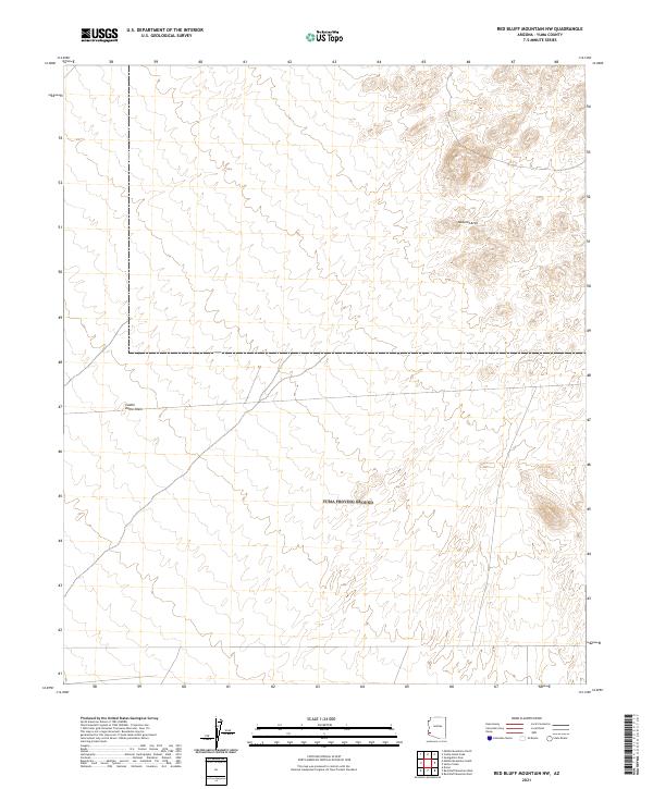
2011 Red Bluff Mountain East
Yuma County, AZ
2011 Red Bluff Mountain NW
Yuma County, AZ
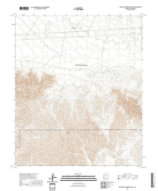
2011 Red Bluff Mountain West
Yuma County, AZ
2011 Roll
Yuma County, AZ
2011 Salton Tanks
Yuma County, AZ
2011 Sierra Arida
Yuma County, AZ
2011 Sierra de la Lechuguilla
Yuma County, AZ
2011 Slumgullion Pass
Yuma County, AZ
2011 Southeast of Somerton
Yuma County, AZ
2011 South of Somerton
Yuma County, AZ
2011 Stone Cabin
Yuma County, AZ
2011 Texas Hill
Yuma County, AZ
2011 Tinajas Altas OE S
Yuma County, AZ
2011 Tinajas Altas
Yuma County, AZ
2011 Tule Mountains
Yuma County, AZ
2011 Turtleback Mountain
Yuma County, AZ
2011 Vopoki Ridge SE
Yuma County, AZ
2011 Vopoki Ridge
Yuma County, AZ
2011 Wellton Mesa
Yuma County, AZ
2011 Wellton SE
Yuma County, AZ
2011 West of Vopoki Ridge OE S
Yuma County, AZ
2011 West of Vopoki Ridge
Yuma County, AZ
2011 Yuma East
Yuma County, AZ
2011 Yuma SE
Yuma County, AZ
2011 Yuma West
Yuma County, AZ
2014 Aguila Mountains NW
Yuma County, AZ
2014 Aguila Mountains SW
Yuma County, AZ
2014 Arch Tank
Yuma County, AZ
2014 Aztec Hills
Yuma County, AZ
2014 Aztec NW
Yuma County, AZ
2014 Baragan Mountain
Yuma County, AZ
2014 Bryan Mountains
Yuma County, AZ
2014 Buck Peak
Yuma County, AZ
2014 Butler Mountains
Yuma County, AZ
2014 Cabeza Prieta Peak
Yuma County, AZ
2014 Castle Dome Peak
Yuma County, AZ
2014 Cementosa Wash
Yuma County, AZ
2014 Charlie Died Tank
Yuma County, AZ
2014 Christmas Pass
Yuma County, AZ
2014 Cipriano Pass
Yuma County, AZ
2014 Coyote Water
Yuma County, AZ
2014 Dome
Yuma County, AZ
2014 East of Buck Peak
Yuma County, AZ
2014 Engesser Pass SW
Yuma County, AZ
2014 Engesser Pass
Yuma County, AZ
2014 Fortuna Mine
Yuma County, AZ
2014 Fortuna SW
Yuma County, AZ
2014 Fortuna
Yuma County, AZ

2014 Gadsden OE S
Yuma County, AZ
2014 Growler
Yuma County, AZ
2014 Hoodoo Well
Yuma County, AZ
2014 Horn
Yuma County, AZ
2014 Imperial Reservoir
Yuma County, AZ
2014 Isla Pinta
Yuma County, AZ
2014 Kofa Butte
Yuma County, AZ
2014 Kofa Deep Well
Yuma County, AZ
2014 Kofa
Yuma County, AZ
2014 Laguna Dam
Yuma County, AZ
2014 Las Playas
Yuma County, AZ
2014 Ligurta
Yuma County, AZ

2014 Little Horn Mountains SE
Yuma County, AZ
2014 Livingston Hills NW
Yuma County, AZ
2014 Livingston Hills
Yuma County, AZ
2014 Mesquite Jim Well
Yuma County, AZ
2014 Middle Mountains South
Yuma County, AZ
2014 Mohawk Mountains NE
Yuma County, AZ
2014 Mohawk Mountains NW
Yuma County, AZ
2014 Mohawk Mountains SE
Yuma County, AZ
2014 Mohawk Mountains SW
Yuma County, AZ
2014 Mohawk SE
Yuma County, AZ
2014 Mohawk SW
Yuma County, AZ
2014 Mohawk
Yuma County, AZ
2014 Monreal Well
Yuma County, AZ
2014 Monument Bluff
Yuma County, AZ
2014 Neversweat Ridge
Yuma County, AZ
2014 North of Isla Pinta
Yuma County, AZ
2014 North of Roll
Yuma County, AZ
2014 Nottbusch Butte
Yuma County, AZ
2014 Palm Canyon
Yuma County, AZ
2014 Palomas Mountains NE
Yuma County, AZ
2014 Palomas Mountains NW
Yuma County, AZ
2014 Palomas Mountains SE
Yuma County, AZ
2014 Palomas Mountains SW
Yuma County, AZ
2014 Paradise Canyon
Yuma County, AZ
2014 Pinta Playa
Yuma County, AZ
2014 Point of the Pintas
Yuma County, AZ
2014 Raven Butte
Yuma County, AZ
2014 Red Bluff Mountain East
Yuma County, AZ
2014 Red Bluff Mountain NW
Yuma County, AZ
2014 Red Bluff Mountain West
Yuma County, AZ
2014 Roll
Yuma County, AZ
2014 Salton Tanks
Yuma County, AZ
2014 Sierra Arida
Yuma County, AZ
2014 Sierra de la Lechuguilla
Yuma County, AZ
2014 Slumgullion Pass
Yuma County, AZ
2014 Southeast of Somerton
Yuma County, AZ
2014 South of Somerton
Yuma County, AZ
2014 Stone Cabin
Yuma County, AZ
2014 Texas Hill
Yuma County, AZ
2014 Tinajas Altas OE S
Yuma County, AZ
2014 Tinajas Altas
Yuma County, AZ
2014 Tule Mountains
Yuma County, AZ
2014 Turtleback Mountain
Yuma County, AZ
2014 Vopoki Ridge SE
Yuma County, AZ
2014 Vopoki Ridge
Yuma County, AZ
2014 Wellton Mesa
Yuma County, AZ
2014 Wellton SE
Yuma County, AZ
2014 West of Vopoki Ridge OE S
Yuma County, AZ
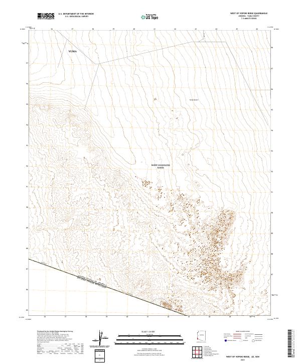
2014 West of Vopoki Ridge
Yuma County, AZ
2014 Yuma East
Yuma County, AZ
2014 Yuma SE
Yuma County, AZ
2014 Yuma West
Yuma County, AZ
2018 Aguila Mountains NW
Yuma County, AZ
2018 Aguila Mountains SW
Yuma County, AZ
2018 Arch Tank
Yuma County, AZ
2018 Aztec Hills
Yuma County, AZ
2018 Aztec NW
Yuma County, AZ
2018 Baragan Mountain
Yuma County, AZ
2018 Bryan Mountains
Yuma County, AZ
2018 Buck Peak
Yuma County, AZ
2018 Butler Mountains
Yuma County, AZ
2018 Cabeza Prieta Peak
Yuma County, AZ
2018 Castle Dome Peak
Yuma County, AZ
2018 Cementosa Wash
Yuma County, AZ
2018 Charlie Died Tank
Yuma County, AZ
2018 Christmas Pass
Yuma County, AZ
2018 Cipriano Pass
Yuma County, AZ
2018 Coyote Water
Yuma County, AZ
2018 Dome
Yuma County, AZ
2018 East of Buck Peak
Yuma County, AZ
2018 Engesser Pass SW
Yuma County, AZ
2018 Engesser Pass
Yuma County, AZ
2018 Fortuna Mine
Yuma County, AZ
2018 Fortuna SW
Yuma County, AZ
2018 Fortuna
Yuma County, AZ
2018 Gadsden OE S
Yuma County, AZ
2018 Growler
Yuma County, AZ
2018 Hoodoo Well
Yuma County, AZ
2018 Horn
Yuma County, AZ
2018 Imperial Reservoir
Yuma County, AZ
2018 Isla Pinta
Yuma County, AZ
2018 Kofa Butte
Yuma County, AZ
2018 Kofa Deep Well
Yuma County, AZ
2018 Kofa
Yuma County, AZ
2018 Laguna Dam
Yuma County, AZ
2018 Las Playas
Yuma County, AZ
2018 Ligurta
Yuma County, AZ
2018 Little Horn Mountains SE
Yuma County, AZ
2018 Livingston Hills NW
Yuma County, AZ
2018 Livingston Hills
Yuma County, AZ
2018 Mesquite Jim Well
Yuma County, AZ
2018 Middle Mountains South
Yuma County, AZ
2018 Mohawk Mountains NE
Yuma County, AZ
2018 Mohawk Mountains NW
Yuma County, AZ
2018 Mohawk Mountains SE
Yuma County, AZ
2018 Mohawk Mountains SW
Yuma County, AZ
2018 Mohawk SE
Yuma County, AZ
2018 Mohawk SW
Yuma County, AZ
2018 Mohawk
Yuma County, AZ
2018 Monreal Well
Yuma County, AZ
2018 Monument Bluff
Yuma County, AZ

2018 Neversweat Ridge
Yuma County, AZ
2018 North of Isla Pinta
Yuma County, AZ
2018 North of Roll
Yuma County, AZ

2018 Nottbusch Butte
Yuma County, AZ
2018 Palm Canyon
Yuma County, AZ
2018 Palomas Mountains NE
Yuma County, AZ
2018 Palomas Mountains NW
Yuma County, AZ
2018 Palomas Mountains SE
Yuma County, AZ
2018 Palomas Mountains SW
Yuma County, AZ
2018 Paradise Canyon
Yuma County, AZ
2018 Pinta Playa
Yuma County, AZ
2018 Point of the Pintas
Yuma County, AZ
2018 Raven Butte
Yuma County, AZ
2018 Red Bluff Mountain East
Yuma County, AZ
2018 Red Bluff Mountain NW
Yuma County, AZ
2018 Red Bluff Mountain West
Yuma County, AZ
2018 Roll
Yuma County, AZ
2018 Salton Tanks
Yuma County, AZ
2018 Sierra Arida
Yuma County, AZ
2018 Sierra de la Lechuguilla
Yuma County, AZ
2018 Slumgullion Pass
Yuma County, AZ
2018 Southeast of Somerton
Yuma County, AZ
2018 South of Somerton
Yuma County, AZ
2018 Stone Cabin
Yuma County, AZ
2018 Texas Hill
Yuma County, AZ
2018 Tinajas Altas OE S
Yuma County, AZ
2018 Tinajas Altas
Yuma County, AZ
2018 Tule Mountains
Yuma County, AZ
2018 Turtleback Mountain
Yuma County, AZ
2018 Vopoki Ridge SE
Yuma County, AZ
2018 Vopoki Ridge
Yuma County, AZ
2018 Wellton Mesa
Yuma County, AZ
2018 Wellton SE
Yuma County, AZ
2018 West of Vopoki Ridge OE S
Yuma County, AZ
2018 West of Vopoki Ridge
Yuma County, AZ
2018 Yuma East
Yuma County, AZ
2018 Yuma SE
Yuma County, AZ
2018 Yuma West
Yuma County, AZ
2021 Aguila Mountains NW
Yuma County, AZ
2021 Aguila Mountains SW
Yuma County, AZ
2021 Arch Tank
Yuma County, AZ
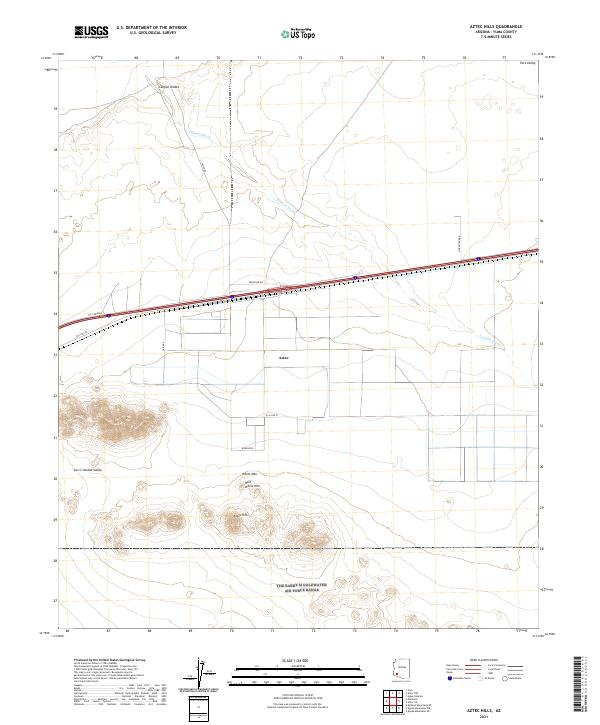
2021 Aztec Hills
Yuma County, AZ
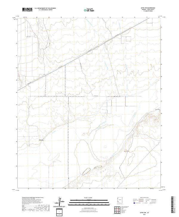
2021 Aztec NW
Yuma County, AZ
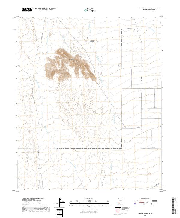
2021 Baragan Mountain
Yuma County, AZ
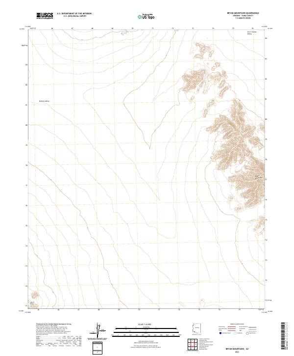
2021 Bryan Mountains
Yuma County, AZ
2021 Buck Peak
Yuma County, AZ
2021 Butler Mountains
Yuma County, AZ
2021 Cabeza Prieta Peak
Yuma County, AZ
2021 Castle Dome Peak
Yuma County, AZ
2021 Cementosa Wash
Yuma County, AZ
2021 Charlie Died Tank
Yuma County, AZ
2021 Christmas Pass
Yuma County, AZ
2021 Cipriano Pass
Yuma County, AZ
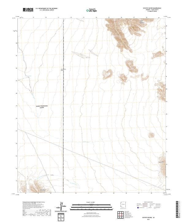
2021 Coyote Water
Yuma County, AZ
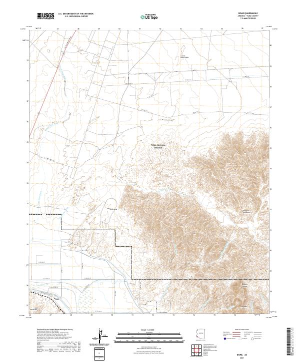
2021 Dome
Yuma County, AZ
2021 East of Buck Peak
Yuma County, AZ
2021 Engesser Pass SW
Yuma County, AZ
2021 Engesser Pass
Yuma County, AZ
2021 Fortuna Mine
Yuma County, AZ
2021 Fortuna SW
Yuma County, AZ
2021 Fortuna
Yuma County, AZ
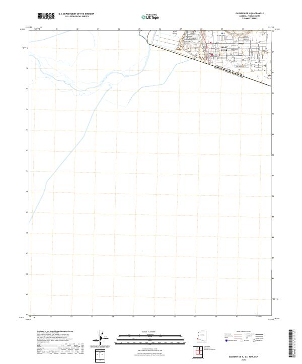
2021 Gadsden OE S
Yuma County, AZ
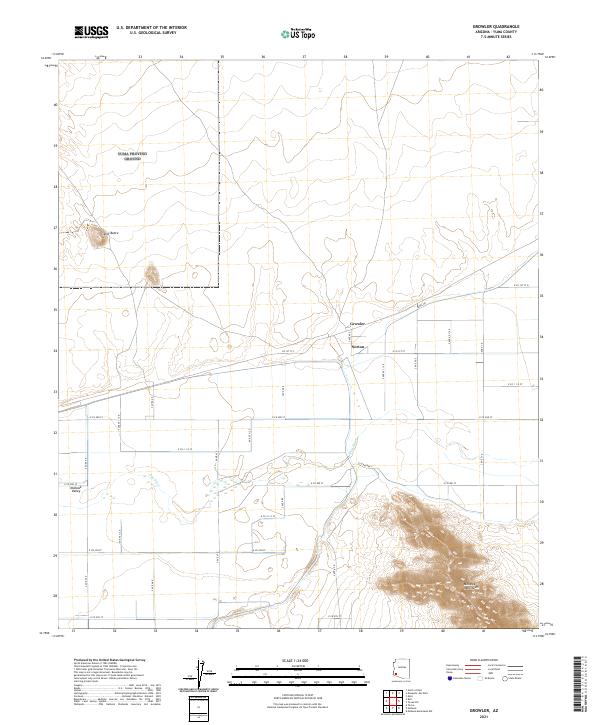
2021 Growler
Yuma County, AZ
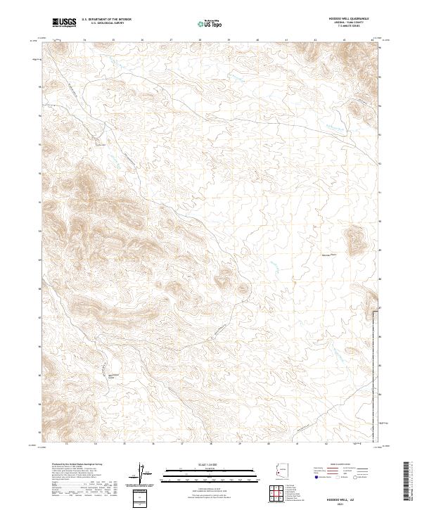
2021 Hoodoo Well
Yuma County, AZ
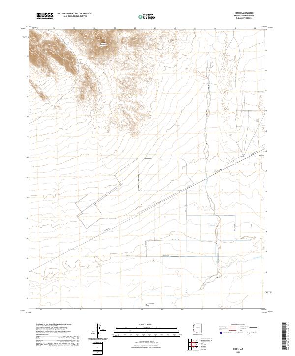
2021 Horn
Yuma County, AZ
2021 Imperial Reservoir
Yuma County, AZ
2021 Isla Pinta
Yuma County, AZ
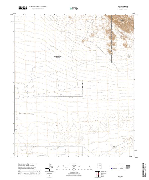
2021 Kofa Butte
Yuma County, AZ
2021 Kofa Deep Well
Yuma County, AZ
2021 Kofa
Yuma County, AZ
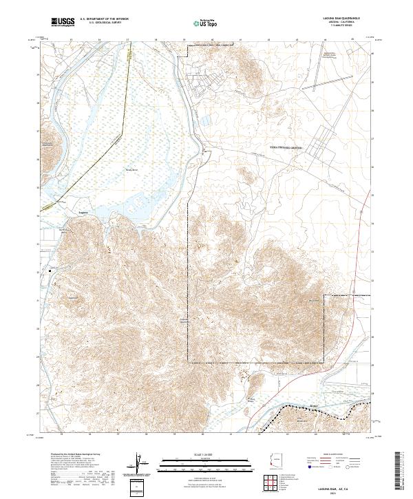
2021 Laguna Dam
Yuma County, AZ
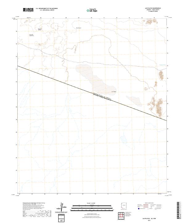
2021 Las Playas
Yuma County, AZ
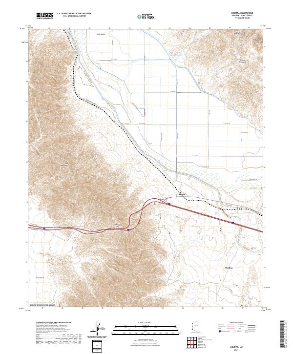
2021 Ligurta
Yuma County, AZ
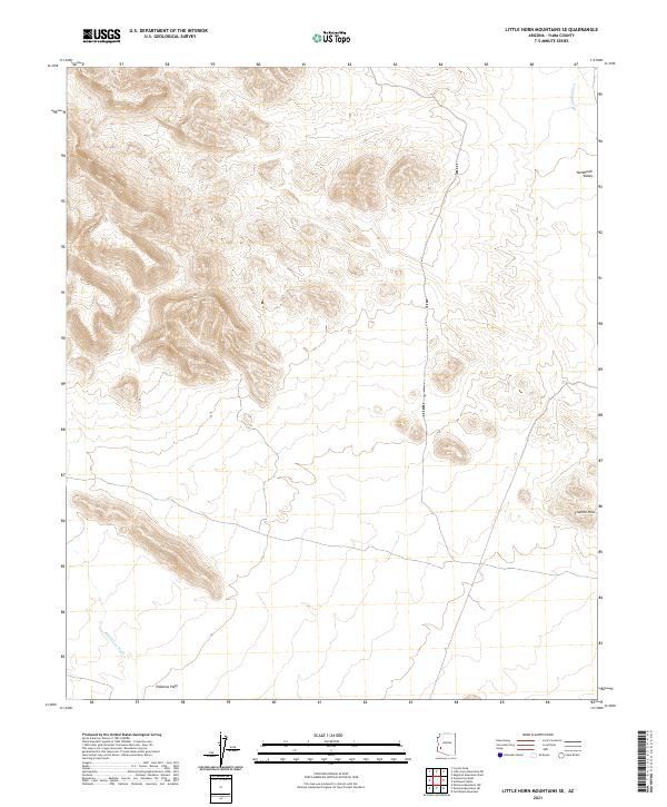
2021 Little Horn Mountains SE
Yuma County, AZ
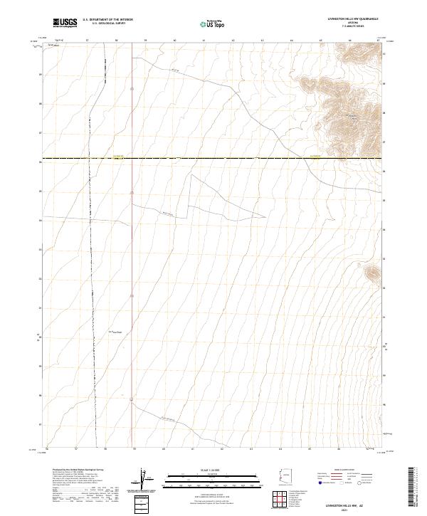
2021 Livingston Hills NW
Yuma County, AZ
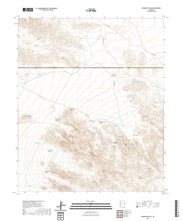
2021 Livingston Hills
Yuma County, AZ
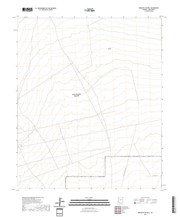
2021 Mesquite Jim Well
Yuma County, AZ
2021 Middle Mountains South
Yuma County, AZ
2021 Mohawk Mountains NE
Yuma County, AZ
2021 Mohawk Mountains NW
Yuma County, AZ
2021 Mohawk Mountains SE
Yuma County, AZ
2021 Mohawk Mountains SW
Yuma County, AZ
2021 Mohawk SE
Yuma County, AZ
2021 Mohawk SW
Yuma County, AZ
2021 Mohawk
Yuma County, AZ
2021 Monreal Well
Yuma County, AZ
2021 Monument Bluff
Yuma County, AZ
2021 Neversweat Ridge
Yuma County, AZ
2021 North of Isla Pinta
Yuma County, AZ
2021 North of Roll
Yuma County, AZ
2021 Nottbusch Butte
Yuma County, AZ
2021 Palm Canyon
Yuma County, AZ
2021 Palomas Mountains NE
Yuma County, AZ
2021 Palomas Mountains NW
Yuma County, AZ
2021 Palomas Mountains SE
Yuma County, AZ
2021 Palomas Mountains SW
Yuma County, AZ
2021 Paradise Canyon
Yuma County, AZ
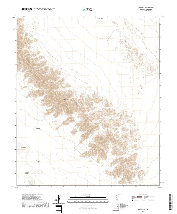
2021 Pinta Playa
Yuma County, AZ
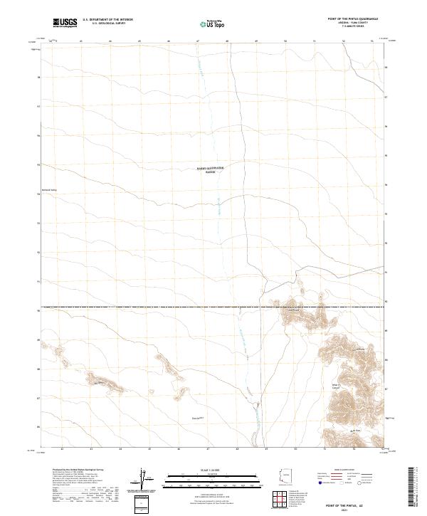
2021 Point of the Pintas
Yuma County, AZ
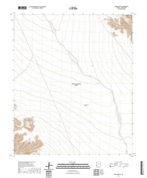
2021 Raven Butte
Yuma County, AZ
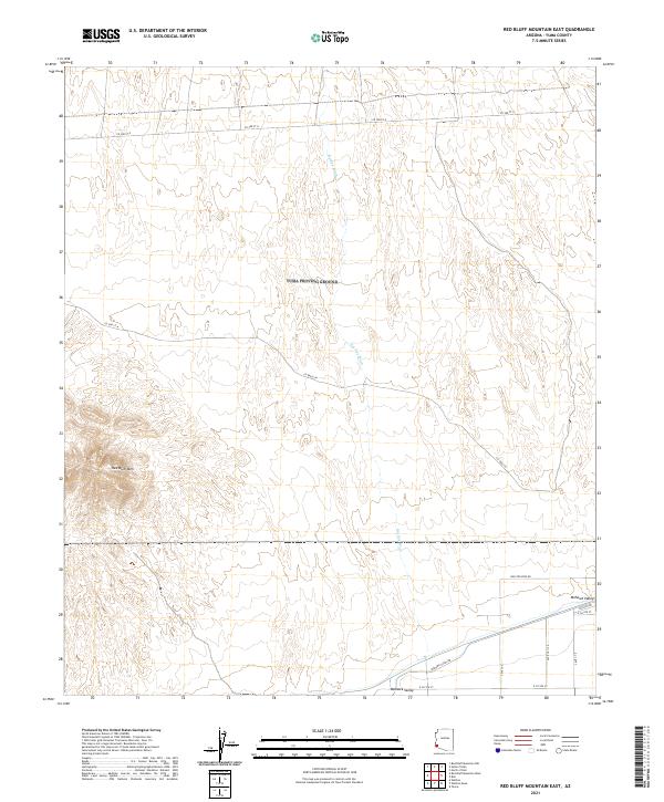
2021 Red Bluff Mountain East
Yuma County, AZ
2021 Red Bluff Mountain NW
Yuma County, AZ
2021 Red Bluff Mountain West
Yuma County, AZ
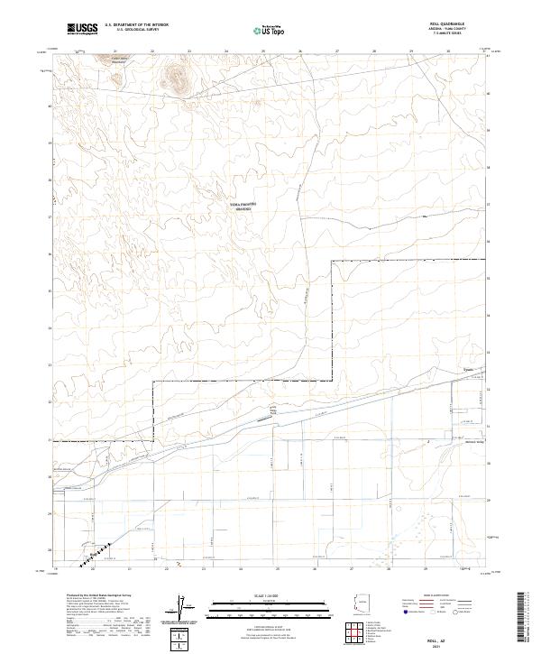
2021 Roll
Yuma County, AZ
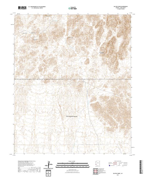
2021 Salton Tanks
Yuma County, AZ
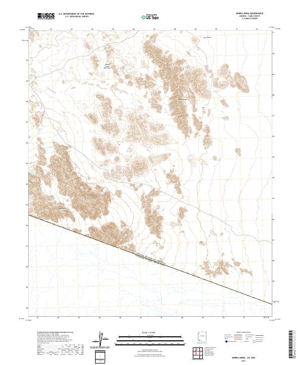
2021 Sierra Arida
Yuma County, AZ
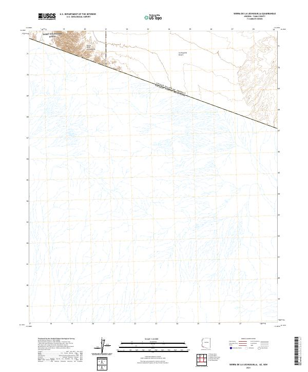
2021 Sierra de la Lechuguilla
Yuma County, AZ
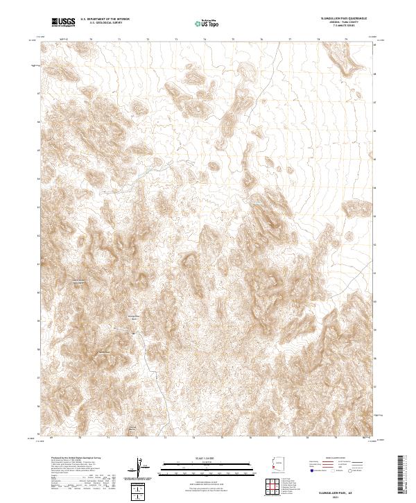
2021 Slumgullion Pass
Yuma County, AZ
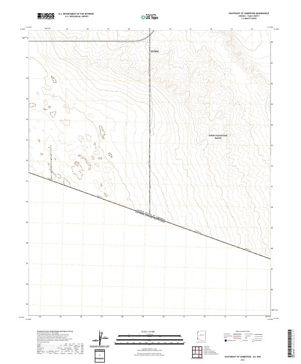
2021 Southeast of Somerton
Yuma County, AZ
2021 South of Somerton
Yuma County, AZ
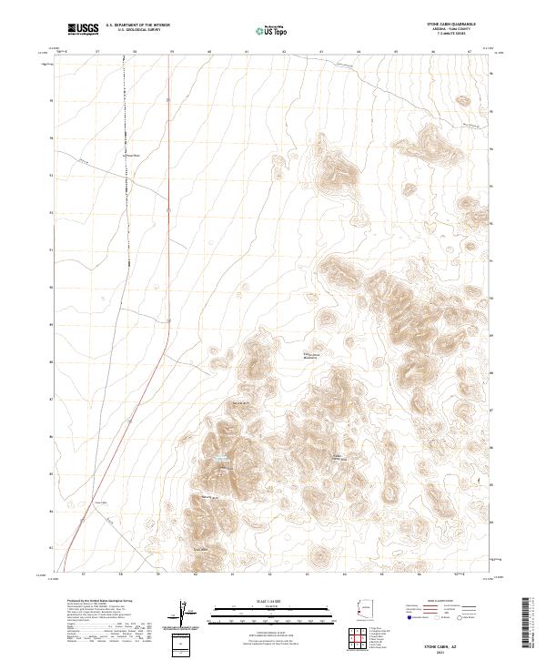
2021 Stone Cabin
Yuma County, AZ
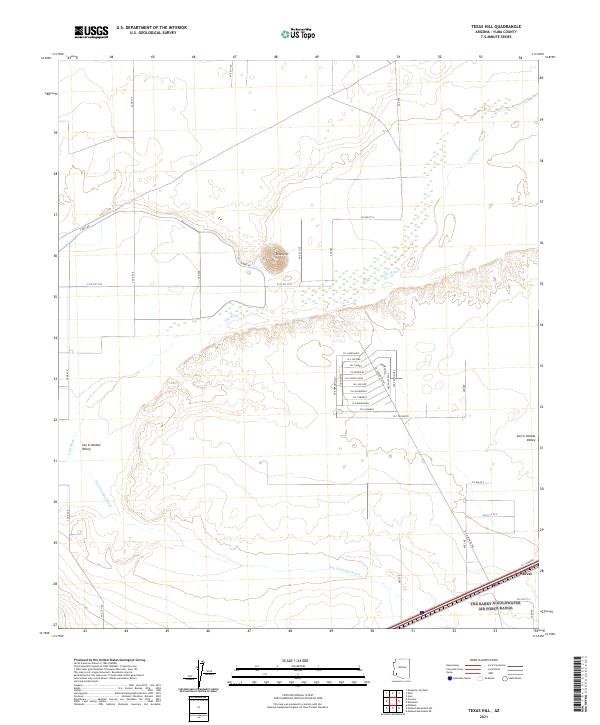
2021 Texas Hill
Yuma County, AZ
2021 Tinajas Altas OE S
Yuma County, AZ
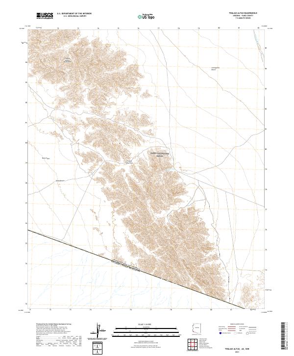
2021 Tinajas Altas
Yuma County, AZ
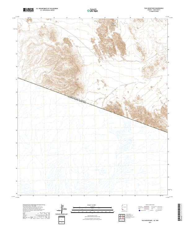
2021 Tule Mountains
Yuma County, AZ
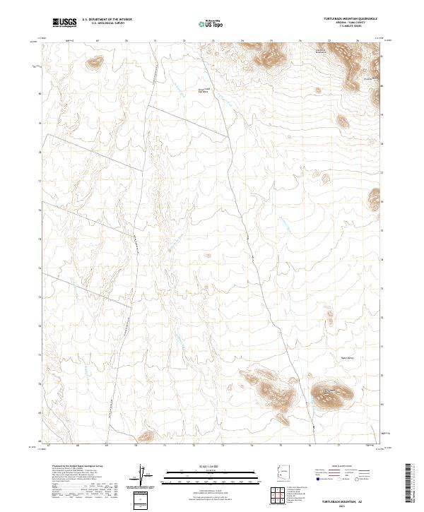
2021 Turtleback Mountain
Yuma County, AZ
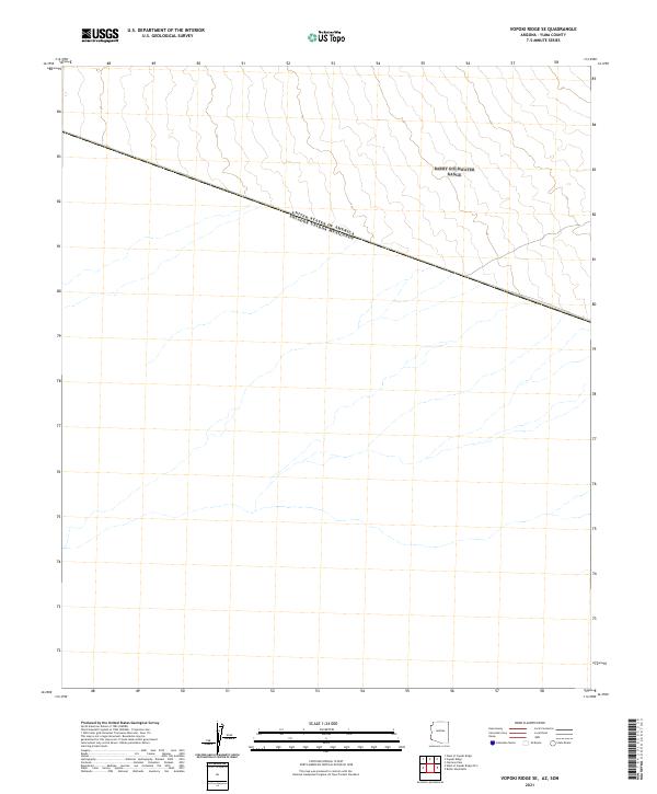
2021 Vopoki Ridge SE
Yuma County, AZ
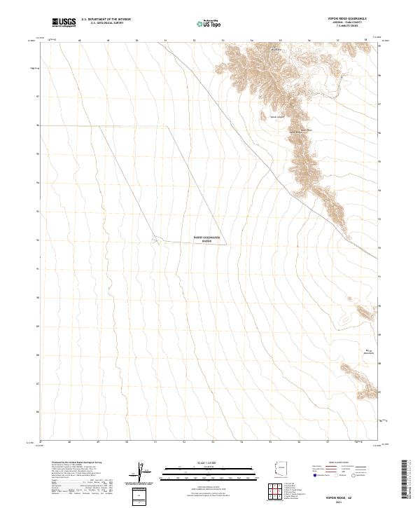
2021 Vopoki Ridge
Yuma County, AZ
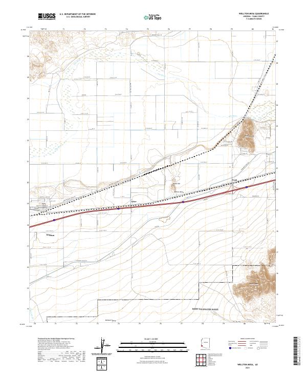
2021 Wellton Mesa
Yuma County, AZ
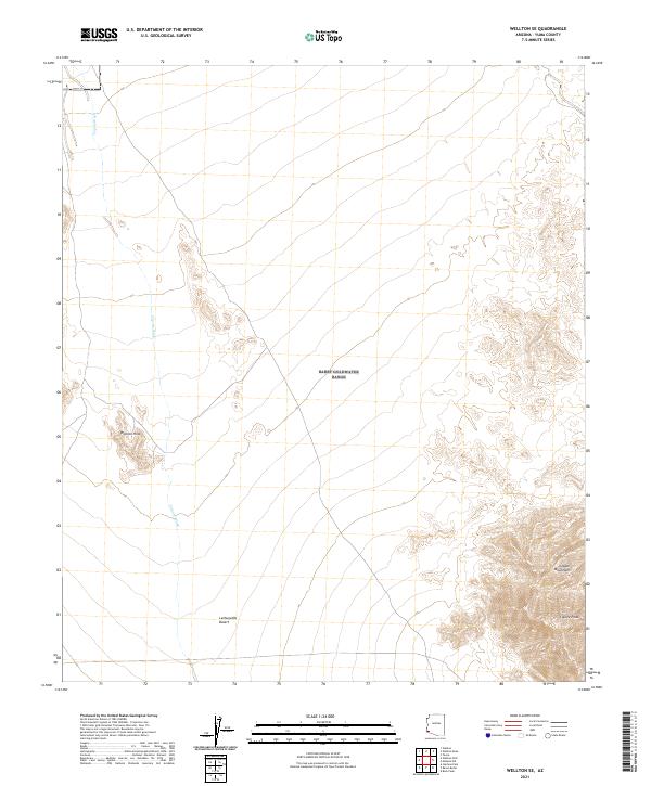
2021 Wellton SE
Yuma County, AZ
2021 West of Vopoki Ridge OE S
Yuma County, AZ
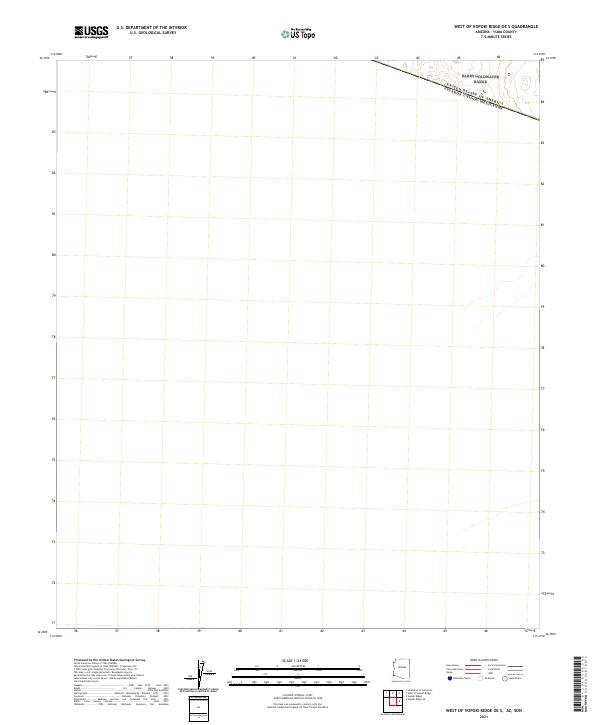
2021 West of Vopoki Ridge
Yuma County, AZ
2021 Yuma East
Yuma County, AZ
2021 Yuma SE
Yuma County, AZ
2021 Yuma West
Yuma County, AZ
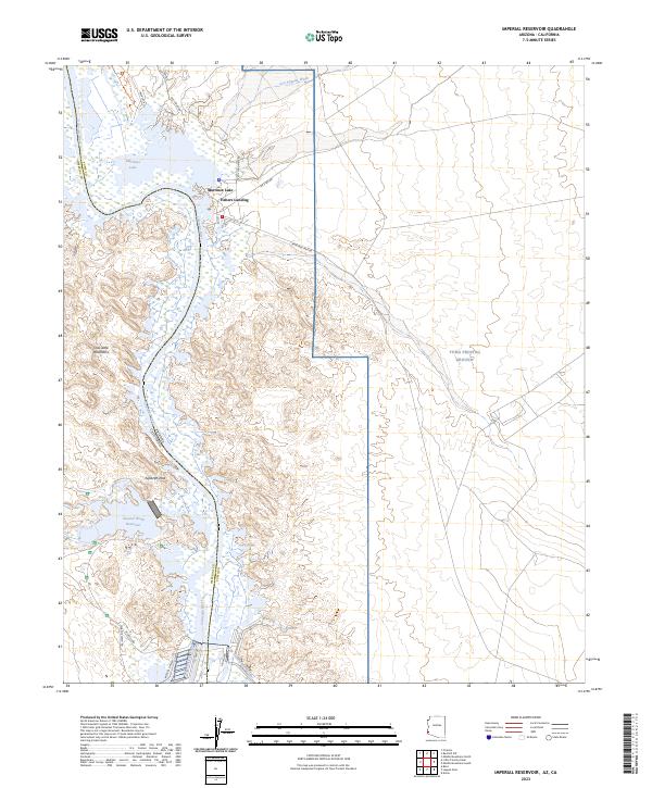
2023 Imperial Reservoir
Yuma County, AZ
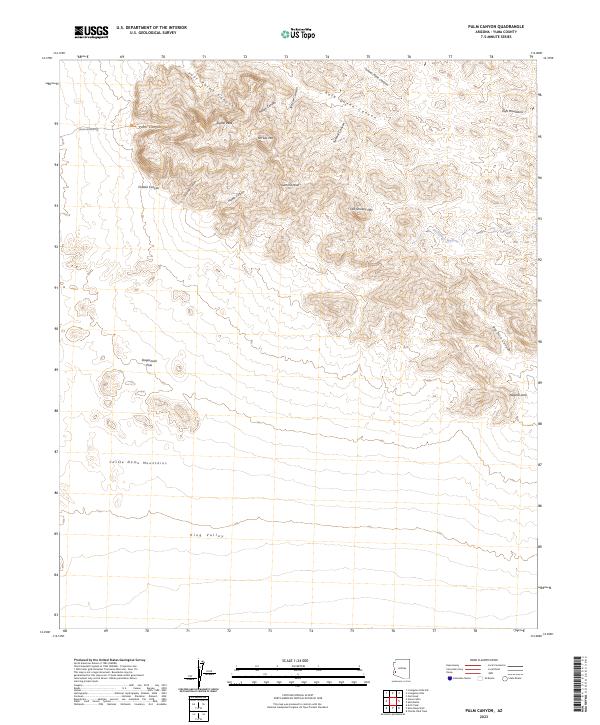
2023 Palm Canyon
Yuma County, AZ
2026 Kofa Butte
Yuma County, AZ
2026 Little Horn Mountains SE
Yuma County, AZ
2026 Palomas Mountains SE
Yuma County, AZ