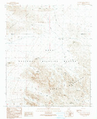
1990 Map of Livingston Hills
USGS Topo · Published 1990About this map
The Kofa Mountains and Livingston Hills dominate this desert landscape, where mineral extraction and critical water sources define the geography. Mining activity is concentrated in the northern reach of the sheet, where the Livingston Mine, Amuy Mine, and various Prospects are found along the drainage of French Creek. The central and southern portions of the map fall within the Kofa National Wildlife Refuge, a protected area marked by steep canyons such as Kofa Queen Canyon and Twin Spires Canyon. For those studying the hydrology of this arid region, the map identifies essential desert watering holes and catchments, including Budweiser Spring, High Tank Six, and the De La Osa Well. These features were vital for both the early mining operations and the wildlife that gives the refuge its name.
Find a feature on this map
40 named features on this map. Tap any name to fly to it.
Don’t see what you’re looking for? This feature index may not catch every label — zoom into the map to look around manually.
Map Details
Editions of this 1990 Livingston Hills Map
This is the sole edition of this map. No revisions or reprints were ever made.
Other maps of this area

1942 · Blythe
USGS Topo · 1:250,000

1942 · Vicksburg
USGS Topo · 1:250,000

1954 · Salton Sea
USGS Topo · 1:250,000

1954 · Phoenix
USGS Topo · 1:250,000

1955 · Salton Sea
USGS Topo · 1:250,000

1957 · Phoenix
USGS Topo · 1:250,000

1958 · Phoenix
USGS Topo · 1:250,000

1959 · Salton Sea
USGS Topo · 1:250,000

1960 · Phoenix
USGS Topo · 1:250,000

1962 · Quartzsite
USGS Topo · 1:62,500