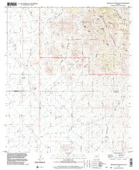
1996 Map of Greasewood Mountain
USGS Topo · Published 2003About this map
Greasewood Mountain anchors this rugged landscape at the southern end of the Pinaleno Mountains, where the boundary between Graham and Cochise counties cuts across the high desert. Within the Coronado National Forest, the map reveals a network of vital water sources in an arid climate, including Frog Spring, Walnut Spring, and Apache Reservoir.
Find a feature on this map
22 named features on this map. Tap any name to fly to it.
Don’t see what you’re looking for? This feature index may not catch every label — zoom into the map to look around manually.
Map Details
Editions of this 1996 Greasewood Mountain Map
This is the sole edition of this map. No revisions or reprints were ever made.
Other maps of this area

1922 · Willcox
USGS Topo · 1:125,000

1942 · Mt. Graham
USGS Topo · 1:62,500

1943 · Willcox
USGS Topo · 1:62,500

1944 · Fisher Hills
USGS Topo · 1:62,500

1945 · Mt. Graham
USGS Topo · 1:62,500

1954 · Silver City
USGS Topo · 1:250,000

1957 · Luzena
USGS Topo · 1:62,500

1958 · Silver City
USGS Topo · 1:250,000

1958 · Willcox
USGS Topo · 1:62,500

1962 · Silver City
USGS Topo · 1:250,000