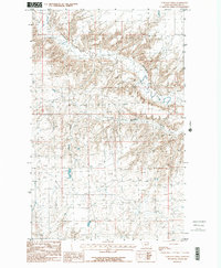
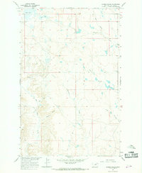
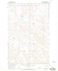
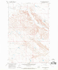
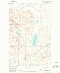
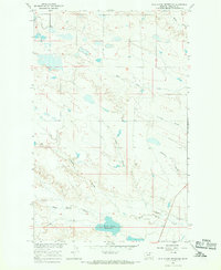
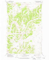
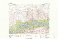
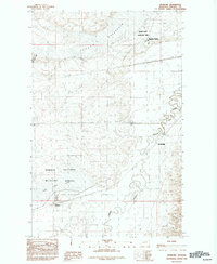
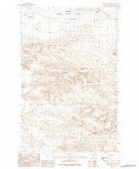
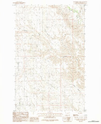
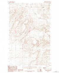
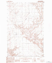
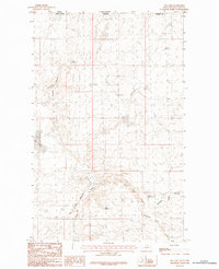
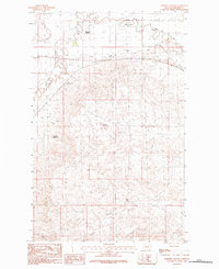
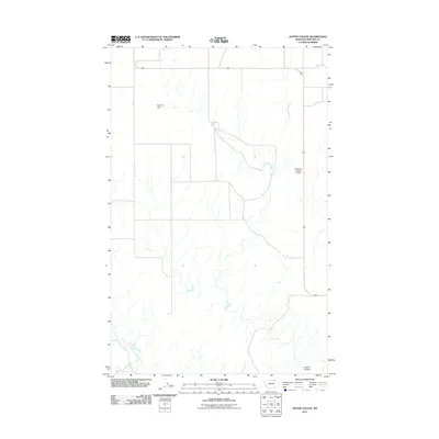
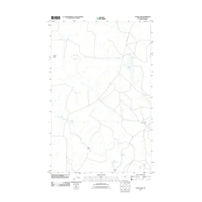
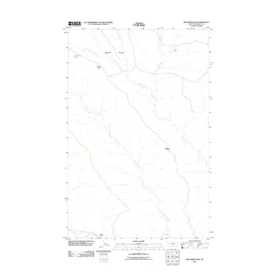
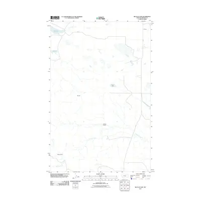
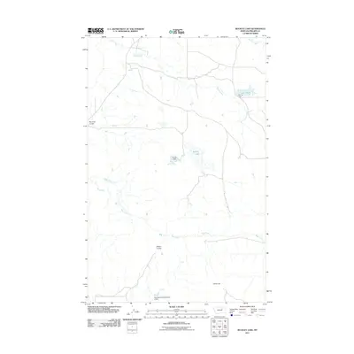
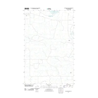
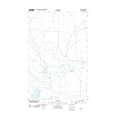
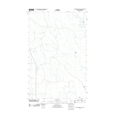
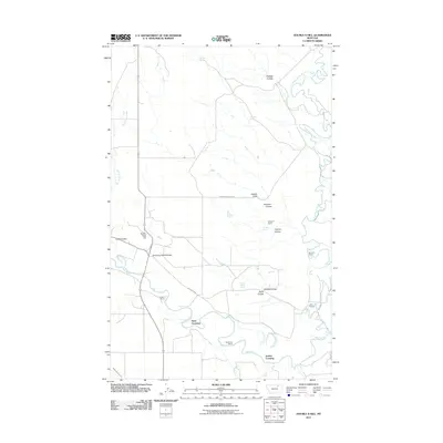
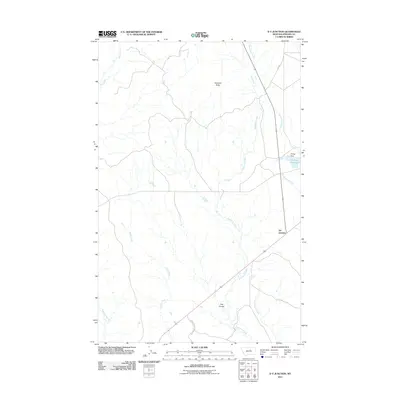
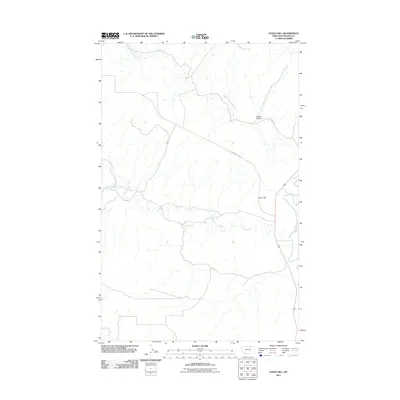
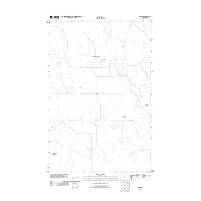
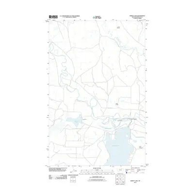
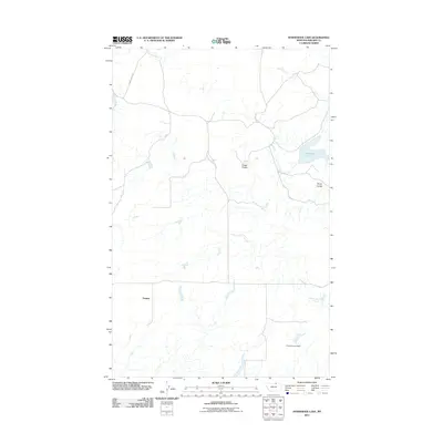
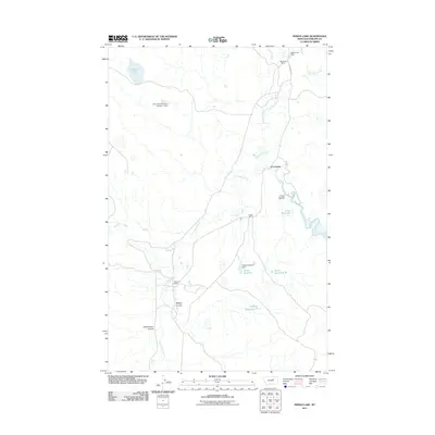
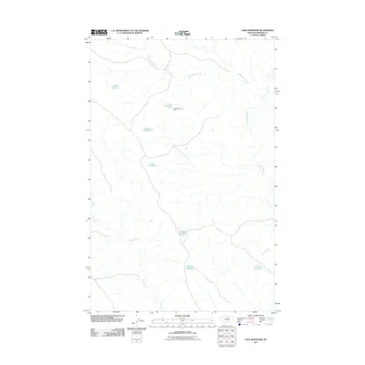
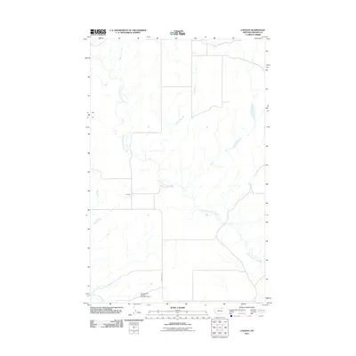
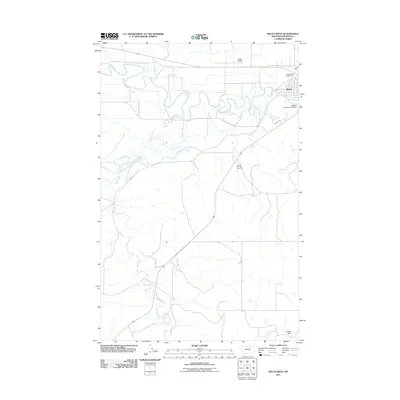
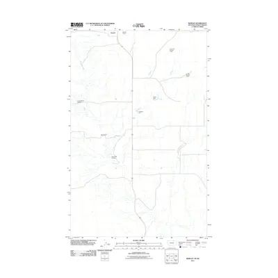
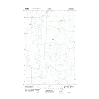
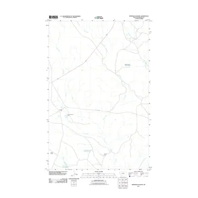
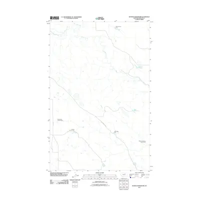
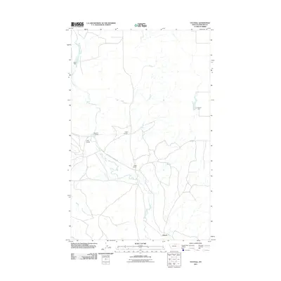
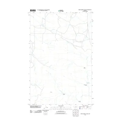
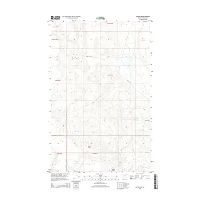
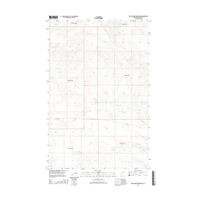
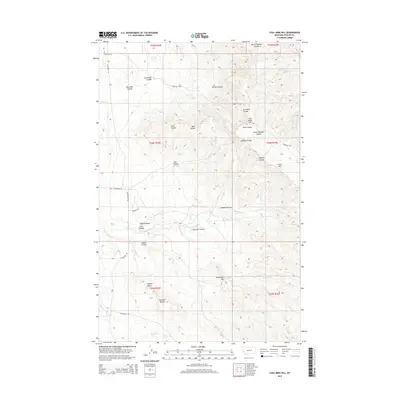
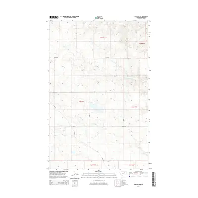
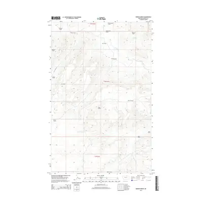
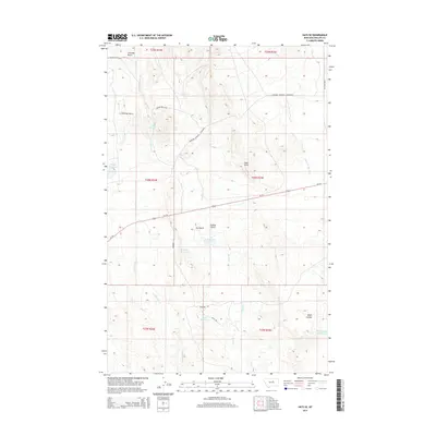
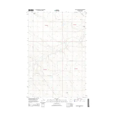
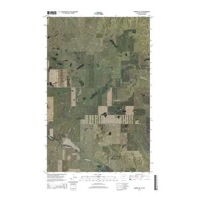
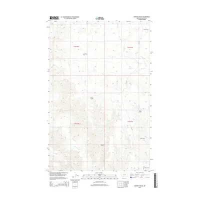
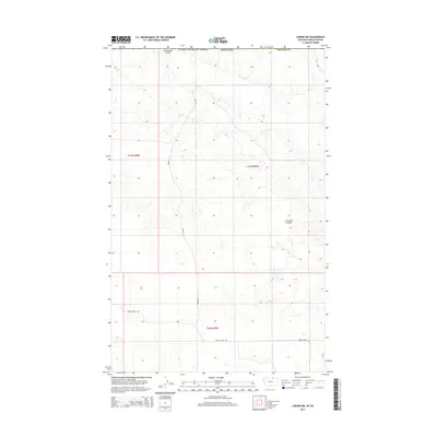
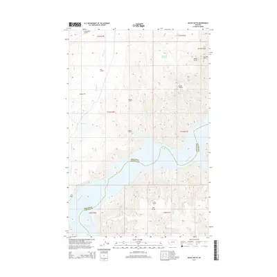
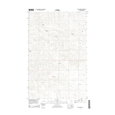
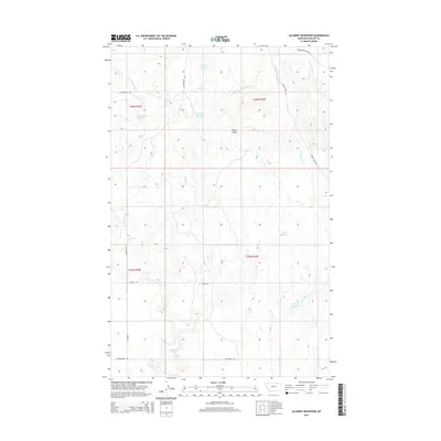
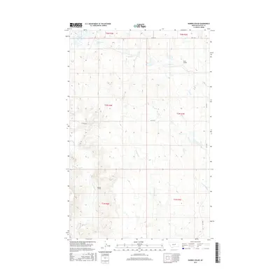
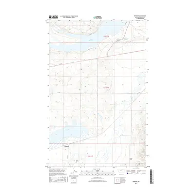
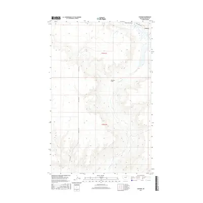
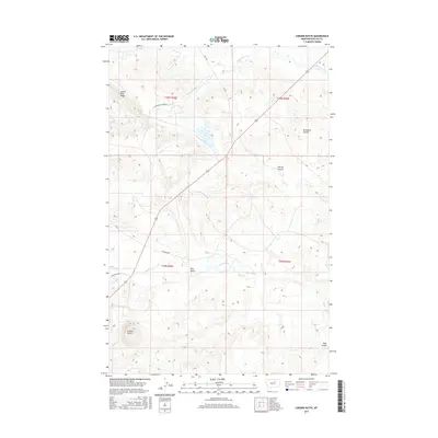
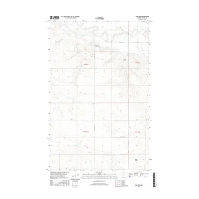
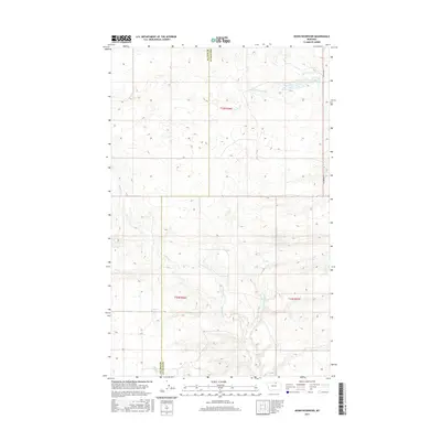
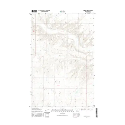
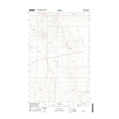
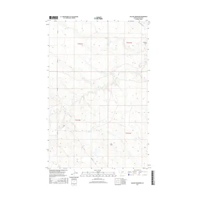
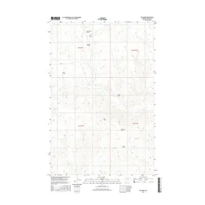
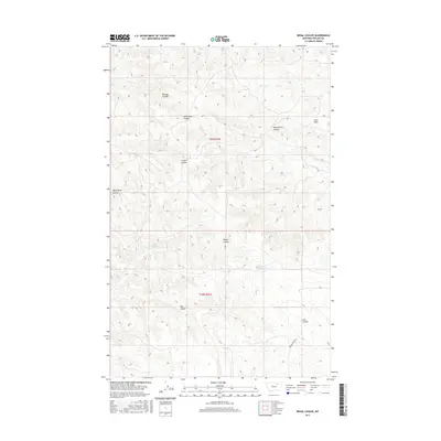
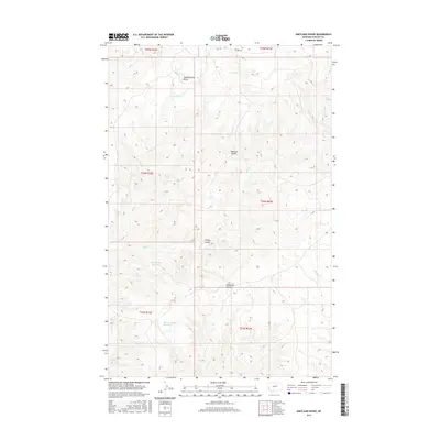
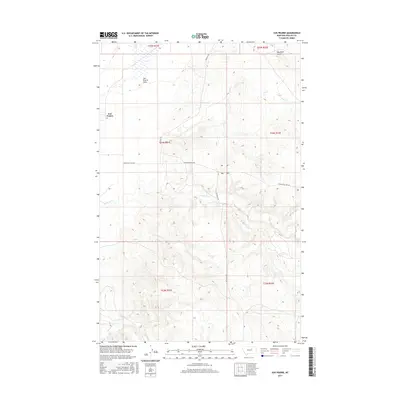
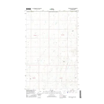
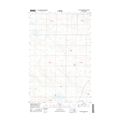
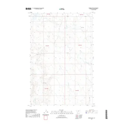
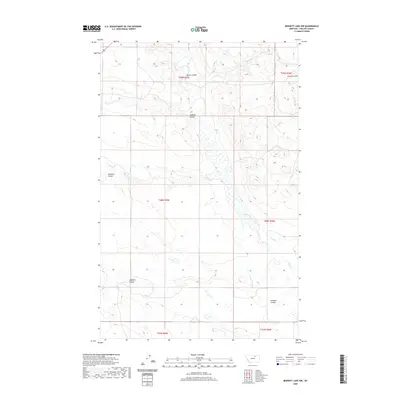
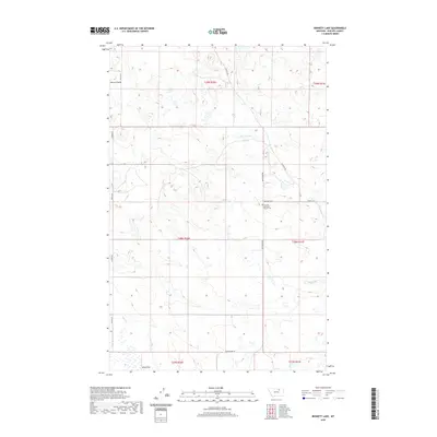
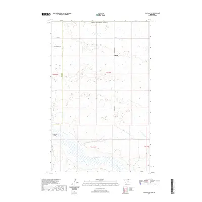
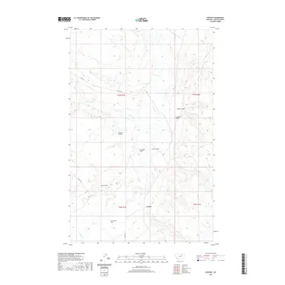
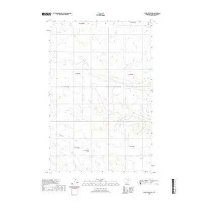
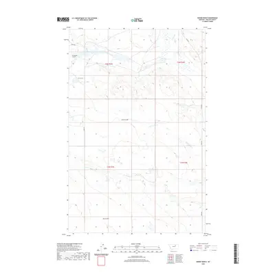
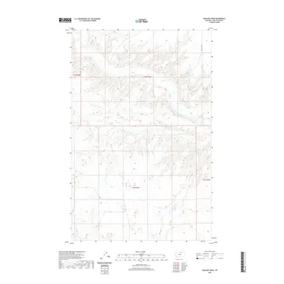
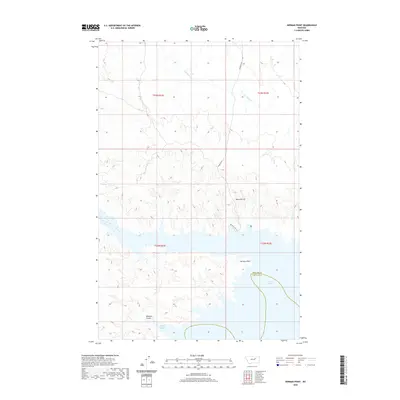
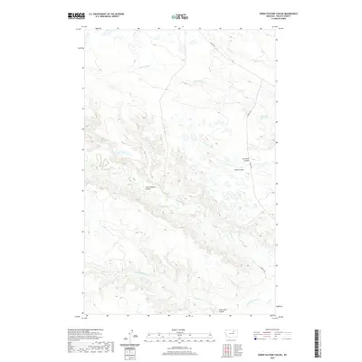
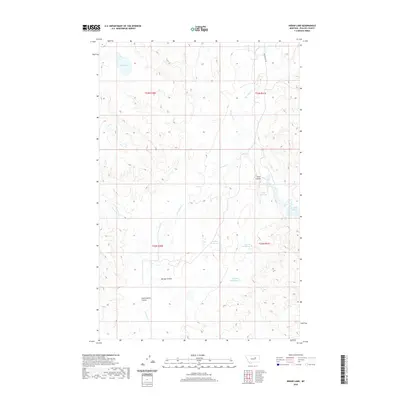
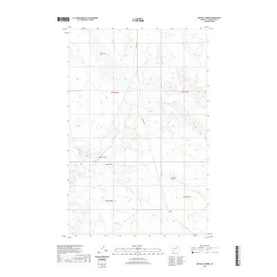
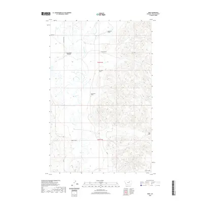
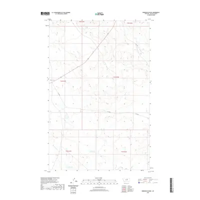
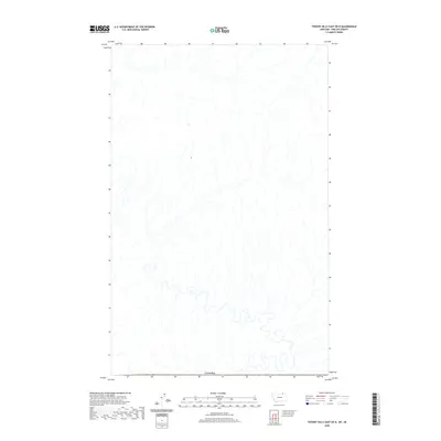
1984 Map of Garland Creek
USGS Topo · Published 1984About this map
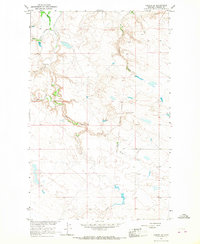
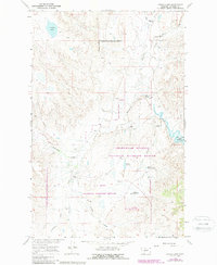
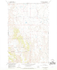
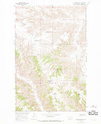
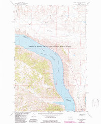
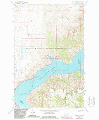
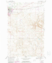
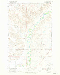
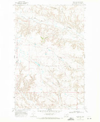
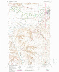
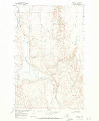
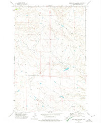
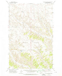
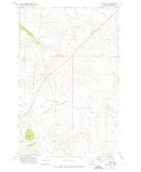
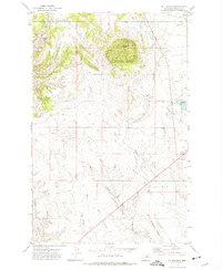
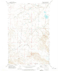
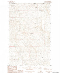
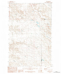
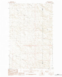
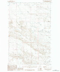
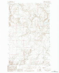
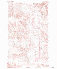
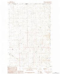
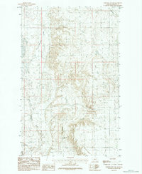
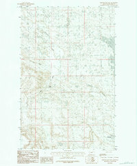
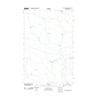
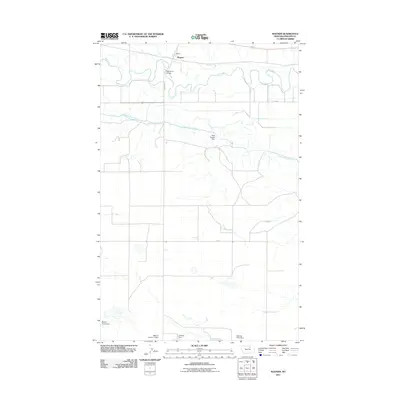
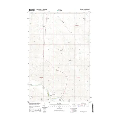
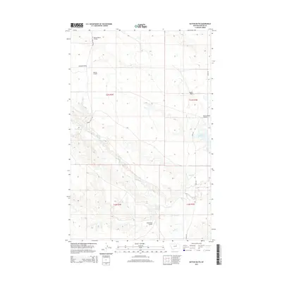
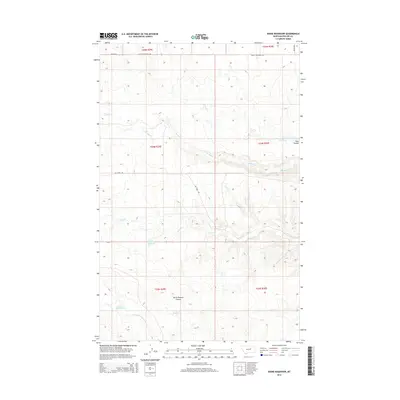
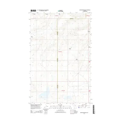
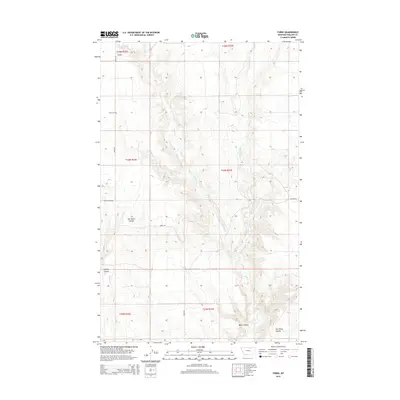
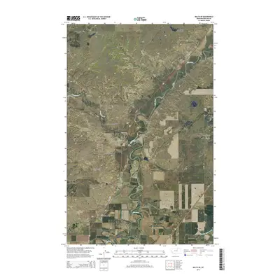
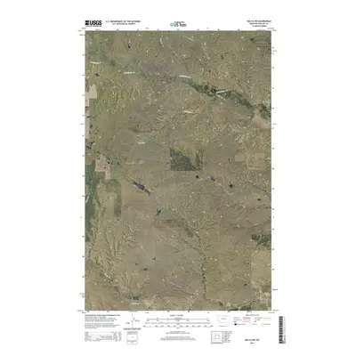
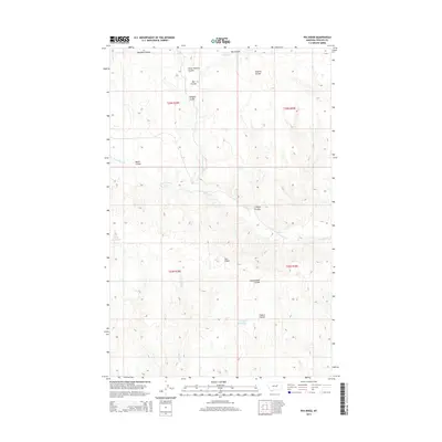
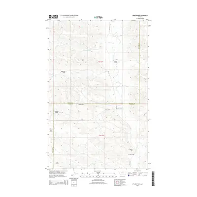
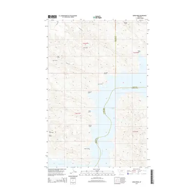
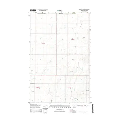
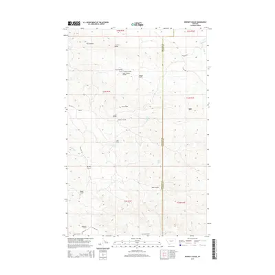
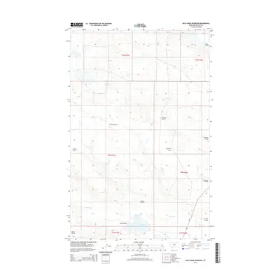
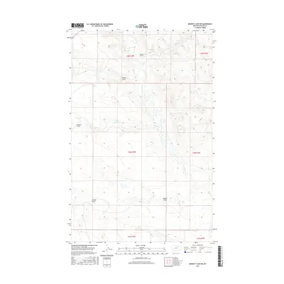
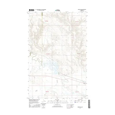
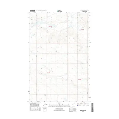
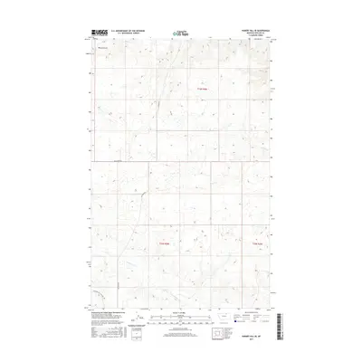
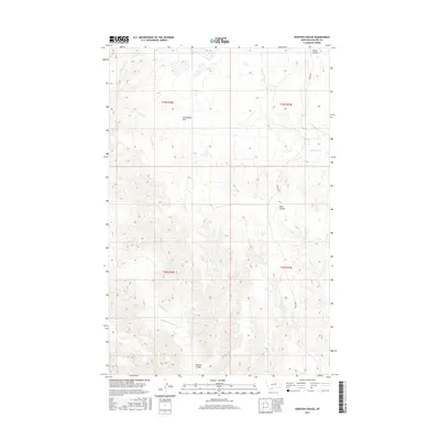
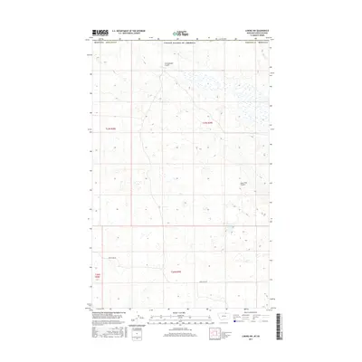
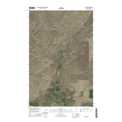
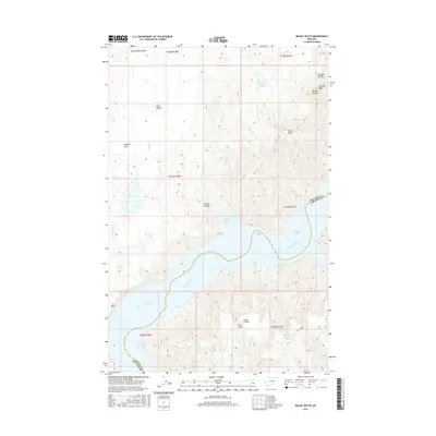
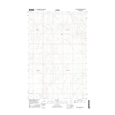
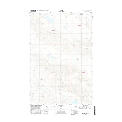
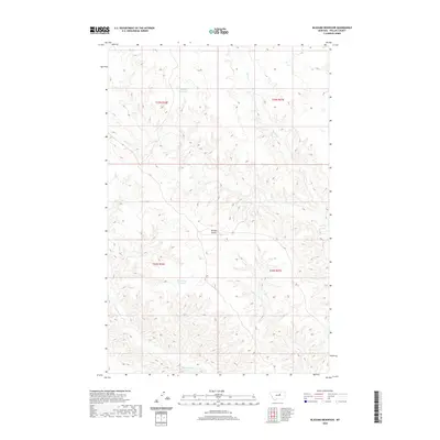
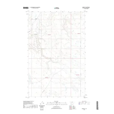
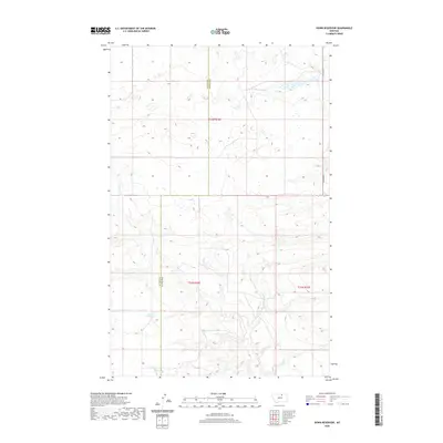
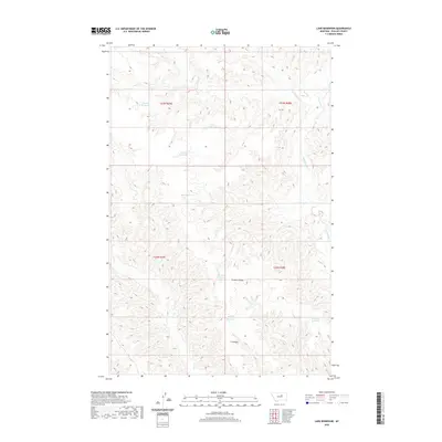
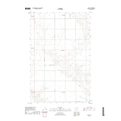
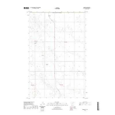
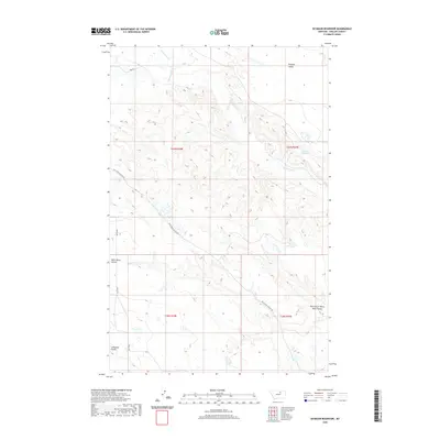
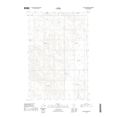
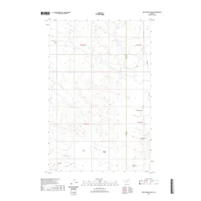
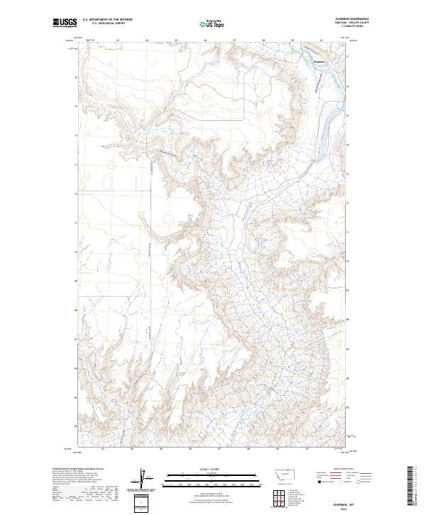
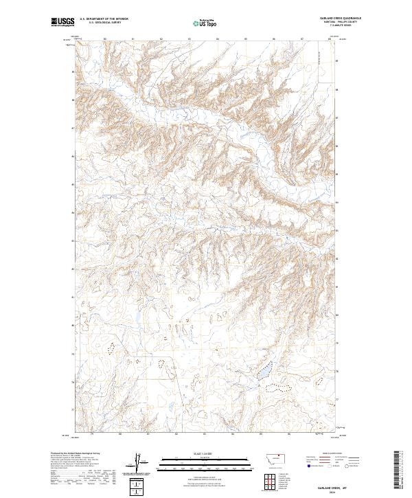
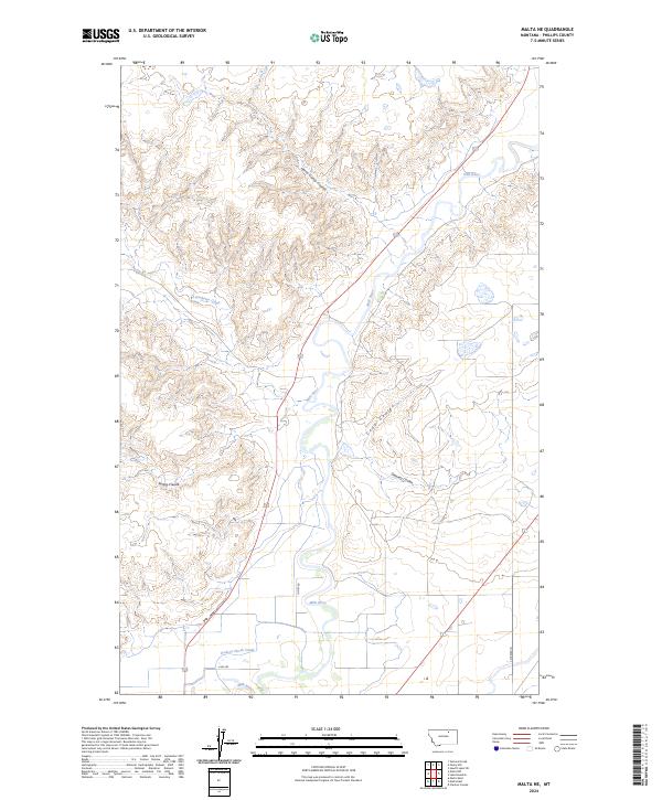
Cottonwood Creek meanders through the breaks and uplands of Phillips County, carving a distinct drainage pattern across this north-central Montana landscape. The terrain is defined by a network of coulees and ridges that converge toward the primary waterway, showing the intricate erosion patterns characteristic of the region. As recorded during fieldwork in the late 1970s, the map illustrates the sparse, open character of the high plains, where water remains the primary shaping force of the land. Garland Creek serves as a secondary drainage, marking a significant topographical transition in the eastern portion of the quadrangle. This provisional survey captures the area before modern developments, preserving a moment when the land was defined almost entirely by its natural hydrology and the section lines of the Public Land Survey System.
Find a feature on this map
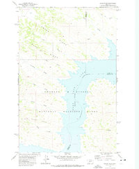
2 named features on this map. Tap any name to fly to it.
Don’t see what you’re looking for? This feature index may not catch every label — zoom into the map to look around manually.
Map Details
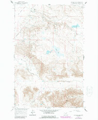
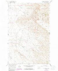
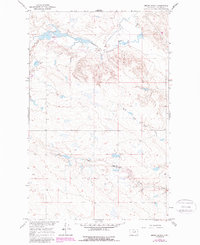
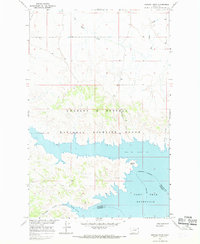
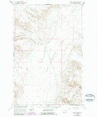
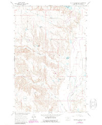
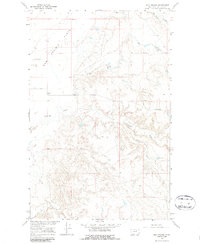
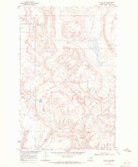
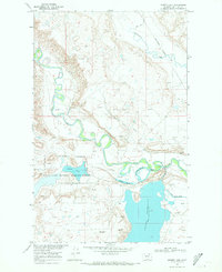
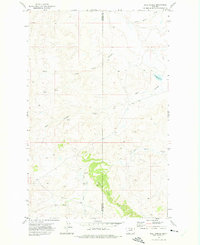
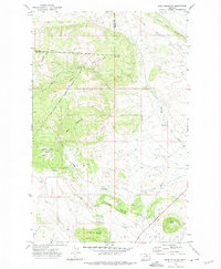
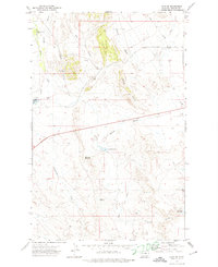
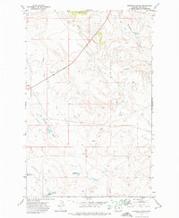
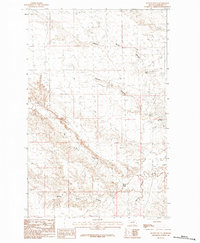
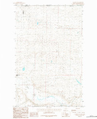
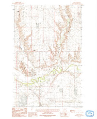
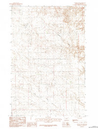
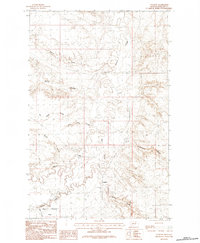
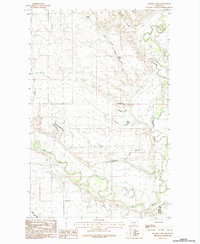
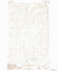
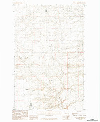
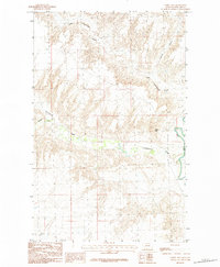
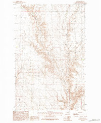
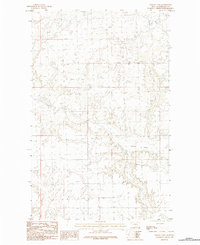
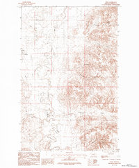
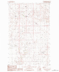
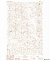
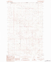
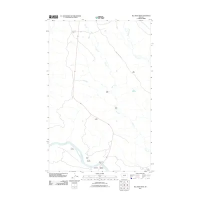
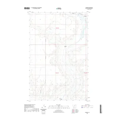
Editions of this 1984 Garland Creek Map
2 editions found
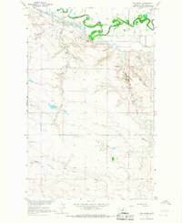
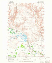
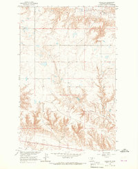
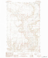
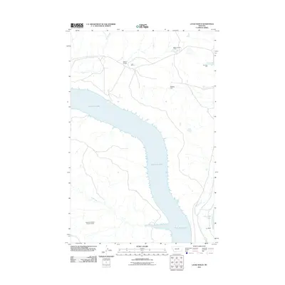
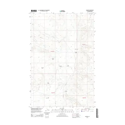
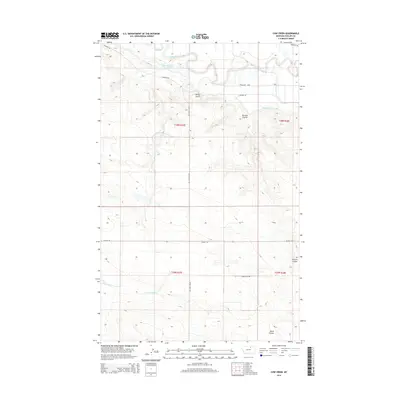
Historical Maps of Phillips County Through Time
618 maps found
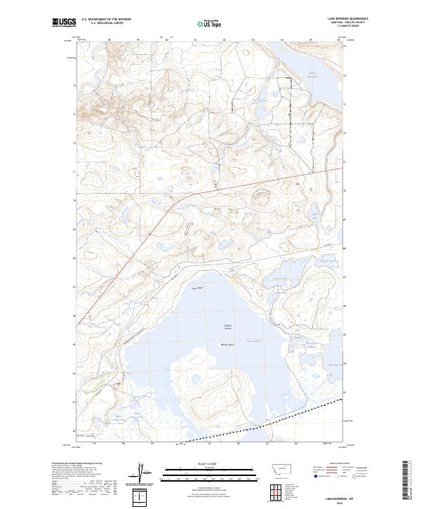
1905 Bowdoin
Phillips County, MT

1920 Avery
Phillips County, MT

1920 Cowan
Phillips County, MT
1954 Bell Ridge East
Phillips County, MT
1954 Bell Ridge West
Phillips County, MT
1964 Coburg SE
Phillips County, MT
1964 Cow Creek
Phillips County, MT
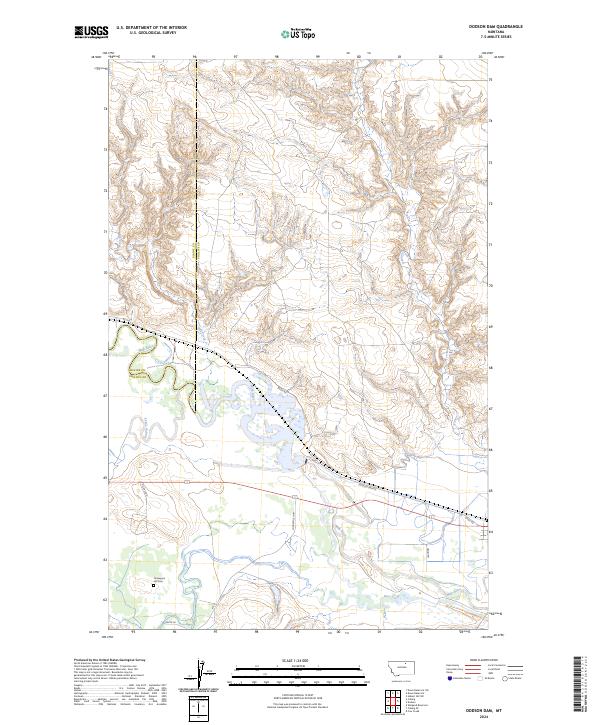
1964 Dodson Dam
Phillips County, MT
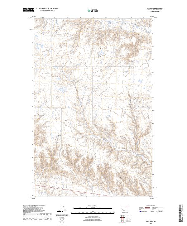
1964 Dodson NE
Phillips County, MT
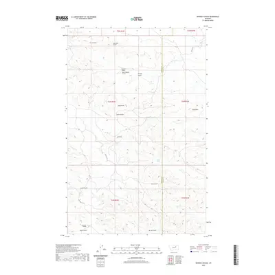
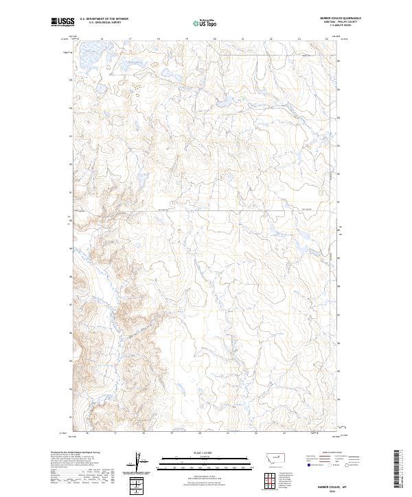
1965 Barber Coulee
Phillips County, MT
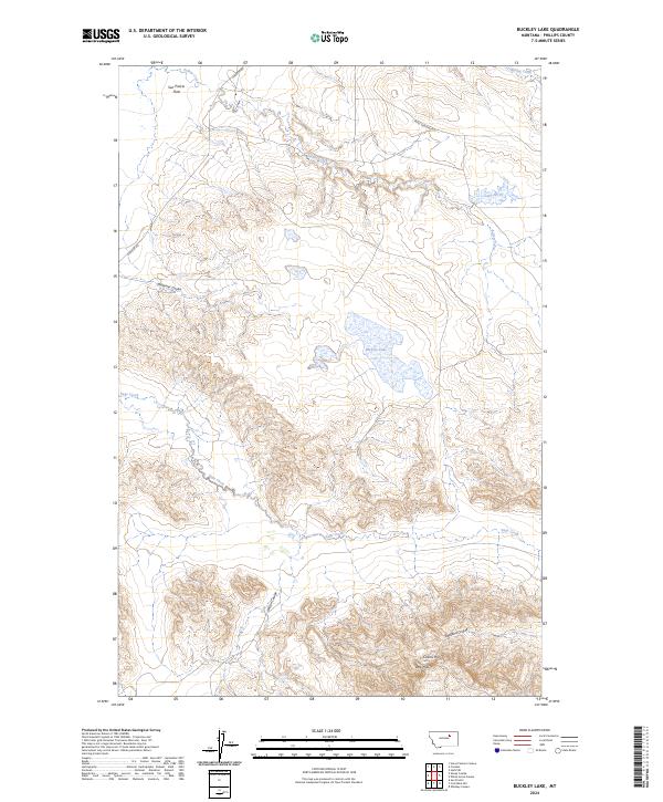
1965 Buckley Lake
Phillips County, MT
1965 Coal Mine Hill
Phillips County, MT
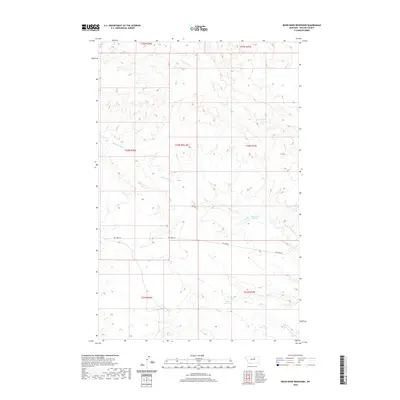
1965 Dione Reservoir
Phillips County, MT
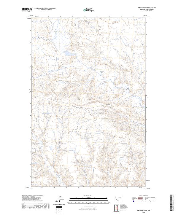
1965 Dry Fork Ridge
Phillips County, MT
1965 Emond Ranch
Phillips County, MT
1965 Herman Point
Phillips County, MT
1965 Holzhey Reservoir
Phillips County, MT
1965 Indian Lake
Phillips County, MT
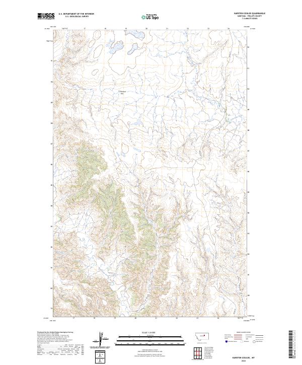
1965 Karsten Coulee
Phillips County, MT
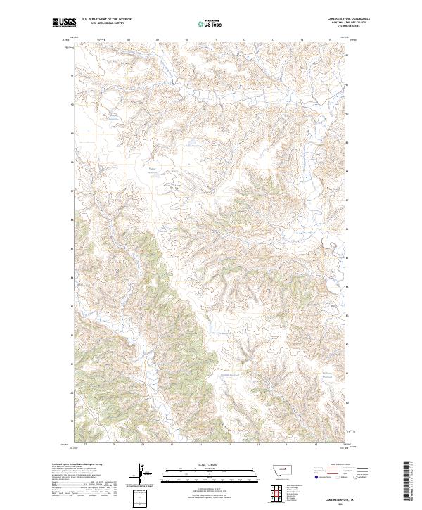
1965 Lake Reservoir
Phillips County, MT
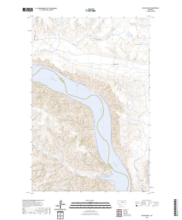
1965 Locke Ranch
Phillips County, MT
1965 Mickey Butte
Phillips County, MT
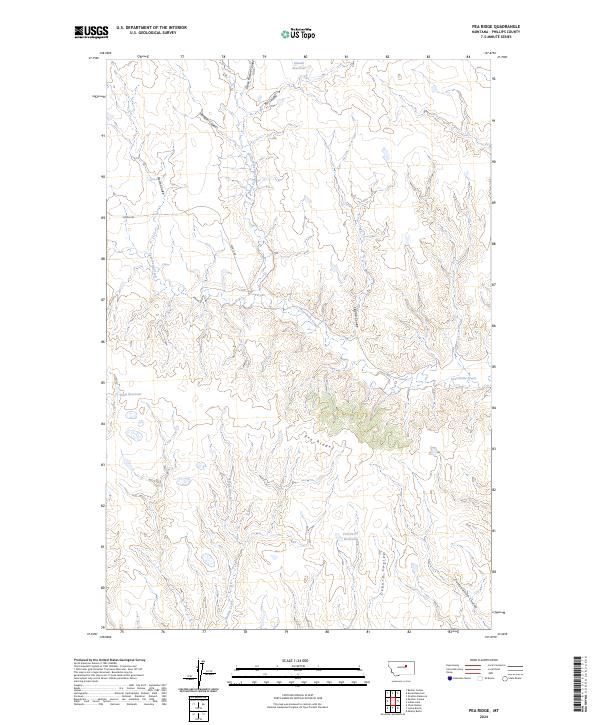
1965 Pea Ridge
Phillips County, MT
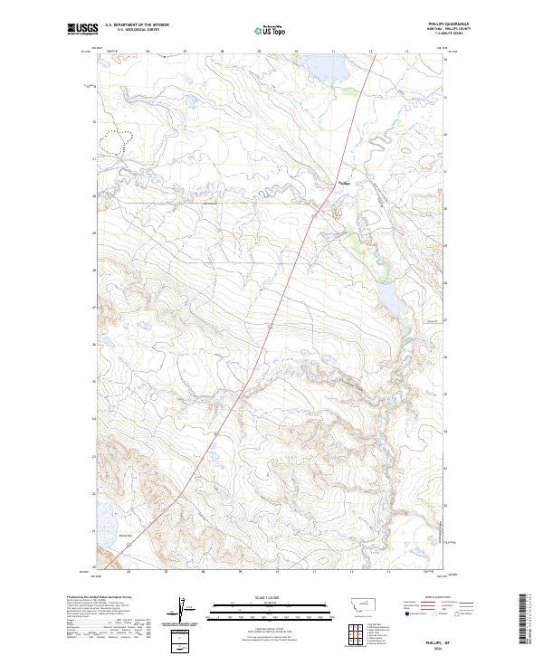
1965 Phillips
Phillips County, MT
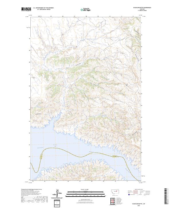
1965 Schuyler Butte
Phillips County, MT
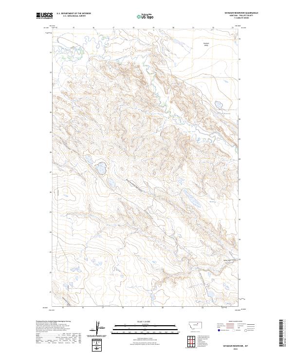
1965 Seymour Reservoir
Phillips County, MT
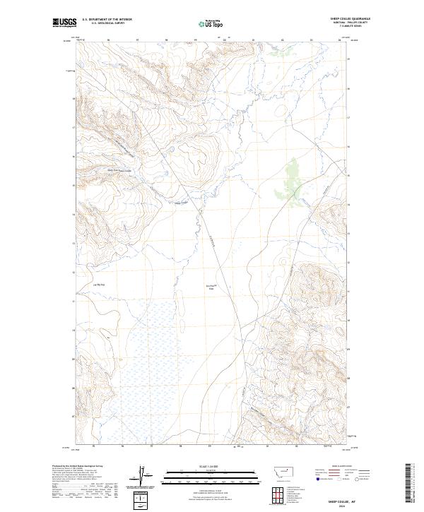
1965 Sheep Coulee
Phillips County, MT
1965 Stratton Reservoir
Phillips County, MT
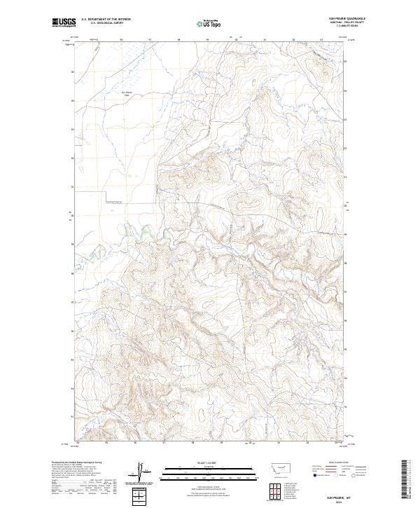
1965 Sun Prairie
Phillips County, MT
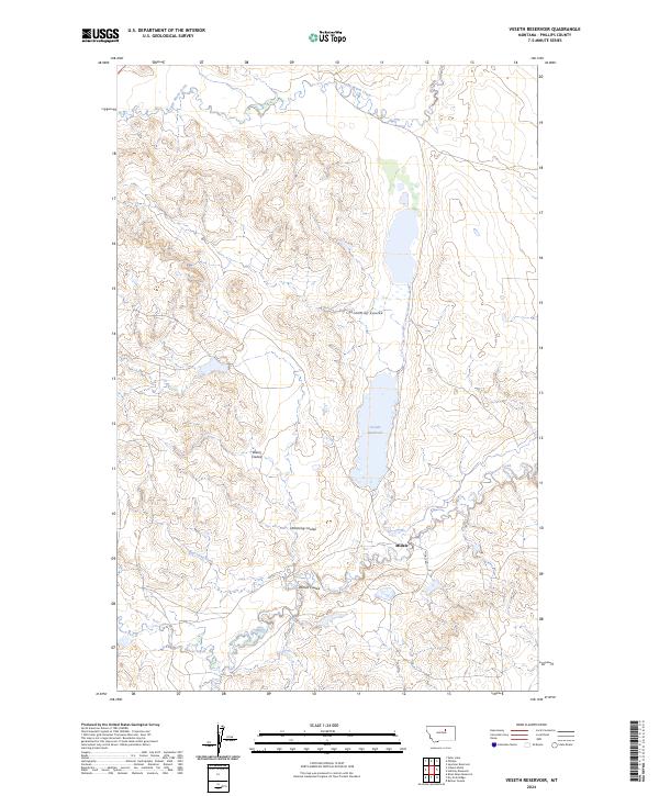
1965 Veseth Reservoir
Phillips County, MT
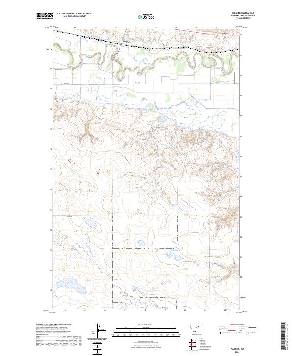
1965 Wagner
Phillips County, MT
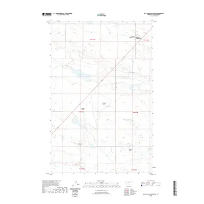
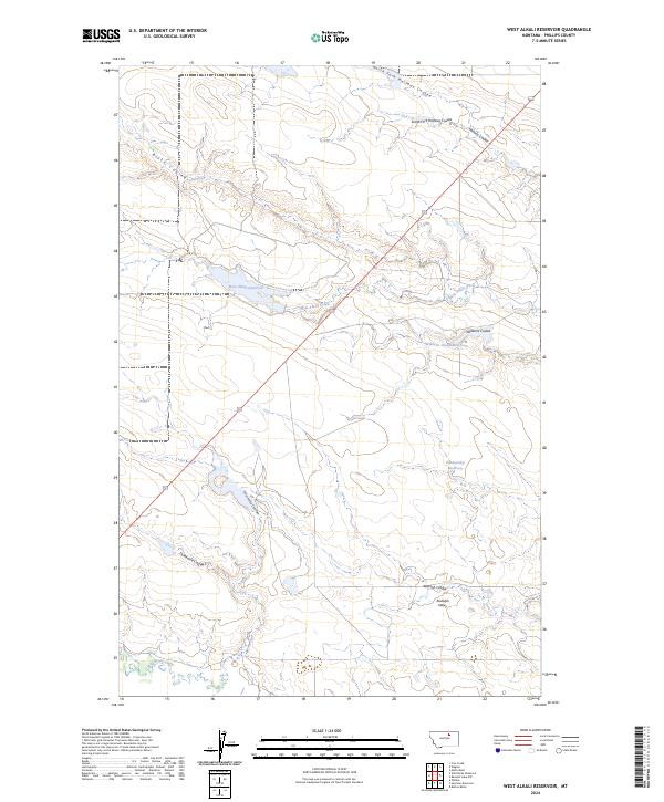
1965 West Alkali Reservoir
Phillips County, MT
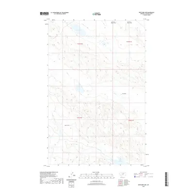
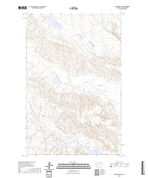
1965 Whitcomb Lake
Phillips County, MT
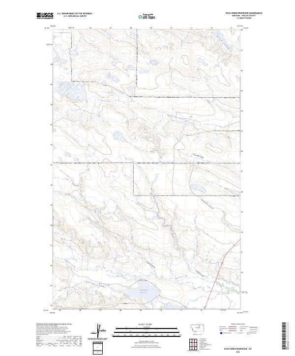
1965 Wild Horse Reservoir
Phillips County, MT
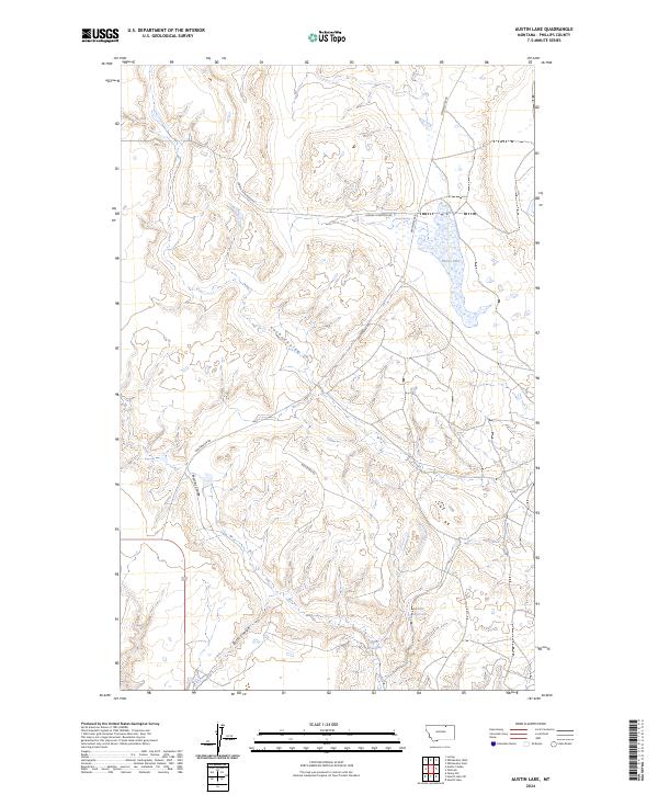
1968 Austin Lake
Phillips County, MT
1968 Hewitt Lake
Phillips County, MT
1968 Hewitt Lake SW
Phillips County, MT
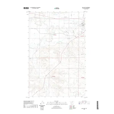
1968 Malta East
Phillips County, MT
1968 Malta NE
Phillips County, MT
1968 Malta NW
Phillips County, MT
1968 Malta West
Phillips County, MT
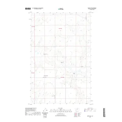
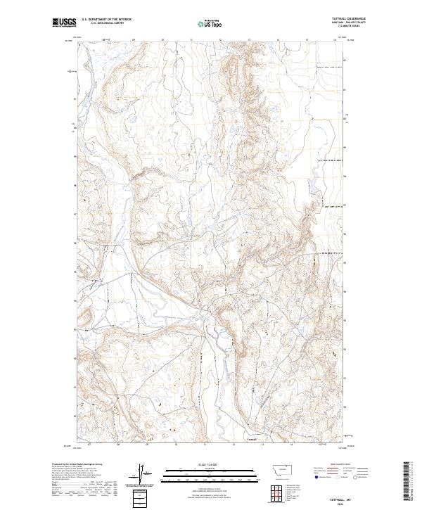
1968 Tattnall
Phillips County, MT
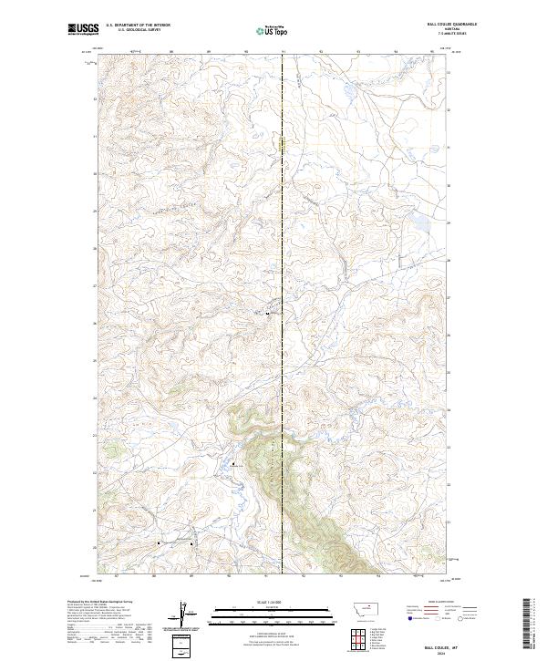
1971 Ball Coulee
Phillips County, MT
1971 Bear Mountain
Phillips County, MT
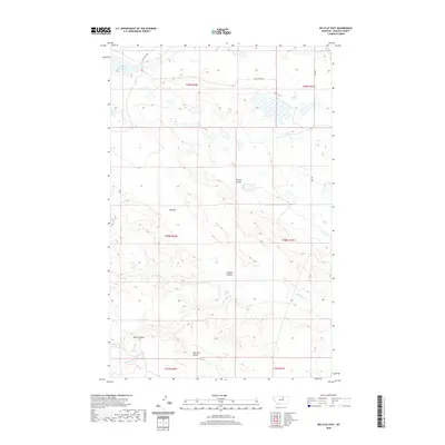
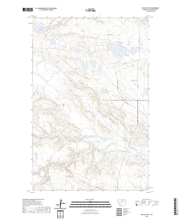
1971 Big Flat East
Phillips County, MT
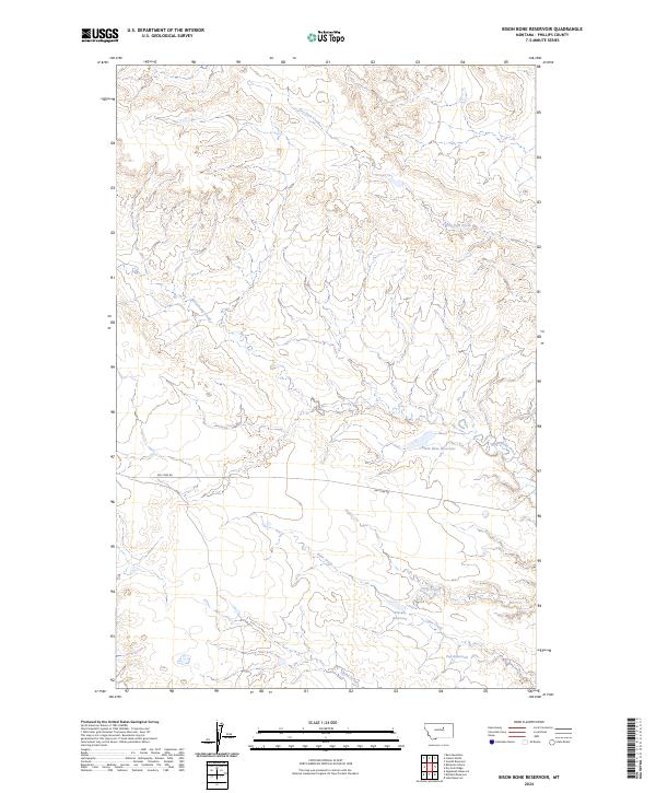
1971 Bison Bone Reservoir
Phillips County, MT
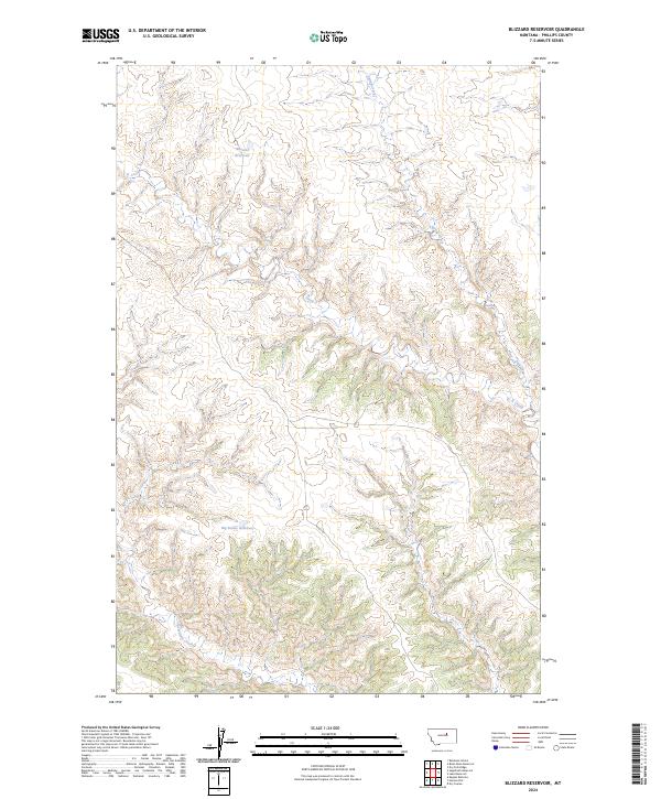
1971 Blizzard Reservoir
Phillips County, MT
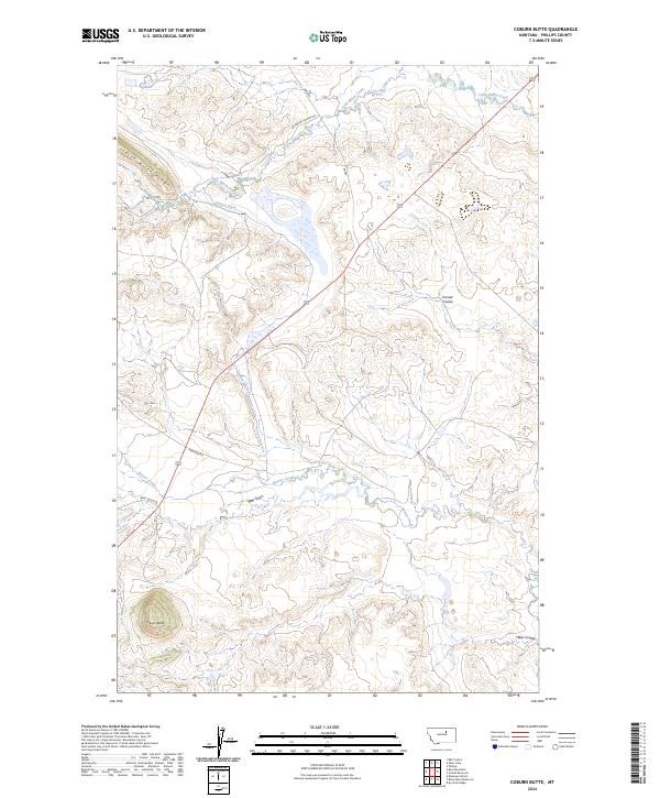
1971 Coburn Butte
Phillips County, MT
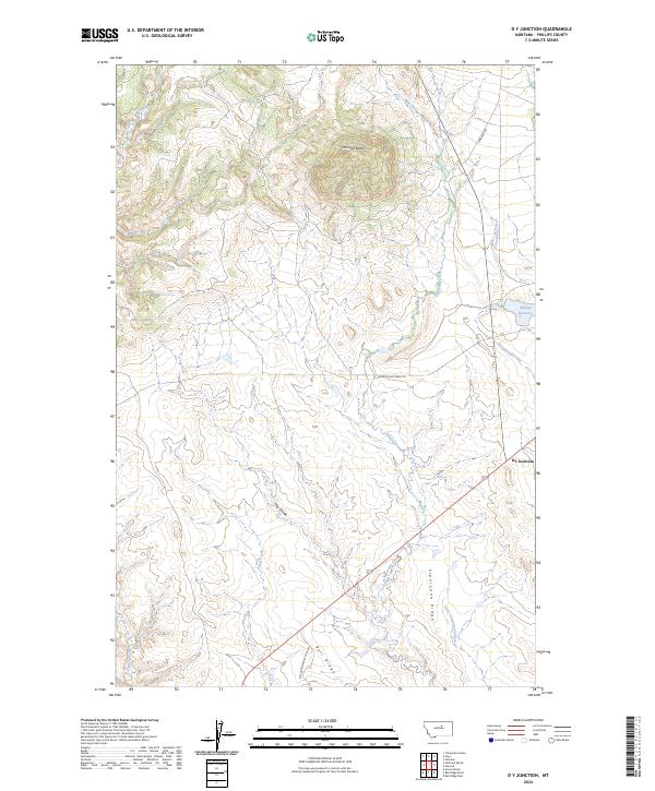
1971 D Y Junction
Phillips County, MT
1971 Ester Lake
Phillips County, MT
1971 Hays SE
Phillips County, MT
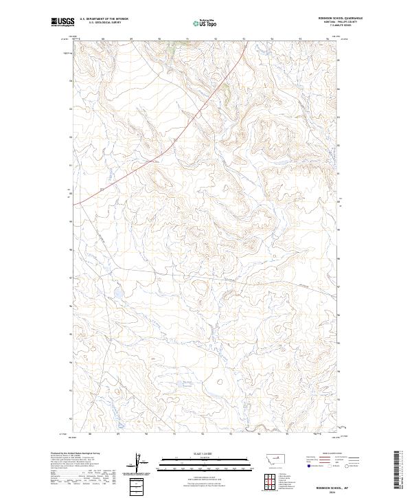
1971 Robinson School
Phillips County, MT
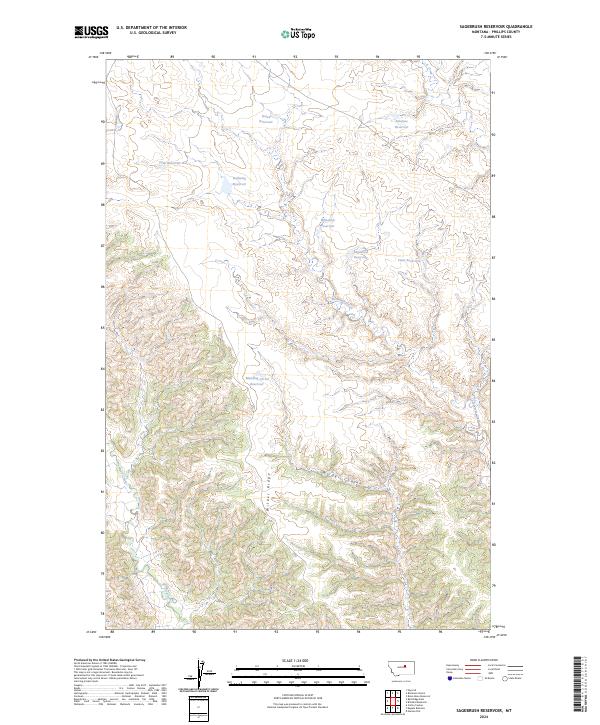
1971 Sagebrush Reservoir
Phillips County, MT
1971 Shetland Divide
Phillips County, MT
1971 Swede Ridge
Phillips County, MT
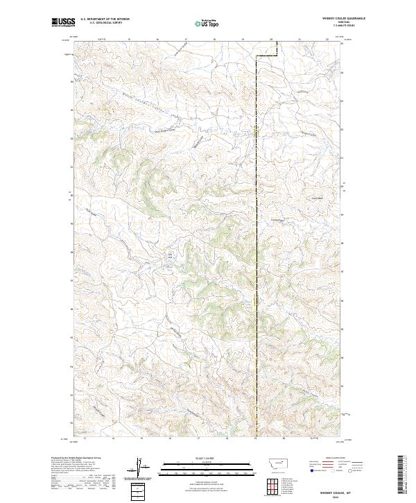
1973 Whiskey Coulee
Phillips County, MT
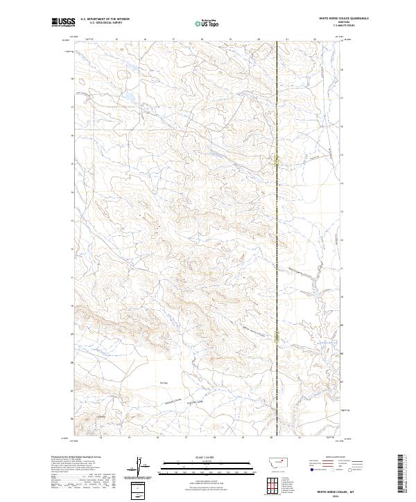
1973 White Horse Coulee
Phillips County, MT
1978 Fort Peck Lake West
Phillips County, MT
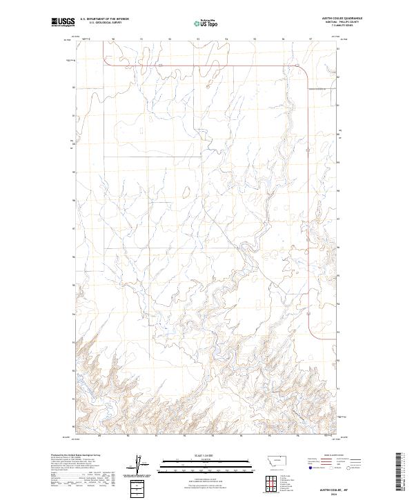
1984 Austin Coulee
Phillips County, MT
1984 Bennett Lake NW
Phillips County, MT
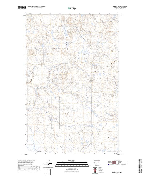
1984 Bennett Lake
Phillips County, MT
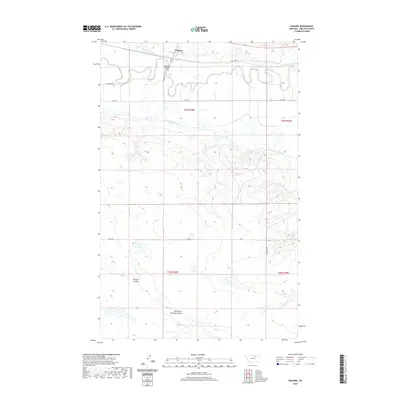
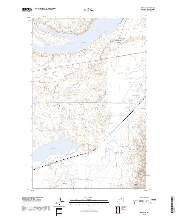
1984 Bowdoin
Phillips County, MT
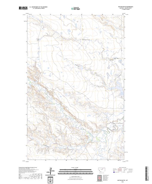
1984 Button Butte
Phillips County, MT
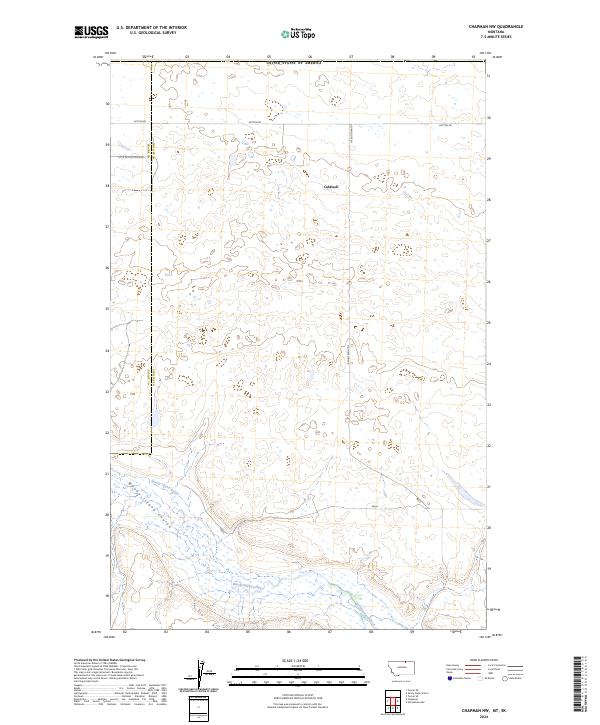
1984 Chapman NW
Phillips County, MT
1984 Chapman
Phillips County, MT
1984 Clanton Coulee
Phillips County, MT
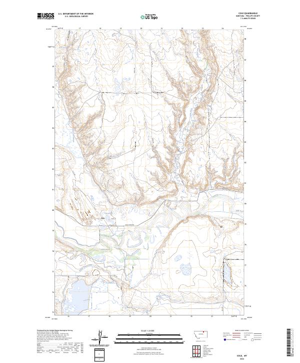
1984 Cole
Phillips County, MT
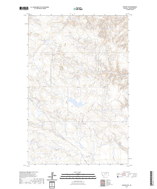
1984 Content NW
Phillips County, MT
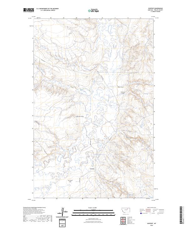
1984 Content
Phillips County, MT
1984 Dead Horse Coulee
Phillips County, MT
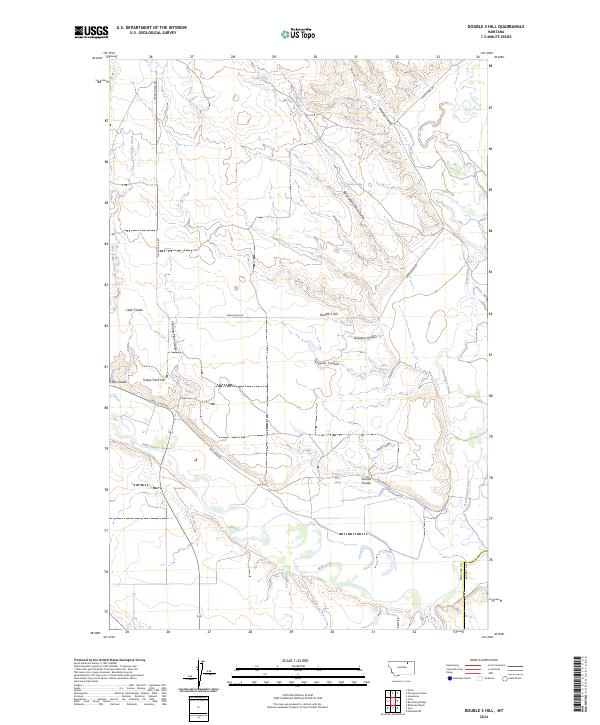
1984 Double S Hill
Phillips County, MT
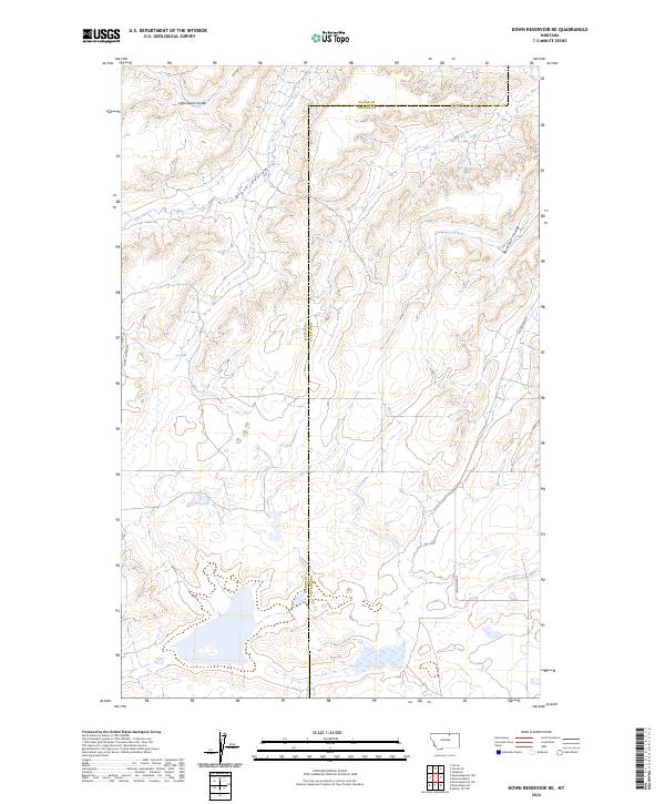
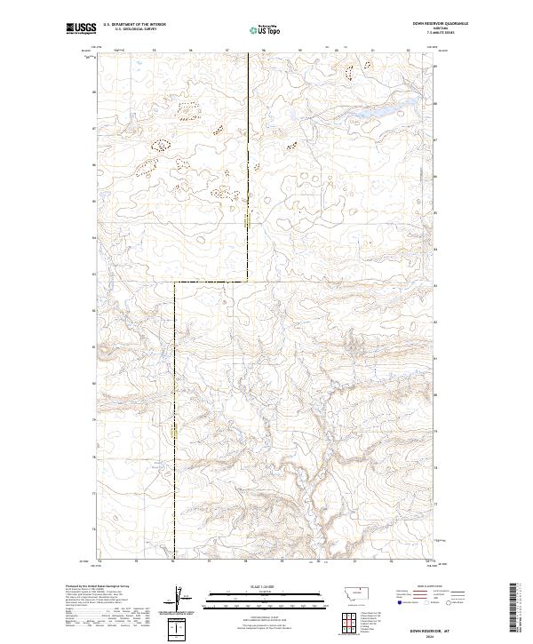
1984 Down Reservoir NE
Phillips County, MT
1984 Down Reservoir
Phillips County, MT
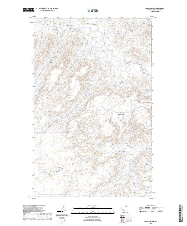
1984 Emerick Bench
Phillips County, MT
1984 Fanny Hill
Phillips County, MT
1984 Forks
Phillips County, MT
1984 Garland Creek
Phillips County, MT
1984 Gustin Coulee
Phillips County, MT
1984 Harb
Phillips County, MT
1984 Harb SW
Phillips County, MT
1984 Horse Pasture Coulee
Phillips County, MT
1984 Horseshoe Lake
Phillips County, MT
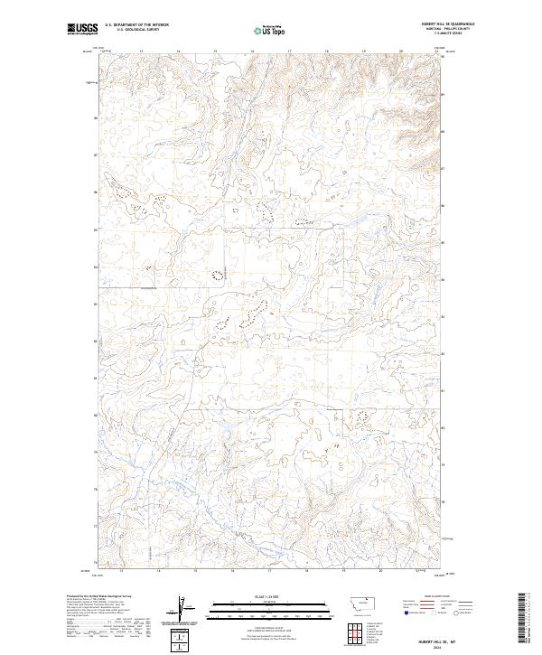
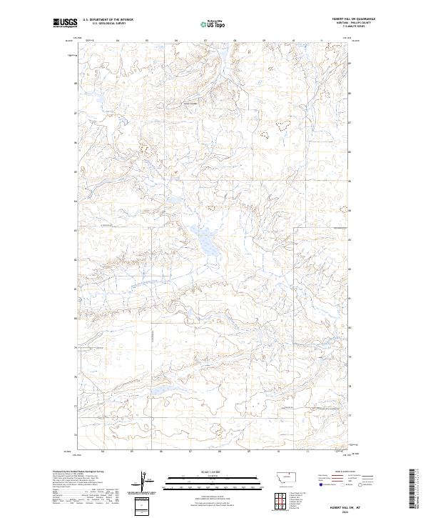
1984 Hubert Hill
Phillips County, MT
1984 Hubert Hill SE
Phillips County, MT
1984 Hubert Hill SW
Phillips County, MT
1984 Johnson Dam
Phillips County, MT
1984 Lake Bowdoin
Phillips County, MT
1984 Loring NW
Phillips County, MT
1984 Loring
Phillips County, MT
1984 Lovejoy
Phillips County, MT
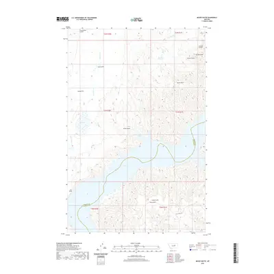
1984 Martin Lake
Phillips County, MT
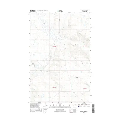
1984 Mitchell Corner
Phillips County, MT
1984 Morgan
Phillips County, MT
1984 Pea Lake
Phillips County, MT
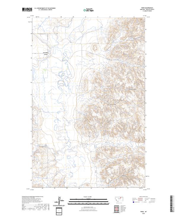
1984 Pinks
Phillips County, MT
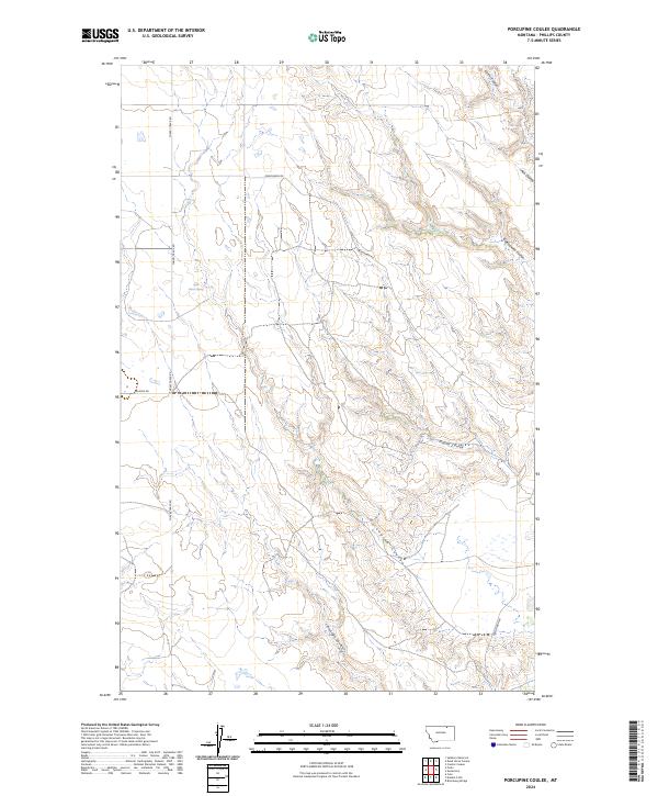
1984 Porcupine Coulee
Phillips County, MT
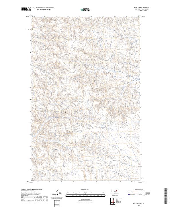
1984 Regal Coulee
Phillips County, MT
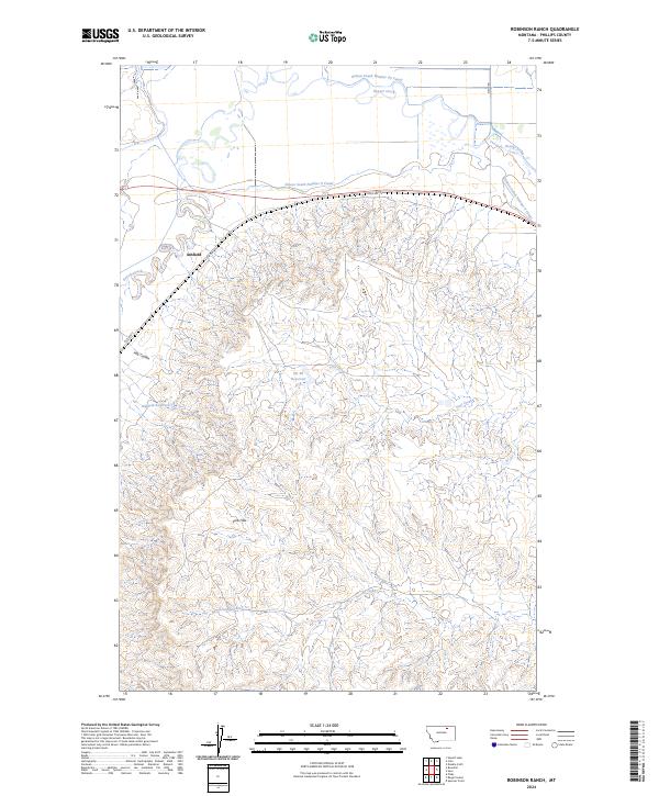
1984 Robinson Ranch
Phillips County, MT
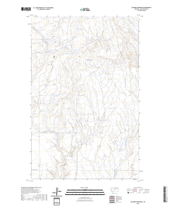
1984 Salsbery Reservoir
Phillips County, MT
1984 Spencer Point
Phillips County, MT
1984 Sunny Slope School
Phillips County, MT

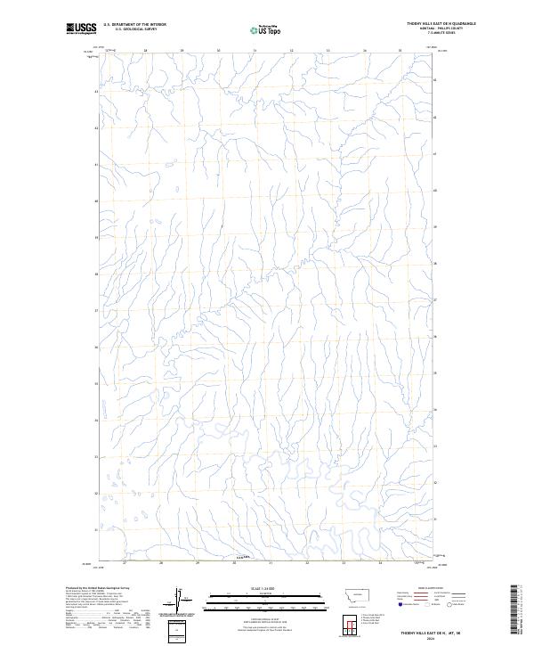
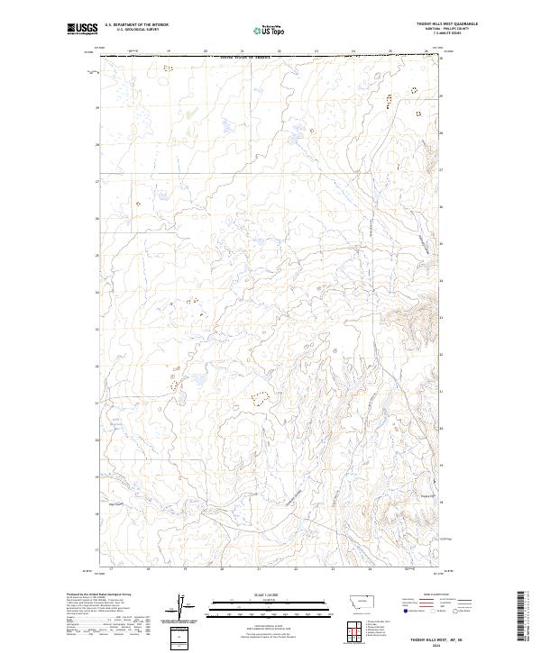
1984 Thoeny Hills East
Phillips County, MT
1984 Thoeny Hills West
Phillips County, MT
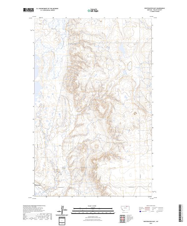
1984 Whitewater East
Phillips County, MT
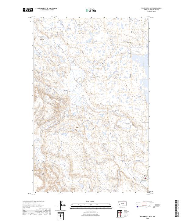
1984 Whitewater West
Phillips County, MT
2011 Austin Coulee
Phillips County, MT
2011 Austin Lake
Phillips County, MT
2011 Ball Coulee
Phillips County, MT
2011 Barber Coulee
Phillips County, MT
2011 Bear Mountain
Phillips County, MT
2011 Bell Ridge East
Phillips County, MT
2011 Bell Ridge West
Phillips County, MT
2011 Bennett Lake NW
Phillips County, MT
2011 Bennett Lake
Phillips County, MT
2011 Big Flat East
Phillips County, MT
2011 Bison Bone Reservoir
Phillips County, MT
2011 Blizzard Reservoir
Phillips County, MT
2011 Bowdoin
Phillips County, MT
2011 Buckley Lake
Phillips County, MT
2011 Button Butte
Phillips County, MT
2011 Chapman NW
Phillips County, MT
2011 Chapman
Phillips County, MT
2011 Clanton Coulee
Phillips County, MT
2011 Coal Mine Hill
Phillips County, MT
2011 Coburg SE
Phillips County, MT
2011 Coburn Butte
Phillips County, MT
2011 Cole
Phillips County, MT
2011 Content NW
Phillips County, MT
2011 Content
Phillips County, MT
2011 Cow Creek
Phillips County, MT
2011 Dead Horse Coulee
Phillips County, MT
2011 Dione Reservoir
Phillips County, MT
2011 Dodson Dam
Phillips County, MT
2011 Dodson NE
Phillips County, MT
2011 Double S Hill
Phillips County, MT
2011 Down Reservoir NE
Phillips County, MT
2011 Down Reservoir
Phillips County, MT
2011 Dry Fork Ridge
Phillips County, MT
2011 D Y Junction
Phillips County, MT
2011 Emerick Bench
Phillips County, MT
2011 Emond Ranch
Phillips County, MT
2011 Ester Lake
Phillips County, MT
2011 Fanny Hill
Phillips County, MT
2011 Forks
Phillips County, MT
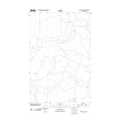
2011 Garland Creek
Phillips County, MT
2011 Gustin Coulee
Phillips County, MT
2011 Harb
Phillips County, MT
2011 Harb SW
Phillips County, MT
2011 Hays SE
Phillips County, MT
2011 Herman Point
Phillips County, MT
2011 Hewitt Lake
Phillips County, MT
2011 Hewitt Lake SW
Phillips County, MT
2011 Holzhey Reservoir
Phillips County, MT
2011 Horse Pasture Coulee
Phillips County, MT
2011 Horseshoe Lake
Phillips County, MT
2011 Hubert Hill
Phillips County, MT
2011 Hubert Hill SE
Phillips County, MT
2011 Hubert Hill SW
Phillips County, MT
2011 Indian Lake
Phillips County, MT
2011 Johnson Dam
Phillips County, MT
2011 Karsten Coulee
Phillips County, MT
2011 Lake Bowdoin
Phillips County, MT
2011 Lake Reservoir
Phillips County, MT
2011 Locke Ranch
Phillips County, MT
2011 Loring NW
Phillips County, MT
2011 Loring
Phillips County, MT
2011 Lovejoy
Phillips County, MT
2011 Malta East
Phillips County, MT
2011 Malta NE
Phillips County, MT
2011 Malta NW
Phillips County, MT
2011 Malta West
Phillips County, MT
2011 Martin Lake
Phillips County, MT
2011 Mickey Butte
Phillips County, MT
2011 Mitchell Corner
Phillips County, MT
2011 Morgan
Phillips County, MT
2011 Pea Lake
Phillips County, MT
2011 Pea Ridge
Phillips County, MT
2011 Phillips
Phillips County, MT
2011 Pinks
Phillips County, MT
2011 Porcupine Coulee
Phillips County, MT
2011 Regal Coulee
Phillips County, MT
2011 Robinson Ranch
Phillips County, MT
2011 Robinson School
Phillips County, MT
2011 Sagebrush Reservoir
Phillips County, MT
2011 Salsbery Reservoir
Phillips County, MT
2011 Schuyler Butte
Phillips County, MT
2011 Seymour Reservoir
Phillips County, MT
2011 Sheep Coulee
Phillips County, MT
2011 Shetland Divide
Phillips County, MT
2011 Spencer Point
Phillips County, MT
2011 Stratton Reservoir
Phillips County, MT
2011 Sunny Slope School
Phillips County, MT
2011 Sun Prairie
Phillips County, MT
2011 Swede Ridge
Phillips County, MT
2011 Tattnall
Phillips County, MT
2011 Thoeny Hills East
Phillips County, MT
2011 Thoeny Hills West
Phillips County, MT
2011 Veseth Reservoir
Phillips County, MT
2011 Wagner
Phillips County, MT
2011 West Alkali Reservoir
Phillips County, MT
2011 Whiskey Coulee
Phillips County, MT
2011 Whitcomb Lake
Phillips County, MT
2011 White Horse Coulee
Phillips County, MT
2011 Whitewater East
Phillips County, MT
2011 Whitewater West
Phillips County, MT
2011 Wild Horse Reservoir
Phillips County, MT

2014 Austin Coulee
Phillips County, MT
2014 Austin Lake
Phillips County, MT
2014 Ball Coulee
Phillips County, MT

2014 Barber Coulee
Phillips County, MT
2014 Bear Mountain
Phillips County, MT
2014 Bell Ridge East
Phillips County, MT
2014 Bell Ridge West
Phillips County, MT
2014 Bennett Lake NW
Phillips County, MT
2014 Bennett Lake
Phillips County, MT
2014 Big Flat East
Phillips County, MT
2014 Bison Bone Reservoir
Phillips County, MT
2014 Blizzard Reservoir
Phillips County, MT
2014 Bowdoin
Phillips County, MT
2014 Buckley Lake
Phillips County, MT
2014 Button Butte
Phillips County, MT
2014 Chapman NW
Phillips County, MT
2014 Chapman
Phillips County, MT
2014 Clanton Coulee
Phillips County, MT
2014 Coal Mine Hill
Phillips County, MT
2014 Coburg SE
Phillips County, MT
2014 Coburn Butte
Phillips County, MT
2014 Cole
Phillips County, MT
2014 Content NW
Phillips County, MT
2014 Content
Phillips County, MT
2014 Cow Creek
Phillips County, MT
2014 Crow Creek Dam OE N
Phillips County, MT

2014 Dead Horse Coulee
Phillips County, MT
2014 Dione Reservoir
Phillips County, MT
2014 Dodson Dam
Phillips County, MT
2014 Dodson NE
Phillips County, MT
2014 Double S Hill
Phillips County, MT
2014 Down Reservoir NE
Phillips County, MT
2014 Down Reservoir
Phillips County, MT
2014 Dry Fork Ridge
Phillips County, MT
2014 D Y Junction
Phillips County, MT
2014 Emerick Bench
Phillips County, MT
2014 Emond Ranch
Phillips County, MT
2014 Ester Lake
Phillips County, MT
2014 Fanny Hill
Phillips County, MT
2014 Forks
Phillips County, MT
2014 Garland Creek
Phillips County, MT
2014 Gustin Coulee
Phillips County, MT
2014 Harb
Phillips County, MT

2014 Harb SW
Phillips County, MT
2014 Hays SE
Phillips County, MT
2014 Herman Point
Phillips County, MT
2014 Hewitt Lake
Phillips County, MT
2014 Hewitt Lake SW
Phillips County, MT
2014 Holzhey Reservoir
Phillips County, MT
2014 Horse Pasture Coulee
Phillips County, MT
2014 Horseshoe Lake
Phillips County, MT
2014 Hubert Hill
Phillips County, MT
2014 Hubert Hill SE
Phillips County, MT
2014 Hubert Hill SW
Phillips County, MT
2014 Indian Lake
Phillips County, MT
2014 Johnson Dam
Phillips County, MT
2014 Karsten Coulee
Phillips County, MT
2014 Lake Bowdoin
Phillips County, MT
2014 Lake Reservoir
Phillips County, MT
2014 Locke Ranch
Phillips County, MT
2014 Loring NW
Phillips County, MT
2014 Loring
Phillips County, MT
2014 Lovejoy
Phillips County, MT
2014 Malta East
Phillips County, MT
2014 Malta NE
Phillips County, MT
2014 Malta NW
Phillips County, MT
2014 Malta West
Phillips County, MT
2014 Martin Lake
Phillips County, MT
2014 Mickey Butte
Phillips County, MT
2014 Mitchell Corner
Phillips County, MT
2014 Morgan
Phillips County, MT
2014 Pea Lake
Phillips County, MT
2014 Pea Ridge
Phillips County, MT
2014 Phillips
Phillips County, MT
2014 Pinks
Phillips County, MT
2014 Porcupine Coulee
Phillips County, MT
2014 Regal Coulee
Phillips County, MT
2014 Robinson Ranch
Phillips County, MT
2014 Robinson School
Phillips County, MT
2014 Sagebrush Reservoir
Phillips County, MT
2014 Salsbery Reservoir
Phillips County, MT

2014 Schuyler Butte
Phillips County, MT
2014 Seymour Reservoir
Phillips County, MT
2014 Sheep Coulee
Phillips County, MT
2014 Shetland Divide
Phillips County, MT
2014 Spencer Point
Phillips County, MT
2014 Stratton Reservoir
Phillips County, MT
2014 Sunny Slope School
Phillips County, MT
2014 Sun Prairie
Phillips County, MT
2014 Swede Ridge
Phillips County, MT
2014 Tattnall
Phillips County, MT
2014 Thoeny Hills East OE N
Phillips County, MT
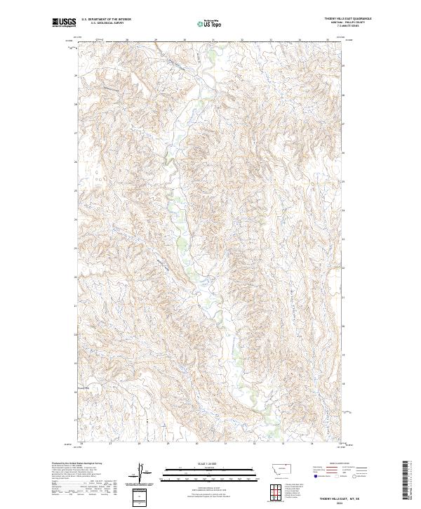
2014 Thoeny Hills East
Phillips County, MT
2014 Thoeny Hills West
Phillips County, MT
2014 Veseth Reservoir
Phillips County, MT
2014 Wagner
Phillips County, MT
2014 West Alkali Reservoir
Phillips County, MT
2014 Whiskey Coulee
Phillips County, MT
2014 Whitcomb Lake
Phillips County, MT
2014 White Horse Coulee
Phillips County, MT
2014 Whitewater East
Phillips County, MT

2014 Whitewater West
Phillips County, MT
2014 Wild Horse Reservoir
Phillips County, MT
2017 Austin Coulee
Phillips County, MT
2017 Austin Lake
Phillips County, MT
2017 Ball Coulee
Phillips County, MT
2017 Barber Coulee
Phillips County, MT
2017 Bear Mountain
Phillips County, MT
2017 Bell Ridge East
Phillips County, MT
2017 Bell Ridge West
Phillips County, MT
2017 Bennett Lake NW
Phillips County, MT
2017 Bennett Lake
Phillips County, MT
2017 Big Flat East
Phillips County, MT

2017 Bison Bone Reservoir
Phillips County, MT
2017 Blizzard Reservoir
Phillips County, MT
2017 Bowdoin
Phillips County, MT
2017 Buckley Lake
Phillips County, MT
2017 Button Butte
Phillips County, MT
2017 Chapman NW
Phillips County, MT
2017 Chapman
Phillips County, MT
2017 Clanton Coulee
Phillips County, MT
2017 Coal Mine Hill
Phillips County, MT
2017 Coburg SE
Phillips County, MT
2017 Coburn Butte
Phillips County, MT
2017 Cole
Phillips County, MT
2017 Content NW
Phillips County, MT
2017 Content
Phillips County, MT
2017 Cow Creek
Phillips County, MT
2017 Crow Creek Dam OE N
Phillips County, MT
2017 Dead Horse Coulee
Phillips County, MT
2017 Dione Reservoir
Phillips County, MT
2017 Dodson Dam
Phillips County, MT
2017 Dodson NE
Phillips County, MT
2017 Double S Hill
Phillips County, MT
2017 Down Reservoir NE
Phillips County, MT
2017 Down Reservoir
Phillips County, MT
2017 Dry Fork Ridge
Phillips County, MT
2017 D Y Junction
Phillips County, MT
2017 Emerick Bench
Phillips County, MT
2017 Emond Ranch
Phillips County, MT
2017 Ester Lake
Phillips County, MT
2017 Fanny Hill
Phillips County, MT
2017 Forks
Phillips County, MT
2017 Garland Creek
Phillips County, MT
2017 Gustin Coulee
Phillips County, MT
2017 Harb
Phillips County, MT
2017 Harb SW
Phillips County, MT
2017 Hays SE
Phillips County, MT
2017 Herman Point
Phillips County, MT
2017 Hewitt Lake
Phillips County, MT
2017 Hewitt Lake SW
Phillips County, MT
2017 Holzhey Reservoir
Phillips County, MT
2017 Horse Pasture Coulee
Phillips County, MT
2017 Horseshoe Lake
Phillips County, MT
2017 Hubert Hill
Phillips County, MT
2017 Hubert Hill SE
Phillips County, MT
2017 Hubert Hill SW
Phillips County, MT
2017 Indian Lake
Phillips County, MT
2017 Johnson Dam
Phillips County, MT
2017 Karsten Coulee
Phillips County, MT
2017 Lake Bowdoin
Phillips County, MT
2017 Lake Reservoir
Phillips County, MT
2017 Locke Ranch
Phillips County, MT
2017 Loring NW
Phillips County, MT
2017 Loring
Phillips County, MT
2017 Lovejoy
Phillips County, MT
2017 Malta East
Phillips County, MT
2017 Malta NE
Phillips County, MT
2017 Malta NW
Phillips County, MT
2017 Malta West
Phillips County, MT
2017 Martin Lake
Phillips County, MT
2017 Mickey Butte
Phillips County, MT
2017 Mitchell Corner
Phillips County, MT
2017 Morgan
Phillips County, MT
2017 Pea Lake
Phillips County, MT
2017 Pea Ridge
Phillips County, MT
2017 Phillips
Phillips County, MT
2017 Pinks
Phillips County, MT
2017 Porcupine Coulee
Phillips County, MT
2017 Regal Coulee
Phillips County, MT
2017 Robinson Ranch
Phillips County, MT
2017 Robinson School
Phillips County, MT
2017 Sagebrush Reservoir
Phillips County, MT
2017 Salsbery Reservoir
Phillips County, MT
2017 Schuyler Butte
Phillips County, MT
2017 Seymour Reservoir
Phillips County, MT
2017 Sheep Coulee
Phillips County, MT
2017 Shetland Divide
Phillips County, MT
2017 Spencer Point
Phillips County, MT
2017 Stratton Reservoir
Phillips County, MT
2017 Sunny Slope School
Phillips County, MT
2017 Sun Prairie
Phillips County, MT
2017 Swede Ridge
Phillips County, MT

2017 Tattnall
Phillips County, MT
2017 Thoeny Hills East OE N
Phillips County, MT
2017 Thoeny Hills East
Phillips County, MT
2017 Thoeny Hills West
Phillips County, MT
2017 Veseth Reservoir
Phillips County, MT
2017 Wagner
Phillips County, MT
2017 West Alkali Reservoir
Phillips County, MT

2017 Whiskey Coulee
Phillips County, MT
2017 Whitcomb Lake
Phillips County, MT
2017 White Horse Coulee
Phillips County, MT
2017 Whitewater East
Phillips County, MT
2017 Whitewater West
Phillips County, MT
2017 Wild Horse Reservoir
Phillips County, MT
2020 Austin Coulee
Phillips County, MT
2020 Austin Lake
Phillips County, MT
2020 Ball Coulee
Phillips County, MT
2020 Barber Coulee
Phillips County, MT
2020 Bear Mountain
Phillips County, MT
2020 Bell Ridge East
Phillips County, MT
2020 Bell Ridge West
Phillips County, MT
2020 Bennett Lake NW
Phillips County, MT
2020 Bennett Lake
Phillips County, MT
2020 Big Flat East
Phillips County, MT
2020 Bison Bone Reservoir
Phillips County, MT
2020 Blizzard Reservoir
Phillips County, MT
2020 Bowdoin
Phillips County, MT
2020 Buckley Lake
Phillips County, MT
2020 Button Butte
Phillips County, MT
2020 Chapman NW
Phillips County, MT
2020 Chapman
Phillips County, MT
2020 Clanton Coulee
Phillips County, MT
2020 Coal Mine Hill
Phillips County, MT
2020 Coburg SE
Phillips County, MT
2020 Coburn Butte
Phillips County, MT
2020 Cole
Phillips County, MT
2020 Content NW
Phillips County, MT
2020 Content
Phillips County, MT
2020 Cow Creek
Phillips County, MT
2020 Crow Creek Dam OE N
Phillips County, MT
2020 Dead Horse Coulee
Phillips County, MT
2020 Dione Reservoir
Phillips County, MT
2020 Dodson Dam
Phillips County, MT
2020 Dodson NE
Phillips County, MT

2020 Double S Hill
Phillips County, MT
2020 Down Reservoir NE
Phillips County, MT
2020 Down Reservoir
Phillips County, MT
2020 Dry Fork Ridge
Phillips County, MT
2020 D Y Junction
Phillips County, MT
2020 Emerick Bench
Phillips County, MT
2020 Emond Ranch
Phillips County, MT
2020 Ester Lake
Phillips County, MT
2020 Fanny Hill
Phillips County, MT
2020 Forks
Phillips County, MT
2020 Garland Creek
Phillips County, MT
2020 Gustin Coulee
Phillips County, MT
2020 Harb
Phillips County, MT

2020 Harb SW
Phillips County, MT
2020 Hays SE
Phillips County, MT
2020 Herman Point
Phillips County, MT
2020 Hewitt Lake
Phillips County, MT
2020 Hewitt Lake SW
Phillips County, MT
2020 Holzhey Reservoir
Phillips County, MT
2020 Horse Pasture Coulee
Phillips County, MT
2020 Horseshoe Lake
Phillips County, MT
2020 Hubert Hill
Phillips County, MT
2020 Hubert Hill SE
Phillips County, MT

2020 Hubert Hill SW
Phillips County, MT
2020 Indian Lake
Phillips County, MT
2020 Johnson Dam
Phillips County, MT
2020 Karsten Coulee
Phillips County, MT
2020 Lake Bowdoin
Phillips County, MT
2020 Lake Reservoir
Phillips County, MT
2020 Locke Ranch
Phillips County, MT
2020 Loring NW
Phillips County, MT
2020 Loring
Phillips County, MT
2020 Lovejoy
Phillips County, MT
2020 Malta East
Phillips County, MT
2020 Malta NE
Phillips County, MT
2020 Malta NW
Phillips County, MT
2020 Malta West
Phillips County, MT
2020 Martin Lake
Phillips County, MT
2020 Mickey Butte
Phillips County, MT
2020 Mitchell Corner
Phillips County, MT
2020 Morgan
Phillips County, MT
2020 Pea Lake
Phillips County, MT
2020 Pea Ridge
Phillips County, MT
2020 Phillips
Phillips County, MT
2020 Pinks
Phillips County, MT
2020 Porcupine Coulee
Phillips County, MT
2020 Regal Coulee
Phillips County, MT
2020 Robinson Ranch
Phillips County, MT
2020 Robinson School
Phillips County, MT
2020 Sagebrush Reservoir
Phillips County, MT
2020 Salsbery Reservoir
Phillips County, MT
2020 Schuyler Butte
Phillips County, MT
2020 Seymour Reservoir
Phillips County, MT
2020 Sheep Coulee
Phillips County, MT
2020 Shetland Divide
Phillips County, MT
2020 Spencer Point
Phillips County, MT
2020 Stratton Reservoir
Phillips County, MT
2020 Sunny Slope School
Phillips County, MT
2020 Sun Prairie
Phillips County, MT
2020 Swede Ridge
Phillips County, MT

2020 Tattnall
Phillips County, MT
2020 Thoeny Hills East OE N
Phillips County, MT
2020 Thoeny Hills East
Phillips County, MT
2020 Thoeny Hills West
Phillips County, MT
2020 Veseth Reservoir
Phillips County, MT
2020 Wagner
Phillips County, MT
2020 West Alkali Reservoir
Phillips County, MT
2020 Whiskey Coulee
Phillips County, MT
2020 Whitcomb Lake
Phillips County, MT
2020 White Horse Coulee
Phillips County, MT
2020 Whitewater East
Phillips County, MT
2020 Whitewater West
Phillips County, MT
2020 Wild Horse Reservoir
Phillips County, MT
2024 Austin Coulee
Phillips County, MT
2024 Austin Lake
Phillips County, MT
2024 Ball Coulee
Phillips County, MT
2024 Barber Coulee
Phillips County, MT
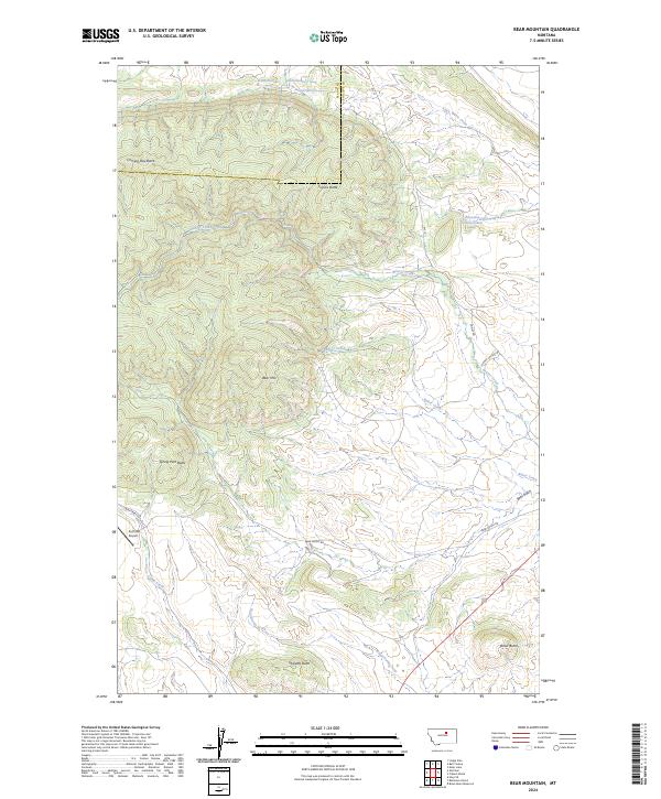
2024 Bear Mountain
Phillips County, MT
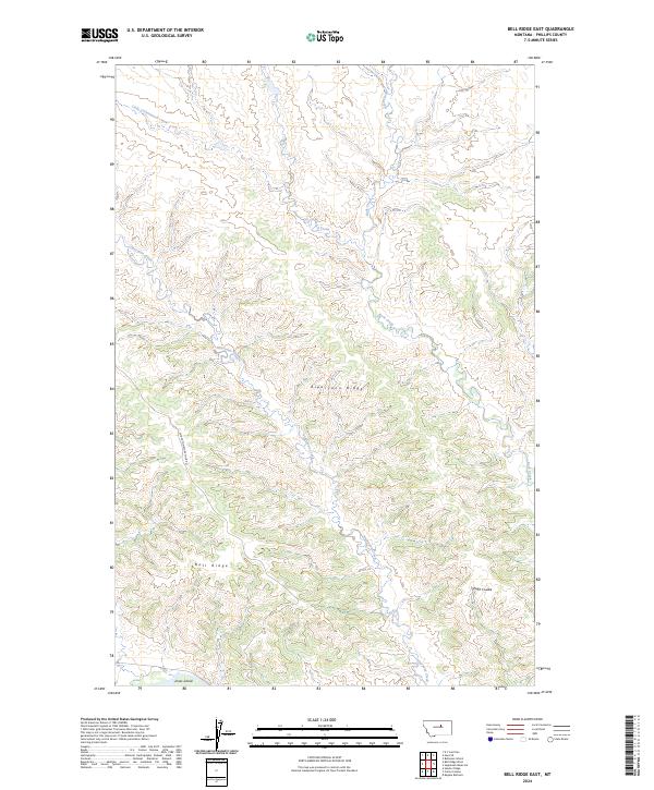
2024 Bell Ridge East
Phillips County, MT
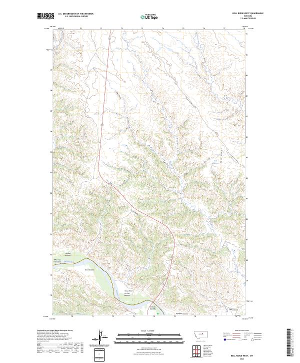
2024 Bell Ridge West
Phillips County, MT
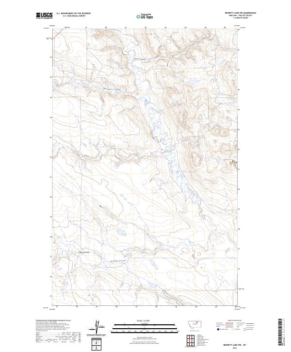
2024 Bennett Lake NW
Phillips County, MT
2024 Bennett Lake
Phillips County, MT
2024 Big Flat East
Phillips County, MT
2024 Bison Bone Reservoir
Phillips County, MT
2024 Blizzard Reservoir
Phillips County, MT
2024 Bowdoin
Phillips County, MT
2024 Buckley Lake
Phillips County, MT
2024 Button Butte
Phillips County, MT
2024 Chapman NW
Phillips County, MT
2024 Chapman
Phillips County, MT
2024 Clanton Coulee
Phillips County, MT
2024 Coal Mine Hill
Phillips County, MT
2024 Coburg SE
Phillips County, MT
2024 Coburn Butte
Phillips County, MT
2024 Cole
Phillips County, MT
2024 Content NW
Phillips County, MT
2024 Content
Phillips County, MT
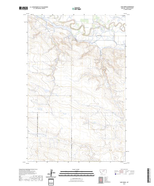
2024 Cow Creek
Phillips County, MT
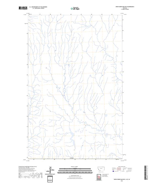
2024 Crow Creek Dam OE N
Phillips County, MT
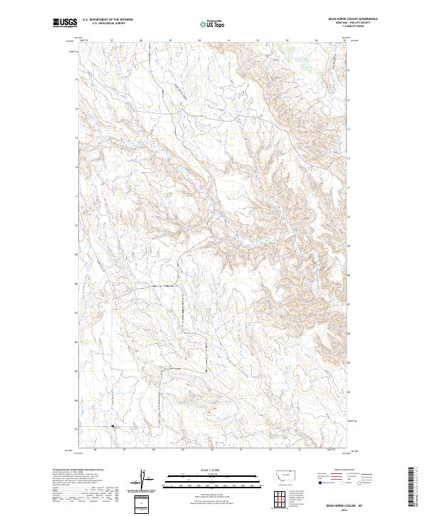
2024 Dead Horse Coulee
Phillips County, MT
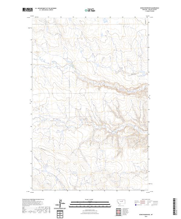
2024 Dione Reservoir
Phillips County, MT
2024 Dodson Dam
Phillips County, MT
2024 Dodson NE
Phillips County, MT
2024 Double S Hill
Phillips County, MT
2024 Down Reservoir NE
Phillips County, MT
2024 Down Reservoir
Phillips County, MT
2024 Dry Fork Ridge
Phillips County, MT
2024 D Y Junction
Phillips County, MT
2024 Emerick Bench
Phillips County, MT
2024 Emond Ranch
Phillips County, MT
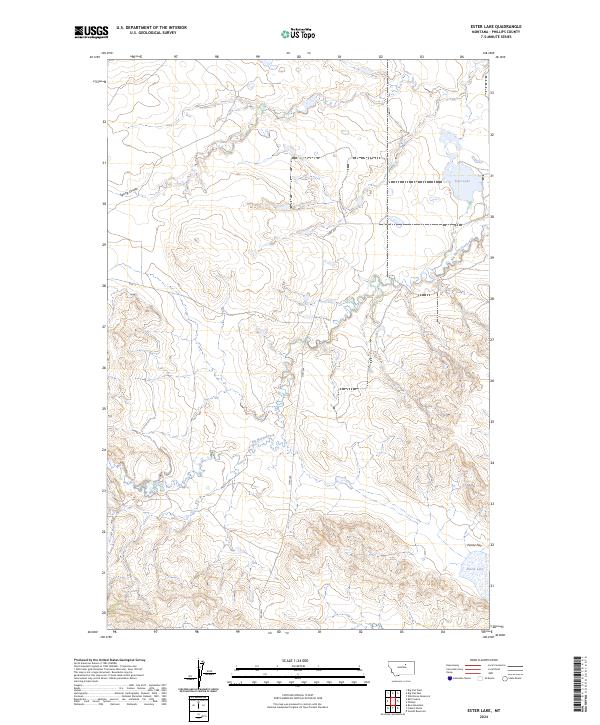
2024 Ester Lake
Phillips County, MT
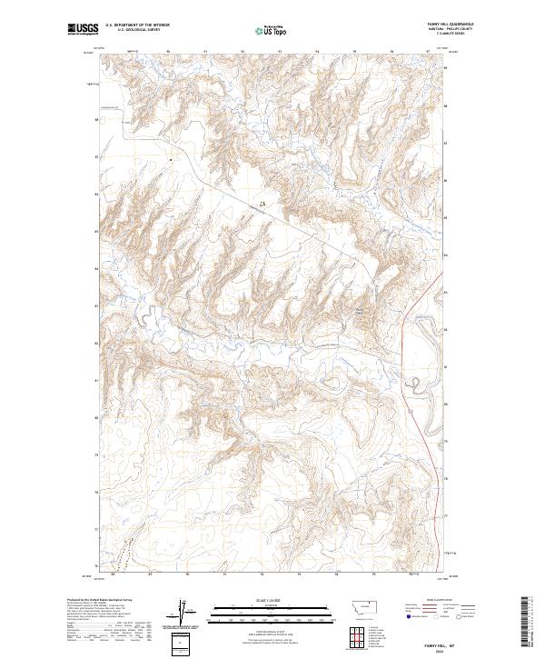
2024 Fanny Hill
Phillips County, MT
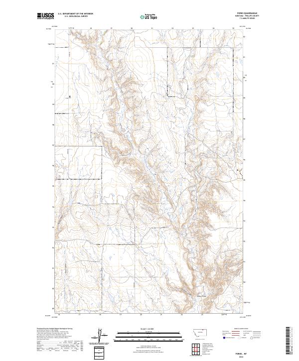
2024 Forks
Phillips County, MT
2024 Garland Creek
Phillips County, MT
2024 Gustin Coulee
Phillips County, MT
2024 Harb
Phillips County, MT
2024 Harb SW
Phillips County, MT
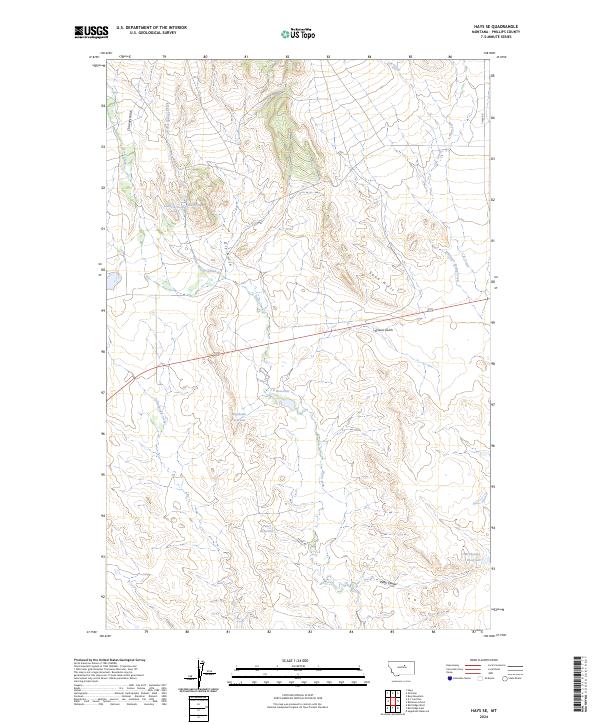
2024 Hays SE
Phillips County, MT
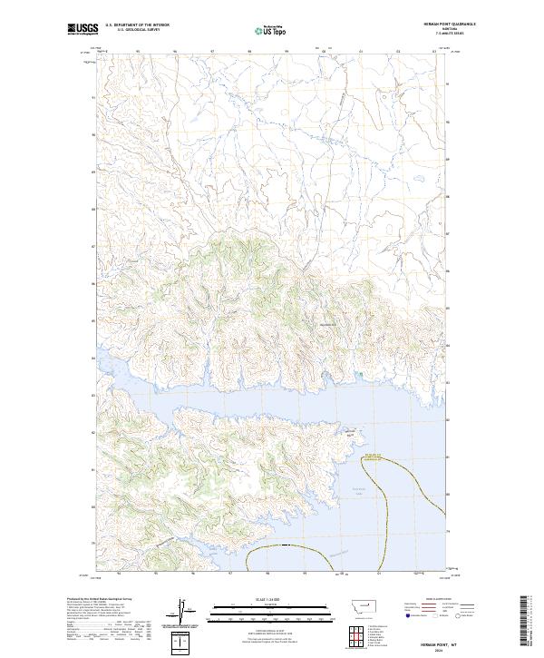
2024 Herman Point
Phillips County, MT
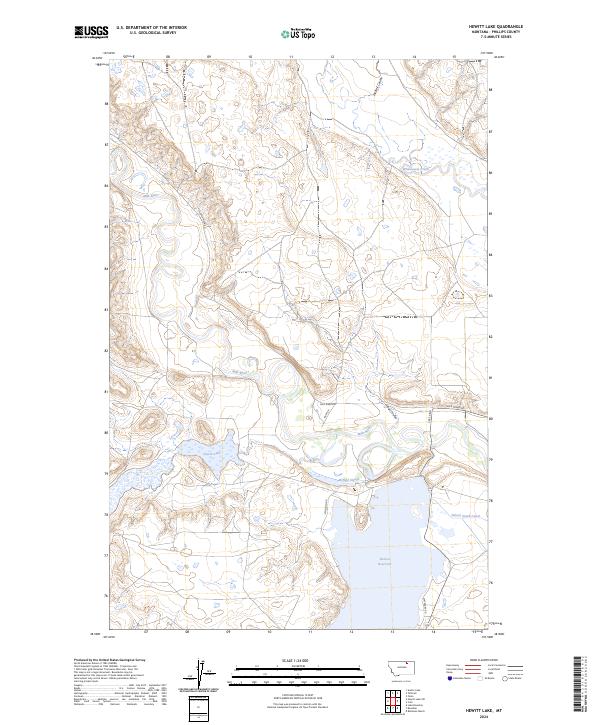
2024 Hewitt Lake
Phillips County, MT
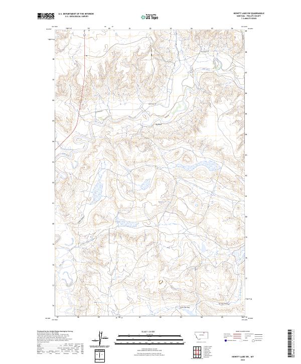
2024 Hewitt Lake SW
Phillips County, MT
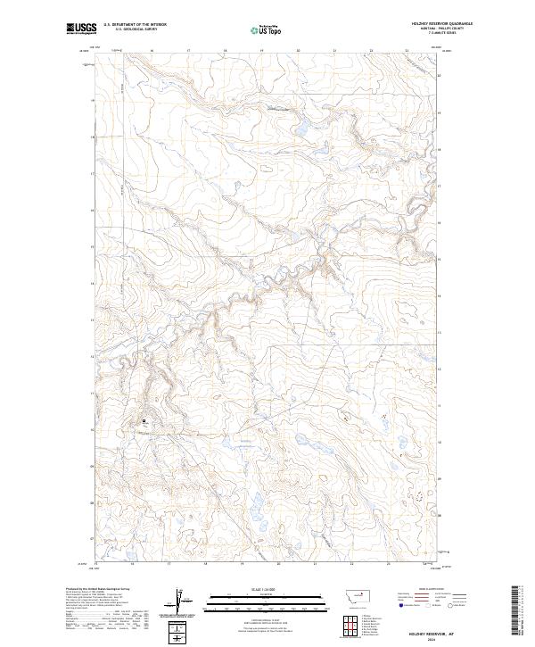
2024 Holzhey Reservoir
Phillips County, MT
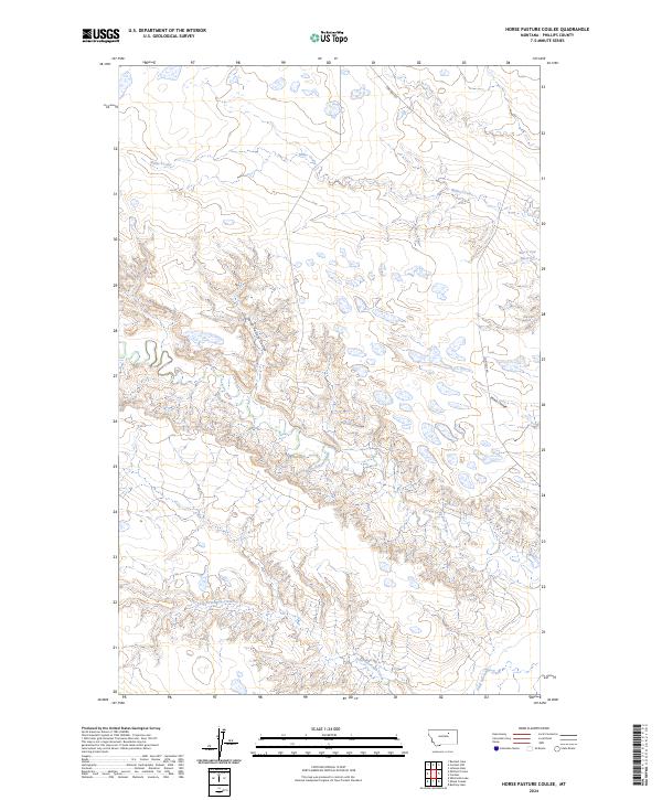
2024 Horse Pasture Coulee
Phillips County, MT
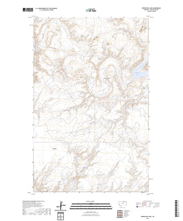
2024 Horseshoe Lake
Phillips County, MT
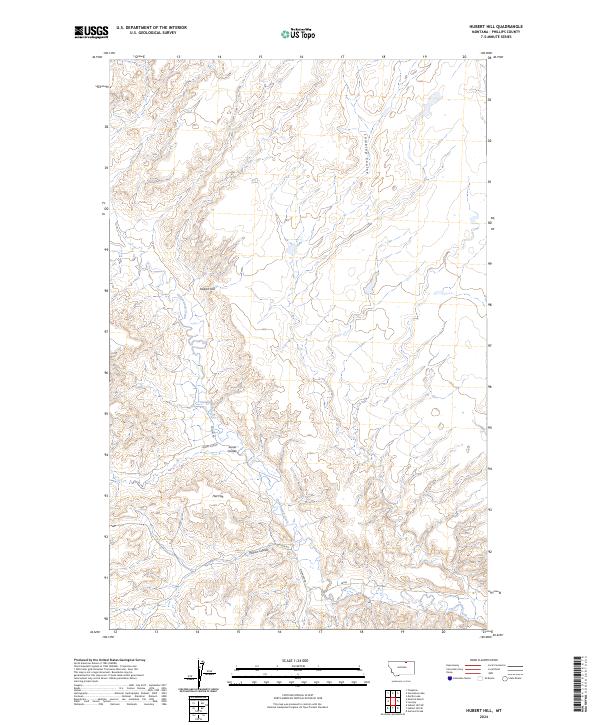
2024 Hubert Hill
Phillips County, MT
2024 Hubert Hill SE
Phillips County, MT
2024 Hubert Hill SW
Phillips County, MT
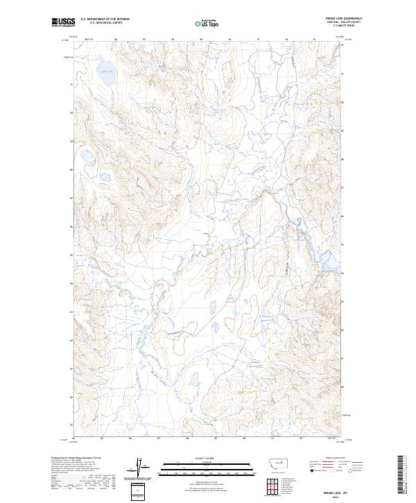
2024 Indian Lake
Phillips County, MT
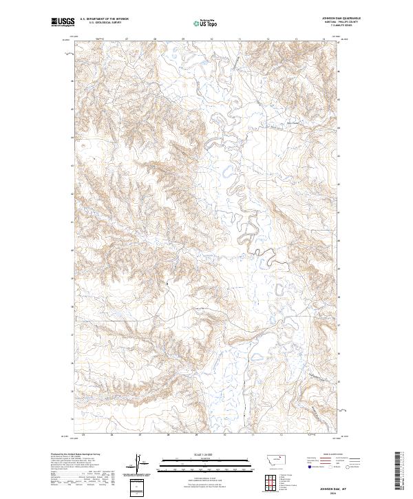
2024 Johnson Dam
Phillips County, MT
2024 Karsten Coulee
Phillips County, MT
2024 Lake Bowdoin
Phillips County, MT
2024 Lake Reservoir
Phillips County, MT
2024 Locke Ranch
Phillips County, MT
2024 Loring NW
Phillips County, MT
2024 Loring
Phillips County, MT
2024 Lovejoy
Phillips County, MT
2024 Malta East
Phillips County, MT
2024 Malta NE
Phillips County, MT
2024 Malta NW
Phillips County, MT
2024 Malta West
Phillips County, MT
2024 Martin Lake
Phillips County, MT
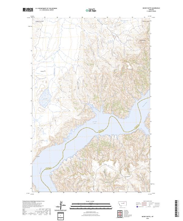
2024 Mickey Butte
Phillips County, MT
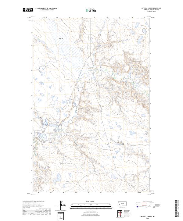
2024 Mitchell Corner
Phillips County, MT
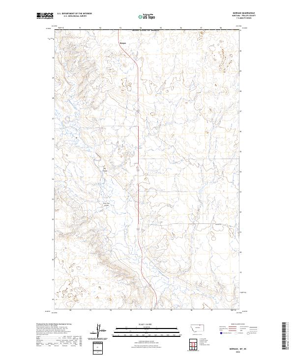
2024 Morgan
Phillips County, MT
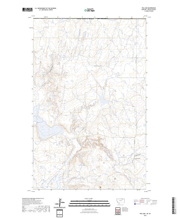
2024 Pea Lake
Phillips County, MT
2024 Pea Ridge
Phillips County, MT
2024 Phillips
Phillips County, MT
2024 Pinks
Phillips County, MT
2024 Porcupine Coulee
Phillips County, MT
2024 Regal Coulee
Phillips County, MT
2024 Robinson Ranch
Phillips County, MT
2024 Robinson School
Phillips County, MT
2024 Sagebrush Reservoir
Phillips County, MT
2024 Salsbery Reservoir
Phillips County, MT
2024 Schuyler Butte
Phillips County, MT
2024 Seymour Reservoir
Phillips County, MT
2024 Sheep Coulee
Phillips County, MT
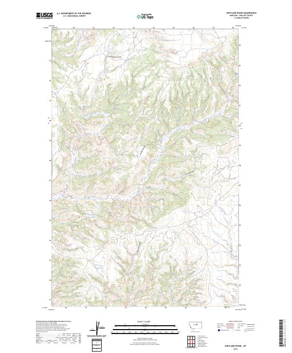
2024 Shetland Divide
Phillips County, MT
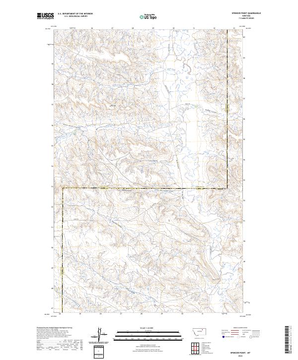
2024 Spencer Point
Phillips County, MT
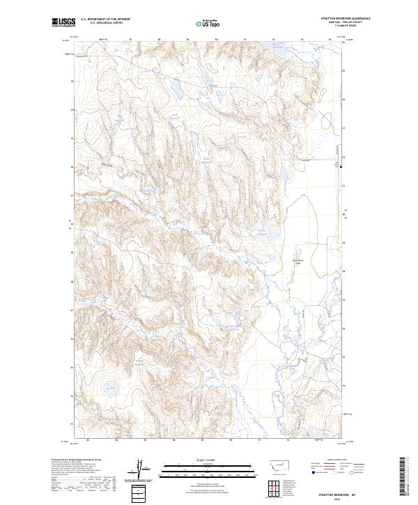
2024 Stratton Reservoir
Phillips County, MT
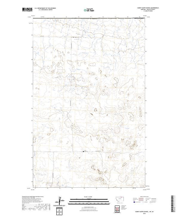
2024 Sunny Slope School
Phillips County, MT
2024 Sun Prairie
Phillips County, MT

2024 Swede Ridge
Phillips County, MT
2024 Tattnall
Phillips County, MT
2024 Thoeny Hills East OE N
Phillips County, MT
2024 Thoeny Hills East
Phillips County, MT
2024 Thoeny Hills West
Phillips County, MT
2024 Veseth Reservoir
Phillips County, MT
2024 Wagner
Phillips County, MT
2024 West Alkali Reservoir
Phillips County, MT
2024 Whiskey Coulee
Phillips County, MT
2024 Whitcomb Lake
Phillips County, MT
2024 White Horse Coulee
Phillips County, MT
2024 Whitewater East
Phillips County, MT
2024 Whitewater West
Phillips County, MT
2024 Wild Horse Reservoir
Phillips County, MT