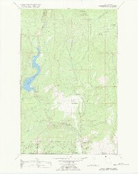
1989 Map of Hubbart Reservoir
USGS Topo · Published 1989About this map
The Little Bitterroot River winds through this mountainous section of the Flathead Indian Reservation in Northwest Montana, feeding into the prominent Hubbart Reservoir. This 1989 compilation, based on mid-century surveys and updated via 1970s aerial photography, reveals a landscape primarily dedicated to resource management and conservation. The reservoir is controlled by a Spillway at its southern end, while the surrounding high ground is dominated by the Flathead Nat For. Human activity is concentrated around infrastructure like the Hubbard Lookout and the Flathead Sunset Quarry, which indicates a history of active land use within the reservation and national forest boundaries. Settlement is sparse, represented by Conrad Camp on the river's upper reaches, while a dense network of forest service roads like L-6200 and L-6000 provides access through the drainage basins of Briggs Creek and Tamarack Creek.
Find a feature on this map
35 named features on this map. Tap any name to fly to it.
Don’t see what you’re looking for? This feature index may not catch every label — zoom into the map to look around manually.
Map Details
Editions of this 1989 Hubbart Reservoir Map
This is the sole edition of this map. No revisions or reprints were ever made.
Other maps of this area

1956 · Wallace
USGS Topo · 1:250,000

1957 · Kalispell
USGS Topo · 1:250,000

1960 · Kalispell
USGS Topo · 1:250,000

1960 · Wallace
USGS Topo · 1:250,000

1961 · Kalispell
USGS Topo · 1:250,000
1964 · Haskill Mountain
USGS Topo · 1:24,000

1964 · Mill Pocket Creek
USGS Topo · 1:24,000
1964 · Kofford Ridge
USGS Topo · 1:24,000

1964 · Hubbart Reservoir
USGS Topo · 1:24,000

1964 · Murr Peak
USGS Topo · 1:24,000