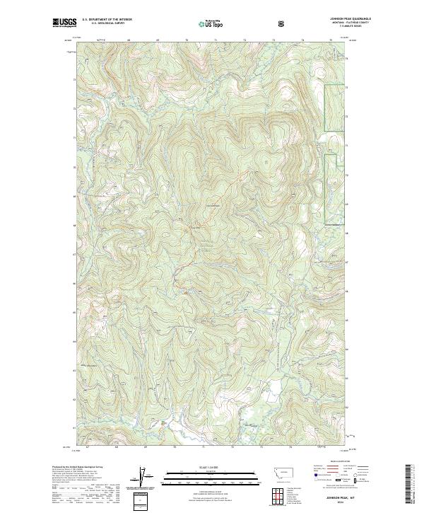
2024 Map of Johnson Peak
USGS Topo · Published 2024About this map
Johnson Peak stands as the central landmark of this terrain within the Flathead National Forest, marking the high ground of the Salish Mountains. This modern topographic study reveals a landscape defined by its drainages, where Good Creek and Sanko Creek carve routes through the timbered slopes. The presence of Star Meadow in the southern reaches of the sheet, served by Star Meadow Rd and the Star Meadow Trl, suggests a rare opening of level ground amidst the steep contours. A network of forest development roads, including the Sanko Creek Rd and Gregg Creek Rd, traces the history of resource management and back-country access. In the northeast, Shorts Meadow and the headwaters of Evers Creek provide further evidence of the diverse alpine meadow and riparian ecosystems that characterize this portion of Montana.
Find a feature on this map
49 named features on this map. Tap any name to fly to it.
Don’t see what you’re looking for? This feature index may not catch every label — zoom into the map to look around manually.
Map Details
Editions of this 2024 Johnson Peak Map
This is the sole edition of this map. No revisions or reprints were ever made.
Other maps of this area

1913 · Stryker
USGS Topo · 1:125,000

1916 · Stryker
USGS Topo · 1:125,000

1957 · Kalispell
USGS Topo · 1:250,000

1960 · Kalispell
USGS Topo · 1:250,000

1961 · Kalispell
USGS Topo · 1:250,000

1962 · Johnson Peak
USGS Topo · 1:24,000

1962 · Lost Creek Divide
USGS Topo · 1:24,000

1962 · Ashley Mountain
USGS Topo · 1:24,000
1962 · Tally Lake
USGS Topo · 1:24,000

1963 · Sylvia Lake
USGS Topo · 1:24,000