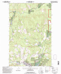
1994 Map of Johnson Peak
USGS Topo · Published 1997About this map
Johnson Peak anchors this corner of the Flathead National Forest, where a dense network of mountain drainages feeds the regional timber and water resources. The terrain is defined by prominent landmarks like Trixie Pass and Swaney Ridge, which separate various creek systems including Good Creek, Sinclair Creek, and Swanson Creek. This 1994 update, revised from earlier 1956 and 1991 aerial photography, reflects the Forest Service's management of the area, notably at the Star Meadow Guard Station. While largely undeveloped forest, small industrial markers like a Gravel Pit and a designated Mine near East Sanko Creek point to localized resource extraction. The map also captures several grassy openings in the timber, such as Shorts Meadow along the North Fork Evers Creek.
Find a feature on this map
28 named features on this map. Tap any name to fly to it.
Don’t see what you’re looking for? This feature index may not catch every label — zoom into the map to look around manually.
Map Details
Editions of this 1994 Johnson Peak Map
This is the sole edition of this map. No revisions or reprints were ever made.
Other maps of this area

1913 · Stryker
USGS Topo · 1:125,000

1916 · Stryker
USGS Topo · 1:125,000

1957 · Kalispell
USGS Topo · 1:250,000

1960 · Kalispell
USGS Topo · 1:250,000

1961 · Kalispell
USGS Topo · 1:250,000

1962 · Johnson Peak
USGS Topo · 1:24,000

1962 · Lost Creek Divide
USGS Topo · 1:24,000

1962 · Ashley Mountain
USGS Topo · 1:24,000
1962 · Tally Lake
USGS Topo · 1:24,000

1963 · Sylvia Lake
USGS Topo · 1:24,000