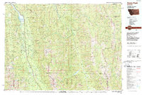
1988 Map of Swan Peak
USGS Topo · Published 1989About this map
The Swan Range and Mission Range dominate this landscape, framing the narrow valley where the Swan River flows north toward Swan Lake. Mapping by the U.S. Geological Survey in the late 1980s reveals a region defined by its protected lands, including the vast Bob Marshall Wilderness and the Swan River State Forest. The settlement at Condon serves as a primary waypoint along the river corridor, while the Swan River National Wildlife Refuge preserves the marshlands at the southern tip of the lake. Evidence of remote access is found at the Spotted Bear Airport and the Meadow Creek Landing Strip, essential for managing the surrounding Flathead National Forest. This era of the survey highlights the intricate drainage systems feeding into the South Fork Flathead River, showing the importance of timber and conservation management in western Montana.
Find a feature on this map
181 named features on this map. Tap any name to fly to it.
Don’t see what you’re looking for? This feature index may not catch every label — zoom into the map to look around manually.
Map Details
Editions of this 1988 Swan Peak Map
This is the sole edition of this map. No revisions or reprints were ever made.
Other maps of this area

1902 · Ovando
USGS Topo · 1:125,000

1903 · Saypo
USGS Topo · 1:125,000

1903 · Coopers Lake
USGS Topo · 1:125,000

1905 · Ovando
USGS Topo · 1:125,000

1913 · Marias Pass
USGS Topo · 1:125,000

1914 · Nyack
USGS Topo · 1:125,000

1914 · Heart Butte
USGS Topo · 1:125,000

1918 · Heart Butte
USGS Topo · 1:125,000

1920 · Flathead Lake
USGS Topo · 1:125,000

1921 · Elbow Lake
USGS Topo · 1:125,000