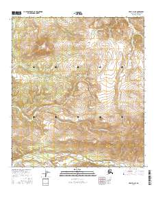
2016 Map of Healy D-4 NE
USGS Topo · Published 2016About this map
Jumbo Dome serves as the dominant landmark in this interior Alaskan landscape, anchoring a terrain defined by a dense network of high-elevation drainages. Flowing from the south, Healy Creek and its many tributaries, including Coal Creek and Cripple Creek, create a complex hydrographic pattern typical of the coal-bearing formations found in this part of the Denali region. To the north, the Totatlanika River and Ptarmigan Creek drain away from the prominent slopes surrounding Ptarmigan Lake. The abundance of creek names like Lignite Creek and Sanderson Creek underscores the region's geological significance and the historical interest in its mineral-rich valleys. This 2016 survey provides a precise view of the watersheds and topographic relief before they transition into the broader Tanana Valley to the north.
Find a feature on this map
23 named features on this map. Tap any name to fly to it.
Don’t see what you’re looking for? This feature index may not catch every label — zoom into the map to look around manually.
Map Details
Editions of this 2016 Healy D-4 NE Map
This is the sole edition of this map. No revisions or reprints were ever made.
Other maps of this area

1950 · Fairbanks
USGS Topo · 1:250,000

1950 · Healy D-4
USGS Topo · 1:63,360

1950 · Fairbanks A-4
USGS Topo · 1:63,360

1950 · Fairbanks A-3
USGS Topo · 1:63,360

1950 · Healy D-3
USGS Topo · 1:63,360

1951 · Healy
USGS Topo · 1:250,000

1951 · Fairbanks
USGS Topo · 1:250,000
1952 · Fairbanks A-4
USGS Topo · 1:63,360
1952 · Healy D-3
USGS Topo · 1:63,360
1952 · Fairbanks A-3
USGS Topo · 1:63,360