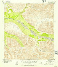
1952 Map of Healy C-3
USGS Topo · Published 1954About this map
The Yanert Fork river valley dominates this mid-century survey of the Alaska Range, showing a wilderness landscape defined by glacial drainage and dramatic elevation changes. Based on aerial photography from 1949, the map documents the complex network of tributaries that feed the main fork, including Dean Creek to the north and the braided path of Moose Creek to the south. The absence of roads or permanent structures in this 1952 edition underscores the isolation of the territory prior to significant modern development. Named water features like Grizzly Creek, Dick Creek, and Louis Creek serve as the primary landmarks for navigating the high-relief terrain, where contour lines reveal the steep ridges and deep basins characteristic of the region's interior.
Find a feature on this map
9 named features on this map. Tap any name to fly to it.
Don’t see what you’re looking for? This feature index may not catch every label — zoom into the map to look around manually.
Map Details
Editions of this 1952 Healy C-3 Map
2 editions found
Other maps of this area

1949 · Healy B-4
USGS Topo · 1:63,360

1949 · Healy C-3
USGS Topo · 1:63,360

1949 · Healy B-2
USGS Topo · 1:63,360

1950 · Healy D-4
USGS Topo · 1:63,360

1950 · Healy C-4
USGS Topo · 1:63,360

1950 · Healy B-3
USGS Topo · 1:63,360

1950 · Healy D-3
USGS Topo · 1:63,360

1951 · Healy
USGS Topo · 1:250,000

1951 · Healy B-4
USGS Topo · 1:63,360

1951 · Healy C-2
USGS Topo · 1:63,360