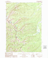
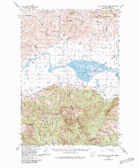
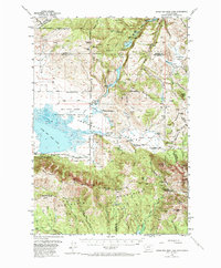
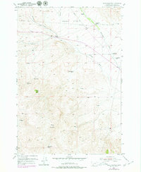
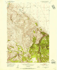
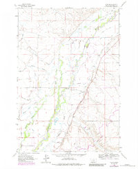
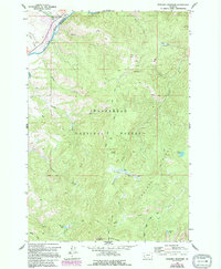
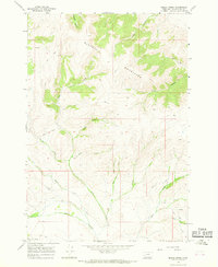
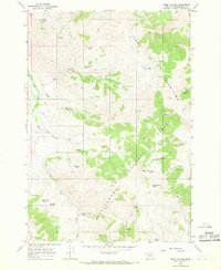
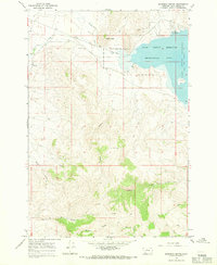
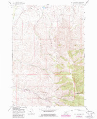
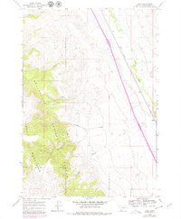
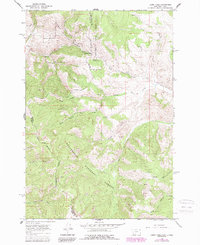
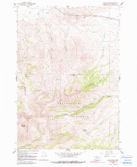
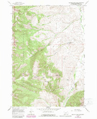
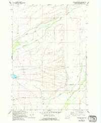
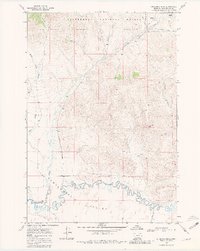
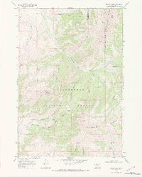
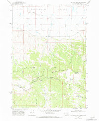
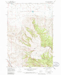
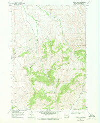
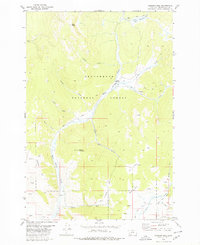
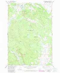
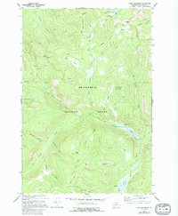
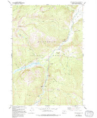
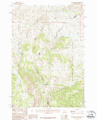
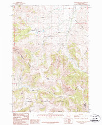
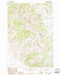
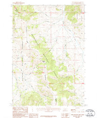
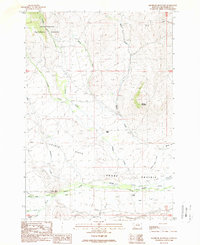
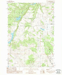
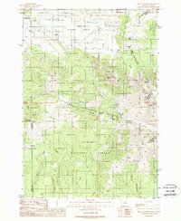
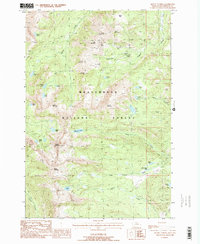
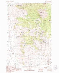
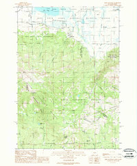
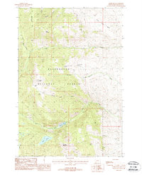
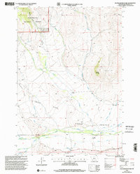
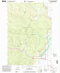
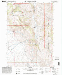
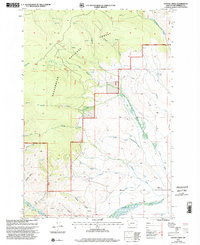
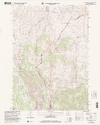
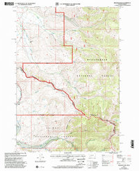
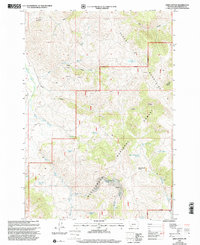
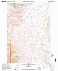
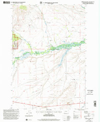
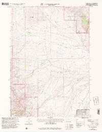
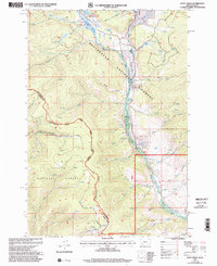
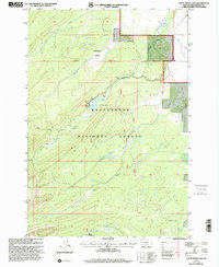
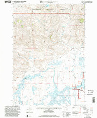
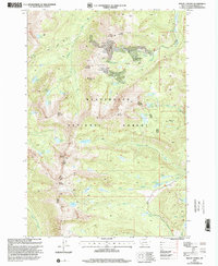
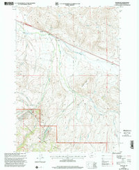
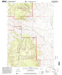
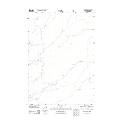
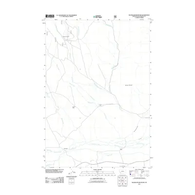
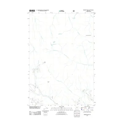
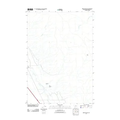
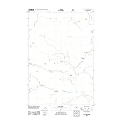
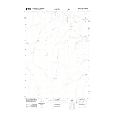
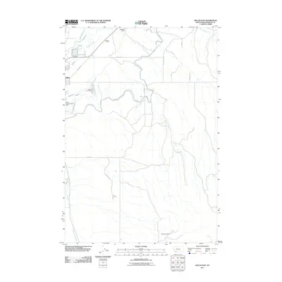
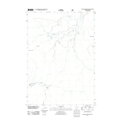
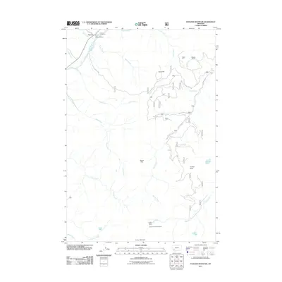
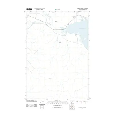
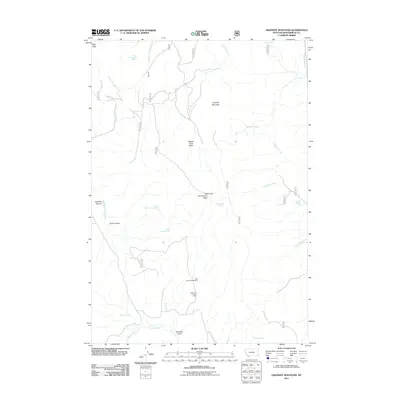
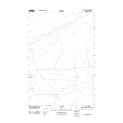
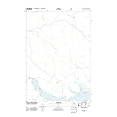
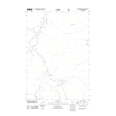
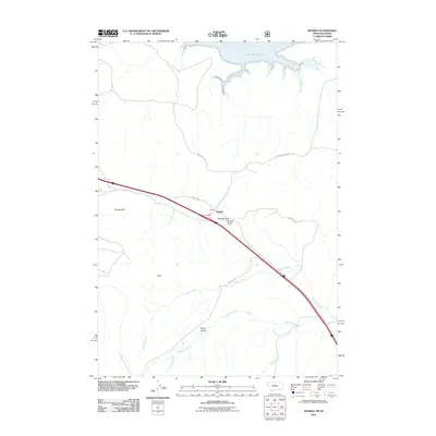
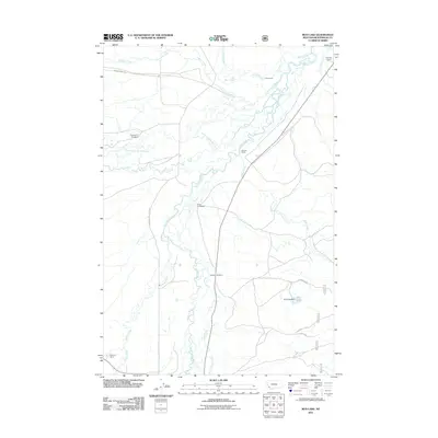
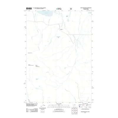
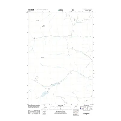
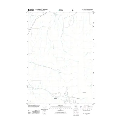
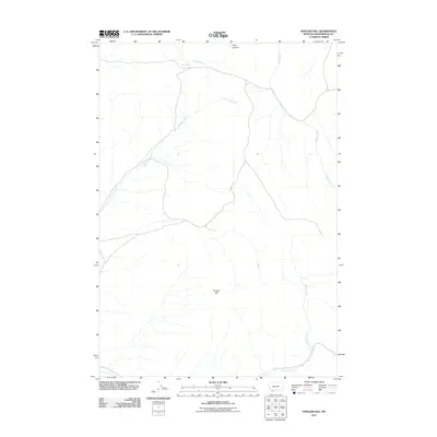
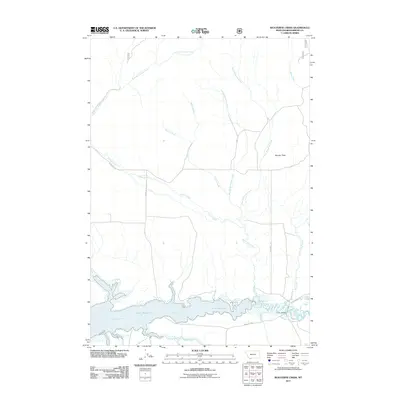
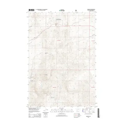
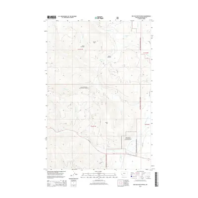
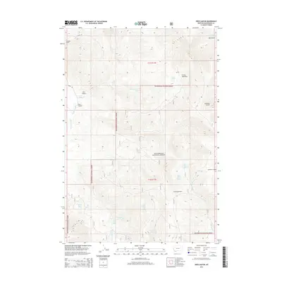
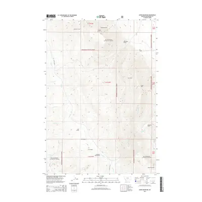
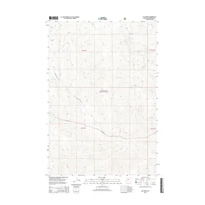
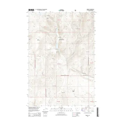
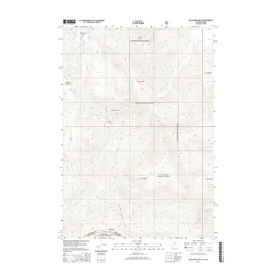
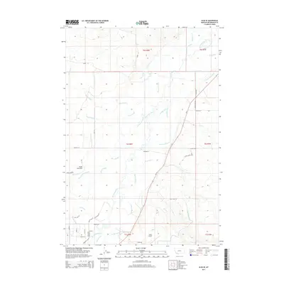
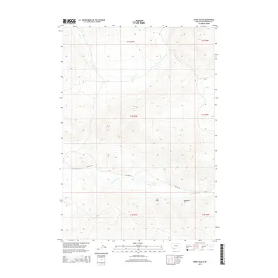
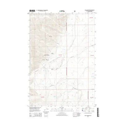
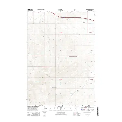
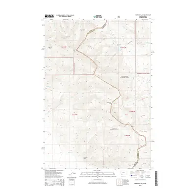
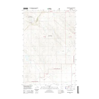
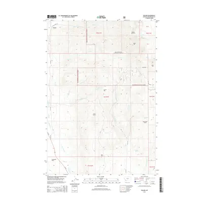
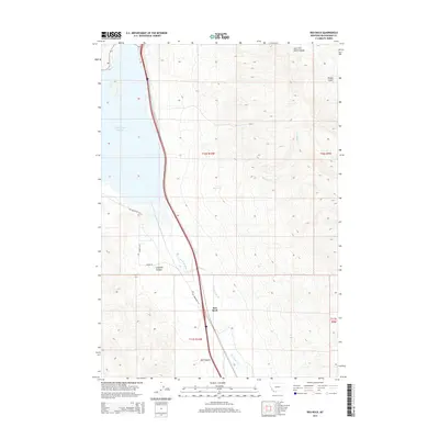
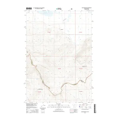
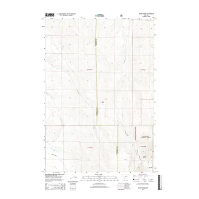
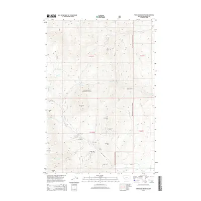
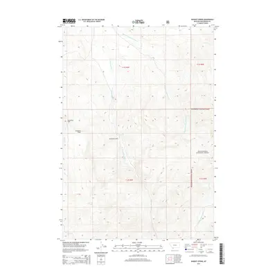
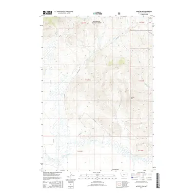
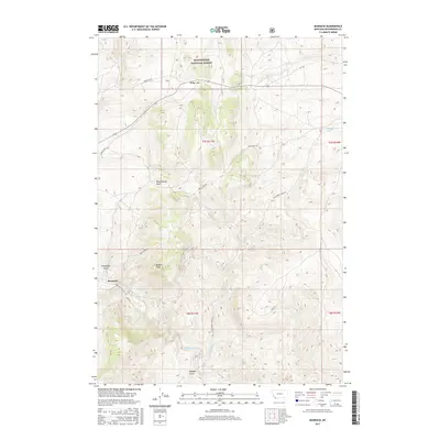
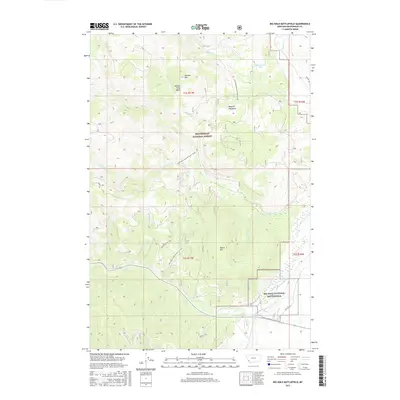
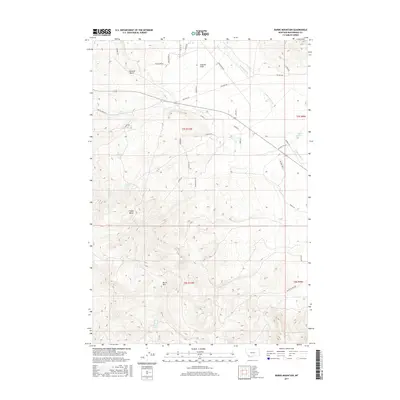
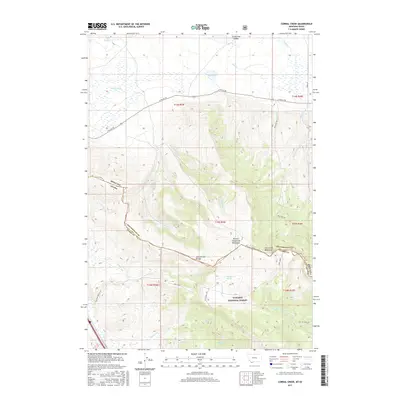
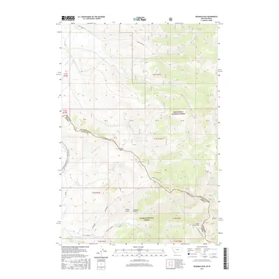
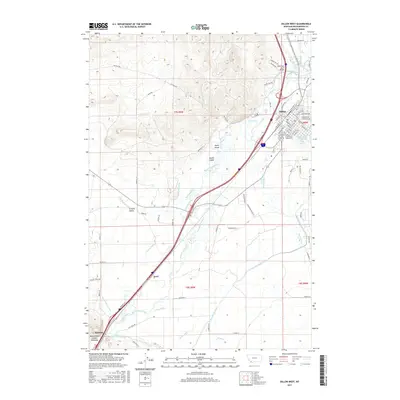
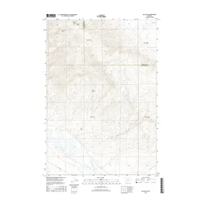
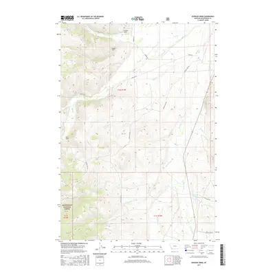
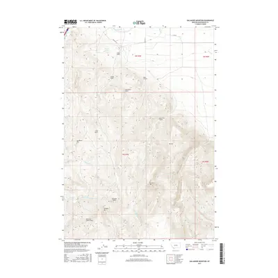
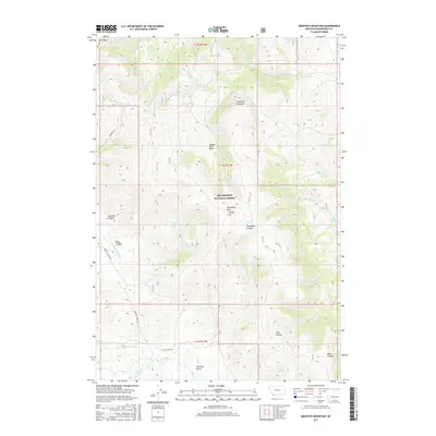
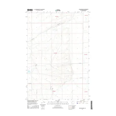
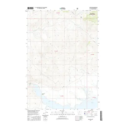
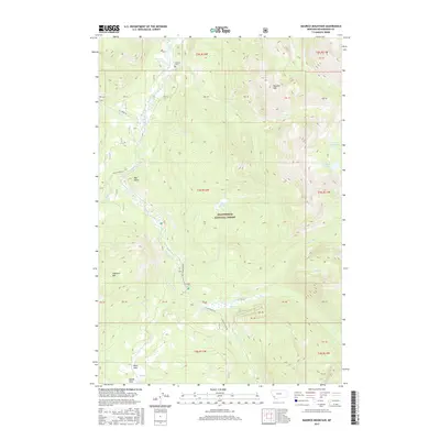
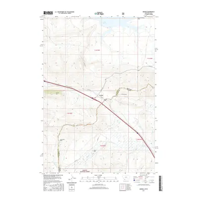
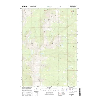
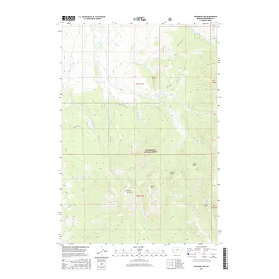
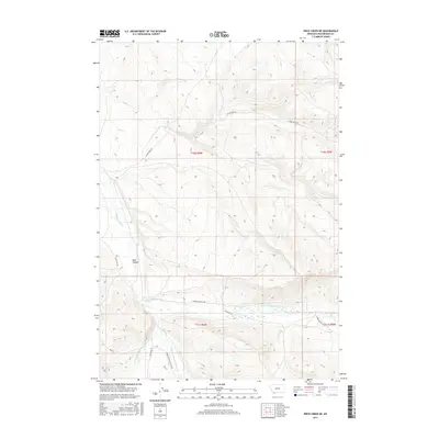
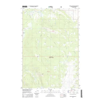
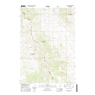
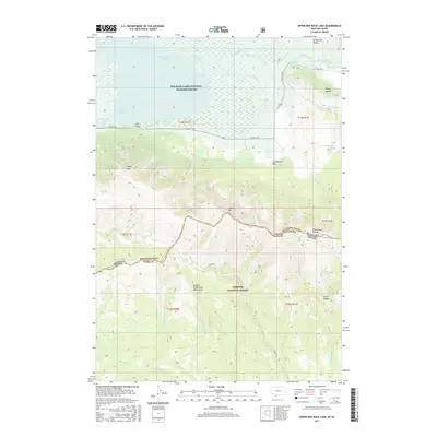
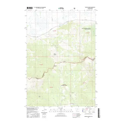
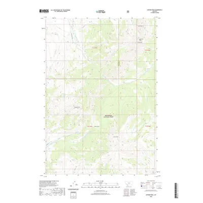
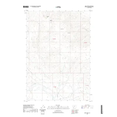
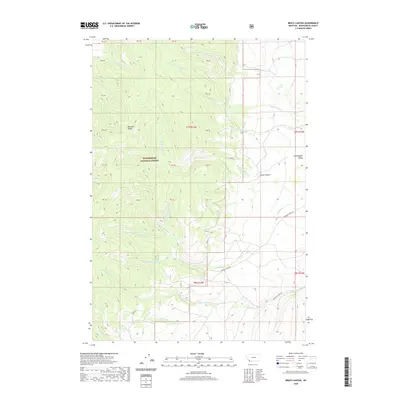
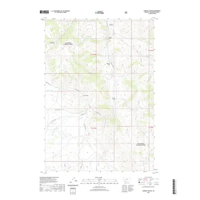
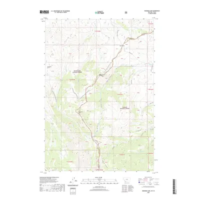
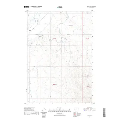
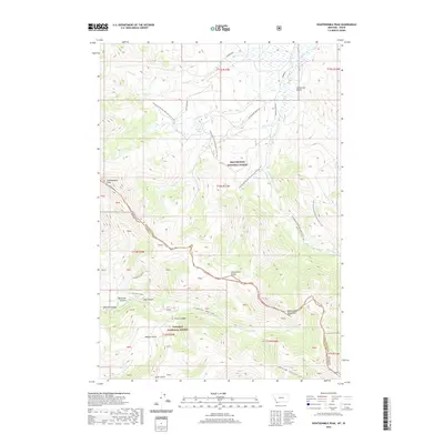
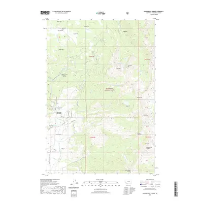
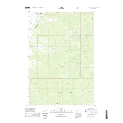
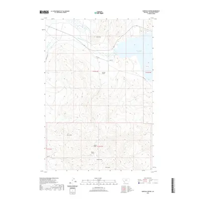
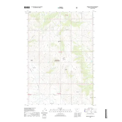
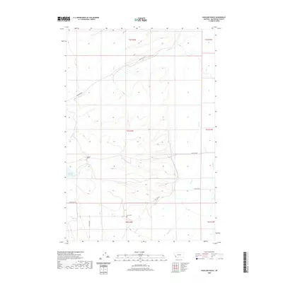
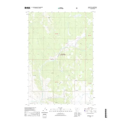
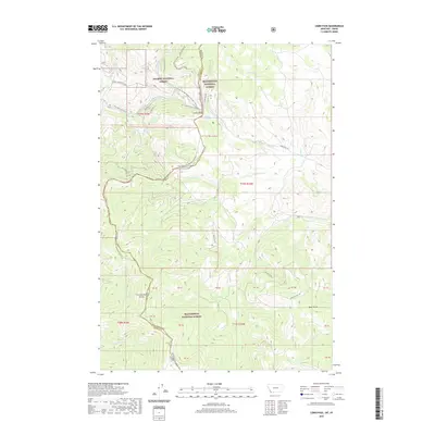
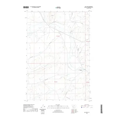
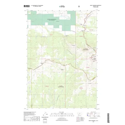
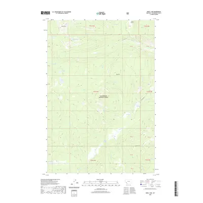
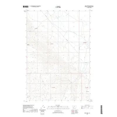
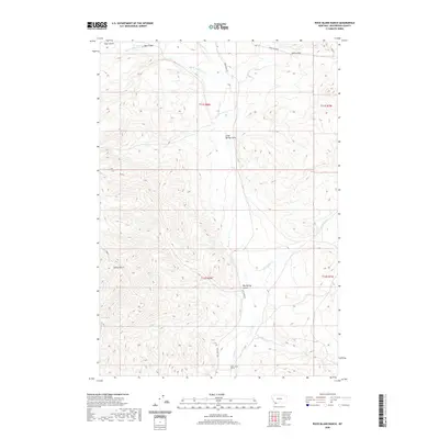
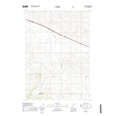
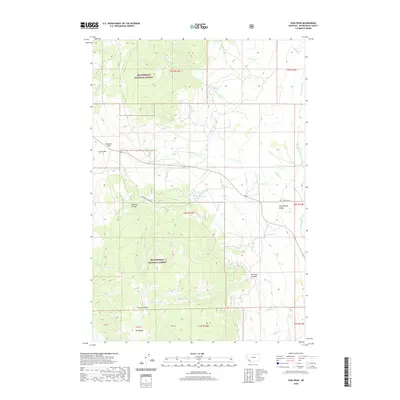
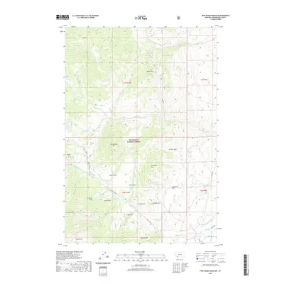
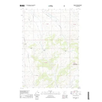
1989 Map of Goldstone Pass
USGS Topo · Published 1989About this map
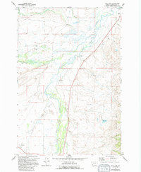
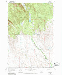
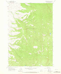
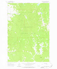
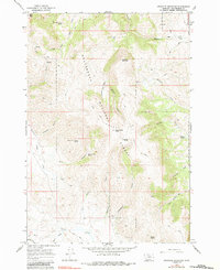
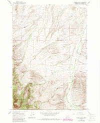
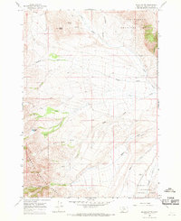
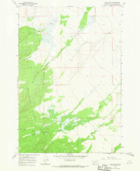
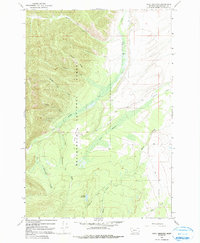
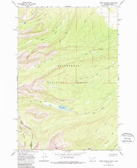
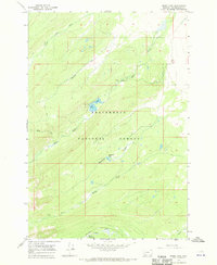
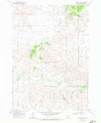
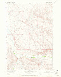
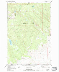
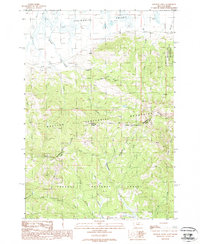
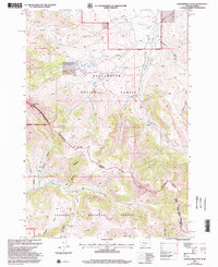
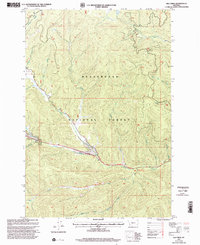
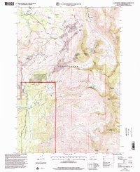
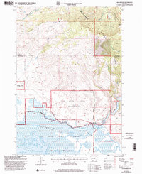
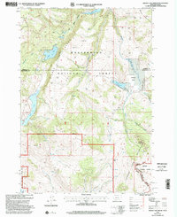
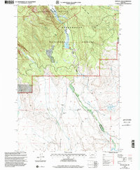
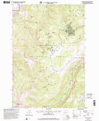
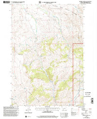
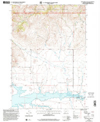
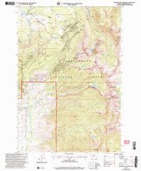
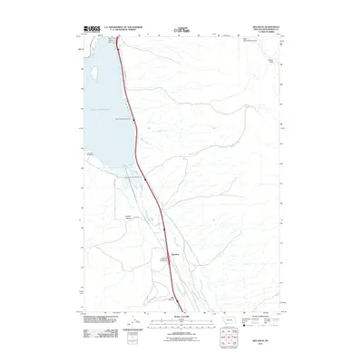
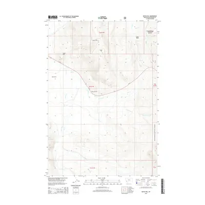
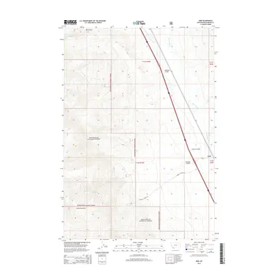
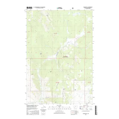
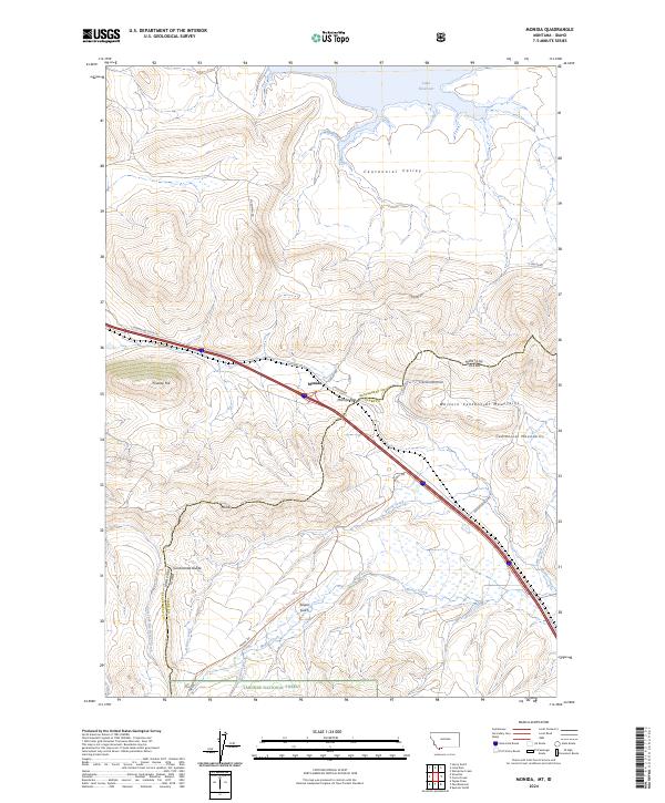
The Continental Divide forms the high spine of this landscape, separating the headwaters of the Big Hole River from the drainages of the Salmon National Forest to the west. This high-altitude terrain in the late 1980s is defined by its mining heritage and water management, with numerous prospects and active sites like the Goldstone Mine situated near Goldstone Pass. The surveyor’s manuscript drawings reveal a complex network of alpine lakes, including Jahnke Lake, Darkhorse Lake, and Cowbone Lake, which feed into the Beaverhead National Forest. To the east, the meadowlands of Skinner Meadows and the winding course of Bloody Dick Creek provide a contrast to the steep slopes of the Beaverhead Mountains. This survey captures the region as it transitioned into more modern recreational use, evidenced by Roadside Park and the network of 4WD trails that replaced older mining access roads.
Find a feature on this map
40 named features on this map. Tap any name to fly to it.
Don’t see what you’re looking for? This feature index may not catch every label — zoom into the map to look around manually.
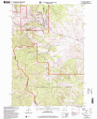
Map Details
Editions of this 1989 Goldstone Pass Map
This is the sole edition of this map. No revisions or reprints were ever made.
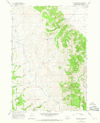
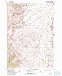
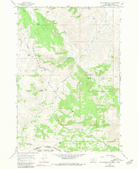
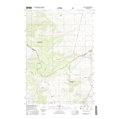
Historical Maps of Beaverhead County Through Time
678 maps found
1950 Lower Red Rock Lake
Beaverhead County, MT
1950 Upper Red Rock Lake
Beaverhead County, MT
1952 Bannack
Beaverhead County, MT
1952 Burns Mountain
Beaverhead County, MT
1952 Dalys
Beaverhead County, MT
1952 Eli Spring
Beaverhead County, MT
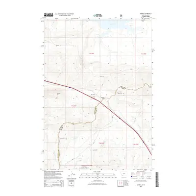
1952 Ermont
Beaverhead County, MT
1952 Gallagher Mountain
Beaverhead County, MT
1952 Torrey Mountain
Beaverhead County, MT
1952 Twin Adams Mountain
Beaverhead County, MT
1958 Vipond Park
Beaverhead County, MT
1959 Polaris
Beaverhead County, MT
1961 Ashbough Canyon
Beaverhead County, MT
1961 Earls Gulch
Beaverhead County, MT
1961 Elk Gulch
Beaverhead County, MT
1961 Glen SE
Beaverhead County, MT
1962 Bond
Beaverhead County, MT
1962 Dickie Hills
Beaverhead County, MT
1962 Dillon East
Beaverhead County, MT
1962 Foolhen Mountain
Beaverhead County, MT
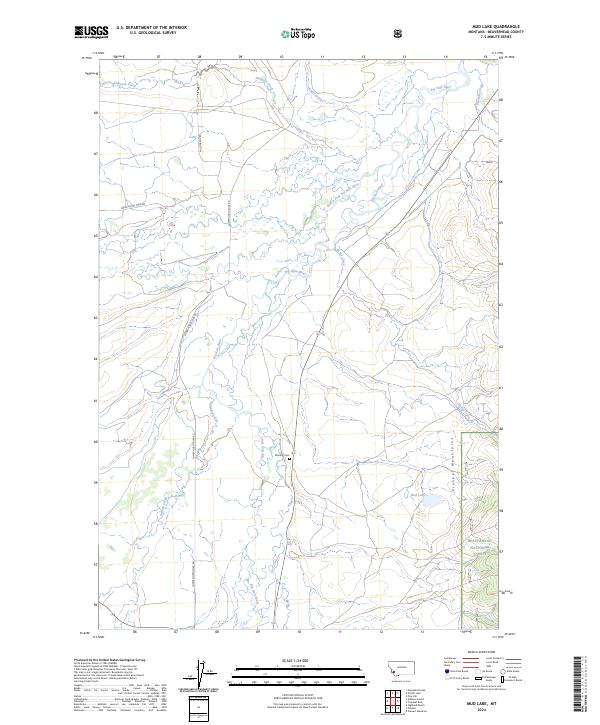
1962 Mud Lake
Beaverhead County, MT
1962 Pintler Lake
Beaverhead County, MT
1962 Proposal Rock
Beaverhead County, MT
1962 Stewart Mountain
Beaverhead County, MT
1963 Dillon West
Beaverhead County, MT
1963 Gallagher Mountain
Beaverhead County, MT
1965 Bannock Pass
Beaverhead County, MT
1965 Beech Creek
Beaverhead County, MT
1965 Briggs Ranch
Beaverhead County, MT
1965 Caboose Canyon
Beaverhead County, MT
1965 Deadman Pass
Beaverhead County, MT
1965 Deer Canyon
Beaverhead County, MT
1965 Dixon Mountain
Beaverhead County, MT
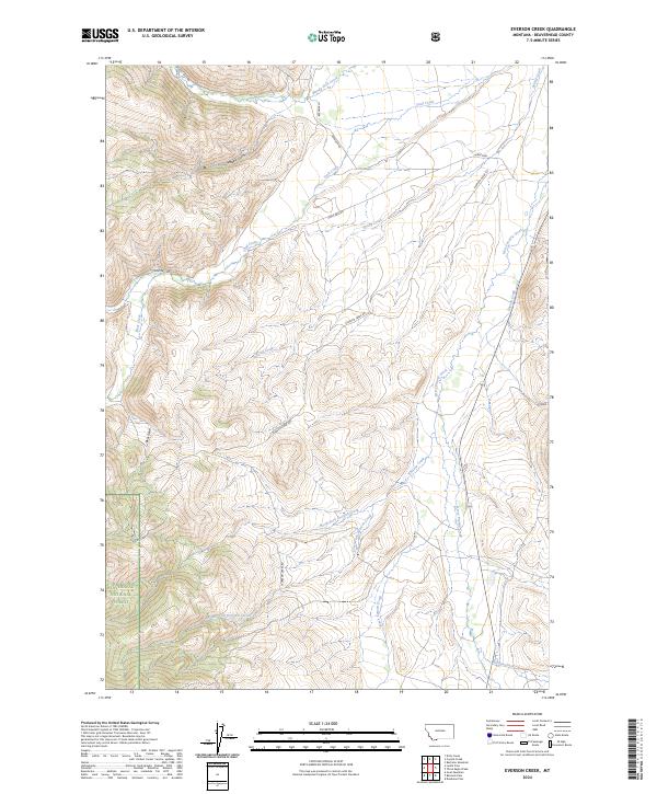
1965 Everson Creek
Beaverhead County, MT
1965 Gallagher Gulch
Beaverhead County, MT
1965 Garfield Canyon
Beaverhead County, MT
1965 Graphite Mountain
Beaverhead County, MT
1965 Hansen Ranch
Beaverhead County, MT
1965 Island Butte
Beaverhead County, MT
1965 Jeff Davis Peak
Beaverhead County, MT
1965 Kidd
Beaverhead County, MT
1965 Lemhi Pass
Beaverhead County, MT
1965 Lima Peaks
Beaverhead County, MT
1965 Medicine Lodge Peak
Beaverhead County, MT
1965 Monument Hill
Beaverhead County, MT
1965 Red Rock
Beaverhead County, MT
1965 Rock Island Ranch
Beaverhead County, MT
1966 Ajax Ranch
Beaverhead County, MT
1966 Big Hole Battlefield
Beaverhead County, MT
1966 Elk Creek
Beaverhead County, MT
1966 Gibbons School
Beaverhead County, MT
1966 Highland Ranch
Beaverhead County, MT
1966 Isaac Meadows
Beaverhead County, MT
1966 Jumbo Mountain
Beaverhead County, MT
1966 Miner Lake
Beaverhead County, MT
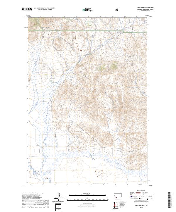
1968 Antelope Peak
Beaverhead County, MT
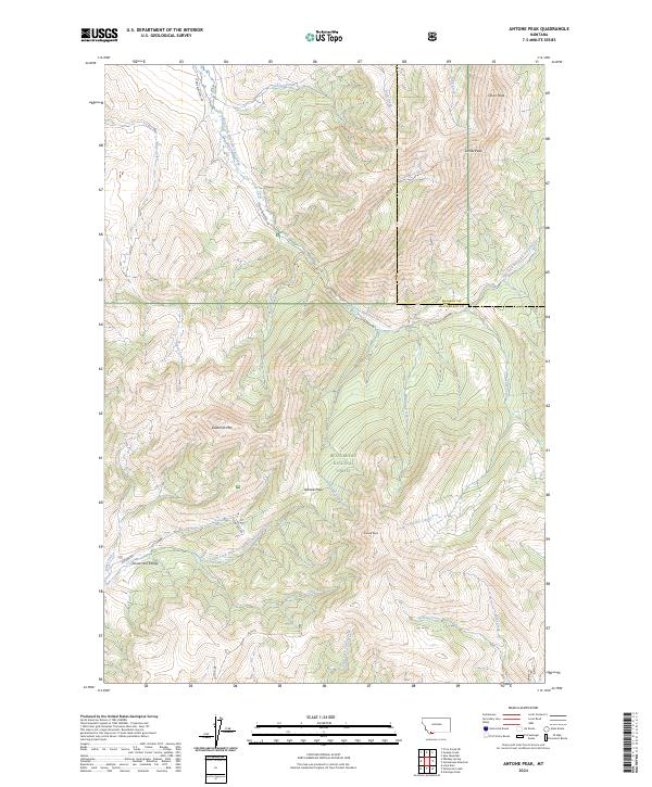
1968 Antone Peak
Beaverhead County, MT
1968 Big Table Mountain
Beaverhead County, MT
1968 Corral Creek
Beaverhead County, MT
1968 Henry Gulch
Beaverhead County, MT
1968 Lima Dam
Beaverhead County, MT
1968 Monida
Beaverhead County, MT
1968 Price Creek
Beaverhead County, MT
1968 Price Creek NE
Beaverhead County, MT
1968 Snowline
Beaverhead County, MT
1968 Swamp Creek
Beaverhead County, MT
1968 Vinegar Hill
Beaverhead County, MT
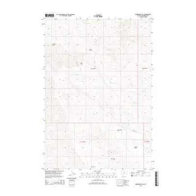
1968 Whiskey Spring
Beaverhead County, MT
1968 Wolverine Creek
Beaverhead County, MT
1974 Bender Point
Beaverhead County, MT
1976 Monument Hill
Beaverhead County, MT
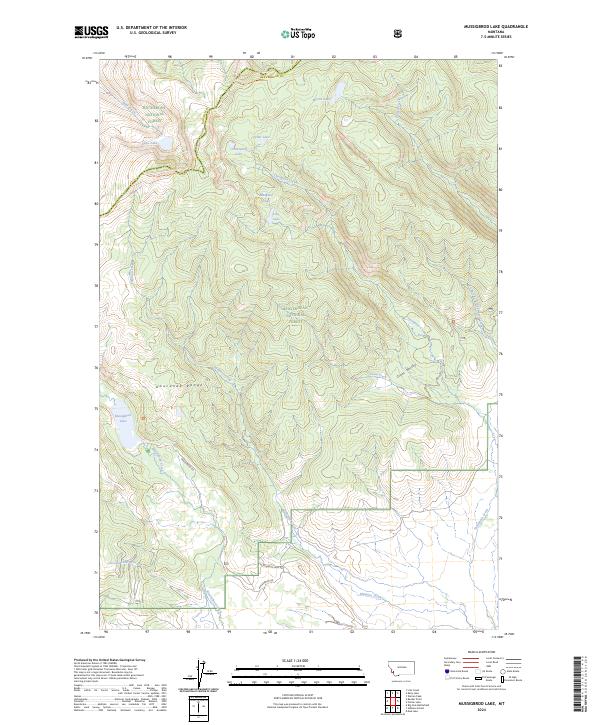
1977 Mussigbrod Lake
Beaverhead County, MT
1978 Butch Hill
Beaverhead County, MT
1978 Coyote Creek
Beaverhead County, MT
1978 Fox Gulch
Beaverhead County, MT
1978 Jackson Hill
Beaverhead County, MT
1978 Kitty Creek
Beaverhead County, MT
1978 Maurice Mountain
Beaverhead County, MT
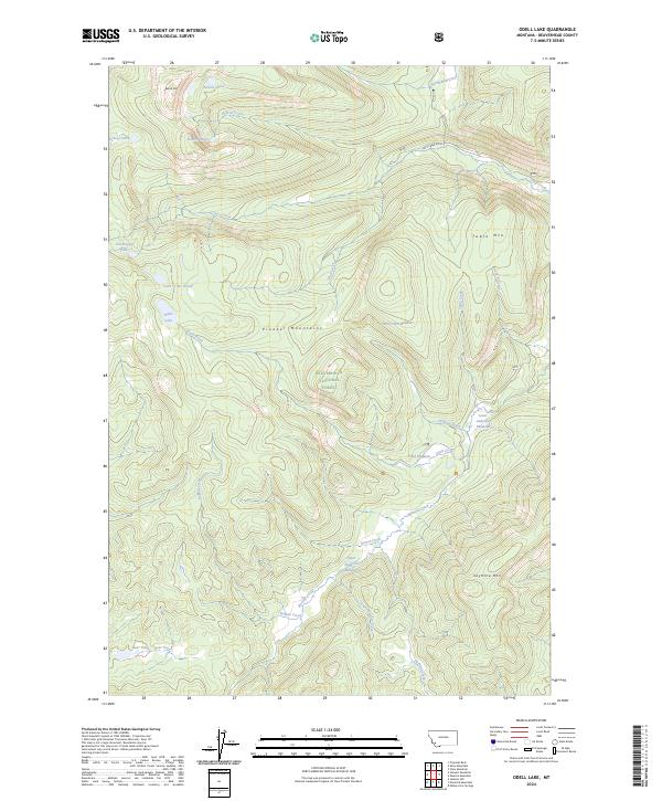
1978 Odell Lake
Beaverhead County, MT
1978 Selway Mountain
Beaverhead County, MT
1978 Shaw Mountain
Beaverhead County, MT
1978 Stine Mountain
Beaverhead County, MT
1987 Deadman Lake
Beaverhead County, MT
1987 Eighteenmile Peak
Beaverhead County, MT
1987 Morrison Lake
Beaverhead County, MT
1987 Tepee Mountain
Beaverhead County, MT
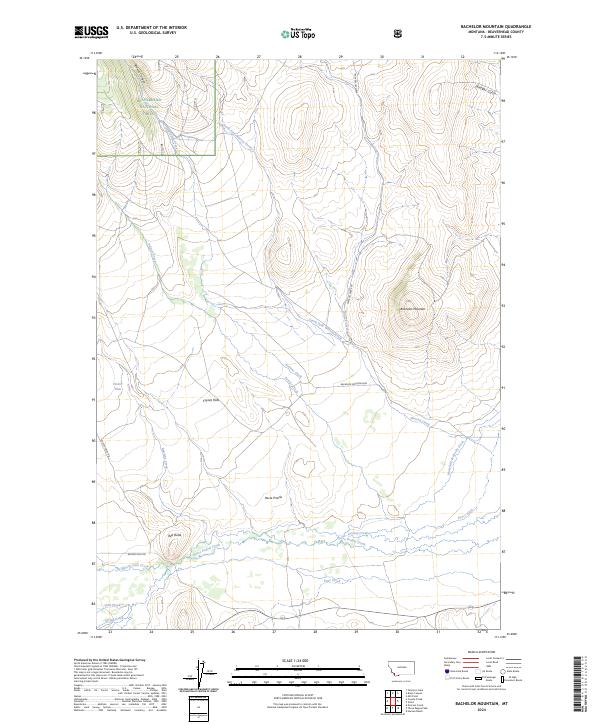
1988 Bachelor Mountain
Beaverhead County, MT
1988 Brays Canyon
Beaverhead County, MT
1988 Cattle Gulch
Beaverhead County, MT
1988 Elkhorn Hot Springs
Beaverhead County, MT
1988 Elk Springs
Beaverhead County, MT
1988 Hidden Lake Bench
Beaverhead County, MT
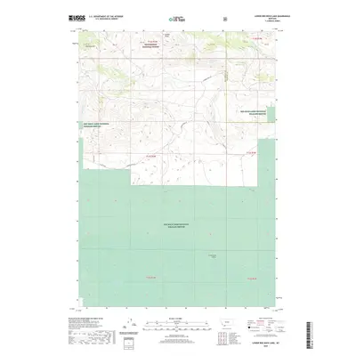
1988 Lower Red Rock Lake
Beaverhead County, MT
1988 Metzel Creek
Beaverhead County, MT
1988 Mill Point
Beaverhead County, MT
1988 Mount Jefferson
Beaverhead County, MT
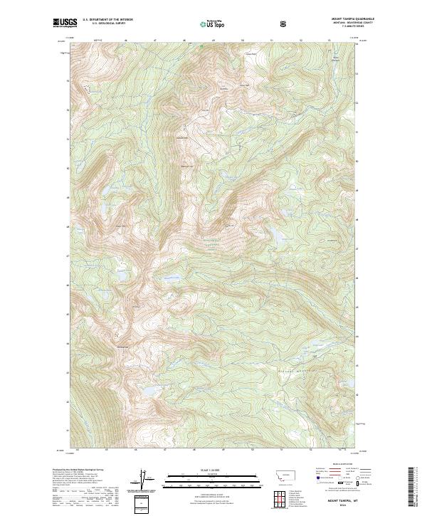
1988 Mount Tahepia
Beaverhead County, MT
1988 Polaris
Beaverhead County, MT
1988 Slide Mountain
Beaverhead County, MT
1988 Storm Peak
Beaverhead County, MT
1988 Tash Peak
Beaverhead County, MT
1988 Upper Red Rock Lake
Beaverhead County, MT
1988 Vipond Park
Beaverhead County, MT
1988 Winslow Creek
Beaverhead County, MT
1989 Goldstone Pass
Beaverhead County, MT
1997 Ajax Ranch
Beaverhead County, MT
1997 Antelope Peak
Beaverhead County, MT
1997 Antone Peak
Beaverhead County, MT
1997 Bachelor Mountain
Beaverhead County, MT
1997 Bannack
Beaverhead County, MT
1997 Bannock Pass
Beaverhead County, MT
1997 Bender Point
Beaverhead County, MT
1997 Big Hole Battlefield
Beaverhead County, MT
1997 Bond
Beaverhead County, MT
1997 Brays Canyon
Beaverhead County, MT
1997 Butch Hill
Beaverhead County, MT
1997 Caboose Canyon
Beaverhead County, MT
1997 Coyote Creek
Beaverhead County, MT
1997 Deadman Lake
Beaverhead County, MT
1997 Deadman Pass
Beaverhead County, MT
1997 Deer Canyon
Beaverhead County, MT
1997 Dickie Hills
Beaverhead County, MT
1997 Dixon Mountain
Beaverhead County, MT
1997 Earls Gulch
Beaverhead County, MT
1997 Eighteenmile Peak
Beaverhead County, MT
1997 Elk Creek
Beaverhead County, MT
1997 Elkhorn Hot Springs
Beaverhead County, MT
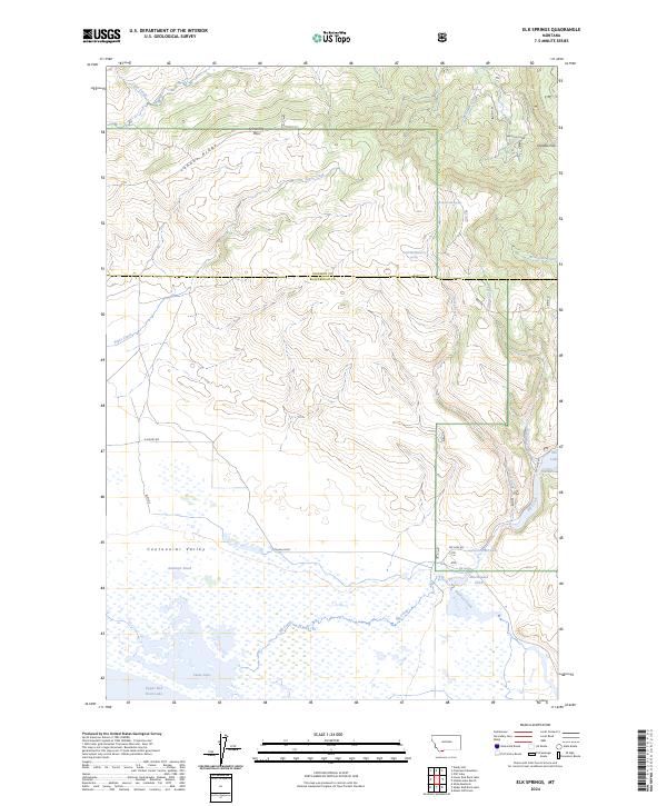
1997 Elk Springs
Beaverhead County, MT

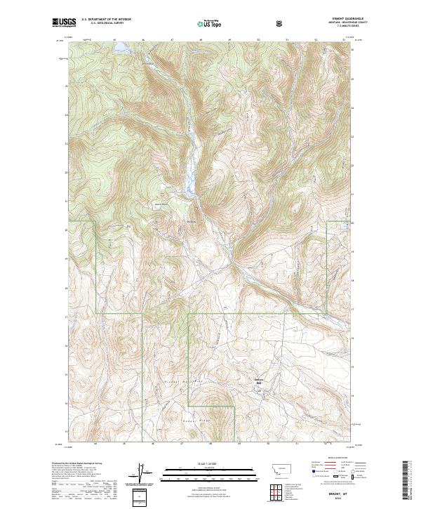
1997 Ermont
Beaverhead County, MT
1997 Everson Creek
Beaverhead County, MT
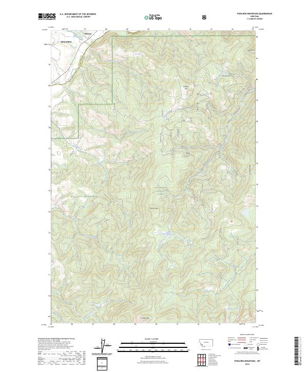
1997 Foolhen Mountain
Beaverhead County, MT
1997 Fox Gulch
Beaverhead County, MT
1997 Gallagher Gulch
Beaverhead County, MT
1997 Gibbons School
Beaverhead County, MT
1997 Goldstone Pass
Beaverhead County, MT
1997 Graphite Mountain
Beaverhead County, MT
1997 Hansen Ranch
Beaverhead County, MT
1997 Hidden Lake Bench
Beaverhead County, MT
1997 Highland Ranch
Beaverhead County, MT
1997 Homer Youngs Peak
Beaverhead County, MT
1997 Isaac Meadows
Beaverhead County, MT
1997 Island Butte
Beaverhead County, MT
1997 Jackson Hill
Beaverhead County, MT

1997 Jeff Davis Peak
Beaverhead County, MT
1997 Jumbo Mountain
Beaverhead County, MT
1997 Kidd
Beaverhead County, MT
1997 Kitty Creek
Beaverhead County, MT
1997 Lemhi Pass
Beaverhead County, MT
1997 Lima Dam
Beaverhead County, MT
1997 Lima Peaks
Beaverhead County, MT
1997 Lower Miner Lakes
Beaverhead County, MT
1997 Lower Red Rock Lake
Beaverhead County, MT
1997 Maurice Mountain
Beaverhead County, MT
1997 Medicine Lodge Peak
Beaverhead County, MT
1997 Metzel Creek
Beaverhead County, MT
1997 Mill Point
Beaverhead County, MT
1997 Morrison Lake
Beaverhead County, MT
1997 Mount Jefferson
Beaverhead County, MT
1997 Mount Tahepia
Beaverhead County, MT
1997 Mussigbrod Lake
Beaverhead County, MT
1997 Odell Lake
Beaverhead County, MT
1997 Peterson Lake
Beaverhead County, MT
1997 Pintler Lake
Beaverhead County, MT
1997 Polaris
Beaverhead County, MT
1997 Proposal Rock
Beaverhead County, MT
1997 Shaw Mountain
Beaverhead County, MT
1997 Snowline
Beaverhead County, MT
1997 Stewart Mountain
Beaverhead County, MT
1997 Storm Peak
Beaverhead County, MT
1997 Swamp Creek
Beaverhead County, MT
1997 Tash Peak
Beaverhead County, MT
1997 Tepee Mountain
Beaverhead County, MT
1997 Torrey Mountain
Beaverhead County, MT
1997 Twin Adams Mountain
Beaverhead County, MT
1997 Vipond Park
Beaverhead County, MT
1997 Whiskey Spring
Beaverhead County, MT
1997 Wolverine Creek
Beaverhead County, MT
2005 Elkhorn Hot Springs
Beaverhead County, MT
2011 Ajax Ranch
Beaverhead County, MT
2011 Antelope Peak
Beaverhead County, MT
2011 Antone Peak
Beaverhead County, MT
2011 Ashbough Canyon
Beaverhead County, MT
2011 Bachelor Mountain
Beaverhead County, MT
2011 Bannack
Beaverhead County, MT
2011 Bannock Pass
Beaverhead County, MT
2011 Beech Creek
Beaverhead County, MT
2011 Bender Point
Beaverhead County, MT
2011 Big Hole Battlefield
Beaverhead County, MT
2011 Bond
Beaverhead County, MT
2011 Brays Canyon
Beaverhead County, MT
2011 Briggs Ranch
Beaverhead County, MT
2011 Burns Mountain
Beaverhead County, MT
2011 Butch Hill
Beaverhead County, MT
2011 Caboose Canyon
Beaverhead County, MT
2011 Cattle Gulch
Beaverhead County, MT
2011 Corral Creek
Beaverhead County, MT
2011 Coyote Creek
Beaverhead County, MT
2011 Dalys
Beaverhead County, MT
2011 Deadman Lake
Beaverhead County, MT
2011 Deadman Pass
Beaverhead County, MT
2011 Deer Canyon
Beaverhead County, MT
2011 Dickie Hills
Beaverhead County, MT
2011 Dillon East
Beaverhead County, MT
2011 Dillon West
Beaverhead County, MT
2011 Dixon Mountain
Beaverhead County, MT
2011 Earls Gulch
Beaverhead County, MT
2011 Eighteenmile Peak
Beaverhead County, MT
2011 Eli Spring
Beaverhead County, MT
2011 Elk Creek
Beaverhead County, MT
2011 Elk Gulch
Beaverhead County, MT
2011 Elkhorn Hot Springs
Beaverhead County, MT
2011 Elk Springs
Beaverhead County, MT
2011 Ermont
Beaverhead County, MT
2011 Everson Creek
Beaverhead County, MT
2011 Foolhen Mountain
Beaverhead County, MT
2011 Fox Gulch
Beaverhead County, MT
2011 Gallagher Gulch
Beaverhead County, MT
2011 Gallagher Mountain
Beaverhead County, MT
2011 Garfield Canyon
Beaverhead County, MT
2011 Gibbons School
Beaverhead County, MT
2011 Glen SE
Beaverhead County, MT
2011 Goldstone Pass
Beaverhead County, MT
2011 Graphite Mountain
Beaverhead County, MT
2011 Hansen Ranch
Beaverhead County, MT
2011 Henry Gulch
Beaverhead County, MT
2011 Hidden Lake Bench
Beaverhead County, MT
2011 Highland Ranch
Beaverhead County, MT
2011 Homer Youngs Peak
Beaverhead County, MT
2011 Isaac Meadows
Beaverhead County, MT
2011 Island Butte
Beaverhead County, MT
2011 Jackson Hill
Beaverhead County, MT
2011 Jumbo Mountain
Beaverhead County, MT
2011 Kidd
Beaverhead County, MT
2011 Kitty Creek
Beaverhead County, MT

2011 Lemhi Pass
Beaverhead County, MT
2011 Lima Dam
Beaverhead County, MT
2011 Lima Peaks
Beaverhead County, MT
2011 Lower Miner Lakes
Beaverhead County, MT
2011 Lower Red Rock Lake
Beaverhead County, MT
2011 Maurice Mountain
Beaverhead County, MT
2011 Medicine Lodge Peak
Beaverhead County, MT
2011 Metzel Creek
Beaverhead County, MT
2011 Mill Point
Beaverhead County, MT
2011 Monida
Beaverhead County, MT

2011 Monument Hill
Beaverhead County, MT
2011 Morrison Lake
Beaverhead County, MT
2011 Mount Jefferson
Beaverhead County, MT
2011 Mount Tahepia
Beaverhead County, MT
2011 Mud Lake
Beaverhead County, MT
2011 Mussigbrod Lake
Beaverhead County, MT
2011 Odell Lake
Beaverhead County, MT

2011 Peterson Lake
Beaverhead County, MT
2011 Pintler Lake
Beaverhead County, MT
2011 Polaris
Beaverhead County, MT
2011 Price Creek
Beaverhead County, MT
2011 Price Creek NE
Beaverhead County, MT
2011 Proposal Rock
Beaverhead County, MT
2011 Red Rock
Beaverhead County, MT
2011 Rock Island Ranch
Beaverhead County, MT
2011 Selway Mountain
Beaverhead County, MT
2011 Shaw Mountain
Beaverhead County, MT
2011 Slide Mountain
Beaverhead County, MT
2011 Snowline
Beaverhead County, MT
2011 Stewart Mountain
Beaverhead County, MT
2011 Stine Mountain
Beaverhead County, MT
2011 Storm Peak
Beaverhead County, MT
2011 Swamp Creek
Beaverhead County, MT
2011 Tash Peak
Beaverhead County, MT
2011 Tepee Mountain
Beaverhead County, MT
2011 Three Eagles Peak
Beaverhead County, MT
2011 Torrey Mountain
Beaverhead County, MT
2011 Twin Adams Mountain
Beaverhead County, MT
2011 Upper Red Rock Lake
Beaverhead County, MT
2011 Vinegar Hill
Beaverhead County, MT
2011 Vipond Park
Beaverhead County, MT
2011 Whiskey Spring
Beaverhead County, MT
2011 Winslow Creek
Beaverhead County, MT
2011 Wolverine Creek
Beaverhead County, MT
2014 Ajax Ranch
Beaverhead County, MT
2014 Antelope Peak
Beaverhead County, MT
2014 Antone Peak
Beaverhead County, MT

2014 Ashbough Canyon
Beaverhead County, MT

2014 Bachelor Mountain
Beaverhead County, MT
2014 Bannack
Beaverhead County, MT
2014 Bannock Pass
Beaverhead County, MT
2014 Beech Creek
Beaverhead County, MT
2014 Bender Point
Beaverhead County, MT
2014 Big Hole Battlefield
Beaverhead County, MT
2014 Bond
Beaverhead County, MT
2014 Brays Canyon
Beaverhead County, MT

2014 Briggs Ranch
Beaverhead County, MT
2014 Burns Mountain
Beaverhead County, MT
2014 Butch Hill
Beaverhead County, MT
2014 Caboose Canyon
Beaverhead County, MT
2014 Cattle Gulch
Beaverhead County, MT
2014 Corral Creek
Beaverhead County, MT
2014 Coyote Creek
Beaverhead County, MT
2014 Dalys
Beaverhead County, MT
2014 Deadman Lake
Beaverhead County, MT
2014 Deadman Pass
Beaverhead County, MT
2014 Deer Canyon
Beaverhead County, MT
2014 Dickie Hills
Beaverhead County, MT
2014 Dillon East
Beaverhead County, MT
2014 Dillon West
Beaverhead County, MT
2014 Dixon Mountain
Beaverhead County, MT
2014 Earls Gulch
Beaverhead County, MT
2014 Eighteenmile Peak
Beaverhead County, MT
2014 Eli Spring
Beaverhead County, MT
2014 Elk Creek
Beaverhead County, MT
2014 Elk Gulch
Beaverhead County, MT
2014 Elkhorn Hot Springs
Beaverhead County, MT
2014 Elk Springs
Beaverhead County, MT
2014 Ermont
Beaverhead County, MT
2014 Everson Creek
Beaverhead County, MT
2014 Foolhen Mountain
Beaverhead County, MT
2014 Fox Gulch
Beaverhead County, MT
2014 Gallagher Gulch
Beaverhead County, MT
2014 Gallagher Mountain
Beaverhead County, MT
2014 Garfield Canyon
Beaverhead County, MT
2014 Gibbons School
Beaverhead County, MT
2014 Glen SE
Beaverhead County, MT
2014 Goldstone Pass
Beaverhead County, MT
2014 Graphite Mountain
Beaverhead County, MT
2014 Hansen Ranch
Beaverhead County, MT
2014 Henry Gulch
Beaverhead County, MT
2014 Hidden Lake Bench
Beaverhead County, MT
2014 Highland Ranch
Beaverhead County, MT
2014 Homer Youngs Peak
Beaverhead County, MT
2014 Isaac Meadows
Beaverhead County, MT
2014 Island Butte
Beaverhead County, MT
2014 Jackson Hill
Beaverhead County, MT
2014 Jumbo Mountain
Beaverhead County, MT
2014 Kidd
Beaverhead County, MT
2014 Kitty Creek
Beaverhead County, MT
2014 Lemhi Pass
Beaverhead County, MT
2014 Lima Dam
Beaverhead County, MT
2014 Lima Peaks
Beaverhead County, MT

2014 Lower Miner Lakes
Beaverhead County, MT
2014 Lower Red Rock Lake
Beaverhead County, MT
2014 Maurice Mountain
Beaverhead County, MT
2014 Medicine Lodge Peak
Beaverhead County, MT
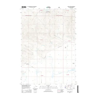
2014 Metzel Creek
Beaverhead County, MT
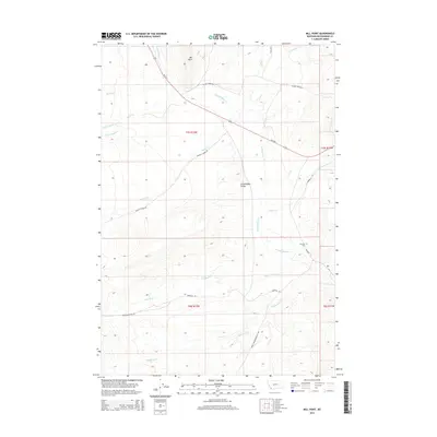
2014 Mill Point
Beaverhead County, MT
2014 Monida
Beaverhead County, MT
2014 Monument Hill
Beaverhead County, MT
2014 Morrison Lake
Beaverhead County, MT
2014 Mount Jefferson
Beaverhead County, MT
2014 Mount Tahepia
Beaverhead County, MT
2014 Mud Lake
Beaverhead County, MT
2014 Mussigbrod Lake
Beaverhead County, MT
2014 Odell Lake
Beaverhead County, MT
2014 Peterson Lake
Beaverhead County, MT
2014 Pintler Lake
Beaverhead County, MT
2014 Polaris
Beaverhead County, MT
2014 Price Creek
Beaverhead County, MT
2014 Price Creek NE
Beaverhead County, MT
2014 Proposal Rock
Beaverhead County, MT
2014 Red Rock
Beaverhead County, MT
2014 Rock Island Ranch
Beaverhead County, MT
2014 Selway Mountain
Beaverhead County, MT
2014 Shaw Mountain
Beaverhead County, MT
2014 Slide Mountain
Beaverhead County, MT
2014 Snowline
Beaverhead County, MT
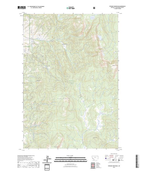
2014 Stewart Mountain
Beaverhead County, MT
2014 Stine Mountain
Beaverhead County, MT

2014 Storm Peak
Beaverhead County, MT
2014 Swamp Creek
Beaverhead County, MT
2014 Tash Peak
Beaverhead County, MT
2014 Tepee Mountain
Beaverhead County, MT
2014 Three Eagles Peak
Beaverhead County, MT

2014 Torrey Mountain
Beaverhead County, MT
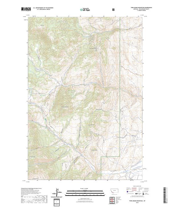
2014 Twin Adams Mountain
Beaverhead County, MT
2014 Upper Red Rock Lake
Beaverhead County, MT
2014 Vinegar Hill
Beaverhead County, MT
2014 Vipond Park
Beaverhead County, MT
2014 Whiskey Spring
Beaverhead County, MT
2014 Winslow Creek
Beaverhead County, MT
2014 Wolverine Creek
Beaverhead County, MT
2017 Ajax Ranch
Beaverhead County, MT
2017 Antelope Peak
Beaverhead County, MT
2017 Antone Peak
Beaverhead County, MT
2017 Ashbough Canyon
Beaverhead County, MT
2017 Bachelor Mountain
Beaverhead County, MT
2017 Bannack
Beaverhead County, MT
2017 Bannock Pass
Beaverhead County, MT
2017 Beech Creek
Beaverhead County, MT
2017 Bender Point
Beaverhead County, MT
2017 Big Hole Battlefield
Beaverhead County, MT
2017 Bond
Beaverhead County, MT
2017 Brays Canyon
Beaverhead County, MT
2017 Briggs Ranch
Beaverhead County, MT
2017 Burns Mountain
Beaverhead County, MT
2017 Butch Hill
Beaverhead County, MT
2017 Caboose Canyon
Beaverhead County, MT
2017 Cattle Gulch
Beaverhead County, MT
2017 Corral Creek
Beaverhead County, MT
2017 Coyote Creek
Beaverhead County, MT
2017 Dalys
Beaverhead County, MT
2017 Deadman Lake
Beaverhead County, MT
2017 Deadman Pass
Beaverhead County, MT
2017 Deer Canyon
Beaverhead County, MT
2017 Dickie Hills
Beaverhead County, MT
2017 Dillon East
Beaverhead County, MT
2017 Dillon West
Beaverhead County, MT

2017 Dixon Mountain
Beaverhead County, MT
2017 Earls Gulch
Beaverhead County, MT
2017 Eighteenmile Peak
Beaverhead County, MT
2017 Eli Spring
Beaverhead County, MT

2017 Elk Creek
Beaverhead County, MT
2017 Elk Gulch
Beaverhead County, MT
2017 Elkhorn Hot Springs
Beaverhead County, MT
2017 Elk Springs
Beaverhead County, MT
2017 Ermont
Beaverhead County, MT
2017 Everson Creek
Beaverhead County, MT
2017 Foolhen Mountain
Beaverhead County, MT
2017 Fox Gulch
Beaverhead County, MT
2017 Gallagher Gulch
Beaverhead County, MT
2017 Gallagher Mountain
Beaverhead County, MT
2017 Garfield Canyon
Beaverhead County, MT
2017 Gibbons School
Beaverhead County, MT
2017 Glen SE
Beaverhead County, MT

2017 Goldstone Pass
Beaverhead County, MT
2017 Graphite Mountain
Beaverhead County, MT
2017 Hansen Ranch
Beaverhead County, MT
2017 Henry Gulch
Beaverhead County, MT
2017 Hidden Lake Bench
Beaverhead County, MT
2017 Highland Ranch
Beaverhead County, MT
2017 Homer Youngs Peak
Beaverhead County, MT
2017 Isaac Meadows
Beaverhead County, MT
2017 Island Butte
Beaverhead County, MT
2017 Jackson Hill
Beaverhead County, MT
2017 Jumbo Mountain
Beaverhead County, MT
2017 Kidd
Beaverhead County, MT

2017 Kitty Creek
Beaverhead County, MT
2017 Lemhi Pass
Beaverhead County, MT
2017 Lima Dam
Beaverhead County, MT
2017 Lima Peaks
Beaverhead County, MT
2017 Lower Miner Lakes
Beaverhead County, MT
2017 Lower Red Rock Lake
Beaverhead County, MT
2017 Maurice Mountain
Beaverhead County, MT
2017 Medicine Lodge Peak
Beaverhead County, MT
2017 Metzel Creek
Beaverhead County, MT
2017 Mill Point
Beaverhead County, MT
2017 Monida
Beaverhead County, MT
2017 Monument Hill
Beaverhead County, MT
2017 Morrison Lake
Beaverhead County, MT
2017 Mount Jefferson
Beaverhead County, MT
2017 Mount Tahepia
Beaverhead County, MT
2017 Mud Lake
Beaverhead County, MT
2017 Mussigbrod Lake
Beaverhead County, MT
2017 Odell Lake
Beaverhead County, MT
2017 Peterson Lake
Beaverhead County, MT
2017 Pintler Lake
Beaverhead County, MT
2017 Polaris
Beaverhead County, MT
2017 Price Creek
Beaverhead County, MT
2017 Price Creek NE
Beaverhead County, MT
2017 Proposal Rock
Beaverhead County, MT
2017 Red Rock
Beaverhead County, MT
2017 Rock Island Ranch
Beaverhead County, MT
2017 Selway Mountain
Beaverhead County, MT
2017 Shaw Mountain
Beaverhead County, MT
2017 Slide Mountain
Beaverhead County, MT
2017 Snowline
Beaverhead County, MT
2017 Stewart Mountain
Beaverhead County, MT

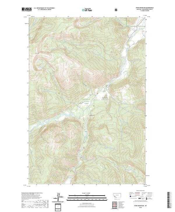
2017 Stine Mountain
Beaverhead County, MT
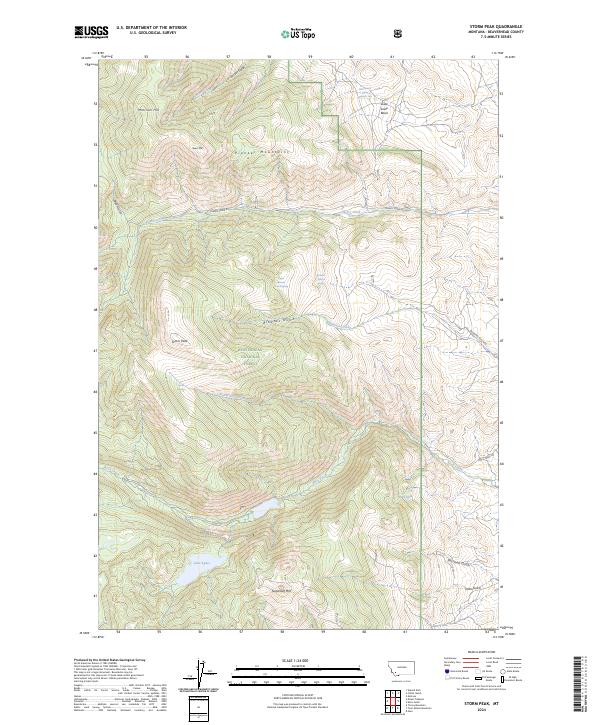
2017 Storm Peak
Beaverhead County, MT
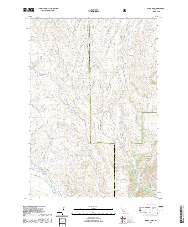
2017 Swamp Creek
Beaverhead County, MT
2017 Tash Peak
Beaverhead County, MT
2017 Tepee Mountain
Beaverhead County, MT
2017 Three Eagles Peak
Beaverhead County, MT
2017 Torrey Mountain
Beaverhead County, MT
2017 Twin Adams Mountain
Beaverhead County, MT
2017 Upper Red Rock Lake
Beaverhead County, MT
2017 Vinegar Hill
Beaverhead County, MT
2017 Vipond Park
Beaverhead County, MT
2017 Whiskey Spring
Beaverhead County, MT
2017 Winslow Creek
Beaverhead County, MT
2017 Wolverine Creek
Beaverhead County, MT
2020 Ajax Ranch
Beaverhead County, MT
2020 Antelope Peak
Beaverhead County, MT
2020 Antone Peak
Beaverhead County, MT
2020 Ashbough Canyon
Beaverhead County, MT

2020 Bachelor Mountain
Beaverhead County, MT
2020 Bannack
Beaverhead County, MT
2020 Bannock Pass
Beaverhead County, MT
2020 Beech Creek
Beaverhead County, MT
2020 Bender Point
Beaverhead County, MT
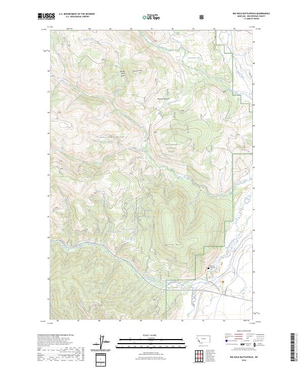
2020 Big Hole Battlefield
Beaverhead County, MT
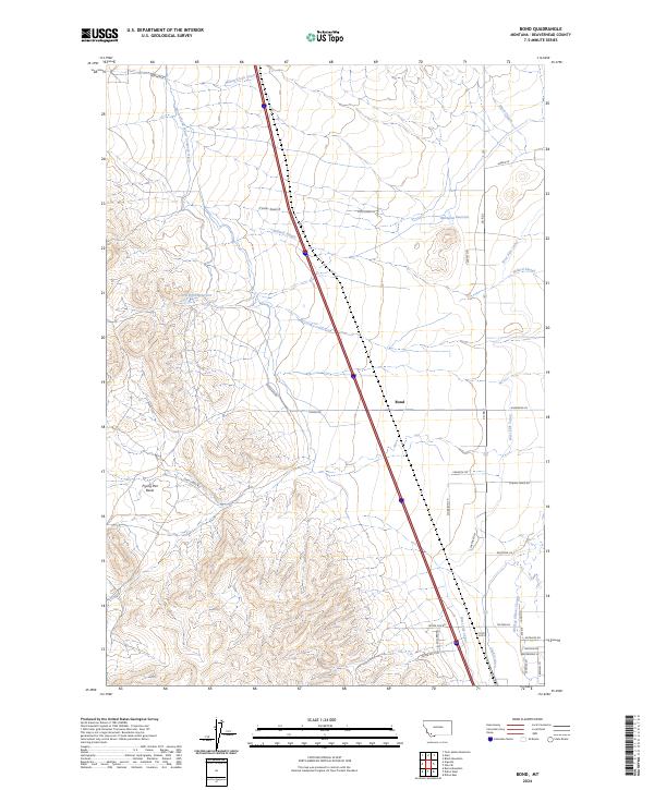
2020 Bond
Beaverhead County, MT
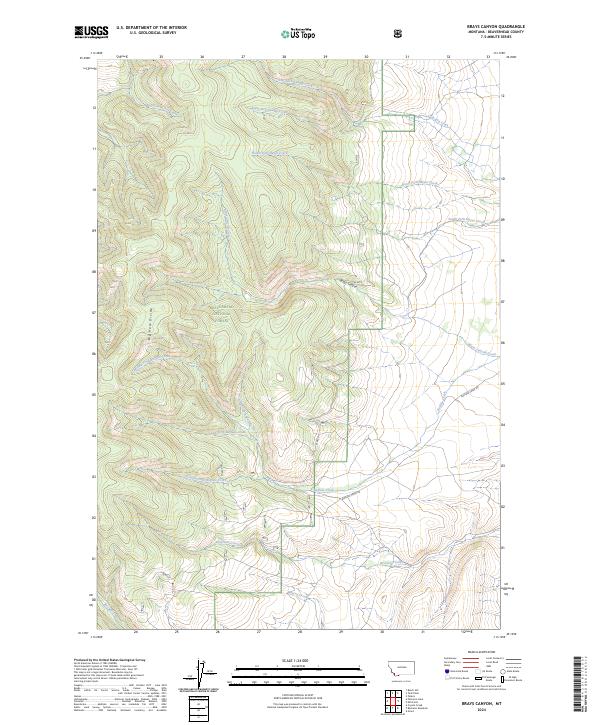
2020 Brays Canyon
Beaverhead County, MT
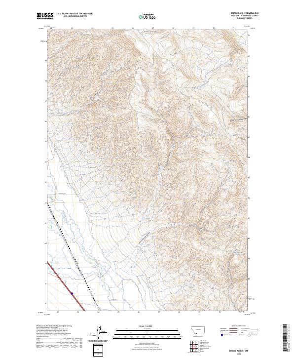
2020 Briggs Ranch
Beaverhead County, MT
2020 Burns Mountain
Beaverhead County, MT
2020 Butch Hill
Beaverhead County, MT
2020 Caboose Canyon
Beaverhead County, MT
2020 Cattle Gulch
Beaverhead County, MT

2020 Corral Creek
Beaverhead County, MT
2020 Coyote Creek
Beaverhead County, MT
2020 Dalys
Beaverhead County, MT
2020 Deadman Lake
Beaverhead County, MT
2020 Deadman Pass
Beaverhead County, MT
2020 Deer Canyon
Beaverhead County, MT
2020 Dickie Hills
Beaverhead County, MT
2020 Dillon East
Beaverhead County, MT
2020 Dillon West
Beaverhead County, MT
2020 Dixon Mountain
Beaverhead County, MT
2020 Earls Gulch
Beaverhead County, MT
2020 Eighteenmile Peak
Beaverhead County, MT
2020 Eli Spring
Beaverhead County, MT
2020 Elk Creek
Beaverhead County, MT
2020 Elk Gulch
Beaverhead County, MT
2020 Elkhorn Hot Springs
Beaverhead County, MT
2020 Elk Springs
Beaverhead County, MT
2020 Ermont
Beaverhead County, MT
2020 Everson Creek
Beaverhead County, MT
2020 Foolhen Mountain
Beaverhead County, MT
2020 Fox Gulch
Beaverhead County, MT
2020 Gallagher Gulch
Beaverhead County, MT
2020 Gallagher Mountain
Beaverhead County, MT
2020 Garfield Canyon
Beaverhead County, MT
2020 Gibbons School
Beaverhead County, MT
2020 Glen SE
Beaverhead County, MT
2020 Goldstone Pass
Beaverhead County, MT
2020 Graphite Mountain
Beaverhead County, MT
2020 Hansen Ranch
Beaverhead County, MT
2020 Henry Gulch
Beaverhead County, MT
2020 Hidden Lake Bench
Beaverhead County, MT
2020 Highland Ranch
Beaverhead County, MT
2020 Homer Youngs Peak
Beaverhead County, MT
2020 Isaac Meadows
Beaverhead County, MT
2020 Island Butte
Beaverhead County, MT
2020 Jackson Hill
Beaverhead County, MT
2020 Jumbo Mountain
Beaverhead County, MT
2020 Kidd
Beaverhead County, MT
2020 Kitty Creek
Beaverhead County, MT
2020 Lemhi Pass
Beaverhead County, MT
2020 Lima Dam
Beaverhead County, MT
2020 Lima Peaks
Beaverhead County, MT
2020 Lower Miner Lakes
Beaverhead County, MT
2020 Lower Red Rock Lake
Beaverhead County, MT
2020 Maurice Mountain
Beaverhead County, MT
2020 Medicine Lodge Peak
Beaverhead County, MT
2020 Metzel Creek
Beaverhead County, MT
2020 Mill Point
Beaverhead County, MT
2020 Monida
Beaverhead County, MT
2020 Monument Hill
Beaverhead County, MT
2020 Morrison Lake
Beaverhead County, MT
2020 Mount Jefferson
Beaverhead County, MT
2020 Mount Tahepia
Beaverhead County, MT
2020 Mud Lake
Beaverhead County, MT
2020 Mussigbrod Lake
Beaverhead County, MT
2020 Odell Lake
Beaverhead County, MT
2020 Peterson Lake
Beaverhead County, MT
2020 Pintler Lake
Beaverhead County, MT
2020 Polaris
Beaverhead County, MT
2020 Price Creek
Beaverhead County, MT
2020 Price Creek NE
Beaverhead County, MT
2020 Proposal Rock
Beaverhead County, MT
2020 Red Rock
Beaverhead County, MT
2020 Rock Island Ranch
Beaverhead County, MT
2020 Selway Mountain
Beaverhead County, MT
2020 Shaw Mountain
Beaverhead County, MT
2020 Slide Mountain
Beaverhead County, MT
2020 Snowline
Beaverhead County, MT
2020 Stewart Mountain
Beaverhead County, MT
2020 Stine Mountain
Beaverhead County, MT

2020 Storm Peak
Beaverhead County, MT
2020 Swamp Creek
Beaverhead County, MT
2020 Tash Peak
Beaverhead County, MT
2020 Tepee Mountain
Beaverhead County, MT
2020 Three Eagles Peak
Beaverhead County, MT
2020 Torrey Mountain
Beaverhead County, MT
2020 Twin Adams Mountain
Beaverhead County, MT
2020 Upper Red Rock Lake
Beaverhead County, MT
2020 Vinegar Hill
Beaverhead County, MT
2020 Vipond Park
Beaverhead County, MT
2020 Whiskey Spring
Beaverhead County, MT
2020 Winslow Creek
Beaverhead County, MT
2020 Wolverine Creek
Beaverhead County, MT
2024 Ajax Ranch
Beaverhead County, MT
2024 Antelope Peak
Beaverhead County, MT
2024 Antone Peak
Beaverhead County, MT
2024 Ashbough Canyon
Beaverhead County, MT
2024 Bachelor Mountain
Beaverhead County, MT
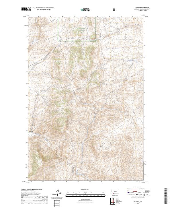
2024 Bannack
Beaverhead County, MT
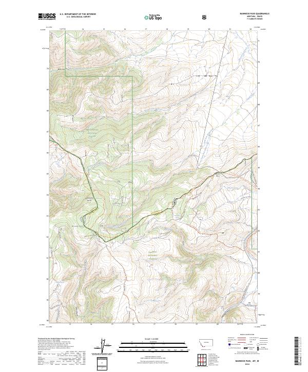
2024 Bannock Pass
Beaverhead County, MT
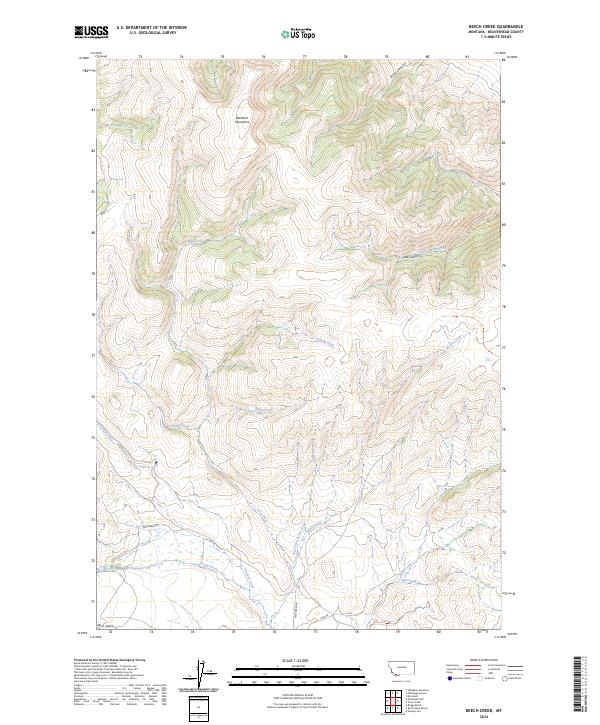
2024 Beech Creek
Beaverhead County, MT
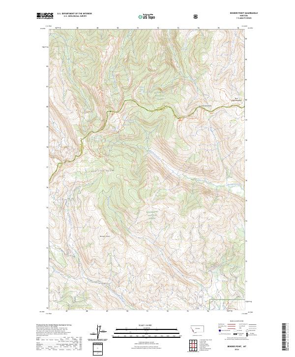
2024 Bender Point
Beaverhead County, MT
2024 Big Hole Battlefield
Beaverhead County, MT
2024 Bond
Beaverhead County, MT
2024 Brays Canyon
Beaverhead County, MT
2024 Briggs Ranch
Beaverhead County, MT
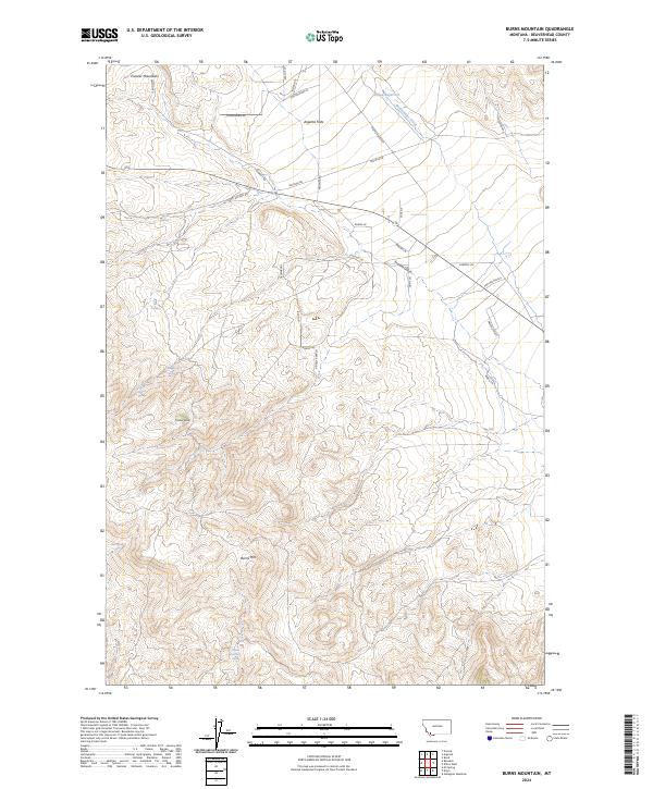
2024 Burns Mountain
Beaverhead County, MT
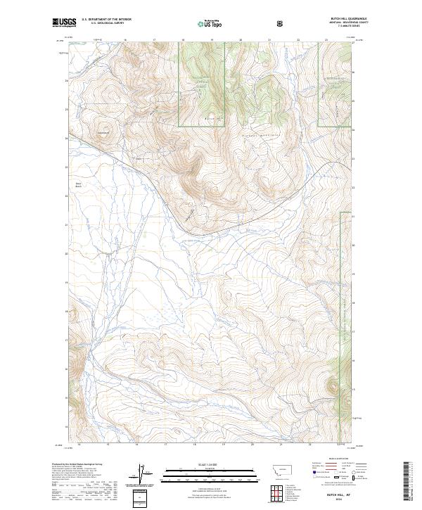
2024 Butch Hill
Beaverhead County, MT
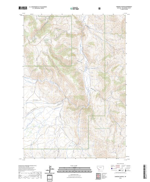
2024 Caboose Canyon
Beaverhead County, MT
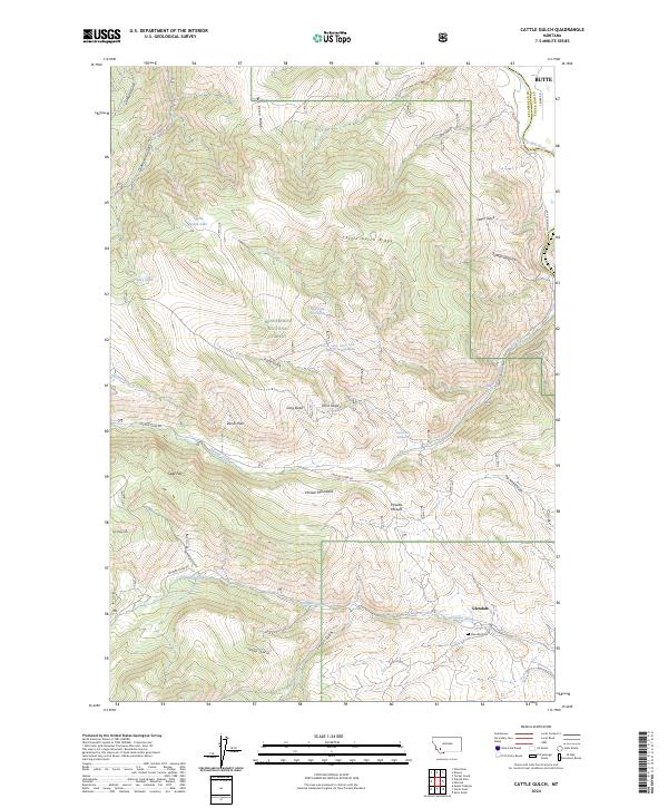
2024 Cattle Gulch
Beaverhead County, MT
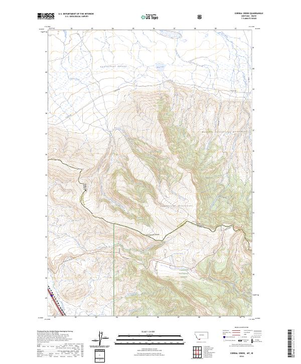
2024 Corral Creek
Beaverhead County, MT
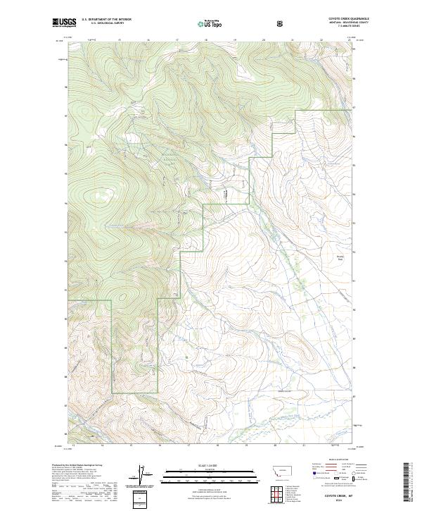
2024 Coyote Creek
Beaverhead County, MT
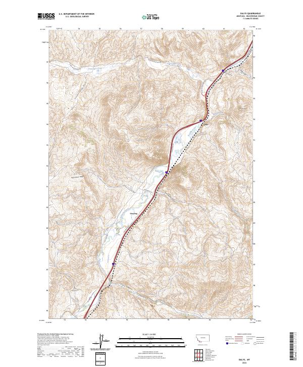
2024 Dalys
Beaverhead County, MT
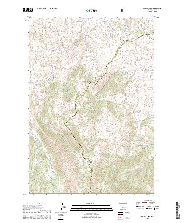
2024 Deadman Lake
Beaverhead County, MT
2024 Deadman Pass
Beaverhead County, MT
2024 Deer Canyon
Beaverhead County, MT
2024 Dickie Hills
Beaverhead County, MT
2024 Dillon East
Beaverhead County, MT
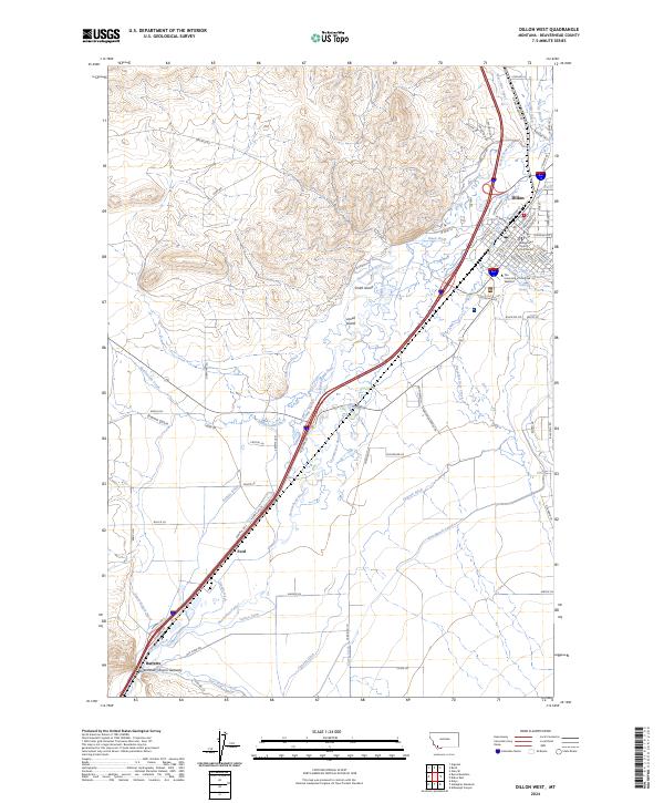
2024 Dillon West
Beaverhead County, MT
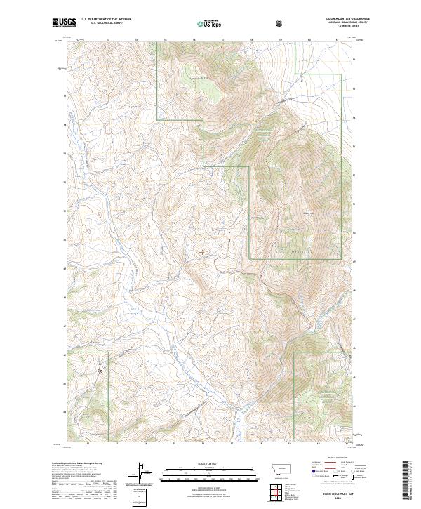
2024 Dixon Mountain
Beaverhead County, MT
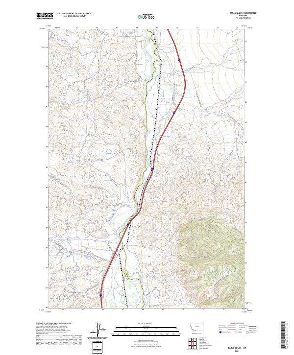
2024 Earls Gulch
Beaverhead County, MT
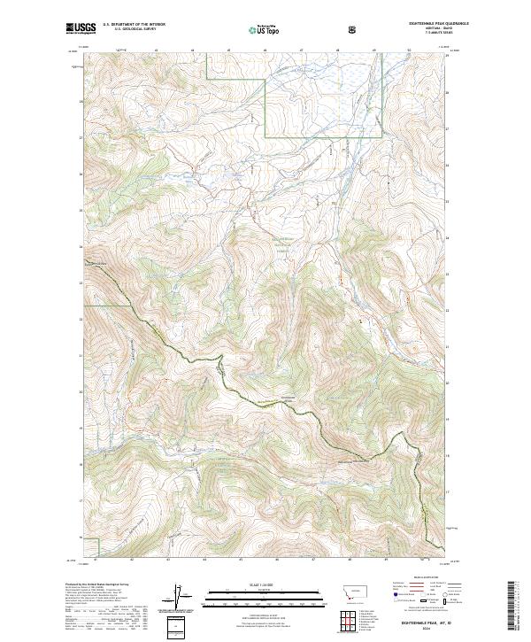
2024 Eighteenmile Peak
Beaverhead County, MT
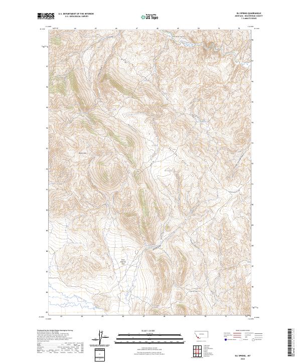
2024 Eli Spring
Beaverhead County, MT
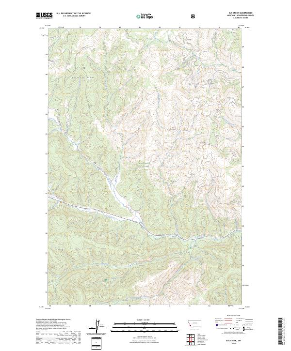
2024 Elk Creek
Beaverhead County, MT
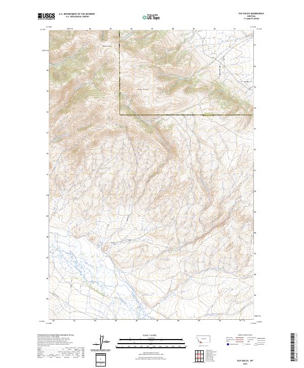
2024 Elk Gulch
Beaverhead County, MT
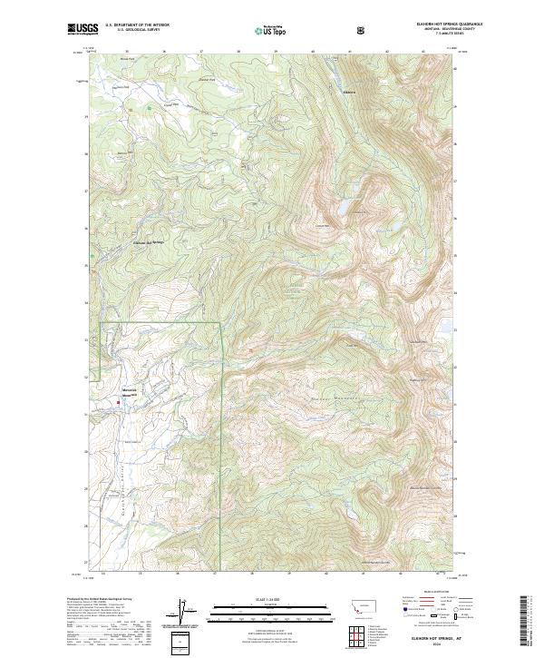
2024 Elkhorn Hot Springs
Beaverhead County, MT
2024 Elk Springs
Beaverhead County, MT
2024 Ermont
Beaverhead County, MT
2024 Everson Creek
Beaverhead County, MT
2024 Foolhen Mountain
Beaverhead County, MT
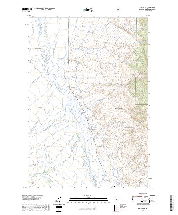
2024 Fox Gulch
Beaverhead County, MT
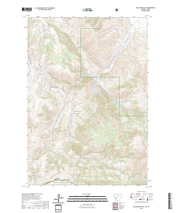
2024 Gallagher Gulch
Beaverhead County, MT
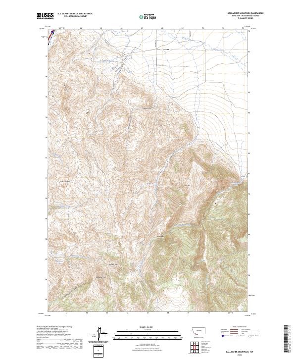
2024 Gallagher Mountain
Beaverhead County, MT
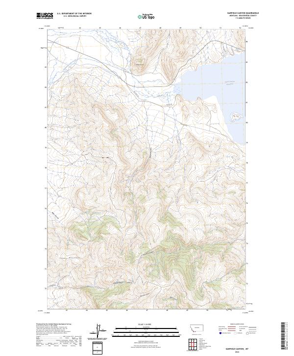
2024 Garfield Canyon
Beaverhead County, MT
2024 Gibbons School
Beaverhead County, MT
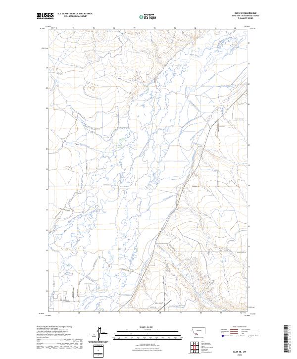
2024 Glen SE
Beaverhead County, MT
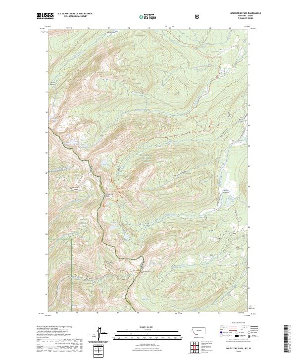
2024 Goldstone Pass
Beaverhead County, MT
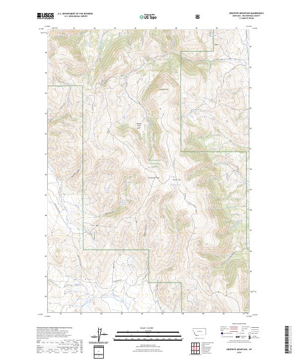
2024 Graphite Mountain
Beaverhead County, MT
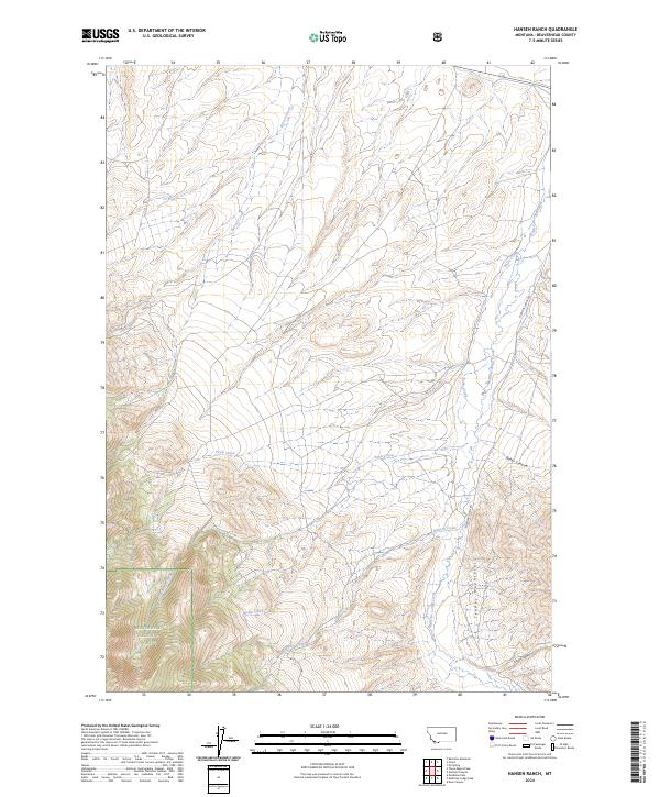
2024 Hansen Ranch
Beaverhead County, MT
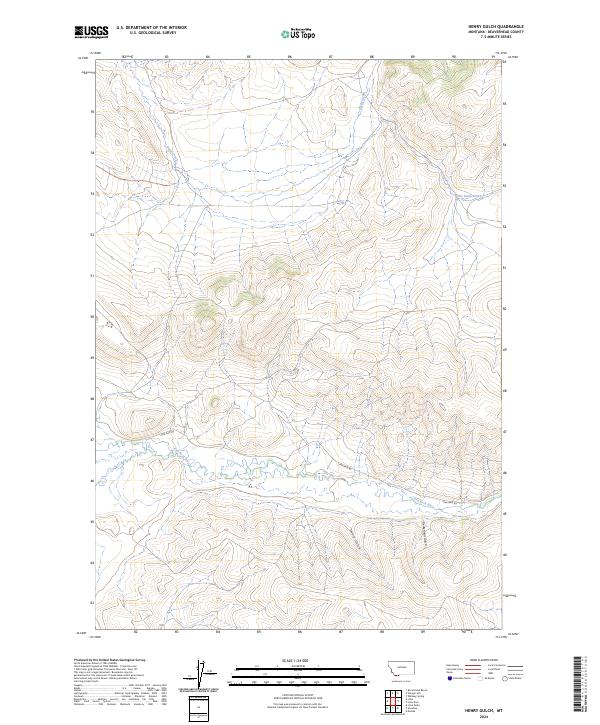
2024 Henry Gulch
Beaverhead County, MT
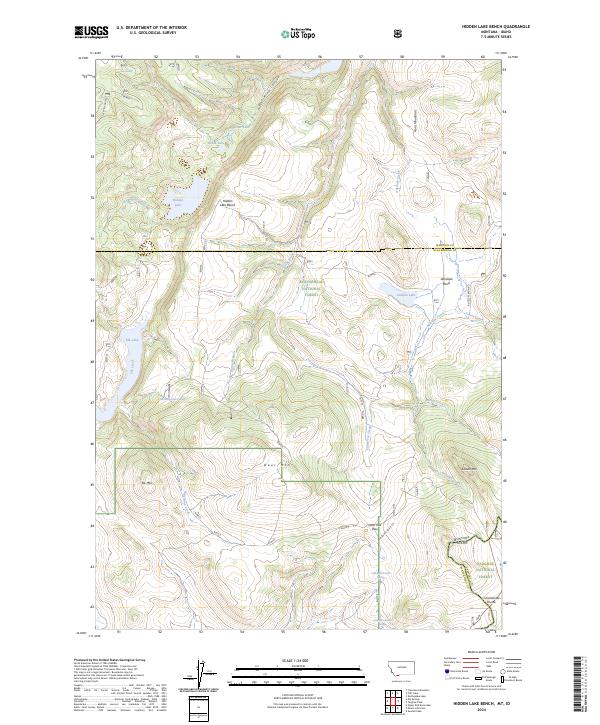
2024 Hidden Lake Bench
Beaverhead County, MT
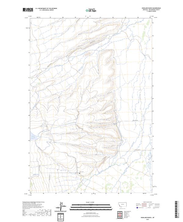
2024 Highland Ranch
Beaverhead County, MT
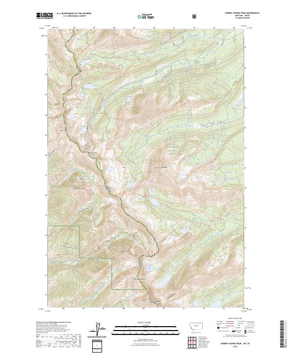
2024 Homer Youngs Peak
Beaverhead County, MT
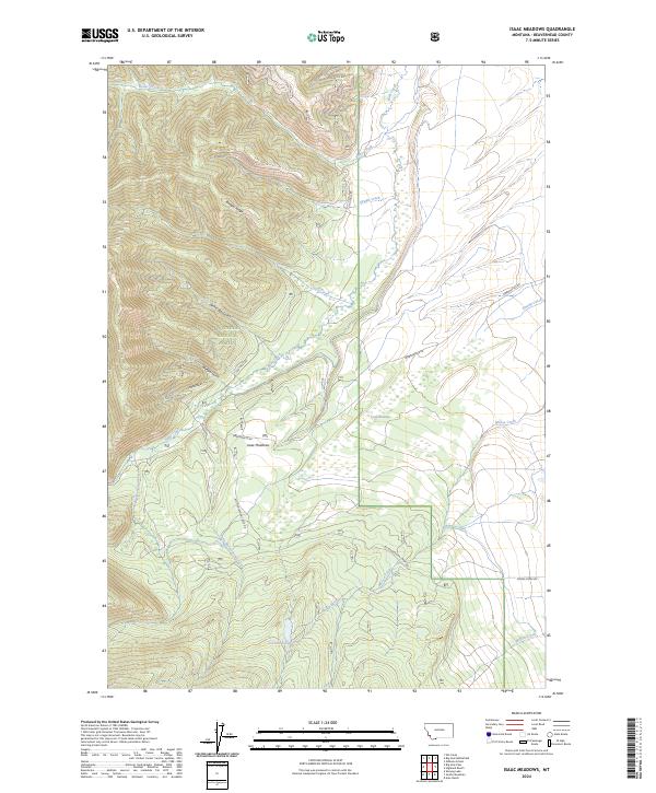
2024 Isaac Meadows
Beaverhead County, MT
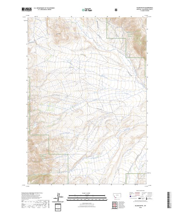
2024 Island Butte
Beaverhead County, MT
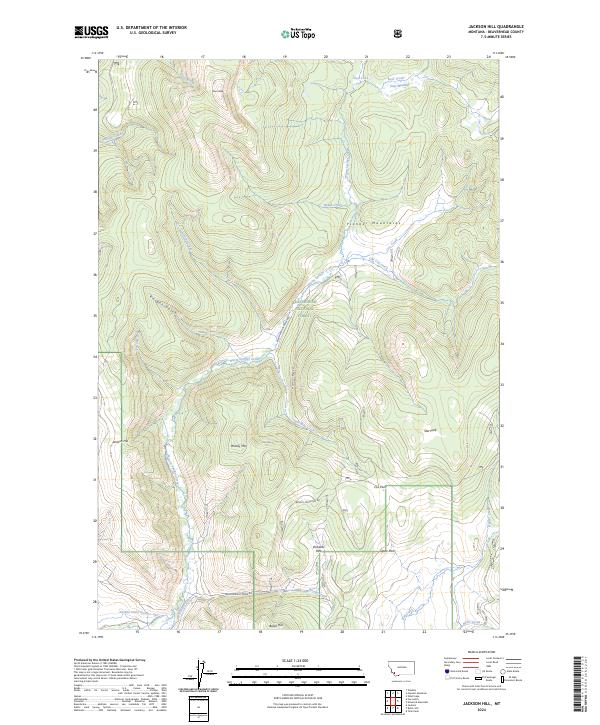
2024 Jackson Hill
Beaverhead County, MT
2024 Jumbo Mountain
Beaverhead County, MT
2024 Kidd
Beaverhead County, MT
2024 Kitty Creek
Beaverhead County, MT
2024 Lemhi Pass
Beaverhead County, MT
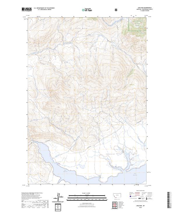
2024 Lima Dam
Beaverhead County, MT
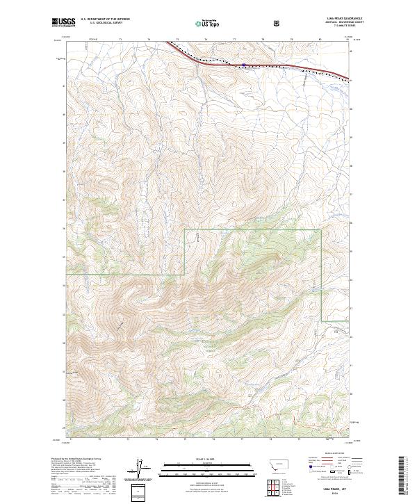
2024 Lima Peaks
Beaverhead County, MT
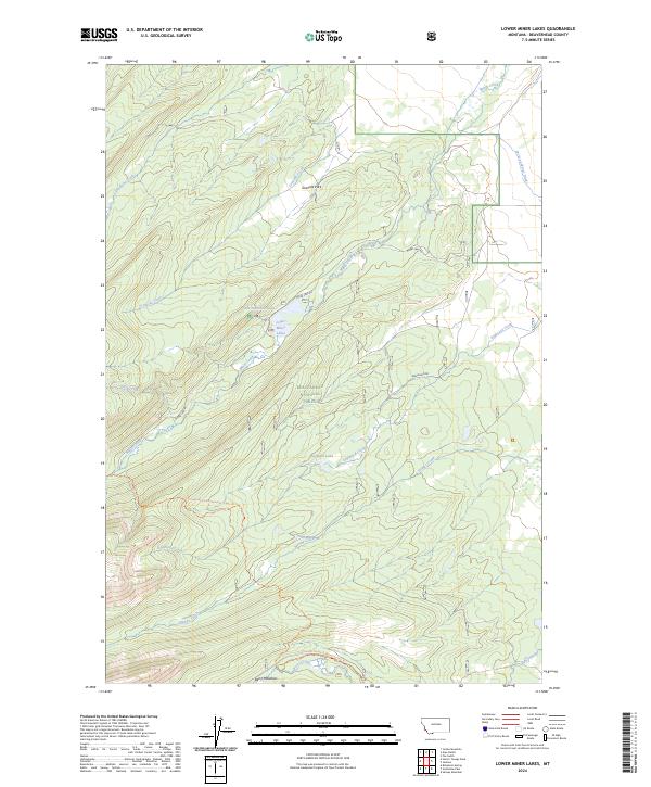
2024 Lower Miner Lakes
Beaverhead County, MT
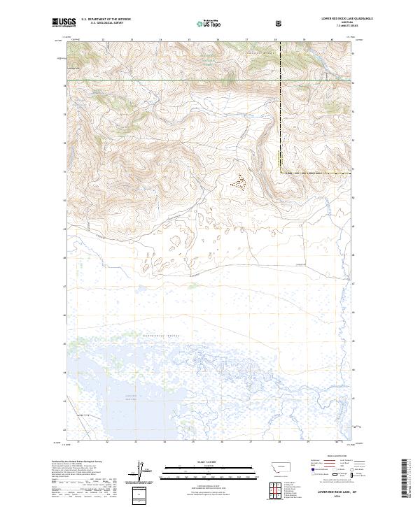
2024 Lower Red Rock Lake
Beaverhead County, MT
2024 Maurice Mountain
Beaverhead County, MT
2024 Medicine Lodge Peak
Beaverhead County, MT
2024 Metzel Creek
Beaverhead County, MT
2024 Mill Point
Beaverhead County, MT
2024 Monida
Beaverhead County, MT
2024 Monument Hill
Beaverhead County, MT
2024 Morrison Lake
Beaverhead County, MT
2024 Mount Jefferson
Beaverhead County, MT
2024 Mount Tahepia
Beaverhead County, MT
2024 Mud Lake
Beaverhead County, MT
2024 Mussigbrod Lake
Beaverhead County, MT
2024 Odell Lake
Beaverhead County, MT
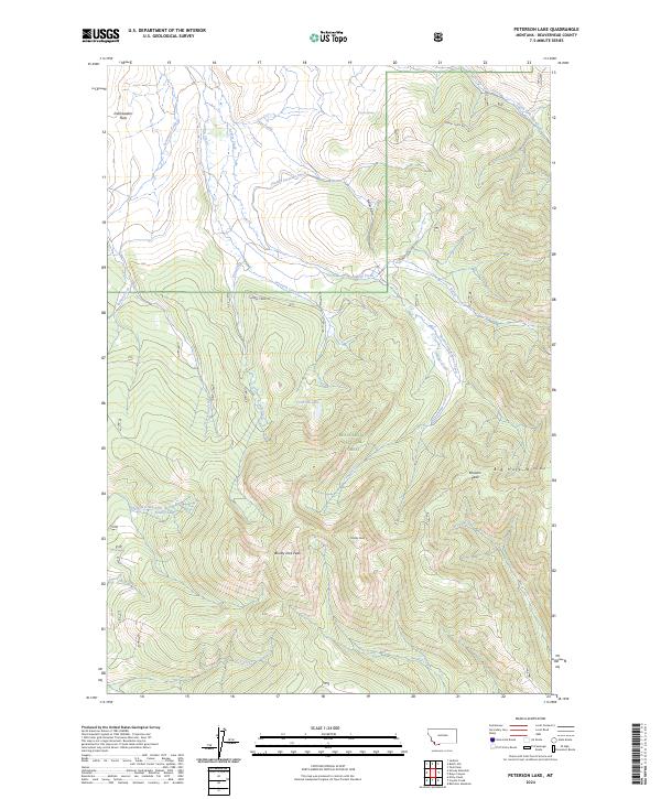
2024 Peterson Lake
Beaverhead County, MT
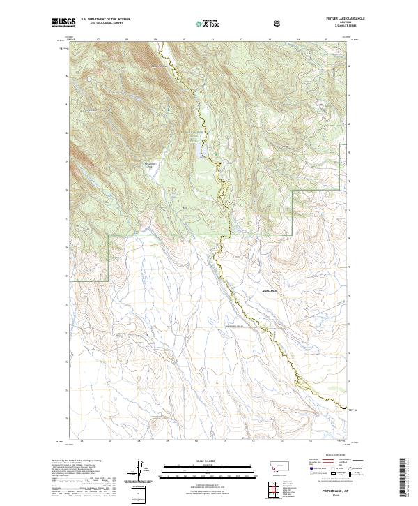
2024 Pintler Lake
Beaverhead County, MT
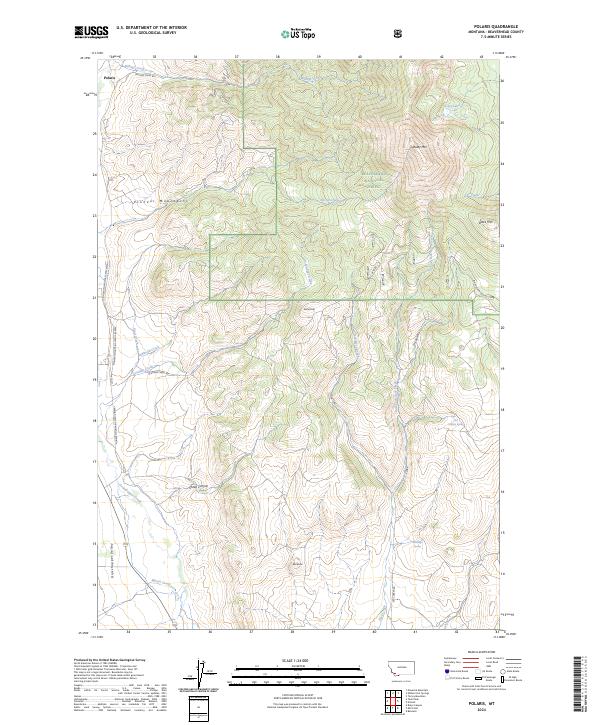
2024 Polaris
Beaverhead County, MT
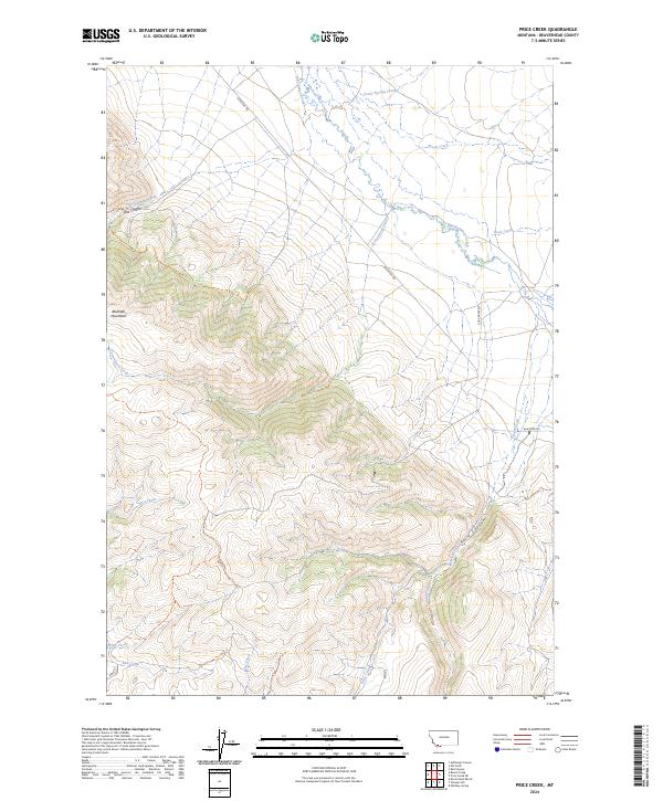
2024 Price Creek
Beaverhead County, MT
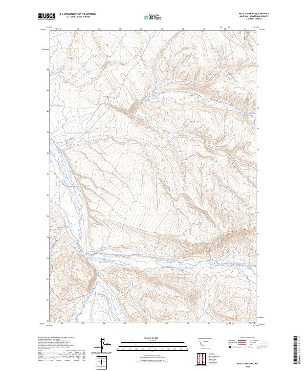
2024 Price Creek NE
Beaverhead County, MT
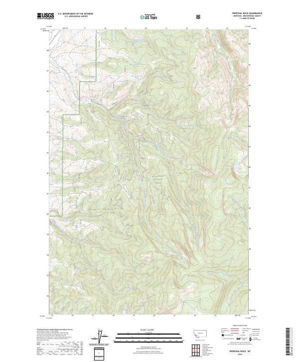
2024 Proposal Rock
Beaverhead County, MT
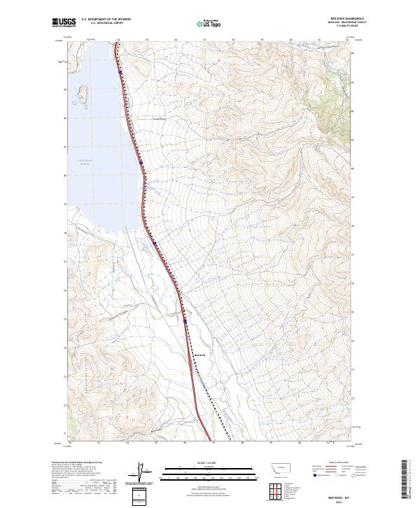
2024 Red Rock
Beaverhead County, MT
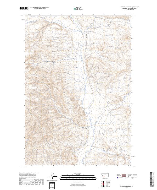
2024 Rock Island Ranch
Beaverhead County, MT
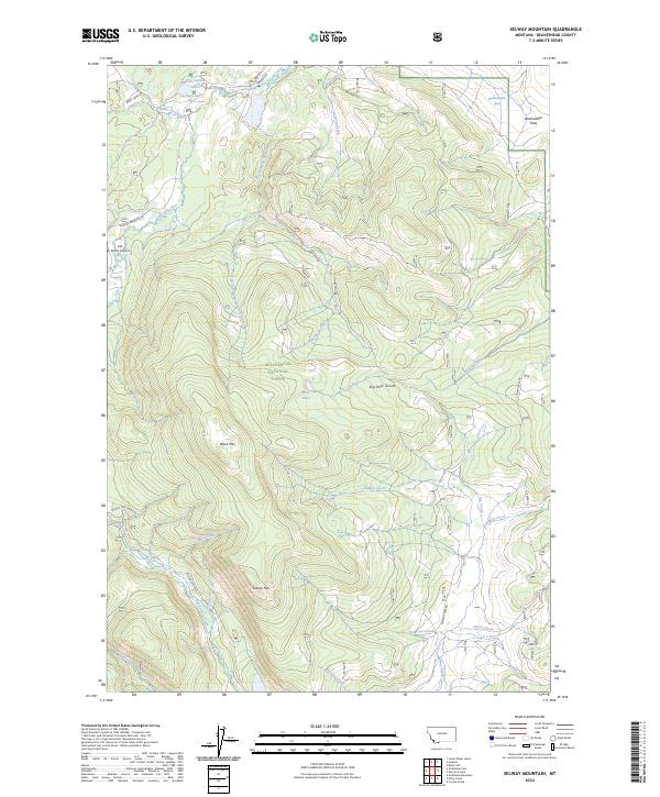
2024 Selway Mountain
Beaverhead County, MT
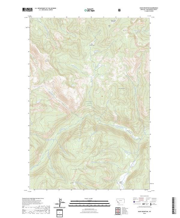
2024 Shaw Mountain
Beaverhead County, MT
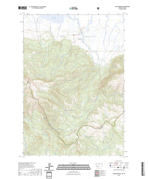
2024 Slide Mountain
Beaverhead County, MT
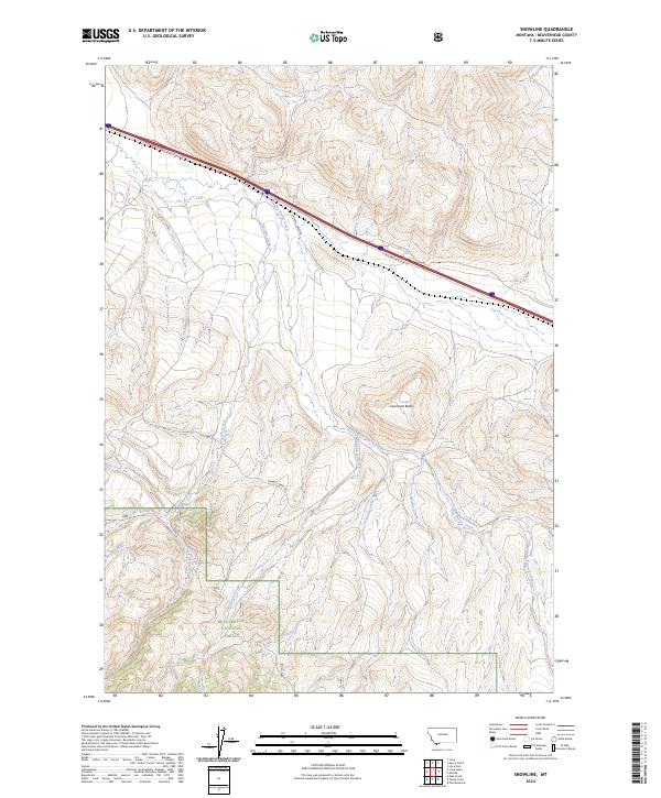
2024 Snowline
Beaverhead County, MT
2024 Stewart Mountain
Beaverhead County, MT
2024 Stine Mountain
Beaverhead County, MT
2024 Storm Peak
Beaverhead County, MT
2024 Swamp Creek
Beaverhead County, MT
2024 Tash Peak
Beaverhead County, MT
2024 Tepee Mountain
Beaverhead County, MT
2024 Three Eagles Peak
Beaverhead County, MT
2024 Torrey Mountain
Beaverhead County, MT
2024 Twin Adams Mountain
Beaverhead County, MT
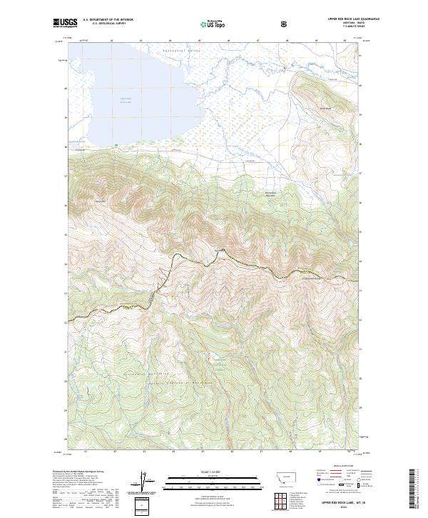
2024 Upper Red Rock Lake
Beaverhead County, MT
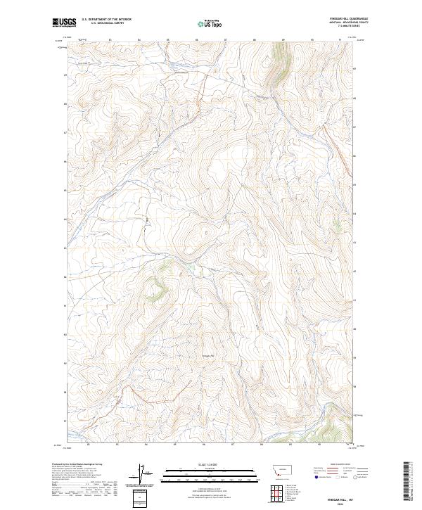
2024 Vinegar Hill
Beaverhead County, MT
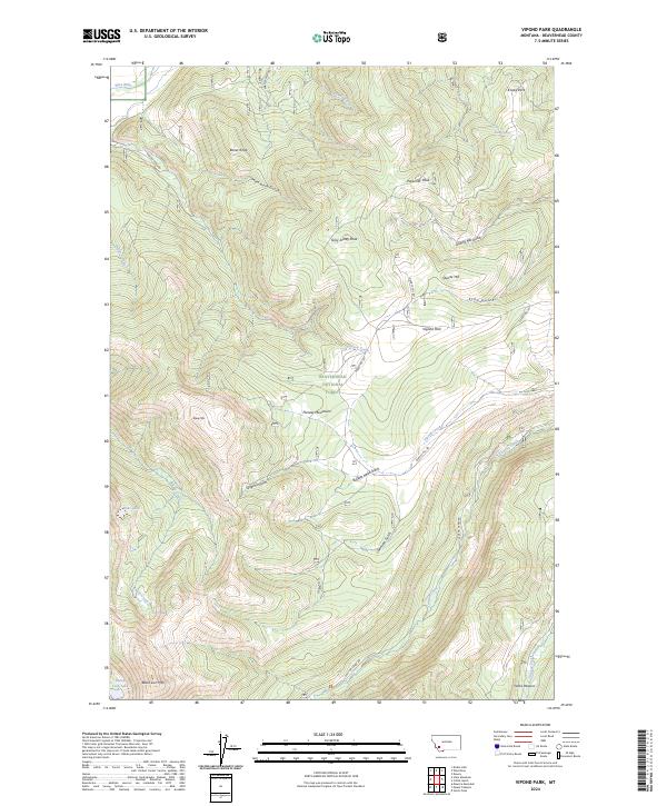
2024 Vipond Park
Beaverhead County, MT
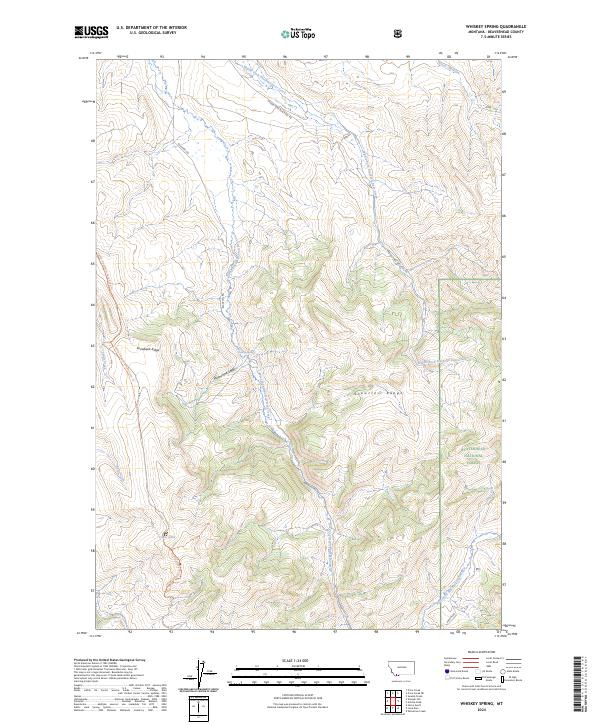
2024 Whiskey Spring
Beaverhead County, MT
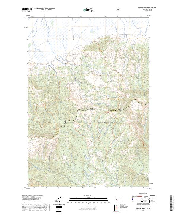
2024 Winslow Creek
Beaverhead County, MT
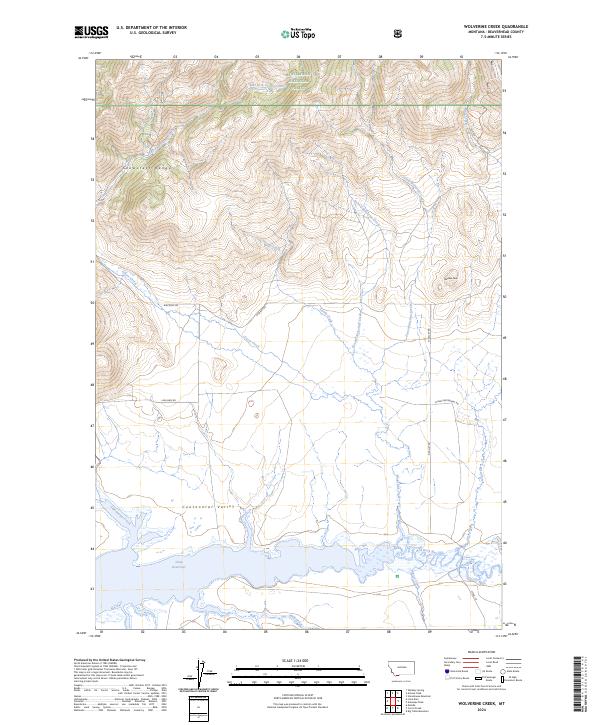
2024 Wolverine Creek
Beaverhead County, MT