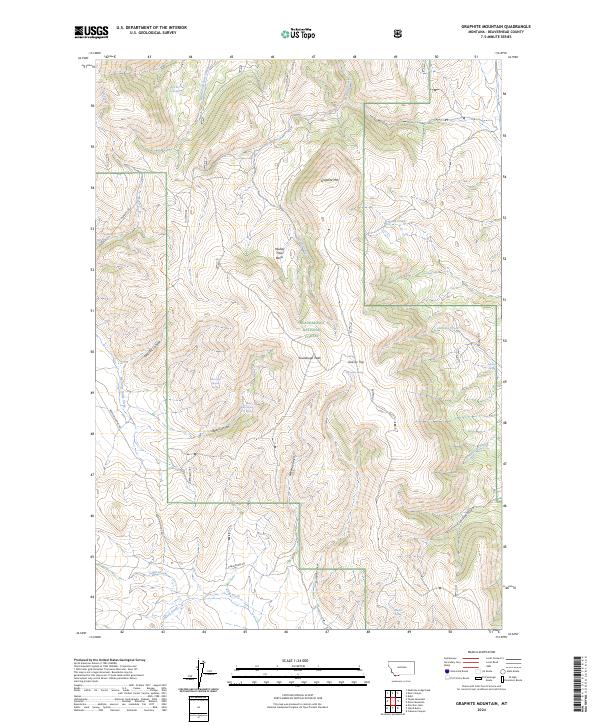
2024 Map of Graphite Mountain
USGS Topo · Published 2024About this map
Beaverhead National Forest land dominates this high-elevation landscape in Beaverhead County, where the Continental Divide drainage patterns are clearly defined by numerous springs and seasonal waterways. The terrain is anchored by Graphite Mtn and Sourdough Peak, with the notable Muddy Hole Basin providing a distinctive geological depression between the ridges. The hydrology of the area is particularly complex, featuring a high concentration of water sources including West Kate Creek Spring, North Bear Canyon Spring, and Hewlett Spring, which feed into the larger Medicine Lodge Creek system. Access to this backcountry is shown via forest routes such as Medicine Lodge Rd and Cabin Creek Rd, illustrating the modern management of these public lands. The naming of features like Tonsillitis Canyon and Grassy Top reflects the local vernacular and topographical character of the Montana high country.
Find a feature on this map
35 named features on this map. Tap any name to fly to it.
Don’t see what you’re looking for? This feature index may not catch every label — zoom into the map to look around manually.
Map Details
Editions of this 2024 Graphite Mountain Map
This is the sole edition of this map. No revisions or reprints were ever made.
Other maps of this area

1955 · Dubois
USGS Topo · 1:250,000

1956 · Morrison Lake
USGS Topo · 1:62,500

1958 · Dubois
USGS Topo · 1:250,000

1965 · Kidd
USGS Topo · 1:24,000

1965 · Caboose Canyon
USGS Topo · 1:24,000

1965 · Graphite Mountain
USGS Topo · 1:24,000

1965 · Deer Canyon
USGS Topo · 1:24,000
1965 · Medicine Lodge Peak
USGS Topo · 1:24,000

1965 · Dixon Mountain
USGS Topo · 1:24,000

1965 · Island Butte
USGS Topo · 1:24,000