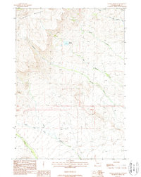
1988 Map of Thomas Reservoir
USGS Topo · Published 1988About this map
Carter Mountain dominates the northwestern horizon of this high-altitude Wyoming landscape, where steep slopes give way to a network of drainage basins. The area is defined by its water management and resource infrastructure, centered on the Thomas Reservoir. This artificial catchment sits at an elevation of 8,485 feet, collecting flow from local drainages to serve the needs of the surrounding high plains. The map reveals a transition from the mountainous heights toward more accessible terrain in the south and east, marked by several prominent watercourses including Rawhide Creek and Little Rawhide Creek. The presence of a long-distance pipeline and various corral markers across the southern sections suggests a landscape dedicated to ranching and energy transport. This 1980s topographic record captures the area after modern infrastructure was established but before subsequent development altered the hydraulic patterns of these remote drainages.
Find a feature on this map
14 named features on this map. Tap any name to fly to it.
Don’t see what you’re looking for? This feature index may not catch every label — zoom into the map to look around manually.
Map Details
Editions of this 1988 Thomas Reservoir Map
This is the sole edition of this map. No revisions or reprints were ever made.
Other maps of this area

1955 · Cody
USGS Topo · 1:250,000

1957 · Wapiti
USGS Topo · 1:62,500

1957 · Devils Tooth
USGS Topo · 1:62,500

1957 · Irish Rock
USGS Topo · 1:62,500

1957 · Sunshine Reservoir
USGS Topo · 1:62,500

1958 · Cody
USGS Topo · 1:250,000

1962 · Cody
USGS Topo · 1:250,000

1980 · Carter Mountain
USGS Topo · 1:100,000
1987 · Devils Tooth
USGS Topo · 1:24,000
1987 · Pitchfork
USGS Topo · 1:24,000