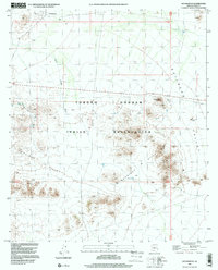
1996 Map of Hotason Vo
USGS Topo · Published 2000About this map
The Tohono O'odham Indian Reservation landscape is defined by the stark transition from the Quijotoa Valley floor to the prominent peaks of the Gunsight Hills. At the heart of this desert terrain, the settlement of Hotason Vo serves as a focal point, supported by vital infrastructure like a Water Tank, a Well, and a local Cem. The presence of the Little Chief Mine and various other Prospect and Mine Shaft locations near Ninemile Peak speaks to the mineral interests that have shaped the land. Movement across this arid region relies on ephemeral watercourses like Sikort Chuapo Wash and rugged transport routes such as the Gunsight 4WD trail. The map details a traditional way of life where water sources and topographic landmarks dictate the location of small communities like Chagit Vo.
Find a feature on this map
22 named features on this map. Tap any name to fly to it.
Don’t see what you’re looking for? This feature index may not catch every label — zoom into the map to look around manually.
Map Details
Editions of this 1996 Hotason Vo Map
This is the sole edition of this map. No revisions or reprints were ever made.
Other maps of this area

1953 · Ajo
USGS Topo · 1:250,000

1957 · Ajo
USGS Topo · 1:250,000

1958 · Ajo
USGS Topo · 1:250,000

1962 · Ajo
USGS Topo · 1:250,000

1963 · Ajo
USGS Topo · 1:250,000

1963 · Sikort Chuapo Mts
USGS Topo · 1:62,500

1963 · Mt. Ajo
USGS Topo · 1:62,500

1963 · Cimarron Peak
USGS Topo · 1:62,500

1963 · Pisinimo
USGS Topo · 1:62,500

1967 · Ajo
USGS Topo · 1:250,000