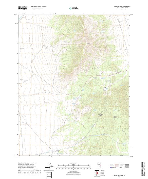
2021 Map of Grassy Mountain
USGS Topo · Published 2021About this map
Grassy Mtn and the Fairview Range dominate this high-desert landscape in Lincoln County, where water sources dictated the patterns of movement and land use. The map reveals a dense network of springs and seeps vital for livestock and survival in the arid Great Basin, including Horse Corral Spring, Hidden Seep Springs, and Lone Cedar Spring. Evidence of early water management is found at Steward Reservoir, situated near the junction of Access Route Trl and Pony Springs Rd. High-elevation landmarks like Kixmiller Summit and Upper Meloy Summit provide surveying points across the terrain. Large drainage features like Coyote Wash and Maloy Wash indicate the seasonal flow patterns that shaped the Muleshoe Valley floor. This 2021 topographic record maps the persistent geography of Nevada's interior ranges, documenting named springs and primitive routes that have remained essential for generations of land users.
Find a feature on this map
37 named features on this map. Tap any name to fly to it.
Don’t see what you’re looking for? This feature index may not catch every label — zoom into the map to look around manually.
Map Details
Editions of this 2021 Grassy Mountain Map
This is the sole edition of this map. No revisions or reprints were ever made.
Other maps of this area

1915 · Bristol Range
USGS Topo · 1:62,500

1917 · Bristol Range
USGS Topo · 1:62,500

1956 · Lund
USGS Topo · 1:250,000

1960 · Lund
USGS Topo · 1:250,000
1971 · Bristol Range NE
USGS Topo · 1:24,000

1971 · Sidehill Spring
USGS Topo · 1:24,000

1971 · Bailey Wash
USGS Topo · 1:24,000
1971 · Fairview Peak
USGS Topo · 1:24,000

1971 · Sidehill Pass
USGS Topo · 1:24,000
1973 · Grassy Mtn
USGS Topo · 1:24,000