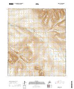
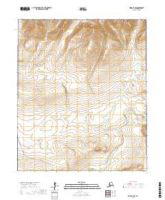
2017 Map of Nome D-3 SE
USGS Topo · Published 2017About this map
The Feather River Airport serves as a remote aviation landmark in this subarctic landscape north of Nome. The terrain is defined by a dense network of drainage systems, where the Feather River and its tributaries, including Thistle Cr and Willis Cr, cut through the tundra. Connectivity in this part of the Seward Peninsula is provided by the Nome-Teller Highway/Bob Blodgett Highway, which winds across the eastern hills, and the Wooley Lagoon Road in the northwest corner. This 2017 survey illustrates the intersection of modern transportation infrastructure with traditional Alaskan wilderness, tracing waterways like Livingston Cr and Blume Cr that have long dictated movement through the region. The map provides essential detail for understanding the hydrological patterns of the area, including Fairview Cr and Stuart Cr.
Find a feature on this map
16 named features on this map. Tap any name to fly to it.
Don’t see what you’re looking for? This feature index may not catch every label — zoom into the map to look around manually.
Map Details
Editions of this 2017 Nome D-3 SE Map
This is the sole edition of this map. No revisions or reprints were ever made.
Other maps of this area

1950 · Nome D-2
USGS Topo · 1:63,360

1950 · Nome
USGS Topo · 1:250,000
1950 · Nome C-3
USGS Topo · 1:63,360

1950 · Nome D-3
USGS Topo · 1:63,360

1950 · Nome C-2
USGS Topo · 1:63,360

1951 · Nome
USGS Topo · 1:250,000

1957 · Nome
USGS Topo · 1:250,000
1975 · Nome C-3
USGS Topo · 1:63,360
2017 · Nome C-2 NW
USGS Topo · 1:25,000
2017 · Nome D-2 SW
USGS Topo · 1:25,000