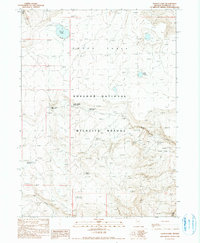
1990 Map of Gooch Lake
USGS Topo · Published 1990About this map
Sheldon National Wildlife Refuge dominates this high-altitude landscape in Humboldt County, where the vast Gooch Table plateau rises over five thousand feet. The 1990 survey captures a region defined by its critical water resources, essential for both wildlife and historic ranching operations. Scattered across the terrain are named water sources including Gooch Lake, Upper Jacobs Water Hole, and Center Reservoir. The map reveals a legacy of exploration through various Prospects located near the head of Echo Canyon, signaling mineral interest in the volcanic soils. The remote nature of this corner of Nevada is underscored by the absence of permanent settlements, replaced instead by functional landmarks like Sheep Pen Reservoir and the descriptively named Hell Creek. Geologic features such as Rhyolite Spring and Perlite Reservoir point to the area's volcanic origins and the specific stone that defines the local geology.
Find a feature on this map
17 named features on this map. Tap any name to fly to it.
Don’t see what you’re looking for? This feature index may not catch every label — zoom into the map to look around manually.
Map Details
Editions of this 1990 Gooch Lake Map
This is the sole edition of this map. No revisions or reprints were ever made.
Other maps of this area

1889 · Long Valley
USGS Topo · 1:250,000

1954 · Vya
USGS Topo · 1:250,000

1958 · Vya
USGS Topo · 1:250,000

1962 · Vya
USGS Topo · 1:250,000

1965 · Rock Spring Table
USGS Topo · 1:62,500

1966 · Big Spring Butte
USGS Topo · 1:62,500

1966 · Blowout Mtn
USGS Topo · 1:24,000
1966 · Catnip Mtn. SE
USGS Topo · 1:24,000
1966 · Sage Hen Hills
USGS Topo · 1:24,000
1987 · Vya
USGS Topo · 1:100,000