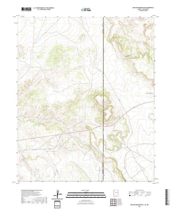
2021 Map of Nelson Reservoir NE
USGS Topo · Published 2021About this map
The high desert borderlands between Apache County, Arizona, and Catron County, New Mexico, are defined by a network of seasonal drainages and early western transit routes. Central to this landscape is Coyote Creek, which winds through the southern portion of the quadrangle, carving a path across the state line. Topographic interest is concentrated in features like Cottonwood Canyon and Cow Springs Draw, illustrating the erosional character of the high plateau region. Transportation history is visible in the alignment of Old US Hwy 60 and modern access roads like Co Rd 4001 and Ap-4225, which cut through the public land survey system grids. The map records the intersection of modern state boundaries and the legacy of ranching-era infrastructure in this sparsely populated reach of the American Southwest.
Find a feature on this map
14 named features on this map. Tap any name to fly to it.
Don’t see what you’re looking for? This feature index may not catch every label — zoom into the map to look around manually.
Map Details
Editions of this 2021 Nelson Reservoir NE Map
This is the sole edition of this map. No revisions or reprints were ever made.
Other maps of this area

1886 · St Johns
USGS Topo · 1:250,000

1892 · St Johns
USGS Topo · 1:250,000

1954 · Saint Johns
USGS Topo · 1:250,000

1957 · Saint Johns
USGS Topo · 1:250,000

1958 · Saint Johns
USGS Topo · 1:250,000

1962 · Saint Johns
USGS Topo · 1:250,000
1968 · Nelson Reservoir NE
USGS Topo · 1:24,000
1968 · Loco Knoll
USGS Topo · 1:24,000

1969 · Coyote Hills
USGS Topo · 1:24,000
1969 · Nelson Reservoir
USGS Topo · 1:24,000