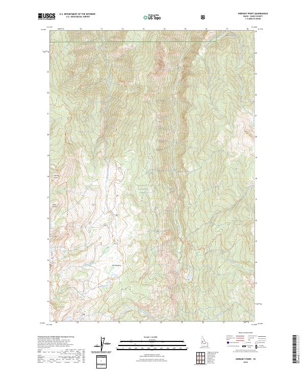
2024 Map of Hershey Point
USGS Topo · Published 2024About this map
The Payette National Forest characterizes this stretch of the Idaho backcountry, where steep drainage networks and ridgelines dictate the movement of both water and travelers. High elevations are punctuated by landmarks like Hershey Point and the distinctive Sams Throne, while the hydrology is dominated by the north-south run of French Creek and its many tributaries, including Elkhorn Creek and Bolton Creek. The presence of the Lava Butte Lakes near Lava Butte provides a rare concentrated water source in the high country, linked by a network of established paths such as the Lava Ridge Trl and Clique Basin Trl. This landscape illustrates the management of public lands for both conservation and transit, with French Creek Rd serving as a primary artery through the complex topography of the Lava Ridge area and Elk Meadows.
Find a feature on this map
31 named features on this map. Tap any name to fly to it.
Don’t see what you’re looking for? This feature index may not catch every label — zoom into the map to look around manually.
Map Details
Editions of this 2024 Hershey Point Map
This is the sole edition of this map. No revisions or reprints were ever made.
Other maps of this area

1938 · Riggins
USGS Topo · 1:96,000

1945 · Riggins
USGS Topo · 1:125,000

1955 · Grangeville
USGS Topo · 1:250,000

1956 · Burgdorf
USGS Topo · 1:62,500

1956 · Elk City
USGS Topo · 1:250,000

1959 · Grangeville
USGS Topo · 1:250,000

1960 · Elk City
USGS Topo · 1:250,000

1963 · Black Tip
USGS Topo · 1:24,000

1963 · Hershey Point
USGS Topo · 1:24,000
1963 · Hazard Lake
USGS Topo · 1:24,000