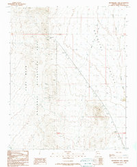
1989 Map of Housholder Pass
USGS Topo · Published 1990About this map
Housholder Pass serves as a prominent natural notch within the arid landscape of Mohave County, where the high desert terrain transitions toward the eastern edges of the Lake Mead National Recreation Area. This late-twentieth-century survey documents a landscape defined by drainage patterns and extraction efforts, with Detrital Wash cutting through the broad expanse of the Detrital Valley. Evidence of mining activity is scattered across the topography, particularly near the volcanic formations of the Malpais, where numerous Mine Shafts, Prospects, and a Shaft indicate historic mineral exploration. A technical landmark, the USMM No 2948 mineral monument, provides a fixed point for early surveying, while a utility corridor and various 4WD tracks represent the limited modern infrastructure crossing this desert expanse.
Find a feature on this map
17 named features on this map. Tap any name to fly to it.
Don’t see what you’re looking for? This feature index may not catch every label — zoom into the map to look around manually.
Map Details
Editions of this 1989 Housholder Pass Map
This is the sole edition of this map. No revisions or reprints were ever made.
Other maps of this area

1886 · Camp Mohave
USGS Topo · 1:250,000

1892 · Camp Mohave
USGS Topo · 1:250,000

1926 · Nelson
USGS Topo · 1:96,000

1942 · Camp Mohave
USGS Topo · 1:250,000

1947 · Kingman
USGS Topo · 1:250,000

1948 · Kingman
USGS Topo · 1:250,000

1954 · Kingman
USGS Topo · 1:250,000

1955 · Kingman
USGS Topo · 1:250,000

1958 · Kingman
USGS Topo · 1:250,000
1959 · Willow Beach
USGS Topo · 1:24,000