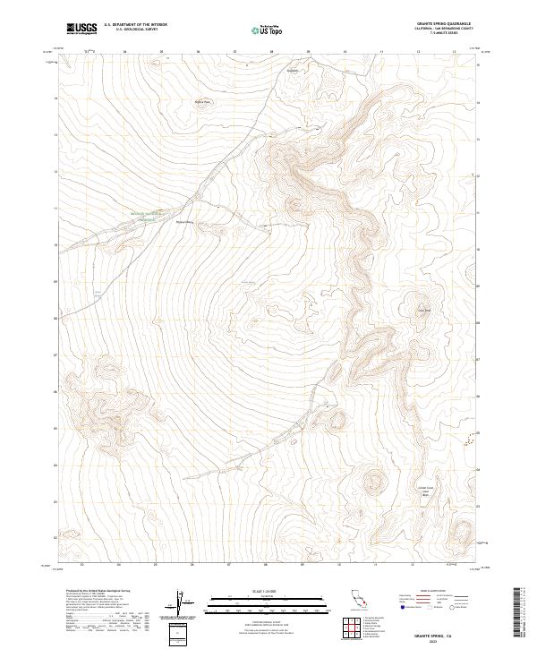
2023 Map of Granite Spring
USGS Topo · Published 2023About this map
Mojave National Preserve and the protected Mojave Wilderness dominate this high-desert landscape in San Bernardino County. The topography is defined by significant volcanic and geological landmarks, most notably the Cinder Cone Lava Beds in the southeastern corner. These formations represent a preserved record of the region's late-stage volcanic activity, set against the backdrop of the broader Mojave Desert. Water, the scarcest and most vital resource for desert life, is localized at specific points like Granite Spring and Henry Spring. High points such as Mojave Peak, Club Peak, and the sharp ridgeline of Sawtooth provide the primary navigational landmarks across this arid terrain. This contemporary survey by the U.S. Geological Survey documents the current conservation boundaries and natural hydrology of the area.
Find a feature on this map
15 named features on this map. Tap any name to fly to it.
Don’t see what you’re looking for? This feature index may not catch every label — zoom into the map to look around manually.
Map Details
Editions of this 2023 Granite Spring Map
This is the sole edition of this map. No revisions or reprints were ever made.
Other maps of this area

1910 · Ivanpah
USGS Topo · 1:250,000

1912 · Ivanpah
USGS Topo · 1:250,000

1942 · Ivanpah
USGS Topo · 1:250,000

1947 · Kingman
USGS Topo · 1:250,000

1948 · Kingman
USGS Topo · 1:250,000

1954 · Kingman
USGS Topo · 1:250,000

1955 · Kingman
USGS Topo · 1:250,000

1955 · Mescal Range
USGS Topo · 1:62,500

1955 · Kelso
USGS Topo · 1:62,500

1956 · Halloran Spring
USGS Topo · 1:62,500