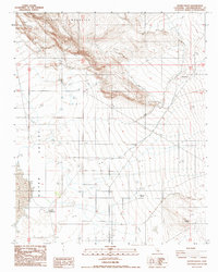
1988 Map of Water Valley
USGS Topo · Published 1988About this map
Water Valley occupies a stark desert basin in the Mojave, dominated by the expansive alkaline flats of Harper Lake to the west. This 1980s landscape is defined by its isolation and the sharp transition from the dry lakebed to the steep, volcanic contours of Black Mountain rising in the north. Human presence is sparse and concentrated around essential water and livestock infrastructure. Blacks Ranch serves as a primary reference point in the valley floor, accompanied by a nearby Corral. The map captures an era of specialized land use, where geological exploration is evidenced by a Drill Hole and a solitary Prospect in the eastern foothills. Numerous four-wheel-drive tracks crisscross the terrain, linking remote points in a region where topography dictates the flow of travel through the arid flats.
Find a feature on this map
10 named features on this map. Tap any name to fly to it.
Don’t see what you’re looking for? This feature index may not catch every label — zoom into the map to look around manually.
Map Details
Editions of this 1988 Water Valley Map
This is the sole edition of this map. No revisions or reprints were ever made.
Other maps of this area

1915 · Searles Lake
USGS Topo · 1:250,000

1932 · Barstow
USGS Topo · 1:125,000

1934 · Barstow
USGS Topo · 1:125,000

1947 · Trona
USGS Topo · 1:250,000

1948 · Trona
USGS Topo · 1:250,000

1953 · San Bernardino
USGS Topo · 1:250,000

1953 · Trona
USGS Topo · 1:250,000

1955 · Opal Mountain
USGS Topo · 1:62,500

1956 · San Bernardino
USGS Topo · 1:250,000

1956 · Fremont Peak
USGS Topo · 1:62,500